Saturday, 18 June 2016

Mor Bheinn

18 June 2016

Participants: Just me
Where: Mor Bheinn, 640m/2100', Graham/Marilyn, Map 52/57, NN 716212
 
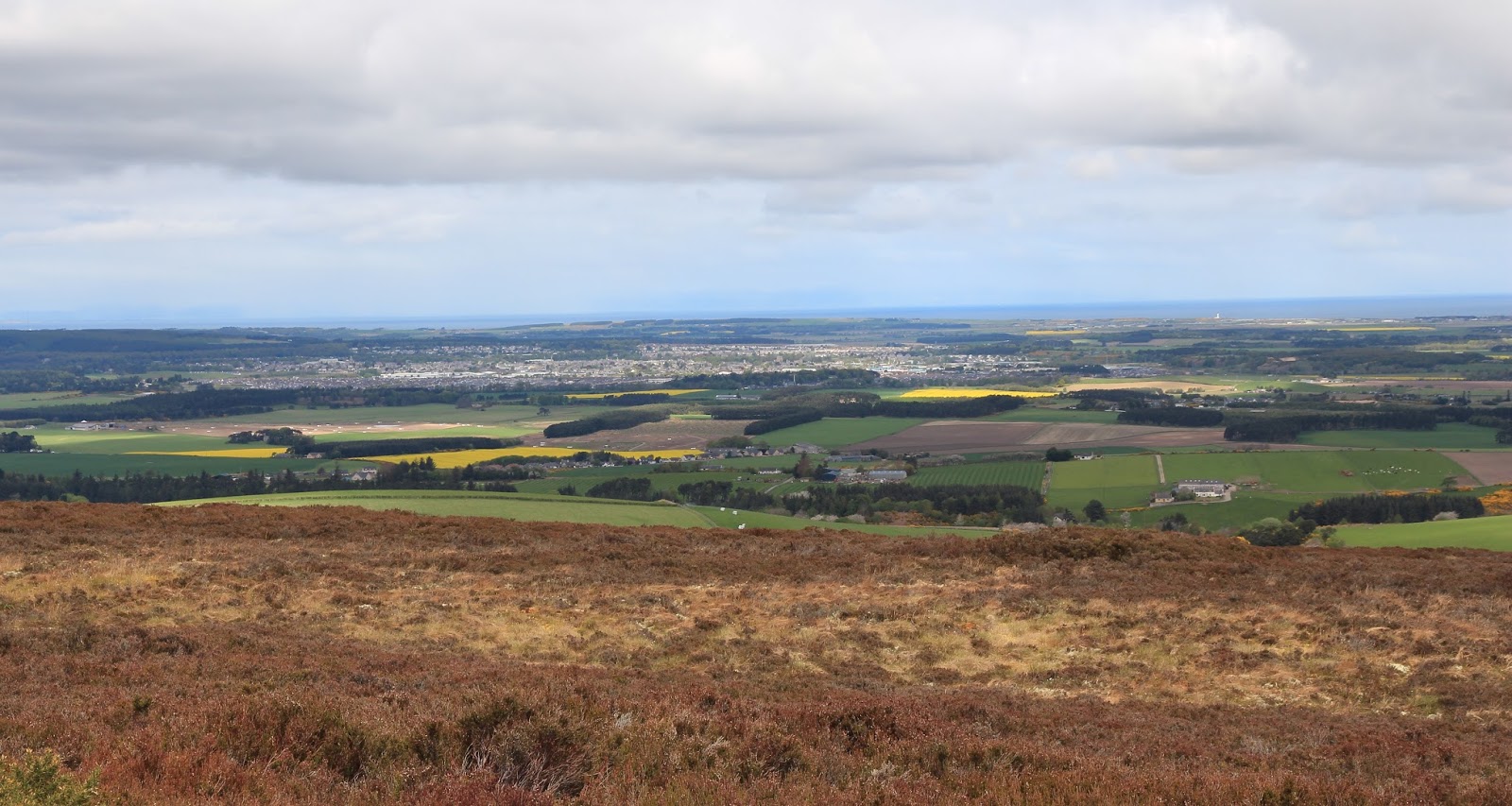
Ben Halton and Mor Bheinn from the Comrie to Braco road.....
 
 
I had seen reports on the Hill Bagging website that suggested that there was a good route from the north, now that some of the forestry had been cut down. So I parked up in a layby just east of Tynreoch and was soon past the farm buildings and on the forestry track that wound uphill gradually on the west side of the hill. It wasn't long before Mor Bheinn came into view.....
 
 
Getting closer.....
 
 
Some reports recommended leaving the track at a burn just after leaving the main forest but that looked steep and not very pleasant underfoot so I carried on up the track which now rose quite steeply. It certainly goes a lot further than my map indicated. I followed it to its end and from there could see what looked like a good route slanting up and across the hillside towards the col between Mor Bheinn and Ben Halton.....
 
 
There were plenty of grass strips to follow which avoided most of the heather. This is looking back from part way up the hillside with the Carn Mairg hills in the distance.....
 
 
I arrived on Mor Bheinn's south ridge just above the col and picked up a developing path which went all the way to the summit. There were none of the crags which the map indicates are prevalent on this hill, at least, not on this route. Unfortunately, the weather was a bit cloudy, especially to the west; this is looking towards Ben Vorlich.....
 
 
North to Ben Chonzie....
 
 
And down to Loch Earn.....
 
 
It was virtually windless so I hadn't been at the trig long when the midges found me. Time to bail out! I returned by the same route, one which avoided all the steepness, most of the heather, all the bracken and all the deer fences. So a thank you to the Hill Bagging site! It took me 2 hours 20 up and the same down, when the sun came out and I stopped a few times for water and photos. This is looking across Strathearn to Ben Each.....


Thursday, 2 June 2016

A'Chruach (Arran)

1 June 2016

Participants: Just me
Where: A'Chruach (Arran), 514m/1,685', Sub-2k Marilyn, Map 69, NR 969335
 
A'Chruach is the least exciting of the Arran Marilyns, unless, of course, you like tramping across lots of upland moorland. Nevertheless, it has a fine remote feel to it and an unsurpassed view to most of the higher peaks.
 
I parked at the high point of the String road. From there, it was straight up -steeply- following a fence line up grassy tongues and then thick heather to the top of Cnoc Dubh. The consolation was the fine view that opened up behind.....the main peaks from Ben Nuis to Goatfell......


There was a substantial cairn on top and when I arrived, I was surprised to see another walker approaching from the direction of the Marilyn. Had to be another Marilyn bagger- it was. A chap who had just bagged his 900th Marilyn on A'Chruach. After chatting to him for a bit, I took a few photos. The cairn and the main hills.....
 
 
A zoom shot into Glen Rosa.....
 
 
And then it was Marilyn time for me. The initial climb up Cnoc Dubh had accounted for most of the day's height gain and it was now just a slog across the moorland (A'Chruach is on the right).....
 
 
There was a lot of moss underfoot which led to some tedious going. Fortunately, it had been dry for a few weeks now; it must be awful going in the wet. I guess that the cairn says something about the popularity of this hill.....
 
 
but the view was still good. The main hills again.....
 
 
Mullach Buidhe, a Graham that I have still to do.....
 
 
Then it was back the same way, 3 hours 30 car to car. As usual when I visit Arran, I drove round a bit before getting the evening ferry back. A last view from the ferry.....

Wednesday, 25 May 2016

Carn Breugach, Isle of Kerrera

24 May 2016

Participants: Just me
Where: Carn Breugach, Isle of Kerrera, 189m/620', Sub-2k Marilyn, SIB, Map 49, NM 815278
 
The sunshine had returned! This is a view of Kerrera from McCaigs folly in Oban on the previous evening.....


and it was still sunny and clear in the morning.....
 
 
Time for an island trip! Looking at my records, I was amazed to find that it had been 10 years since I last visited Kerrera. Apart from work on-going to improve the slipways, nothing had changed. The ferry still ran at times that bore little relationship to the published timetable.....


There were Black Guillemots swimming around.....
 
 
Leaving the ferry, I set off southwards on the track that is the islands main road. There was a good view back along the Sound of Kerrera to Oban.....
 
 
I passed a small cluster of houses.....
 
 
Last time I climbed Carn Breugach, I made a direct ascent from close to the ferry. It was a poor route, very steep in places, thick bracken, barbed wire fences, and lots of ups and downs. This time, I did the sensible thing and walked about 2 miles along the track to its highest point before heading for the south ridge which was mainly short grass. This is the view of the hill from the high point of the track (the summit is at the furthest away point from here).....
 
 
The views quickly opened out, this is looking south to Scarba.....


and west to the hills of Mull.....
 
 
The trig was on a prominent knoll......


with great views to Oban.....
  
 
Ben Cruachan was easily recognisable.....
 
 
I could see the low lying Isle of Tiree on the western horizon.....
 
 
Dun da Ghaoithe on Mull.....
 
 
and Scarba again.....
 
 
Cows range freely on the island and there was plenty of evidence that they had visited the summit. Today, however, they were well down the hillside, and  in the area where I would have had to go if I had been following the route I took previously.
 
It was a summit to linger on but eventually I had to drag myself away and return the way that I had come. One more picture of the cliffs of Mull from the track.....


I do love islands.

Carn Dearg (Scammadale)

23 May 2016.

Participants: Just me.
Where: Carn Dearg (Scammadale), 438m/1436', Sub-2k Marilyn, Map 55, NM 896190
 
This hill was in an area that I hadn't visited before. I drove to the end of the public road at Bragleenbeg where there was a big parking area. It was a welcoming area, I got friendly waves from folk in houses, cars and on tractors - very refreshing. The route was straightforward, bridge across the river and follow a track past the farm to its end before taking to the hillside. It started off sunny and warm, clouded over while I was up the hill, and returned to sunshine when I got back down. The air was very clear however so the views were excellent. This is a view of Loch Scammadale from a short distance up the track.....
 
 
After climbing steeply, the track reached a flat area and stopped abruptly. However the hillside was nice and dry and after climbing over a few knolls, the summit came into view.....
 
 
I don't know where the stone for the cairn came from, there was nothing else that colour around. Here it is with Cruachan in the background.....
 
 
Scarba was prominent to the south.......
 
 
the Mull hills to the west.....
 
 
and the hills on the eastern horizon.....
 
 
I noticed that there were a number of Rights of Way signs in the glen, they would be worth exploring if you were staying in the area as you are well away from the main hillwalking area here. There were two other sub-2k's nearby but I decided to leave them for another day!

Tuesday, 17 May 2016

Brown Muir

16 May 2016

Participants: Just me
Where: Brown Muir, 339m/1112', Sub-2k Marilyn, Map 28, NJ 258 549
 
A contrasting hill to the previous day, Brown Muir as its name suggests is an area of upland moorland and is crowned by a radio mast. This is it from the west.....
 

I parked at the end of the public road near Teindland from where a track goes all the way to the top and at an easy angle. I started off with Ben but soon arrived at a field full of sheep guarded by a locked gate with no obvious way past so decided to take him back to the car; I took him for another run about at Rothiemurchus on the way home. Past the field I was out on the open moor with the mast in view ahead.....


Spring was definitely well advanced- I saw Curlew, Stonechat, Swallow, a pair of Red Grouse and heard a Cuckoo. The trig may or may not be the highest point, the ground looked a bit higher about 50 yards further on but from there the trig looked higher. Anyway, the trig had a metal cover, inside of which was a box containing several visitor notebooks. I duly entered my name with the confession that I was climbing Marilyns.....


Like all the hills in this part of the country, the views were wide. This is looking over Elgin.....
 
 
and this is looking east to the Bin of Cullen and The Knock......
 
 
Not as grand as the west but very pleasant country nonetheless.

Hill of the Wangie

15 May 2016

Participants: Neil and Ben
Where: Hill of the Wangie, 319m/1047', Map 28, NJ 137 538
 
This hill has a certain notoriety in Marilyn bagging circles. Tales abound of folk thrashing through dense conifers in search of the illusive trig. So, before venturing forth, I busied myself on the internet searching for advice as to the best route. This is a view of the hill from the east.....
 
 
For the benefit of anyone reading this who might be tempted, this was my route. I parked at the end of a track at NJ 13669 53733 on the south side of the hill. I followed the track up hill to a junction with another track, turned on to this and after 100m left it to climb up a mountain bike trail. What a terrifying trail; it was bad enough walking it far less cycling. I wouldn't have wanted to meet a cyclist coming the other way! This trail climbed through new plantations, crossed another forestry track and continued upwards into the old part of the forest. I knew that the MB trail emerged into an old forest ride and that the trig was just off that. However, I had assumed that the ride continued in the same direction as I had been going- south/north. I ended up searching through this.....
 
 
After about 10 minutes, I did the sensible thing and paused to think. I went back to the top of the MB trail and saw that the ride in fact also ran east/west and worked out that the trig must be off that. About 100m along- eureka......
 
 
It was a very solid looking trig without any of the usual chips, markings etc. Presumably it gets very few visitors......


Mission accomplished, I retraced my steps. There was a reasonable view south-east to Ben Rinnes from the top of the new plantings.....