Saturday 31 May 2014

Stob na Cruaiche- a wanted hill

Participants: Neil and Ben
Where: Stob na Cruaiche, 739m/2,423', Graham, Map 41, NN 363571

There are a number of hills that I really want to climb, hills like An Sgurr on Eigg, Dun Caan on Raasay, and Beinn Ghoblach overlooking the Summer Isles. Stob na Cruaiche was also on the list. It sits in the middle of Rannoch Moor, an area of moorland, bog and water roughly 50sq. miles in area. I have of course climbed the Munros and Corbetts that fringe the moor but Stob na Cruaiche is something special- it sits wholly within the moor and must, I reckoned, be a superlative view point. I had thought about travelling by train to do this one but the fact that I would have had at least a couple hours wait at Rannoch station at the end of the day before the train back south persuaded me to go by car. I left the house at more or less the same time as the train left Glasgow and arrived at Rannoch station just before it.....


The start of the walk is signposted as a path to Glencoe. I could just see my target rising above the forest.....
 
 
The initial stages of the walk were pleasant along the shore of Loch Laidon looking across it to Beinn a Chreachain and Beinn Achaladair.....
 
 
The next mile or so was through the forest. This is the key to the route; a 4WD track not marked on the map that leaves the main forest track and rises steeply through the trees. It starts just after going through a gate and before a stream is reached with another "Path to Glencoe" sign beside it. This rough track goes all the way to the summit....


The next bit was quite wet underfoot and old fence posts had been laid down to help vehicles get through the mud. It must be an interesting drive in a 4WD! It put the building of the railway across the moor into perspective. The steep bit was quite short and looking back there was a good view down to the loch with Schiehallion in the distance.....
 
 
I was now out on moorland and it was a bit drier underfoot. A ridge ahead looked as though it might contain the top.....
 
 
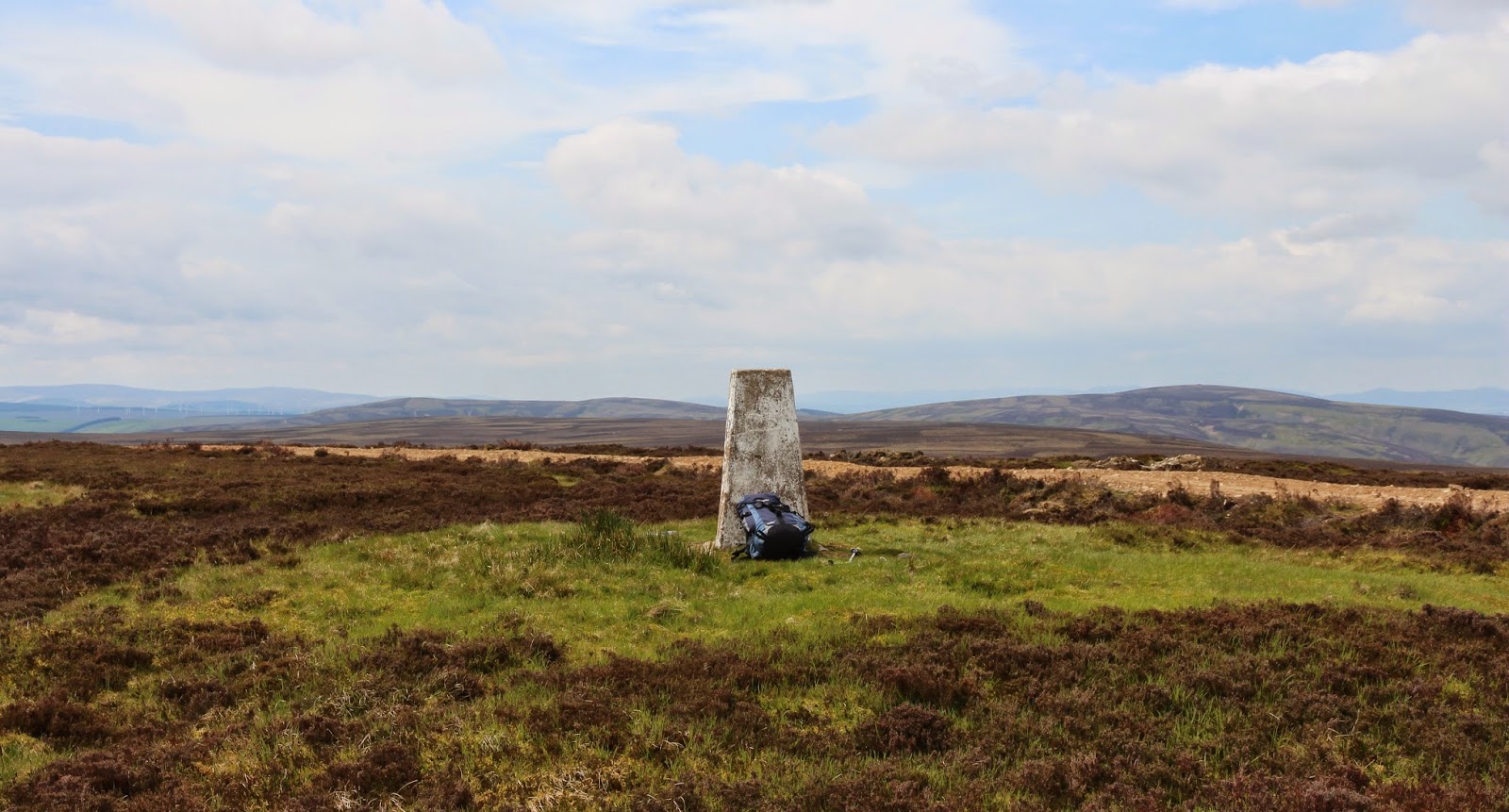
Nope, from the ridge there was still a bit to go and some more ascent, still following the path, but I could now see the trig point on the horizon.....
 
 
The views had started to open out. This is from about the 2,000' contour looking to Beinn Achaladair (left) and the Blackmount (right).....

 
Approaching the summit I got the view that I was waiting for, towards Buachaille Etive Mor and the hills of Glencoe. It was a bit hazy but, hey, I couldn't really complain.....
 

It wasn't far to the top and a chance to take in the views. This is looking towards Ben Alder.....
 
 
This is back the way we had come with Schiehallion now looking a long way away, as was the start/finish point.....
 
 
This is the Black Mount with Glen Etive straight behind the summit boulder.....


This is across the moor in s general south-west direction with Ben Lui on the horizon. This shows the amount of water that there is on the moor.....


Now turning round to look in a northerly direction across the Blackwater Reservoir to the Mamores and Ben Nevis.....
 
 
and across the reservoir to the Corbett of Leum Uilleim with the Grey Corries in the distance.....
 
 
It was really warm sitting at the summit and although there was no breeze, it was early enough in the year to avoid the flies and midges that must plague this area in high summer. I could have sat about for ages just looking at the views but it was a long drive home so I reluctantly set off back down. Here is another view of the loch taken on the way down.....


Well, the hill didn't disappoint. It is a good viewpoint and the track is a great help. Without it, I suspect that it might be a bit of a nightmare especially in summer. The walk was about 9 to10 miles and it took about 5 hours 20 car to car. It would be really good on a clear winter's day when there is snow on the surrounding hills; conversely, it would be a complete waste of time on a rainy, claggy day.

Wednesday 21 May 2014

Creachan Dubh

21 May 2014

Participants: Just me
Where: Creachan Dubh, 470m/1,542', Sub-2k Marilyn, Map 55, NS 015910

Well, here's an obscure one! Creachan Dubh is east of Loch Fyne, south of Strachur. This is it's east side, the route of ascent. The actual summit is beyond what you can see here.....
 
 
Handily, a minor single track road leaves the A886 and runs along the foot of the hill. After about a mile, I came to a cattle grid where there was parking for a few cars, although I doubt if many car loads of folk will turn up at the same time to climb this hill! After parking the car, I wandered down the road for about a hundred yards until I came to a gap in the trees and a gate on to the hill. It looked steep from here.....
 
 
Although it's not particularly high, the start was almost at sea level so there was a fair bit of ascent. There was no path but the grass and bracken were short so it was a relatively easy climb. I tended to the right higher up to avoid the crags. After about 300m of ascent, the ground levelled out and I could see what I was sure must be the summit area ahead. I stopped here for a wee rest and took this photo looking back down.....
 
 
The trig was one of the nice stone variety. This photo is looking north-east to the Arrochar hills.....
 
 
and this one is east over the Cruach Mhor wind farm in the general direction of Dunoon.....
 
 
There was a reasonable view of Loch Fyne but the hills beyond were lost in the haze.
 

I wandered back down in considerably less time than it had taken me to climb up. It had been a pleasant 3 hour walk. As I usually do when I visit hills in this area, I made a round trip of it driving to the hill via Loch Lomond side and going back by Dunoon and the Clyde ferries. By the time I got to Dunoon, it was a really beautiful day and it was a nice sail across the Clyde to Gourock.....

Friday 16 May 2014

Meikle Says Law

16 May 2014

Participants: Just myself
Where: Meikle Says Law, 535m/1,755', Sub-2k Marilyn, Map 67, NT 581617

I had been putting this one off as all the reports that I had read suggested that it was just boring moorland. However, east was best for weather and there was nothing else new to do in that direction within a day's drive from home. So the highest point of the Lammermuir Hills it was. Spring is a great time to visit East Lothian, it is a county that seems to go in for colour both in the fields and gardens. There are some picturesque wee villages too and I drove through some of them on my way to the starting point on the Gifford to Duns road. There was space to park off the road opposite the start of the track to Faseny cottage. Meikle Says Law looked a long way away.....


And the bad news was that the first part of the walk was downhill so it would be uphill at the end of the day. And it was the steepest slope of the route.....
 
 
The good news however was that the start point was 401m so there wasn't a great deal of ascent involved between the start and the summit. This is grouse country- serious grouse country going by the number of shooting butts. An area to be avoided in the shooting season. An early obstacle was the Faseny Water, I crossed dry-shod at the first ford but it might well be a case of off with the boots and socks in the rainy season. After that, it was simply a case of following firstly a well made track, then a 4WD track and finally an intermittent path across the moorland all the way to the summit. This is looking to the summit from the 4WD track.....


and here is the trig with the turbines of the Fallago Ridge wind farm in the background. If the Lammermuirs are a home for grouse, they are also a home for wind turbines.....
 
 
It was indeed a bit featureless, this is looking south-east with Dirrington Great Law framed between turbines.....
 
 
looking west, mercifully free of turbines.....
 
 
and looking north, back the way that I had come.
 

It was one of these hills where you could have plonked the trig down in any one of a number of places, called it the summit and no-one would be any the wiser! However, the day was livened up by the sheer number and variety of birds- as well as grouse, there were lots of wheatear, lapwing and curlew and golden plover were making their plaintive call. The nesting season was in full swing. I also spotted rabbits and hare, and a buzzard circled overhead at one point no doubt looking for a feed. I sat around at the trig for a bit before returning by the same route. Back across the moor this time with Spartleton in the background.....


and the final uphill pull to the car.....
 
 
It was between 5 and 6 miles and with lots of stops, took me 3 hours and 40 minutes. And it was not boring at all, although I wouldn't like to do it in bad weather. 

Friday 2 May 2014

Cairn Pat

2 May 2014

Participants: Just me on the hill.
Where: Cairn Pat, 182m/596', Sub-2k Marilyn, Map 82, NX 044563

The weather forecast was good, particularly for the west, so a trip down the Ayrshire coast beckoned. I fancied making it a multi-purpose day out stopping at a couple of beaches so that Ben would get a good run about and I would get my last but one sub-2k in this part of Scotland. Cairn Pat is one of the easiest of hills, a few hundred yards up a track from the road. But it apparently had gates on it, so Ben had to stay in the car. He doesn't mind, he just curls up on the back seat and sleeps. For anyone wondering where this hill is, and that will probably be everyone who reads this blog, it is the highest point of the Rhins of Galloway, about two miles west of Stranraer.
 
While the sun was coming out in Kirkintilloch when we left, by the time we reached the hill it had clouded over, although the tops were well clear. Apparently the sunshine was in the east of the country. Weather forecasts, don't you just love em!  And all the gates on the track were open, so Ben could have come up. Ah well!

Parking is at a premium for this one. I managed to park near the top of a minor road opposite the track end where anyone coming round the corner could easily see the car. Not ideal but there was no-where else. The track up was good.....


In days long ago, Cairn Pat was crowned by a hill fort. There is nothing left of it now but you could see from the small plateau that is the summit and the wide views of the surrounding countryside what an ideal place it must have been for a small settlement. This is looking up at the trig above where one of the walls would have been.....
 
 
Today, the hill is crowned by a radio mast and a building. Fortunately, the highest point proved to be outwith the compound. This is looking west.....
 

and this is the view north, looking up Loch Ryan. You can just make out Ailsa Craig......
 
 
 So not bad for such a modest hill.