Friday 24 June 2011

Ben Ledi

24 June 2011

Participants - Neil and Ben
Where - Ben Ledi, 879m/2,883', Corbett, Map 57, NN 562098

"A weak ridge of high pressure will move in calming down the showers temporarily before another front moves up from the south-west this evening". Well, that's as good as it seems to get this dreadful May/June in this part of Scotland so Ben and I headed out to take advantage. To whet the appetite, I had a look first at the picture of Ben Ledi that I took earlier on in the year.....


I parked in the car park over the River Leny at the start of the road to the forest cabins; for a Friday, there were quite a few cars there already. The path through the forest is like a well maintained motorway compared to what used to be the route years' ago when I climbed this hill fairly regularly. All the boggy patches have been eliminated so boulder hopping is no longer required to make progress. Past the forest, the views started to open up behind us, this is looking back to Callander with the Ochils in the distance.....


The "classic view" from early on in the walk is of Loch Lubnaig with Stuc a'Chroin behind it and the Ben Lawers hills in the "V".....


I put Ben on his lead temporarily in case there were any sheep lurking where we turned on to the south ridge but it was all clear today and he was soon running about freely again. I remember this as being a good winter hill- broad and easy angled so not too much to go wrong in snow conditions. The summit was in sight most of the way up the ridge so it was head down for me while Ben charged up and down!


Getting near the top, my attention was caught by a smallish bird which looked like a type of wader with a pronounced eye stripe. There were obviously chicks about as well; I could hear them in the grass and the adult didn't fly away any distance. I wasn't sure what it was but checking the bird book when I got home it seems most likely to have been a dotterel. The markings certainly looked like the picture in the book. I didn't think that they were found so far south.


As has been the case for weeks now (with only a very few days' exceptions) there was a lot of cloud about although visibility was excellent. This is looking west over Glen Finglas Reservoir to Ben Lomond and the hills around Arrochar.....


and north to Ben More and Stobinian.....


One advantage of doing a hill like this as against a sub-2,000 where I usually don't meet anyone else is that I can ask someone to take a pic of me and Ben. Normally it is just Ben in the summit pic. Here we are at the trig with the Ben Lawers hills behind.....


Wednesday 15 June 2011

Cruach nam Mult

14 June 2011

Participants - Neil and Ben
Where - Cruach nam Mult, 611m/2005', Graham, Map 56, NN 169056

The morning was bright and sunny but I had something else that needed doing so it was early afternoon before I was driving up Loch Lomondside on my way to climb this Graham on the west side of Hell's Glen. Of course by that time it was clouding over; however, the clouds were high and visibility was excellent. I parked just before the high point of the road where two forest tracks strike off, one to the east which is the route to the neighbouring Graham of Stob an Eas and one to the west for Cruach nam Mult. Everything looked very green.....


The hill is one of those that is guarded by conifers. I had decided on this route as the south side of the hill is very steep and rough with an area of crags higher up, a route that didn't look at all inviting. From reading other folks reports, the key to my route was finding a rough path through the trees from where the forestry track ended; in the event, the start of the path was obvious and in its initial stages, easy to follow. There were a lot of deer tracks on the path so Ben stayed on his lead until we exited the forest. As we continued up, the path got rougher and less obvious and I was beginning to wonder if we were heading in the right direction.....


However we were and it didn't take too long until we reached the open hillside. This is looking back with Ben Cruachan on the horizon.....


We headed generally towards the col between Cruach nam Mult and Cruach nan Capull and then took the easy angled west ridge.  Walking was good on short grass and we were soon at the top. There were a number of bumps and knolls but the highest one was fairly obvious. Here is Ben looking across Hell's Glen to Stob an Eas.....


There was a fine view of some of the main Arrochar Alps from here; Beinn an Lochain, Beinn Ime, Ben Narnain and the Cobbler.....


and to the south the hills above Loch Goil.....


Looking down to Hell's Glen and Loch Fyne- spot the car!.....


The way to ensure an anxiety free day on a hill like this is to make sure that you know exactly where to re-enter the forest. I don't have a GPS but on the ascent I had carefully noted in my mind the trees that I would need to aim for to find the start of the path. Of course I headed to the wrong bit and had to traverse the hillside at the edge of the forest until I spotted something that was familiar. Ben was back on his lead which was more than a bit of a pain as it is not easy being pulled down a rough and muddy path by an excited spaniel! But we made it ok and completed an excellent half days walk not all that far from home and got another tick in the Graham's list into the bargain.

Wednesday 8 June 2011

Carn Aosda and The Cairnwell (plus Carn a'Gheoidh from an earlier trip

5 June 2011

Participants - still us
Where - Carn Aosda, 917m, Munro and The Cairnwell, 933m, Munro, Map 43. Plus photos of an earlier trip to the third Munro in the group- Carn a'Gheoidh

Oh well, summer only lasted a couple of days so we were on our way home again. I have climbed these two hills on lots of occasions along with Carn a'Gheoidh and the three together provide a fine round with excellent views. Today, as the skies were grey again and I was only looking for a leg stretcher to break up the journey home I only did the two. Not many photographs today as the light was a bit flat but these show the key points in the route.

I did Carn Aosda first, a straightforward and easy walk up one of the tracks.....


to the large cairn at the summit (Carn a'Gheoidh background).....


with a good view back down to the ski centre (The Cairnwell on the right).....


We kept following the tracks to the col between the two hills and from there up to the mess of buildings and ski equipment that decorates the summit of The Cairnwell. I managed to avoid including most of this in this shot looking south down Glenshee.....


And this is a view of the hill from Glenshee taken on the way home.....


Although the skies were grey the tops were clear; this is looking over Carn nan Sac to Carn a'Gheoidh with Beinn a'Ghlo in the far distance......


The grouse population seems to have had a good year, there were a few about here which interested The Furry One, fortunately, he didn't spot a Ptarmigan that scuttled away from us near the top of The Cairnwell as I think it may have had young chicks.

There have been a lot of improvements to the buildings at the ski centre and I was tempted into the cafe after I finished the walk!

As these two hills are more usually combined with Carn a'Gheoidh, I am adding on pics from a 2008 trip. On that occasion, after reaching the low point between Carn Aosda and the Cairnwell, I followed the high ground above Loch Vrotachan to the top of Carn nan Sac and on up the gentle incline to the Munro. I then returned to the low point and continued my walk to the Cairnwell.

This is the approach to Carn a'Gheoidh.....


Looking over Loch Vrotachan to An Socath, a Munro that I have also taken in with those three. There is a fair drop between Carn a'Gheoidh and An Socath and that has to be reversed on the return. So I think that An Socath is better done seperately.....


The summit of Carn a'Gheoidh looking to Glas Tulaichean...

Tuesday 7 June 2011

Ben Newe

4 June 2011

Participants - us again
Where - Ben Newe, 565m/1,854', Sub-2,000' Marilyn, Map 37, NJ 382143

When I got back to the car after climbing Mona Gowan, the temperature gauge registered 28 C. When I set off this morning it was registering 9 C. The temperature reached the dizzy heights of 13 C during the day which remained cloudy with bits of drizzle at times. Ahhh, the Scottish weather! I was staying at Aboyne and drove the short distance to Strathdon for this Marilyn. I had read a report that there was a route up through the trees on a marked trail that started at a car park just off the A97 at 395139. This is Ben Newe from the south which shows the extensive forestry on this side of the hill.....


The car park was easy to find because I knew it was there; there was a directional sign on the main road but it wasn't particularly obvious. I followed the yellow route through the forest which was a mix of  different types of trees.


I suspected that there might be deer about and sure enough, not long after setting off, the Furry One careered off into the trees and raised a small deer. I thought that he must be gone this time but no, he returned after a few minutes and we resumed our walk with Ben now on the lead until we cleared the trees. The marked trail continued through the forest but a path had formed at the edge of the trees so we took that with the summit now in view ahead.....


It is obviously a popular walk, there was a large cairn and a wooden bench.....


Unfortunately it had remained cloudy but most of the tops were clear so there was a view; this is looking north with The Buck the pointed hill in the far distance.....


I was nervous about encountering more deer so we went back by the same route, when we got to the bit where we had encountered the deer on the way up Ben went back on his lead. And sure enough, I spotted the deer again in among the trees although Ben didn't notice it on this occasion. It was an easy short walk and the views are pretty good when you get past the trees.

Monday 6 June 2011

Mona Gowan

3 June 2011
Participants - Same as yesterday
Where - Mona Gowan, 749m/2,456', Graham, Map 37, NJ 336058

I had had my eye on Mona Gowan, one of the highest Grahams but one of the easiest to climb, for a while. It is on the fringes of the Cairngorms, a part of the country that I like. It was even hotter than the day before, already above 20C when we started walking. I had checked the map beforehand that we would be passing a number of streams so that Ben could cool down. There was a big lay-by beside a green painted fence over the Allt Glas- choille, a few hundred yards south of the start of the track which passed the a ruined cottage at Glenfenzie. From here, Mona Gowan looked a long way off- the bump in the far distance.....
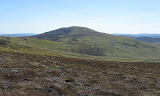

After about a mile, we came to a junction of tracks and a decision needed to be made- up Cairnagour Hill and across the plateau or follow the main track for a bit more to a col immediately south of Mona Gowan. With the heat there was only one decision that could be made- take the shortest route, so it was on to the high col. Mona Gowan looked a bit closer now.....


The area was obviously managed grouse moor and there were a lot of grouse about. Ben raised a few and chased them for a bit but fortunately soon returned. It is a bit nerve racking walking with an excitable springer spaniel, never knowing when he will dash off after something of interest and wondering if he will be sensible enough to stop the chase before he forgets where I am. However, despite several times when he was away and out of sight for two or three minutes he always came charging back. There was a newish fence on the south ridge and we followed that to the summit over mostly short cropped heather.....


Although we were well past the streams by now Ben found a few pools in which to cool off.....


There was a huge cairn on the summit, apparently built for Queen Victoria's Jubilee.....


This is looking north.....


and south to a distant Lochnagar.....


and east to Morven.....


I sat in the sun at the cairn for a bit then we simply reversed the route. On a cooler day I would have traversed west over Cairnagour Hill and Scraulac to meet another track heading south to the A939 but today it was so hot that I wanted to get Ben down to the burns again so he could cool off. While he was playing in the water, I noticed this trap over the burn and similar traps at frequent intervals. To trap stoats or rats maybe to protect the grouse?


Back at the car the temperature gauge said 28 C. A long time since we've had that!

Morrone

2 June 2011.

Participants - Neil and Ben
Where - Morrone, 859m/2,819', Corbett, Map 43, NO 132886

After a month of poor weather, it had suddenly turned fine so it was a chance to do some hills further away from home. So I headed to the north-east for a few days where I still had some new Marilyns to visit. I wasn't sure what to do on the way up- something around Braemar that would not take too long- and as visibility was excellent I wanted a good summit view point. Driving down Glen Clunie, Morrone caught my eye as one that would fulfill the criteria.

On previous occasions I had used the Braemar approach so for a change I decided to use the tracks up the south side of the hill. There was plenty of room to park the car at the start of the track just off the old road to Braemar in Glen Clunie (almost opposite Achallater).  This picture is from the track near the start with the summit of Morrone over to the right.....


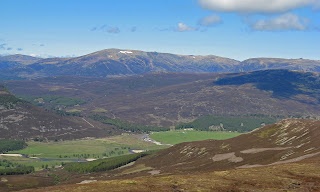
The views soon started to open up- this is looking back down Glen Clunie to a distant Carn Aosda which I was to climb a few days later in much different weather conditions.....


It was certainly hot today but the track made for easy walking; there are now so many tracks on these hills that they are becoming just part of the landscape and whatever you think of them, they do make the climbs easier, particularly if, like me, you are not as fit as you used to be! The track contoured across the hillside at a fairly gentle angle and the summit soon came into sight.....


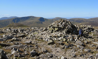
As well as the phone mast and buildings, there was a substantial cairn.....


The views to the Cairngorms were excellent today; this is looking to the bigees of Cairn Toul, Braeriach and Ben Macdui......


with Beinn a'Bhuird further to the east.....


The ugly buildings served one useful purpose today- they provided some shade in which to sit and take in the views. But I still had a bit of driving to do so after about 15 minutes, we set off down again. Although it was the same route in reverse, the perspective was different; this is looking to the hills around Glen Ey- some remote stuff there.....


and then when the track swung to the east there was a good view to Lochnagar.....