Saturday 9 July 2022

Aberdeenshire Tumps and Humps Day 6: Clashmach Hill (Huntly)

 5 July 2022

Where: Clashmach Hill, 375m/1,230', P 63, Tump, OS 28/29, NJ 497 384

The final walk of my trip and one of the hills that had been on my radar for a while. I parked in a picnic area at the entrance to the town, crossed the main road and walked past Huntly Mart to the start of the path up the hill. It wound its way steadily up between an avenue of gorse.....

View of Huntly from part way up.....

Looking north to The Knock from part way up- I did this Banff-shire Marilyn a few years ago.....

The gorse gave way to grass and heather but the path continued all the way to the summit and the trig. The hill beyond (looking south) is Tap o'Noth, another previously climbed Marilyn....


Ben Rinnes was just visible to the west.....

I sat at the summit and watched a shower of rain pass over Huntly and the northern hills, it passed quickly and the visibility soon returned to excellent.....

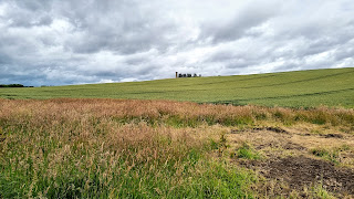
The view over the Aberdeenshire farmland to the west.....

Rain clearing The Knock as I started down.....

What a great way to finish my few days away; Clashmach Hill is a wonderful viewpoint easily attained. 


Aberdeenshire Tumps and Humps Day 5

 Where: Hill of Pitcow, 179m/587', P 31m. Tump, OS 38, NJ 839 245

               Hill of Ythsie, 119m/390', P 53m, Tump, OS 30, NJ 884 314

               Core Hill, 245m/804', P 127m, Hump, OS 29, NJ 760 330

                Hill of Loanhead, 162m/531', P 43m, Tump, OS 38, NJ 746 288

Today's hills started with a drive up- to a NATS aircraft navigation beacon on Hill of Pitcow, north of Aberdeen- the hill high point was in the field immediately to the north.....


Then it was on to Tarves and Hill of Ythsie, one of the most striking of the small hills in the county by reason of The Prop, a striking square tower on its summit built in 1861 as a memorial to the 4th Earl of Aberdeen. There is an information plaque above the entrance which says:

To George Hamilton Gordon, Fourth Earl of Aberdeen, by his attached and grateful tenantry, He was born at Edinburgh 28 Jan 1784 and died at London 14 December 1860.

Gordon was Prime Minister during the Crimean War.

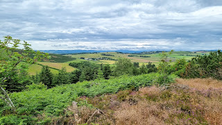
The monument looks like a rook on a chessboard and is open to the public, 93 steps took me to the viewing area at the top which as expected was a wonderful viewpoint.....


As expected, there was a view  over Tarves to the Mither Tap.....


and over a large chunk of Aberdeenshire in the direction of the North Sea.....


The cloud was starting to roll in again as I headed west for the next objective, Core Hill, a Hump but a very easy one as there was a road up to radio masts at the top. Rather than drive all the way, I parked at the end of the public road and walked the rest. Not an inspiring hill as the views were by now reduced by incoming rain.....


I then headed back in the direction of Aberdeen to the village of Daviot for the Hill of Loanhead. Another easy one as there was a car park only metres from the top. This wooded hill has been taken over by the Scouts with buildings everywhere. The saving grace is the well preserved stone circle and crematorium on its northern flank which is worth a visit on its own....


A mixed day with the Prop of Ythsie being a highlight of the entire trip.


Friday 8 July 2022

Aberdeenshire Tumps and Humps: Day 4

Where: Glack Wood, 202/679', P 94m, Tump, OS 38, NJ 738 110

            Kemnay Hill, 129/ 420', P 34m, Tump, OS 38, NJ 739 168

            Logie Hill, 115/ 377m, P 38m, Tump, OS 38, NJ 869 160

Another cloudy day but with bright periods and occasional showers. First hill of the day was Glack Wood, just outside Dunecht. I parked at a wooden gate to the south and followed a good track to a working area in the wood and then a clear path to the trig. This one felt like a proper hill! There was a fine view north to the Mither Tap on the route up.....

The trig.....

looking south-west.....

looking east to the coast.....

Using my hill identification app, I managed to pick out Lochnagar in the far distance (just off centre in the photo).....

Nice hill.

A short drive took me to the village of Kemnay. Kemnay Hill was on the outskirts and was crowned by an unusual man made viewpoint- unusual because it incorporated a flight of steps.....

The north side of the hill had been quarried for granite and was now flooded.....

There were a number of possible high points around the rim.....

and this is the view of the village from the top of the viewpoint.....


The final hill of the day was closer to Inverurie- Logie Hill which was due north of the main runway of Aberdeen airport. I could have driven to the top but decided to park in a lay-by on the road below and walk. There was an old caravan at the top! Looking straight down the runway with Aberdeen City in the background.....


Thursday 7 July 2022

Aberdeenshire Tumps and Humps Days 2 and 3

 1 and 2 July 2022

Where: Elrick Hill, 202/663, P 54m, Tump, OS 38, NJ 848 102

            Hill of Kinellor, 155/509, P 63m, Tump, OS 38, NJ 819 132

            Gillahill, 183/600, P 31m, OS 38, NJ 873 067

I had intended to climb Tyrebagger Hill north of Westhill but the forest and car parks were closed as a result of storm damage last winter. I had already climbed Brimmond Hill. But there was another Tump between the two, Elrick Hill so I headed for that. The start point on the south side of the hill was a small and dark car park at the foot of a rough track. The hill before descending to the car park.....


A flight of steps led up from the car park and on to a path which led up the hill. Looking back at Brimmond Hill.....

Higher up I reached an old picnic area, there was a lot of wind damage to the forest here and it wasn't possible to determine exactly where the high point was; I thought that it was here.....

.

Brimmond Hill from the summit.....


Despite the lush vegetation there were some views to the south-west, this is to the Grampians with Kerloch the prominent hill (I have an app on my phone which identifies hills seen from any point- very useful).....

Back down the same way and a short drive to Blackburn for the Hill of Kinellor. This is another hill where housing has encroached but again it provided an easy route on to the hill. I liked this one, a nice forest area with some views. The high point is a pile of stones on the north side of the path.....

and there was a view to the Mither Tap.....

I continued my walk along the spine of the hill and back again, there was a road at the other end and a small car park.

The following day promised rain but not until later in the morning so I set off early for Gillahill. Parking for this one was at a small shopping centre in Kingswood. There was a good path through a wood and a gate into a field on reaching the hill proper.....

An open gate led to another field containing the high point which was beside a wall.....

The rain arrived as I left the top.


Aberdeenshire Tumps and Humps- Day 1

 30 June

Participants: Just me

Where: Seafield Hill (Auchmithie), 95m/312', P 65m, Tump, OS 54, NO 670 455 

Torry (Aberdeen), 51m/167', P 34m, Tump, OS 38, NJ 949 047 

Mains of Kinmundy (Westhill), 194m/ 636', P 36m, Tump, OS 38, NJ 835 078

I had booked a few days holiday in Aberdeen with the intention of bagging a few north-east Tumps. The weather forecast wasn't great but in the event although it was mostly cloudy there was little rain. I decided to take the coastal route up which gave me Seafield Hill north of Arbroath, one of the "drive up" Tumps. The high point is on the road just north of a windmill! This is a view of the hill from the west and the view from it to the Grampians.....


On to Aberdeen and another drive up! The housing estate of Torry is built on hill and it's highest point meets the 30m all round drop criteria. There used to be a school on top which has now been demolished and something else is being built in its place. Doesn't affect the Tump status, the high point is somewhere on the surrounding road.....

Continuing to Westhill the next target was Mains of Kinmundy. The Aberdeen suburbs have encroached on a lot of the little hills in the area which certainly makes things easier. There was a dog walking area/ viewpoint above the houses and then a stile and fence into the fields. The high point was beside a stone wall.....

North-west I could make out the Mither Tap of Bennachie which was to be a constant feature in the view all week....

east was the Marilyn Brimmond Hill which I have climbed on a couple of occasions.....

and south over the houses were the south Grampian hills with Kerloch prominent.....


Not a taxing day!