Wednesday 30 May 2018

Corlick Hill, Clyde Muirshiel Country Park

30 May 2018

Participants: Neil and Ben
Where: Corlick Hill, 303m/994', P 108, HuMP, OS 63, NS 290 728

I'd been out twice this week already doing TuMPS but as it looked as though there might, by the weekend, be a breakdown in the long, fine spell of weather that we were enjoying, I decided to head out again. Boy, was it hot. If it hadn't been for the light breeze, I would really have been struggling. Corlick Hill, south of Greenock had been on my radar for a while and it didn't disappoint. It was easily the best hill that I have climbed so far in the Clyde Muirshiel Country Park. It probably helped that there was a track all the way to the top and that you can drive up to about 200m on the minor road that runs from Greenock over the moors to Largs. The track passes Whitelees cottage after which the hill is in view.....
 

There were sheep and lambs about so Ben stayed on his lead. Not ideal as he was in his most tugging mood on the way up! He was OK coming back, I guess that this is because he has already covered the ground so there is nothing totally new to examine. Here he is at the trig with the Roseneath peninsula and the Clyde sea lochs in the background.....
 

and south over the Gryfe reservoirs to the higher hills to the south of the Park.....
 

Looking up the Clyde towards Dumbarton, Clydebank and I suppose Glasgow. That wind anemometer is a bit worrying, surely they're not planning on building a wind farm here?
 

Another photo of the sea lochs.....
 

We didn't linger too long at the top, it was too hot to sit about. So not a long walk but a good one.

Tuesday 22 May 2018

Gairloch in May

Participants: Neil and Ben
 
A good forecast saw us heading for the north-west. I had booked self catering in Melvaig and there were lots of not too taxing walks around. I stopped overnight in Inverness on the way up and bagged the two TuMPS within the city boundary.
 
Craig Phadrig, 172m/331', P32, TuMP, OS 52, NO 091 234. A wooded hill on the west side of the canal with lots of paths. The summit area is the site of an iron-age fort, thought to have been built around 500 BC; all that remains are the grass covered ramparts which would once have stood 10m high.....
 
 
Unfortunately, the view is mostly obscured by trees but there was a glimpse of the Beauly Firth.....
 
 
Tomnahurich, 70m/230', P38, NH 655 441. The first TuMP that I have come across that is used as a cemetery. It is another wooded hill and the highest point is at the war memorial.....


Next day it was on to Gairloch. First stop was at Gairloch beach where a great walk started taking in the beach and a couple of wooded hills, both TuMPS.
 
An Ard, 48m/157', P33, OS 19, NG 806 752 and Ord na h-Eaglaise, 54m/177', P36, NG 810 753. The beach.....
 
 
Gairloch from An Ard.....
 
 
 A glimpse of the Flowerdale Grahams, Beinn an Eoin and Baosbheinn.....
 
 
Gairloch harbour from An Ard.....
 
 
The summit of Ord na h-Eaglaise. I didn't realise until I got home that it was Ben's 200th listed hill or I would have probably done these in the reverse order as An Ard is the better of the two. Stll, doubt if Ben minds!
 
 
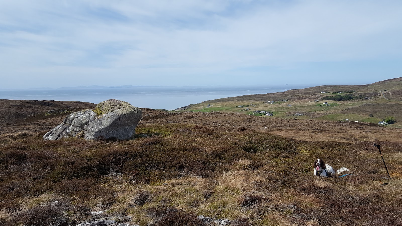
There was time for another TuMP on the drive out to Melvaig. This one was more like a hill!
 
Meall Glac na Daraich, 161m/528', P32, NG 760 808.
 
 
It stands at the edge of a vast moorland; there are settlements all along the coast on both sides of the peninsula but inland it is all bleak moorland. The highest point is the Marilyn An Cuaidh, seen in the distance, more of which later.....
 
 
It was a great viewpoint for the hills to the east. The Flowerdale and Torridon hills.....
 
 
Skye on the western horizon.....
 
 
the Fannichs and Fisherfield.....
 
 
I had been in two minds about doing An Cuaidh. The reports that I had read talked about rough and wet moorland with nothing much to see when you got there. I think, however, that most folk must leave this Marilyn for an "off"/bad weather day and I decided that as it was on my doorstep, I had better do it.
 
An Cuaidh, 296m/971', Sub-2k Marilyn, NG 765 891. I could have made it a really short day by driving up to the masts that are visible for miles around but instead decided to park at the foot of the private road to them and walk. The view when we arrived at the masts was not encouraging, the moorland certainly didn't look like enticing walking (you can just see the trig on the distant highest point in this photo.....
 
 
However, after a couple of hundred yards faffing about in the peat bog, I was able to reach much better ground by heading slightly north where I found some higher ground. Approaching the trig.....
 
 
Ben at the trig.....
 
 
It was an atmospheric spot, I doubt if it gets many visitors, and the views of the surrounding hills, although distant, were terrific. The Fisherfield hills were the most prominent.....


but they were only a few among many. I was also able to identify Suilven, Stac Pollaidh, Slioch, Flowerdale, Torridon, the Cuillin, Dun Caan, Trotternish and Clisham in Harris. Not bad for a remote Marilyn.
 
One advantage of staying in the area was that I was on the hill early. So I was back at the car before noon and after visiting the lighthouse at Rhubha Reidh, decided that I had time for another hill in the afternoon.


Druim an Rubha Bhain, 129m/423', P74, TuMP, NG 749802. This one was across the road from Meall Glac na Daraich which I had climbed yesterday. Being closer to the sea, it was an even better viewpoint. Ben at the summit.....
 
 
Looking down on North Erradale with Skye background.....
 
 
Longa Island and Skye.....
 
 
The hills of Flowerdale and Torridon.....
 
 
The weather on my final full day at Melvaig was a bit overcast. I decided on a drive north to Aultbea taking in the HuMP of Meall a'Cliuth at Poolewe on the way. It stood at the head of Loch Maree so I reckoned would be a good viewpoint.
 
Meall a'Cliuth, 229m/751', P 104m, HuMP, NG 850 800. I parked at the start of a track to a mast on the hill and followed it all the way. The trig was only a matter of yards past the mast.....


As expected, not a bad view towards Loch Maree with the Corbett, Beinn Airigh Charr prominent.....


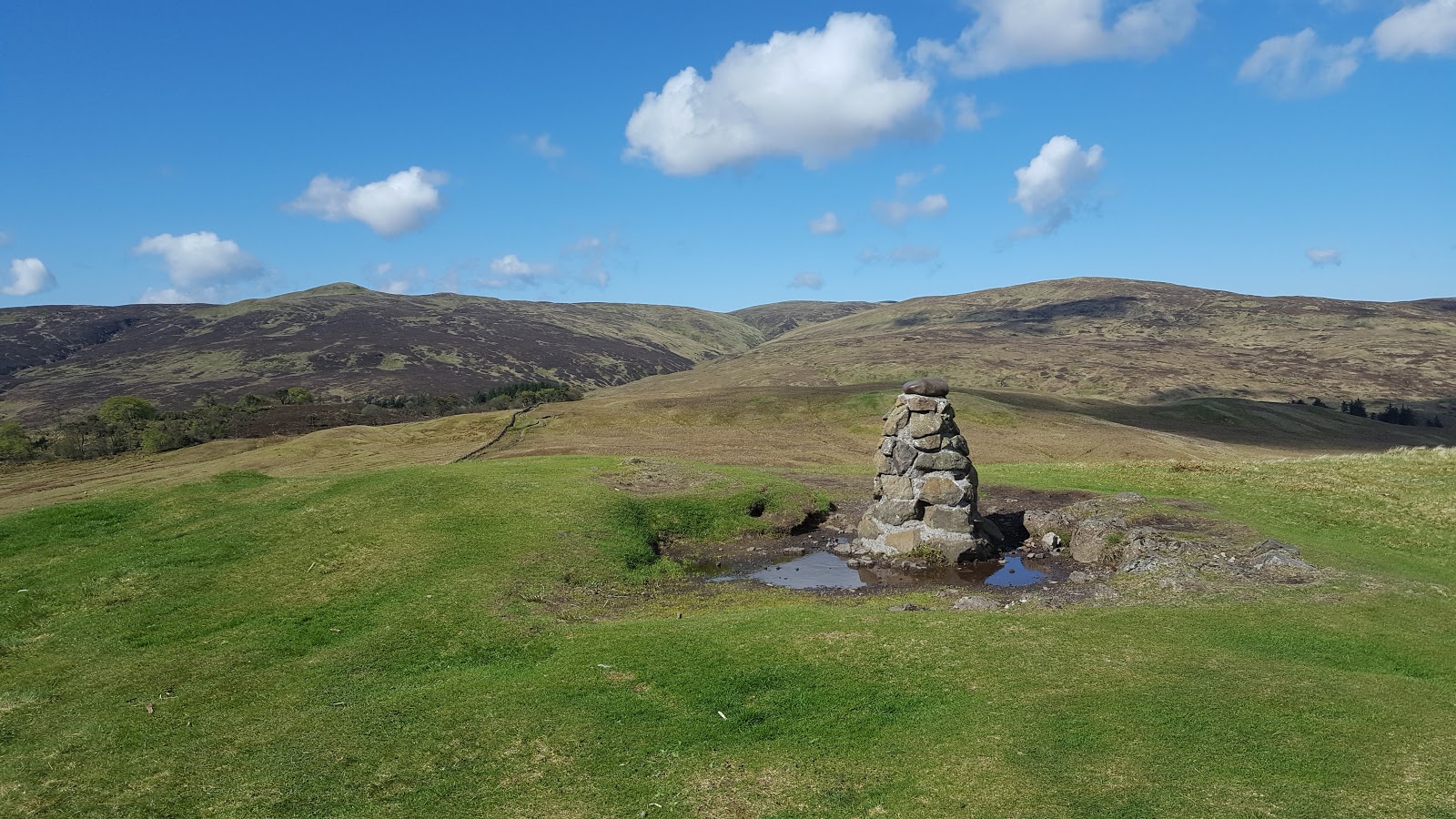
The next day was home. With the whole day ahead of me, I stopped at Strathpeffer and climbed Knock Farrel.
 
Knock Farrel, 218m/715', P36, TuMP, NH 505 585. This was an excellent walk, from the car park next to the old Youth Hostel up on to and along the ridge joining Knock Farrel and the Marilyn Cnoc Mor, which I had done on a previous occasion. The highest point was the site of another iron age fort and there were good views of Strathpeffer and of Ben Wyvis to the north. Definitely recommended if you're looking for a break on a drive north.


Sunday 13 May 2018

Windy Hill and Craig Minnan, Muirshiel Country Park

12 May 2018

Participants: Just me
Where: Windy Hill, 315m/1,037', P52, TuMP, OS 63, NS 318 637 and Craig Minnan, 303m/994', P32, TuMP, NS 322 640
 
A short walk on a nice and sunny Saturday morning. The roads were quiet so it didn't take long to get to the Muirshiel Country Park Visitor Centre on the moor above Lochwinnoch. There are a number of marked trails from here one of which goes to the top of Windy Hill, a walk of no more than 30 minutes.....
 
 
Even if that was the end destination it would be worthwhile as it is a fine viewpoint. The cairn looking south-west to Misty Law with the Marilyn, Hill of Stake in the middle distance.....
 
 
The Park consists of high moorland, the Visitor Centre sits at a height of 250m. It is generally very wet underfoot and rough- the walk to and from Hill of Stake is one of the roughest that I have encountered. This is the view across the moorland in the general direction of the Clyde coast, hidden from view of course. There is a disused barytes mine up here.....
 
 
It was a bit hazy so the distant views could have been better, this is looking south to the distant Galloway hills.....
 
 
Windy Hill was not my final destination today, however. That was another TuMP to the north- Craig Minnan. Another volcanic plug but a different sort of hill altogether.....


It was a bit wet underfoot down on the moorland but I was soon over that and climbing the steep grassy slopes of this fine little hill. From here I was looking to the towns of Kilmacolm and Bridge of Weir and the Clyde.....
 
 
Looking back to Windy Hill.....
 
 
Then it was back the same way.....
 
 
with a stop at the Visitor Centre for a coffee before the short drive home. 

Monday 7 May 2018

Edinburgh Hills Part 2- Blackford Hill and Braid Hills

6 May 2018
 
Participants: Just me
Where: Blackford Hill, 164m/538', P63, TuMP, OS 66, NT 254 706 and Braid Hills, 213m/699', P51, TuMP, NT 250 694
 
In over 30 years living in Edinburgh, I had never visited Blackford Hill; neither had I been at the summit of Braid Hills although I had hacked about on the Braids golf course on a number of occasions. So now I was taking the train through to Edinburgh to put that right. I took the bus from Waverley to Comiston and started the walk on Blackford Hill, seen here from the slopes of Braid Hills.....


If anyone is in any doubt about what a magnificent city Edinburgh is, all they need to do is visit, on a clear day, any one of the 10 TuMPS within the city boundary- apart from Corstorphine Hill which is tree covered. Blackford Hill is as good as any of the others, perhaps better as it does not attract the vast crowds that flock to the summit of Arthur's Seat. It is perhaps best known for being the site of the Royal Observatory. There is also a communications mast near the summit which fortunately does not obscure the views.

It was one of the hottest days of the year so far and the distant views were a bit hazy but, hey, you can't have perfection all of the time. This is the view round the northern arc.  Arthur's Seat and Salisbury Crags.....


Edinburgh Castle.....
 
 
Corstorphine Hill.....
 
 
and a panorama of all three.....
 
 
The trig with Arthur's Seat beyond.....
 
 
Looking down the Forth estuary with North Berwick Law on the horizon.....


another view of west Edinburgh and Corstorphine Hill.....


two TuMPS still to do, Wester and Easter Craiglockhart Hills (centre).....


The Pentland Hills with Braid Hills in the foreground.....


After drinking in the views for a bit, I set off for Braid Hills, taking in part of the Hermitage of Braid on the way. There was a strong smell of coconut in the air as the broom was now fully out. It is extensive on these two hills and I remember investigating it more thoroughly years ago on Braids golf course! A footbridge across the Braid burn took me to Braids Road from where it was only a short walk to the golf club house and the walkers way on to the hill. There is a fairly extensive area of ground between the two golf courses, including the highest point, that is set aside for public use other than golf and a number of paths wound uphill to the masts which sit on the summit......


The highest point seems to be on a tee for a practice area.....


There is a trig and a viewpoint a few hundred yards to the west. Arthur's Seat with Blackford Hill in front of it......


the Pentland Hills with the ski slope prominent.....


looking west, you can just make out the spans of the Queensferry crossing.....


So six more hills to visit to complete my Edinburgh set. I've been to some of them before but they deserve a revisit. Outwith the main tourist season of course.