Wednesday 22 April 2015

Millfore

22 April 2015
 
Participants: Just me
Where: Millfore, 656m/2,152', Graham, Map 77, NX 478755
 
The good spell of weather was forecast to end in a couple of days. So I reckoned that, just in case this was our summer, I had better get out again and do another hill. This time, I headed south instead of north- to Galloway to climb the Graham, Millfore. The Galloway hills are less frequented than the Highlands and I suspect that this part of Galloway sees few visitors.
 
I decided on the approach from the south and parked at the Black Loch car park. This is the loch; on the opposite bank is a tall, conical structure constructed from tiny bricks- an artwork apparently called "the Eye"- goodness knows why- and built by Colin Rose. It was certainly unusual!


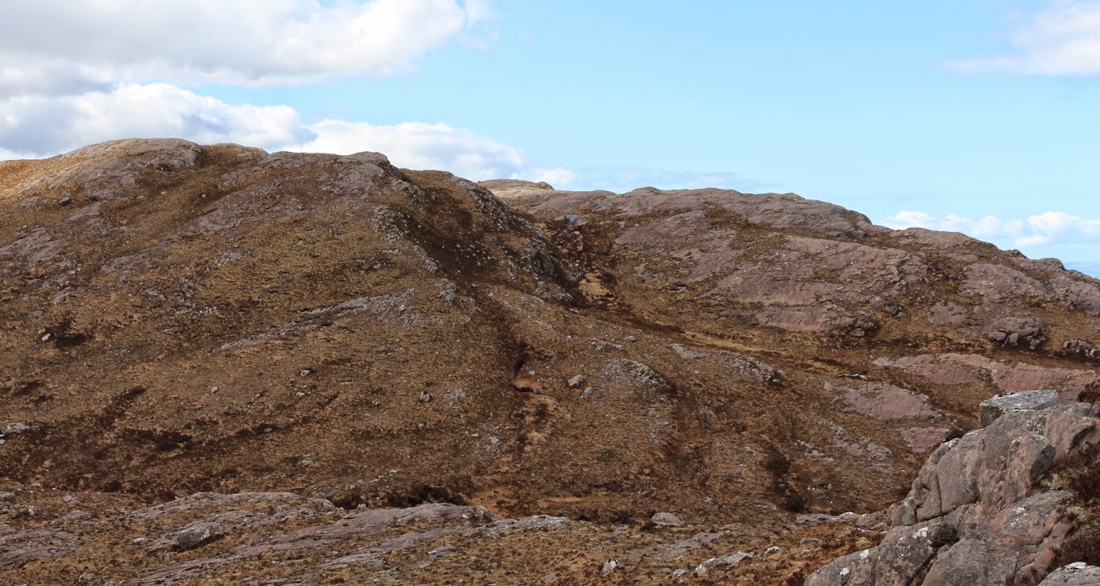
I followed the good forestry track until it reached the bealach between Kirkloch and Poultrybuie Hill. As I approached this point, Millfore came into view for the first time.....
 
 
There were no gates, the track was well surfaced and I could see no reason why I could not have driven to this point. I am however wary of driving off-road, mainly because I know nothing about car mechanics and if anything happens I doubt if a garage would be willing to come out and get me. Anyway, the walk to the point where I left the track was pleasant and was only a couple of miles, adding about 2 hours to the return trip.
 
The first few hundred yards on the hillside were rough- Galloway rough! But after crossing an old deer fence, the angle increased and the going got better. In fact there was more grass than heather; it wasn't really a typical Galloway hill. There was even a faint path forming that went all the way to the summit.....
 
 
There were a number of cairns plus a trig, which looks as though it is on the highest point.....
 
 
Unfortunately it was hazy and not a great day for photography. But here are a few shots anyway which give an indication of the area. Lamachan Hill and Curleywee.....
 
 
The Merrick, the highest hill in Galloway, in the distance with Loch Dee in the foreground.....
 
 
South to Cairnsmore of Fleet.....
 
 
And on the way down, Craignell.....
 

An interesting outing in previously unvisited country.

Monday 20 April 2015

Creag na Doire Duibhe

19 April 2015

Participants: Neil and Ben
Where: Creag na Doire Duibhe, 574m/1,883', Sub-2k Marilyn, Map 35, NN 615906

I hadn't intended to go walking again today especially as the forecast was for heavy cloud cover and my knee was still giving me bother. But as I drove down the A9 it was obvious that the cloud was only affecting the east of the country so I decided to make a detour to Laggan to do another sub-2k on my wanted list- Creag na Doire Duibhe. I parked at a bridge over the burn at the start of a track that crossed the moor almost to the foot of the hill; there was room for a few cars here. The hill was in view after the first couple of hundred yards and it looked like a good walk.....


The track ended where the hill proper started but unlike the previous day, the heather was short and good to walk on. The view east was over Loch Glas-choire to Creag Dhubh at Newtonmore.....


My route followed the line of a new deer fence which I didn't have to cross although higher up there was an older fence, fortunately with a gate. Then it was simply a case of taking the least steep route to the west ridge and then shortly after I was at the cairn. This is the view east to Creag Dhubh.....
 
 
south to the Munro, Meall Chuaich.....
 
 
and north to the Munro, Geal Charn.....
 
 
But the view that attracted most attention was the panorama of snow covered peaks to the west which included Ben Alder, the Loch Pattack hills and the Creag Meagaidh hills. I took a wide angled photo to try to show the whole lot.....
 
 
Another view of the Loch Pattack hills.....
 
 
and Creag Meagaidh.....
 
 
A real gem of a hill- highly recommended. It took just less than 3 hours car to car so could easily be fitted in in a drive up or down the A9.
 
Ben had had a great three days, goodness knows how many miles he covered in total but that evening and today he has been extremely listless. Even spaniels get tired and need rest days apparently.


What a contrast- Cnoc an t-Sabhail (east)

18 April 2015

Participants: Neil and Ben
Where: Cnoc an t-Sabhail (east), 321m/1,054', Sub-2k Marilyn, Map 21, NH 722817
 
Marilyns come in all shapes and sizes, as demonstrated by yesterday on Seana Mheallan and todays objective, Cnoc an t-Sabhail above Tain. I climbed it's twin, also called Cnoc an t-Sabhail, last year. This one had a bit of a reputation for rough going and it was well deserved. The photo is taken from the Struie road on the way back to Inverness.....
 
 
I parked in a Forestry car park to the east of the hill. The going initially was good, through some mixed forestry that covered a lot of Hill of Tain.....
 
 
I kept on the tracks as far as a nice wee loch- Lochan Uaine. The lump of moorland above it was todays objective!
 
 
Off track, the going varied from poor to awful. There was some of that really thick, spongy grass, some thick heather, and occasionally a patch that had been burned in the recent past and which provided slightly better going. Eventually the trig came into view.....


As I expected, the views were not great. The best was to the Graham of Beinn Tharsuinn to the west with Ben Wyvis to the left of it.....
 
 
and there was a glimpse of a distant Ben Klibreck to the north with the Dornoch Firth in the foreground.....
 
 
Despite the going, it had a certain interest- there is nothing like a bit of variety- and I found it a lot easier on the way down. This is looking down on the lochan with Hill of Tain behind it.....

Torridon superlative- Seana Mheallan

17 April 2015
 
Participants: Neil and Ben
Where: Seana Mheallan, 437m/1,435', Sub-2k Marilyn, Map 25, NG 929551
 
The forecast was excellent so I decided to head for Inverness for a few days. I used to go to Torridon a lot when I was in a walking club and climbing Munros and Corbetts but for some reason, since I retired, I hadn't been back. It was time to put that right. Only downside was that my knee was hurting me again but I reckoned that the views that I was going to get would be adequate compensation. There was hardly a cloud in the sky when I drove down the glen. I always get a thrill when the road bends round a bit to the right and Liathach comes into view. I just had to stop for a photograph- Seana Mheallan is the small hill on the left directly opposite the Grey One. That was why I was so keen to climb it- it paralleled the length of Liathach on the opposite side of the glen.....


I parked in the Coire Dubh car park at the start of the track to the Ling Hut. What a fantastic situation for a mountaineering hut! I've stayed in it once, many years ago. Here it is over Lochan an Iasgair with Seana Mheallan to the right.....


I had hardly started the walk and the camera was already working overtime. This is looking back from beside the hut to Liathach.....


There is a good stalkers path that goes past the hut and carries on up the side of the burn well up the hillside on the way towards the Corbett of Sgorr an Lochan Uaine. I remembered coming this way to climb that Corbett and its near neighbour Sgurr Dubh- they were rough hills. Not all that far along the path there was a good view back to Beinn Eighe.....


I crossed the burn fairly high up and it was then just a case of ploughing upwards to the east top over mostly short heather. I know that distances can be deceptive but the main top looked an awfully long way away from the east top. And there was a fair bit of down and up work required before I got there.....
 
 
Getting closer now.....
 
 
There are lots of wee lochans on this ridge and they provided good foregrounds for pictures of the surrounding hills. This is to Sgorr nan Lochan Uaine, Beinn Liath Mhor (Munro) and Sgorr Ruadh (Munro).....


and this is to Maol Chean-dearg (Munro).....
 

I was now passing opposite the Fasarinan pinnacles on Liathach on the other side of the glen.....


Eventually the cairn came into view, with a convenient lochan beside it for Ben to cool off in.....


What a magnificent viewpoint! West down Loch Torridon and over to Skye.....


Beinn Damh (Corbett) in the distance.....


The Fasarinan pinnacles.....


Beinn Liath Mhor and Sgorr Ruadh.....


and back along the ridge to Sgurr Dubh.....


It was a summit on which to linger- and we did- before heading back the same way and seeing the views all over again. Somehow, I managed to take almost 6 hours to do this one, but it is definitely in the top 10 of sub-2k's.

Friday 10 April 2015

Creag Ruadh, Glen Tarken

9 April 2015
 
Participants: Just me
Where: Creag Ruadh, 712m/2,335', Graham, Map 51, NN 674292
 
I climbed the western of the two Glen Tarken Grahams, Creag Each, a few years ago but until today had not got round to tackling its neighbour Creag Ruadh. Probably because it looked as though it was a long way from anywhere in the midst of moorland!
 
It was another warm, sunny day although quite a bit hazier than earlier in the week. The track heads uphill steeply from the loch side past some old houses now converted into barns. Where it started to level off, there was a good view back across the loch to Ben Vorlich. Still plenty of snow on its northern aspect.....
 
 
The track passed Creag Each......
 
 
and then dropped down a bit passing what looked like a small hydro scheme before rising up again to cross the moor. Creag Ruadh looked a long way away from here.....
 
 
I doubt if Glen Tarken is much visited apart from hill baggers- and grouse shooters in the season. It has a nice remote feel to it. You can follow the track up one side of the glen, round the top and back down the other, a nice walk in itself.

I carried on along the track to round about its highest point before taking to the slopes. Creag Each looked a distance away now......
 
 
There was no path, it was just a case of trying to follow what grassy bits that there were. This would be a bit of a bugger when the heather is higher in the summer. There was some heather burning going on so I went a bit further east than I would otherwise have done to keep well out of the way. There were some nice wee lochans higher up as well as some really rough ground.....


There were two tops, quite rocky in places- obviously where the "Creag" in the name comes from with a steep grassy slope between them.....
 
 
The eastern top looked higher but when I got there it clearly wasn't. So it was back along the ridge to the main top.....
 
 
which had a small cairn perched on a rocky bluff.....
 
 
It was a pity that it was so hazy as this would be a fine viewpoint on a clear day. This is looking to the Lawers group.....
 
 
The heather burners seemed to have moved on by this time so I was able to make a more direct descent to the track following a stream a lot of the way. After about 15 minutes I looked back and there was someone else on the top! They never caught up with me even though I had a long stop when I reached the track so I have no idea where they came from or where they were going. The haze cleared slightly and I took this photo of the south Loch Earn Grahams on the way down.....
 
 
I'm definitely slowing down though- this hill took me as long- 5 hours 20 minutes- as the recommended book time for the two hills! But time is incidental when out on the hills.