Friday 28 April 2023

Knockencorsan (Muirshiel)

 25 April 2023

Where: Knockencorsan, 332m/1,091', P 55m, Tump, OS 63, NS 240 667

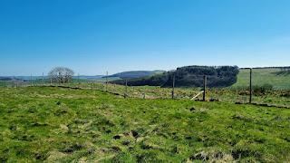
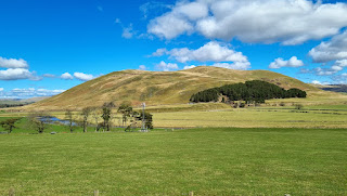
A return to Old Largs Road in Muirshiel Park south of Greenock to bag Knockencorsan which lies south of Berry Hill which I climbed earlier in the year. I really should have done both on the same day as Knockencorsan requires little effort. I parked at the communications mast from where it was straight up to the ridge alongside the fence. There are a number of knolls all of which the map claims to be the same height so I wandered over the most likely candidates. This one in the distance looked the highest but wasn't; it was however the best viewpoint.....

Views towards Arran with Largs in the foreground in some of the pics.....


Clyde estuary and hills....


North across the moors.....


An easy stroll.


Monday 24 April 2023

Emily Hill, Black Hill (Fife), Kinpurney Hill, Ironside Hill, Gallow Hill (Sidlaws)

 19-21 April 2023

Where: Emily Hill, 154m/505', P 32m, Tump, OS 59, NO 323 197; Black Craig, 202m/666', P 73m, Tump, OS 59, NO 330 217; Kinpurney Hill, 345m/1,132', P 49m, Tump, OS 53, NO 332 417; Ironside Hill, 354m/1,161', P 30m, Tump, OS 54, NO 399 411; Gallow Hill, 378m/1,240', P 37m, Tump, OS 54, NO 390 413.

I had wanted to climb Kinpurney Hill for a while and a spell of good weather encouraged me to spend a couple of nights in Dundee bagging it plus another couple of Tumps in Fife on the way up and a couple more of the Sidlaw hills on the way home. I had a dentist appointment in Glasgow at lunch time so it was almost 14.00 before I set off. First hill on the journey was Emily Hill at the village of Creich. I parked opposite the church at the start of a track that led up the side of fields planted with oil-seed rape.....


There was a pheasant enclosure higher up but the summit of the hill itself was outwith the enclosed area. Norman's Law came into view to the west....

Norman's Law from the summit area.....

To the south I could see the tower on Mount Hill, near Cupar.....


Looking east from the summit....

Looking north to Black Craig (right), the next hill on the list.....

It was only a couple of miles drive to the parking spot for Black Craig. A track led up the west side of a wood and continued to the summit, just as well as there was a lot of gorse on the hill. In fact, the high point could have been in this gorse bush, or perhaps to a rocky area a few feet away.....

It wasn't a great viewpoint, Mount Hill again to the south.....

And across the Tay to Dundee.....

The next day was the one set aside for Kinpurney Hill, seen from the car park at Newtyle.....

From the parking area, I walked along Glamis Road away from the village until I reached Denend farm where a signposted path pointed the way to the hill. The path followed the Edderty burn through a beautiful Den, with masses of spring flowers.....


Then it was out on to the open hillside and a steep track up.....

Eventually, the tower that sits at the top of the hill came into view. It was built in 1774 by James Mackenzie as an observatory. Today it is just a roofless shell.....


There is also a trig and a viewfinder and a fabulous view in most directions......


Views north to the Angus glens and west to Schiehallion and (just) the Lawers group.....


I stayed on top for a while enjoying the views but eventually the strong cold wind drove me down. Great views over Newtyle on the way down.....


A top Tump!

Day 3 was back to the Sidlaws before the drive home. This time, I parked in a lay-by just north of Lumley Den, at the start of a track that went all the way to the summit of Ironside Hill. These are heather hills but there were big stretches of cleared ground and the going was easy. Looking down at the car from part way up Ironside Hill....

Guess the prevailing wind direction.....

Craigowl from Ironside Hill.....


From Ironside Hill I dropped down to the col between it and Gallow Hill, close to a communications mast. The way up Gallow Hill.....

Cairn close to the high point of Gallow Hill.....

Ironside Hill from Gallow Hill.....


Saturday 8 April 2023

Castle Hill (Abington)

7 April 2023

Where: Castle Hill, 483m/1,585', P 101m, Hump, OS 71/72, NS 944 222

A fine start to the Easter weekend and I headed south to Abington to an area that I was totally unfamiliar with. Castle Hill is one of the few hills on the east side of the M 74 that has not been taken over by wind farms.   It has a solitary mast on it's west top and there is an excellent track as far as that. The track continues as a rough ATV track all the way to the summit where there is a small cairn. Together with easy parking beside a forest area on the west slopes, this trip provided a relaxing day out. Castle Hill from the west.....

Heading up the track.....

Looking at the upper slopes from the mast.....

At the summit, looking north to Tinto.....
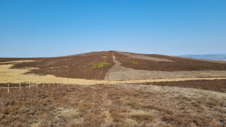

East to Tewsgill Head. There is a Roman road between the two hills and I could have come up Castle Hill that way and perhaps added the second hill on to the day but it will be no hardship to go back. Tewsgill Head is now on my "to do" list!....

West to the Lowther Hills and Ravensgill Dod.....

South over Crawford to the Clyde wind farm hills.....


The Lowther Hills and Ravensgill Dod from the track down.....


Tuesday 4 April 2023

Little Hill and Thorney Hill

 3 April 2023

Where: Little Hill, 350m/1,148', P 41m, Tump, OS 57, NN 770 169 and Thorney Hill, 104m/358', P 32m, Tump, OS 58, NN 974 132

This week's trip was to just south of Comrie to bag Little Hill. It was a shortish walk so I decided to divert to Auchterarder on the way home and bag Thorney Hill.

It was a very pleasant spring day although a bit hazy. I left the car in a very convenient lay-by a couple of hundred metres north of the entrance to the track that circled Little Hill. The path started off flat but then rose steeply through a nice wood to emerge onto the moor where it branched. This is or was grouse country so there were lots of tracks, one of which went almost to the summit. I could see the trig in the distance from well down the hill. 

The trig is not the summit. This is about a hundred metres to the south-west and is unmarked. There is a fine view of the Marilyn Ben Clach from both.....


Looking east from the trig.....

The trig from the summit with Ben Chonzie beyond.....

I took a couple of pictures from the track on the way back down. Ben Vorlich and Ben Halton to the west.....

Comrie and Ben Chonzie to the north.....

A Tump that I can recommend!

It was still early when I got back to the car so I decided to make a slight detour to Auchterarder to hopefully bag Thorney Hill. I had looked at this one in the past but there was always a herd of cows on it, which I tend to avoid if at all possible. However, I was in luck today, the cows had been replaced with sheep. I was able to park at the side of the road just east of a farm entrance and a quick 10 minutes saw me at the top..... 

There is a memorial to a local shepherd just before reaching the high point.....


and the hill is a good viewpoint for the surrounding countryside despite its small stature.


A satisfying day.