Friday 21 October 2016

A Visit to Shropshire: Caer Caradoc Hill

14 October 2016

Participants: Just me
Where: Caer Caradoc Hill, 459m/1506', Sub-2k Marilyn, Map 137, SO 477953
 
This was my final days walking. The objective was Caer Caradoc Hill above Church Stretton, on the opposite side of the valley from Long Mynd. This picture was taken the day after, when I was stuck in the MBA AGM in perfect weather conditions. Sods law!.....
 
 
Like a number of the hills that I had climbed during the week, it is volcanic in origin and was formed by rock thrust upwards by movement deep down in the Stretton fault, which apparently runs from Staffordshire to south Wales.
 
It was quite dull when I parked in the main car park in Church Stretton but the forecast was an improving one. My route crossed the railway, then the A49, turned first left along a lane which became a track which was a permissive path, through a field, then some woods and then another permissive path up the south ridge. This is looking back at Church Stretton from the field area.....
 
 
The hill top area was another Iron Age fort which local legend suggests was also the site of a battle between Caractacus and the Roman legions during the latters conquest of Britain. Whatever, it is not as impressive as Burrow, although it is in an equally commanding position. This is the remains of a ditch.....
 
 
and there were various rock outcrops towards the top.....
 
 
The exact summit was unmarked and could have been at any one of a number of rocky areas. I wandered round them all just to make sure.
 
The weather was really dull at this point which was a shame as I had really been looking forward to this hill. This is looking to Church Stretton.....
 
 
and this is north along the ridge of hills in this particular range.....
 
 
The weather had started to improve but by this time lots of people were arriving so I decided to set off down and take some photos looking back up so that I would have a photographic record of the ascent. Here they are in descending order.....


So that was my trip. Nine new Marilyns, all interesting, as were the towns and villages that I passed through.

A Visit to Shropshire (and Wales): Y Golfa

13 October 2016

Participants: Just me
Where: Y Golfa, 341m/1119', Sub-2k Marilyn, Map 125, SJ 182071
 
I decided to have the morning looking round Shrewsbury- a busy and interesting City. The weather wasn't too bad, there were showers around but basically it was another useable day. So I decided that I had better get my boots back on and spend the afternoon on a hill. Something short and easy; Y Golfa a couple of miles west of Welshpool fitted the bill. This one was definitely mixing both language and sports- its western slopes were occupied by a golf course! And what a course. Well kept, looked testing, and fantastic views. Apparently Welsh course of the year a couple of years ago.
 
There was a narrow layby on the main road which I didn't fancy so I drove up a minor road to the golf club house and asked permission to park there. It was readily granted, there was apparently only one person playing the course. A track took me most of the way and where it ended I followed the edge of the fairway to the heathery area which contained the trig. About an hour there and back. Here are the photos.....


It was certainly different!


A Visit to Shropshire: Callow Hill and Burrow

12 October 2016

Participants: Just me
Where: Callow Hill, 334m/1096', Sub-2k Marilyn, Map 137, SO 459849 and Burrow, 358m/1175', Sub-2k Marilyn, Map 137, SO 381831
 
It was a getting better sort of day. I drove south to the village of Craven Arms and followed some (very) narrow country roads to a parking place north of Callow Hill between the hamlets of Lower Dinchope and Moorwood. This is a view of the hill from the drive down.....
 
 
I had chosen this hill because it has a prominent landmark on top- Flounders Folly. The Folly was built from local sedimentary mudstone in 1838 and is today a Grade II listed building. It is named after its builder- Benjamin Flounders, and remained in good condition for the first 100 years of its existence. However, it began to suffer damage and started to deteriorate from around the 1940's and was eventually fenced off in the 1980's. Around the Millennium, a local group started raising funds for restoration and it was reopened in 2005. It is only open to the public at certain times; unfortunately, the day of my visit was not one of them so I didn't get to see the view from the top which must be very fine on a clear day.
 
 
There was a good public footpath from the car park and it didn't take long until the tower came into view.....


It was a bit hazy so the views were not particularly sharp. These photos are looking up the valley towards Stretton; the first shows Caer Caradoc which was on my "to climb" list and the second The Wrekin (just visible far right)....


As I returned to the car, the sun was starting to come out and it was turning into a very promising day.
 
By the time I reached my next hill, Burrow, less than 10 miles away on the other side of Craven Arms, the weather was perfect. I parked in the village hall car park at Aston on Clun. It was also the car park for the village shop, which sold me a big cup of tea for £1 on my return from the hill. On the way to the hill, I passed this tree, the Arbor Tree.....
 
 
Apparently, it was a Celtic custom to dress the tree to seek favour from Brigit, their goddess of fertility. Nowadays, on the last Sunday in May, villagers dress the tree in flags-which remain throughout the year- as part of their local festival.
 
The way to the hill went between some houses and then became a track through fields, going through a couple of gates and then narrowly uphill through some forestry to join a forest road.....
 
 
The interest in this hill was that it contained a large Iron Age fort, complete with ramparts and ditches and hut platforms. It was one of the best that I have seen. There was no commercial forestry at the summit area, only some lovely mature deciduous trees. By now the sun was blazing down so I spent some time exploring the fort and sitting on the ramparts enjoying the views.....


It was easy to see why there was a fort here. Burrow commands the countryside for miles around.This is looking towards Stretton and the Long Mynd and Caer Caradoc......

 
to Corndon Hill and Wales.....
 
 
and to some nice Shropshire countryside in the direction of Hereford.....
 
 
A really interesting day. Burrow also marked the half way point for me for the Marilyn list, not that I have any intention of climbing them all, far less being able to.


Thursday 20 October 2016

A Visit to Shropshire: The Wrekin

11 October 2016

Participants: Just me
Where: The Wrekin, 407m/1334', Sub-2k Marilyn, Map 127, SJ 628081

The Wrekin is probably one of the best known hills in England. It is an isolated, volcanic plug, mostly tree covered but cleared on top and it is visible from many miles away.....


It was foggy when I arrived at the substantial car park so I waited for about an hour before setting off in the hope that it might clear the higher up I got. The ascent was straight forward- I just followed the wide track.....
 
 
About half way up, I passed a sign explaining a bit about the use of the hill as a fort. It said "The Wrekin was possibly first settled in the Neolithic or the Bronze Age but the visible defences are between 2,000 and 2,500 years old and date from the Iron Age. It stands out among over 50 such sites in Shropshire and is likely to have been the tribal capital of the Cornovii. It comprises an inner (3 hectare) enclosure encircling the summit and outer (8 hectare) defences encircling the lower slopes. Its fortifications clearly point to defence but it probably served a range of functions such as a tribal meeting place and/or ritual centre. It seems to have been abandoned around the time of the Roman conquest and there is no archaeological evidence for later re-occupation."
 
Approaching the large radio mast near the summit, the fog began to thin and it looked as though I might be in luck.....
 
 
And I was, it was clear on top and the sun was shining. I expected that it would be a popular hill and it was.....


The mist shrouded the lower ground so I saw nothing of the industrial landscape below.....


It would have been interesting to have seen the major cities, maybe another time. They are somewhere down there.....


In fact, the only indication of industry that I was able to see was the stack of the now disused Buildwas power station at Ironbridge (peeping out of the cloud to the left of the trig).....
 
 
I returned the same way and went to have a look at the village of Much Wenlock. 
 

Wednesday 19 October 2016

A Visit to Shropshire: Corndon Hill, Stiperstones, Long Mynd (Pole Bank)

10 October 2016

Participants: Only me
Where: Corndon Hill, 513m/1683', Sub-2k Marilyn, Map 137, SO 306969: Stiperstones, 536m/1760', Sub-2k Marilyn, Map 137, SO 368987: and Long Mynd - Pole Bank, 516m/1694', Sub-2k Marilyn, Map 137, SO 415944

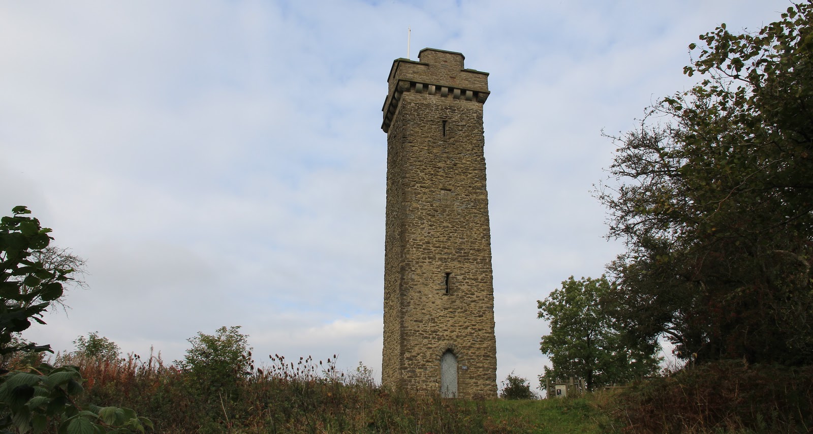
There are a lot of sub-2k Marilyns within a short distance of Shrewsbury, where I was based, but I decided to concentrate on these that had a bit of additional interest, e.g., good views, geological features, hill forts and so on. Weather wise, it looked like being the best day of the week so I decided to visit three of the bigger and more well known hills, Corndon Hill, which is actually a couple of miles over the Welsh border, Stiperstones, and the Long Mynd. A feature of the day was the number of Red Kites that I spotted, they are certainly well re-established in this neck of the woods. Here is the first objective, Corndon Hill.....
 
 
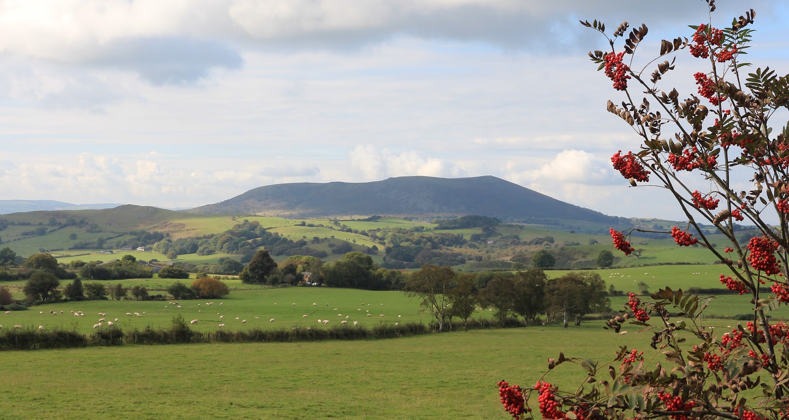
There was a small car park to the north of the hill, provided for visitors to a stone circle. I didn't bother visiting the standing stones as there only appeared to be a few stones left and there are better examples in Scotland. A farm track led to a gate in the fence and a sign informing me that I was permitted to climb the hill from that point. Lots of folk appear to have taken up the offer as there was a well developed path that led all the way to the top, steeply in places. As forecast, the early morning mist was dispersing and it was turning into a beautiful day. Here are a couple of views looking further into Wales.....


I got a pleasant surprise when I reached the summit- there was a seat.....
 
 
How they got this up the hill I don't know because it was a really solid structure. Anyway, it was welcome and I sat on it for a while taking in the views including to Heath Mynd, another Marilyn which was not on my to do list this visit.....
 
 
and to Stiperstones, which was next on my list.....
 
 
Stiperstones is a 10 kilometre quartzite ridge which includes a number of prominent jagged tors of which Manstone Rock is the highest point. Unsurprisingly, given the jagged, rocky nature of the landscape, Stiperstones is also rich in legend, particularly featuring the Devil.....


On the way to the hill, I stopped at the Bog visitor centre. The area around Stiperstones used to be a big mining area and at one time produced around 10% of Britain's lead ore. The Visitor Centre, formerly the village school, tells the story of mining in the area and is well worth a visit. Apparently, at one time the Bog was a bustling village but most of the houses are now long gone. There is a car park at the Bog and a path from there up the hill but I chose to carry on to a higher car park and shorten the walk a bit. My excuse was that I still had another hill to do after this one.

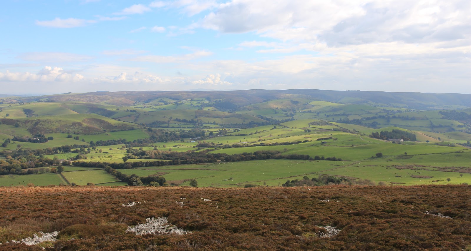
A walk taking in the whole ridge would be well worthwhile as it sits high above the surrounding countryside. There was a good view of Corndon Hill to the west.....


while to the east across another valley was my next objective, the Long Mynd.....


Here are some views along the ridge including some of the tors.....


There was no mistaking the highest point (the figure to the right gives it's scale).....


I reached the trig by way of a short easy scramble on the west side, it was a great perch.....


Then it was back to the car and a drive along narrow country lanes- and I mean narrow! They took me down into another valley and then up again to another ridge, the Long Mynd, whose highest point, Pole Bank, was another Marilyn.

Long Mynd was one of the easiest Marilyns that I have done; "climbed" would be to totally misrepresent the facts. There was another high car park and a smooth track along the ridge to the highest point involving no more than 30m of height ascent.....


There was both a trig and a topograph; both pictures have Corndon Hill and Stiperstones in the background.....


  Stiperstones again.....


On the east side of the ridge was another valley, the one that contains a number of villages including Church Stretton. However, none of the valley can be seen from the ridge; what can be seen (just) is another Marilyn to the east, Caer Caradoc, on my list for later in the week......


The Long Mynd has lots of good walking but on its flanks rather than on the ridge itself. Nevertheless, I found this a fascinating days hillwalking with three different and distinctive types of hill. And I only had to drive about 50 miles in total from base and back to bag them!