Saturday, 19 April 2014

Hill of Wirren

18 April 2014

Participants: Just me
Where: Hill of Wirren, 678m/2,224', Graham, Map 44, NO 523739

Hill of Wirren is a big, sprawling mass of a hill that is well seen from the A90 between Forfar and Brechin. I had passed it on many occasions but it hadn't registered what hill it was.....
 
 
There are lots of routes on to the hill and I chose to go in from Glen Lethnot. Signposts don't seem to have found their way onto the little roads north of Brechin and more by guesswork than anything else I found my way to the starting point at Auchourie where there was space to park a number of cars at the start of a Right of Way that went over the hills to Glen Esk and then Ballater. Spring had definitely sprung- the air was full of the cries of Peewit, Curlew and Oyster Catcher. I didn't take the RoW but instead went up the track next to it which led to the farm. Just before reaching the buildings, I went through a gate into a field, followed a grassy path through it, went through another gate, across a bit of heather, and joined a wide track heading uphill. More about tracks later. The view to the head of Glen Lethnot opened up as I climbed with the Glen Clova hills coming into view behind it.....


As far as I can recall, this was the first time I had been in Glen Lethnot. I was brought up in Dundee and the Angus glens are a favourite but I was seeing them today from a different angle. The track ended half way up the hill but was replaced by a path through the heather that led to the plateau summit. It was a bit eroded up here.....
 
 
but the peat was dry so it was no bother. Here, I was looking north over Glen Esk to the most eastern Corbett, Mount Battock.....
 
 
Rather than go back the same way, I decided to head for West Wirren. A track went all the way. As I was heading along it, a vehicle approached from the other direction and the keeper stopped to chat. He was out checking on the grouse. I was glad that I had decided not to take Ben- I didn't think that the locals would be very happy at a thought of a spaniel charging through the heather disturbing nesting birds. And there were lots of grouse up here.
 
I got another good view of Mount Battock from the col between the two tops.....
 
 
West Wirren was a better viewpoint. This is looking towards Mount Keen, the most easterly Munro....
 
 
and beyond it were the still snow capped hills around Lochnagar.....
 
 
My route led down the south ridge of West Wirren. I was shocked at the number of hill tracks here, they were on every hill that I could see. This included this dual carriageway that I was following.....
 
 
There was a fence between the two tracks and I guess that one was on one estate and it's neighbour was on another. You would have thought that they could have co-operated and agreed to build just one track between them. While grouse shooting is important to the local economies it should not come at the expense of such desecration of the hills. Even the shooting butts here were a bit over the top.....
 
 
Here is a look across to Hill of Wirren from lower down the track.....
 
 
The walk took just less than 4 hours so I had time for some Ancient Monuments on the way home.....
 
 
The road from Glen Lethnot to Brechin passes between the Brown and the White Caterthuns, hill forts sitting at the tops of two adjacent hilltops. They were thought to have been constructed and used during the Iron Age and there is also a Roman connection. I took a wander up the White Caterthun. The walls had been estimated to have been about 20m high but of course there are now only heaps of stones. It is though an impressively big area within the walls.....
 
 
And the fort certainly commanded the countryside round about; this is looking north to the hill that I had just climbed.....
 
 
I stopped again just west of Brechin to have a look at the Aberlemno standing stones. Three of these Pictish stones are now set alongside the road with a fourth in the local churchyard. The carvings were really clear. This is one of the roadside stones- it is carved on one side with symbols of a serpent over a double-disc and z-rod with a mirror and comb beneath. On one side are cup marks which the information board says has prompted some archaeologists to suggest that the stone might be originally Neolithic or Bronze Age re-used by the Picts.....
 
 
One side of the stone in the churchyard is carved with a cross surrounded by serpents and horses and the other depicts a battle. The information board says that it may represent the Battle of Nechtansmere, fought about 6 miles south of Aberlemno in 685AD.
 
 
My final stop on the journey home was to a much less exotic site- the Little Chef outside Dunblane.

Saturday, 12 April 2014

Roan Fell

11 April 2014

Participants: Just me
Where: Roan Fell, 568m/1,862', Sub-2k Marilyn, Map 79, NY 451931

The area south of the wee road that crosses the hills to Hermitage castle south of Hawick was a new one for me. So when I read that the track up the Twislehope valley had been extended to the top of the sub-2k of Roan Fell, I added it to the list of hills to do. The dismal grey spring weather in the central belt had continued but today promised brighter things, although it had clouded over by the time I arrived at the start of the walk.....


I was greeted by lots of barking as I passed Twislehope farm; I was glad that they were behind a fence.....
 

The track followed the burn initially; typical Southern Upland scenery this.....
 

and then climbed steeply up the side of Ewe Hill (the name gives the reason why Ben wasn't with me). Looking back as I got higher, the view was to Caldcleuch Head, the most south-easterly Graham which I had climbed from the north many moons ago.....
 

The original track ended at the top of Hartsgarth Hill. The extension was motorway smooth and there was no obvious reason why it was there. No grouse butts, no wind speed mast, no young conifers, just a track winding its way across a boggy expanse of what was in effect desolate moorland. I was glad that it was there however as it would have been an awkward navigation exercise otherwise to keep out of the boggy bits. It was another hill where the highest point could have been anywhere but fortunately there was a cairn, and right beside the track as well! This is looking back the way I had come with Caldcleuch Head and Greatmoor Hill in the background.....
 

I was very close to the border with England. The sun came out a bit and although it was hazy, I could just make out the Lake District hills and the north Pennines. However, too hazy and distant for photographs so this is one looking towards the Kielder forests.....
 

The track carried on past the summit to I know not where but my route was back the way I had come. Just before the steep bit, I got a good view north to Wisp Hill and Ellson Fell, two more sub-2ks but ones I have already done.....
 

I passed a few old sheep fanks.....
 

and was back at the car in a shade over 3 hours.
 
I couldn't be in the area and not visit Hermitage castle.....


This is a real castle, one that has been built for fighting. For a number of centuries it was key to control of the border country. Nowadays, there is not much to see inside but from the outside, it is still an impressive fortress.

Monday, 24 March 2014

Meikle Bin

24 March 2014

Participants: Neil and Ben
Where: Meikle Bin, 570m/1,870', Sub-2k Marilyn, Map 57, NS 667822

It had been frosty overnight and the sky remained clear, so I had to get out. In this year of grey and cloudy skies, you have to take advantage of a good day when it comes along. Driving into Glasgow yesterday, I had noticed that there had been a considerable new dump of snow on the hills which would obviously have been very soft and laborious to walk through. So I quickly forgot any idea of driving to find a new Marilyn and went instead to re-visit one of the nearest to me and which was snow free- Meikle Bin in the Campsie Fells. Driving along by the Carron Valley reservoir, it was clear that I was in for a good day.....
 
 
 The tracks had been repaired by removing the top surface so although the surface was hard on the way in to the hill, by the time that I was returning it had turned quite muddy- just right for a white coated spaniel. Ben hadn't been out on the hill for a while and was racing about. He is a strong dog now and there is no way that I would manage him on the lead when he is in full excitement mode. Fortunately there is no need for a lead on Meikle Bin. This is the hill from near the start of the walk.....
 
 
The forestry folk had erected new signage since I was last here.....
 
 
There were glimpses of the surrounding hills as I got higher, this is looking to Stronend.....
 
 
And the short bit between the forest road and the open hill has now been made into a proper, drained path. It used to be a real wet area previously.....
 
 
It is further that it looks from the end of the forest to the summit but the angle is gentle.....
 
 
and we were soon there. What a great view today of the snow covered highland hills. In the next photo you can see from the Luss hills round to Ben Chonzie in Perthshire.....


This is looking down on the Carron valley reservoir.....
 
 
and this is looking south to the central belt.....
 
 
There were quite a few folk- and dogs- about. However, there was a cold wind blowing at the top so we dropped back down to the forest where the FC have considerately erected a bench and table for folk to sit at and have their cup of tea.

Thursday, 13 March 2014

Blake Fell

12 March.

Participants: Just me
Where: Blake Fell, 573m/1,879', Sub-2k Marilyn, Map 89, NY 110197

Day 3 of my short trip to the Lakes dawned bright and sunny although there was more of a haze than previously. Today's hill was on the other side of Loweswater from Low Fell and approached from the village of Lamplugh. About a mile past the village there was a small Forestry Commission car park, Feldyke, and this was the start point. Shortly after leaving the car I got my first view of the hill. My route was up to the right hand of the two notches and then following the skyline.....


In less than a mile I reached a small reservoir, Cogra Moss, a strange name for a piece of water.....


My route ran along the track on the south side of the water before taking to a narrow path that went steeply up the hillside at the side of the trees to emerge on the hillside at the foot of Low Pen. There had been a lot of felling in this area and the route of the path from below was not obvious. However, it leaves the track just where the lake ends and once on it, the route is clear. Out of the trees, there was now a fence to follow all the way to the summit and to ease things even further, a good path had also developed. I got a fine view of the steep west slopes of Blake Fell from up here.....


It was a good ridge walk, rather like being in the Southern Uplands, say, around Ettrick and there was a good view down to Cogra Moss.....


A gentle walk over High Pen and a steeper pull up Blake Fell saw me at the shelter on top.....


The view towards High Stile etc. was definitely hazy today; Crummock Water can just be seen in the middle distance in this photo.....


There were a few other folk about and it obviously receives a fair number of visitors. After loafing about at the top, I returned by the same route; I could have continued over the summit and down the other side of the hill but a lot of this route was in the forest. I reckon that the car to car walk was about 6 miles with about 400m of ascent and I took a leisurely 4 hours. Here is another photo that I took of Blake Fell and Cogra Moss from almost back at the car.....

Low Fell

11 March 2014

Participants: Just me
Where: Low Fell, 423m/1,388', Sub-2k Marilyn, Map 89, NY 137226

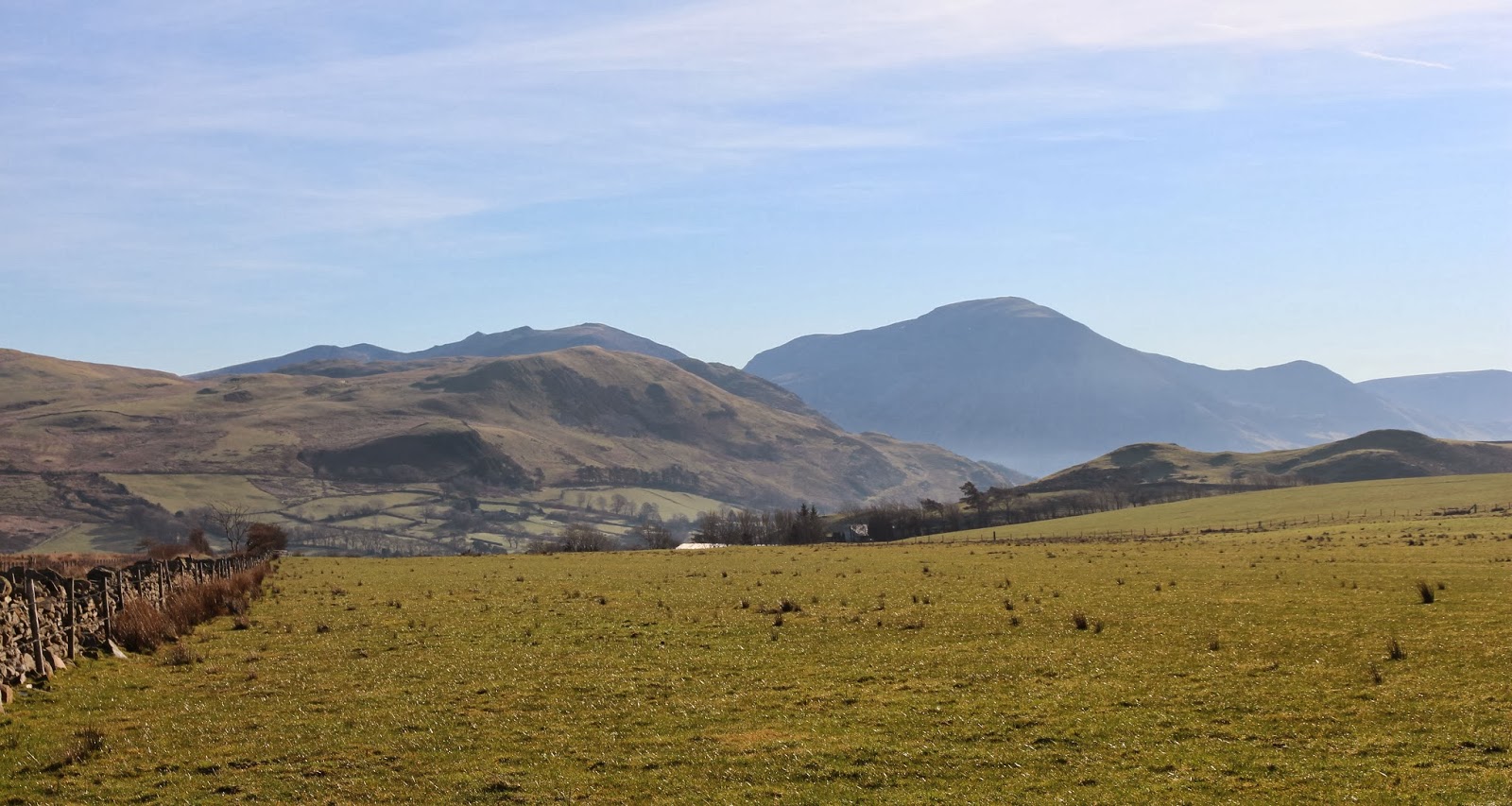
I woke up to a stunner of a day! I was getting the Lake District at it's best. I drove south from Cockermouth and took the side road through a place called Mockerin heading for Loweswater. Just before dropping down to the lake I stopped to take this picture of the fells that I was heading for with the bulk of Grassmoor beyond.....


There was plenty of roadside parking at the end of the track to the farm of Askill which I followed for less than a mile before taking to the hillside of Darling Fell. It was already warm and I was down to shirt sleeves before I'd gone very far. This was the view that I got when I reached the top of Darling Fell; Low Fell is ahead with Whiteside and Grassmoor in the background.....


Grassmoor looks really steep from this side, I did it from the other side over Grisedale Pike which is quite a gradual ascent.
 
It was just empty moorland to the north- well, apart from numerous sheep- and with a distant view of Skiddaw.....


The cairn on Darling Fell was a couple of hundred yards beyond the highest point, presumably because that is the better view point. Crummock Water is the lake in the distance with Buttermere showing just beyond it.....


What was less welcome was a view of a hundred metre drop and re-ascent to Low Fell! But it was worth the effort, Low Fell was another stunning viewpoint overlooking the length of Crummock Water with the High Stile range to it's right.....


I was now very much closer to Grassmoor.....


I sat for quite a while at the cairn, it was a day to linger.....


There were a few other people about, all seeming to have started from the north, over Fellbarrow and across the plateau. And that was the way that I started back, over to Sourfoot Fell and then angling back across the moor to join the track that I had left earlier in the day. This is a view back at Low Fell from the moor.....


Back at the car, I continued along Loweswater and followed the road through Lorton Vale back to Cockermouth, stopping at Scale bridge to take this last photo of Low Fell.....


The walk was about 4 miles with about 400m of ascent and took a leisurely 3 hours.