4 May 2018
NOW DELETED AS A TUMP FOLLOWING RESURVEY
NOW DELETED AS A TUMP FOLLOWING RESURVEY
Participants: Just me
Where: North Birkhill, 88m/289', P30m, TuMP, NS 934 936
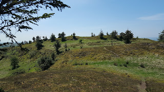
Not much to commend this one- a bit of forest on the north side of the A977 not far from the bridges at Kincardine.....
It wasn't as bad going as it might have been although it will probably be a different story in high summer. I started at a gap in the wall from where there was a trace of a path through the trees initially. Where it ended I headed west to arrive at a clump of trees surrounded by a fence which I had read was the summit area. It's somewhere here.....
15 May 2018
Participants: Neil and Ben
Where: Burghmuir, 101m/331', P32m, OS 52, NO 091 234
In Perth, completely built up, the recognised highest point appears to be here, although it is higher inside the gate but looks man-made. Slight diversion to visit when on my way north.....
23 May 2018.
Participants: Just me
Where: Broadfield Hill, 236m/774', P54m, TuMP, OS 64, NS 409 592
A short drive to Howwood on another glorious sunny day to climb Broadfield Law, which is located to the east of the town. I parked in Hill Street and followed a good track up into Skiff wood, which was a mix of broadleaf and conifer. Although the lower slopes above Howwood are wooded, the upper slopes are largely free of trees, although someone has been planting a few conifers at the very top. There were some cows in the top field but they showed no interest in me. When I got to the trig, after climbing a barbed wire fence, I found a path which crossed the summit area and descended via a stile to join the track that I had come up. A pleasant hour and a half walk. The view to Paisley from a local viewpoint.....
Approaching the trig.....
View towards Whitelee.....
28 May 2018
Participants: Just me
Where: The Drum, 125m/410', P37m, TuMP, OS 57, NN 743 032
The Drum is a north-south wooded ridge just to the east of Doune. It was a very hot day so I was glad of the shade from the trees. I approached by the road to Argaty and track to Glenwhilk Farm, turning left on to another track at the high point before reaching the farm. The high point seems to be in an area previously used for rearing pheasants. There were Buzzards and Red Kite overhead and bird song in the woods making it a pleasant walk.
29 May 2018
Participants: Just me
Where: Floak Hill, 257/843', P33, OS 64, NS 495 504
I had to take the car into Glasgow and it was only a few miles further on to this TuMP. Wouldn't have been worth a separate journey. I was able to drive up to Floak farm and the summit was only a few minutes walk from there. Track to summit.....
Summit hump with sheep.....
Nice view over west Renfrewshire.....
8 June 2018
Participants: Neil and Ben
Where: Peathill, 103m/338' P57m. TuMP, OS 58, NS 951 900
I hadn't intended to go out today but the forecast was suggesting that the long, dry period was coming to an end in the next few days so instead of taking Ben on his usual canal or reservoir walk, I decided to drive to Devilla Forrest at Kincardine where the highest point was a TuMP. There is an excellent network of forest roads here and we followed them all the way to the top and back, a distance of about 5 miles. There has been some forestry activity at the top of the forest and the highest point was clear. Approaching the top.....
Looking to Saline Hill in Fife.....
Ben at the top with the Ochils in the background.....
There are a number of lochs in the forest and a walk around them would make a good further visit.
20 June 2018
Participants: Just me
Where: Holehead (Campsie Fells), 552m/1,811', P96, TuMP, OS 64, NS 618 828
This is the Fell with the radar dish at its summit.....
Parking at the start of the track to the dish is difficult so I parked at the county boundary and followed a rough path alongside the boundary wall and fence. The trig is west of the dish and I reckon that neither is the true summit; I think that that is alongside the wall some 20 yards north of the dish. Whatever, it is all pretty flat up there. The trig hosts a plaque by the Strathkelvin Ramblers and there is a fine view north to the hills of the Southern Uplands.....
and a reasonable view down towards Glasgow and the central lowlands.....
Holehead stands across the Craw Road from Lecket Hill which I have still to do.....
and there was a good view of Meikle Bin on the way down.....
A pleasant wander.


No comments:
Post a Comment