Participants: Neil and Ben
Where: Fir Hill, 78m/256' P59, OS 57, NS 537 970
Fir Hill is a small wooded hill south of Aberfoyle off the Glasgow road. There seemed to be no objection to parking in the Trossachs Holiday Park site beside a dog walking area from where a path led almost to the summit. Best of what views there were was of the Craig of Monievreckie to the north; looking to the west through the branches I could also see Ben Lomond......


5 February 2018
Participants: Neil and Ben
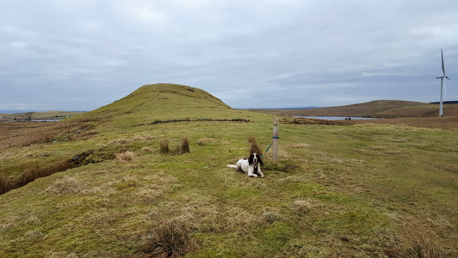
Where: Dunwan (Whitelee), 300m/984', P33, OS 64, NS 547 489
Back to Whitelee to bag the Tump I missed out (due to an excess of sheep) on my last visit. On this occasion, we just made it, the farmer was gathering up his sheep from the moor and looking back after we'd climbed it, we saw that he was leaving them in the pasture around the hill! This is the best of the Whitelee Tumps, a very distinctive hill which apparently had an Iron Age fort on top. Some photos.....


9 February 2018
Participants: Just me
Where: Gallow Hill (Bridge of Allan), 110m/361' P43, OS 57, NS 783 987
I used public transport for this one- the train to Bridge of Allan. The path to the hill started opposite the station......

The best of the views were towards Abbey Craig and the Wallace Monument and to Stirling castle......


The highest point was a boulder in the trees with a view through the foliage to Dumyat.....

16 February 2018
Participants: Neil and Ben
Where: Eastcraigs Hill (Blackridge) 250m/820', P43m, OS 65, NS 903 680; Tormain (Ratho) 147m/482', P39, OS 65, NT 129 697; and Grayrigg, 210m/689', P49m, OS 65, NS 909 767
Off to West Lothian on a bright day but with a strong, cold wind. From the A89 in Blackridge, I followed Heights Road to get to the north of Eastcraigs Hill. It was a bit muddy but only a short walk to the broken down trig and the summit boulder. There was a fine view to the Bathgate Hills.


I next drove to Ratho for Tormain, a very pleasant woodland walk to the west of the village. This was obviously the place that Ratho dogs go for their walks; we met lots of furry friends. The highest point was a mound with a couple of cup and ring marked stones. There were fine views of Edinburgh and of the Pentlands Hills from the edge of the woods with viewfinders to help with the identification of the distant hills.


I drove home by Avonbridge to tick off Grayrigg. The questions for this Tump must be "why" and "who finds these things"? It was a drive by as the B8028 runs within yards of the highest point which is next to the wall of a barn. I did jump the gate and go to it. A few minutes for this one!


1 comment:
I've done a few of these with Alex in the past and enjoyed visiting new areas. Nice views.
Post a Comment