18 March 2015
Participants: Neil and Ben
Where: Bidein Bad na h-Iolaire, 528m/1732', Sub-2k Marilyn, Map 41, NN 090713
This one had been on my radar for some time because of the view that it was bound to give of Ben Nevis. It can be approached from Glen Nevis but that way seemed to involve a lot of forestry walking; the better route was obviously from the narrow road that runs from Fort William to Lundavra. Looking at other blogs and walking sites, most folk seemed to start from well down the road and to follow the south-west ridge; however, that involved crossing fields and fences and I had Ben with me. So I opted for the longer route via the track to Cow Hill and the lumpy north ridge.
I followed the track to its highest point just before the start of the forest. My hill was in view most of the way and as I got higher Ben Nevis also came into view.....


The sun was out and it was warm, unfortunately it was also hazy. There was a steep, rough, heathery section immediately after leaving the path but once up that the walking became a bit easier. There were also a succession of humps that I mostly climbed over although I managed to skirt some of them on the way back. Part way up I came across an old path crossing the hillside and disappearing into the forest, it must have been the old route across the hill before the trees were planted and the new path network was put in place. There is not much to say about the ascent apart from that it was a bit of a plod! Just as well there was a good view of the Ben on one side and of the Corbett, Stob Coire a'Chearcaill across Loch Linnhe on the other side.....

And then at last I was on a narrowish ridge and the cairn appeared ahead- two cairns in fact. Here is Ben at the top...

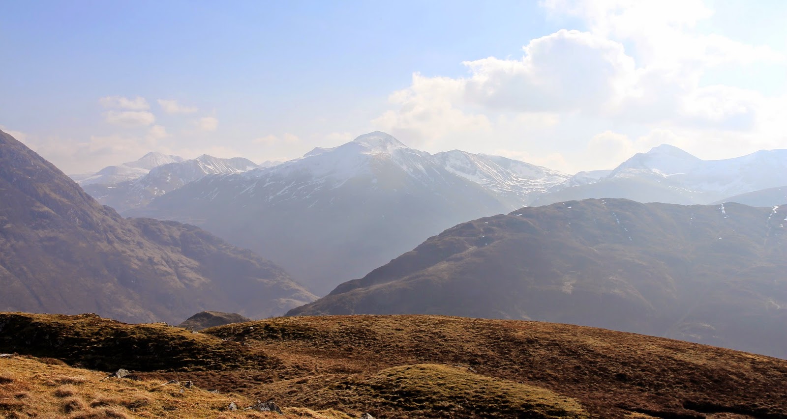
This would be an amazing viewpoint on a crisp, clear day. The afternoon would be best from the point of view of photography and the position of the sun. Even today with the haze it was good and certainly atmospheric. This is the view up Glen Nevis to Sgurr a'Mhaim.....
Across Loch Linnhe to Stob Coire a' Chearcaill.....

and down to Fort William.....

And of course to Ben Nevis. The zig-zags of the tourist path were clearly visible, and the snow on the upper reaches looked really deep. I was looking almost straight at the big south-east face which unfortunately has seen a number of accidents over the years. From this angle, you could see just how close it was to the tourist path and how easy a small navigation error in thick mist would lead you into trouble. Certainly, when I did Nevis by the tourist route I didn't realise that any of those gullies and cliffs were there.

Did I say that it was warm? I sat about at the cairn for a while and then it was just a case of reversing the route. 4 hours and 45 minutes- a good walk before setting off down the road home.
1 comment:
Looks a good viewpoint. I remember a 1000 foot plus bum slide off Ben Nevis one spring that took at least 30 mins off the descent route but ruined a pair of waterproof trousers with the friction and speed involved. You live and learn by trial and error.Good standing or sitting glissades seemed to be the best part of mountaineering in the early days.
Post a Comment