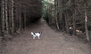
Participants - Neil and The Furry One
Where - Crock, 554m/1,820', Sub-2,000' Marilyn, Map 44, NO 226633: Meall Mor, 551m/1808', Sub-2,000' Marilyn, Map 43, NO 173602
Although Angus is one of my favourite areas, Crock was not a Marilyn that was on my radar. It is one of these hills that has been taken over by thousands of conifers although the summit area is clear.....
From the map, I could not see any way of getting through the forests without a battle so I was pleasantly surprised to read someone else's account of the hill that gave a route from the south that was without difficulties. And so it was that The Furry One and I arrived in the car park at the houses at Freuchies on what was the warmest day of the year so far. (The car park is not marked on the maps either.).....
The forest track had an excellent surface and rose at a gentle gradient through the trees. First point of interest was Loch Shandra which seems to be a private fishing loch, it was a nice spot to sit for a while.....
After the loch, the track rose more steeply past the house at Tulloch and we arrived at an area where the forest had been cleared allowing a good view to Badandun Hill.....
and to Badandun Hill again.....
but more importantly allowing access at its north end to another, rougher track that went up on to the north ridge of Crock. Then it was back into the forest again but an area where the Forestry Commission had kindly left an avenue between the trees that was carpeted in pine needles and great to walk on. It was very dark however and Ben stuck close to me as we walked through!
Soon we emerged back onto the open hillside.....
and it was then only a 10 minute walk on short cropped heather to the cairn and a fine open view over the hills of the lower Grampians.....
So Crock had provided a good walk after all with no difficulties; it took us about 3 hours car to car.
I decided to make the most of my day and vary the route home so I took the hill road at Brewlands Bridge which took me from Glen Isla to Glen Shee. I had it half in mind to stop at the highest point in the road and climb Meall Mor; the last time I had passed this way the locals were out in force shooting pheasants and I just carried on to wherever it was I was headed. I wondered about taking Ben up; as well as the pheasants there seemed to be a lot of fences and dyke's on the hill and there is no way that I can lift him over any obstacle like that. And this is another hill with lots of trees! Anyway, we stopped at the high point of the road at the entrance to a track and after having something to eat, I decided to take a look. (This is Meall Mor from further down the road- from Drumore Loch.....
We had only gone up the track for a couple of minutes when we arrived at a gap in the trees- again not shown on the map. So we followed this up some rough ground at the side of a dyke (following in fact what used to be the county boundary between Angus and Perthshire- which is marked on the map).....
and lo and behold this went all the way to the summit area; the pheasants thought better than appear in front of Ben, the fences were all old and broken and the only dyke we had to cross had a gap in it. So nothing to stop Ben earning his "tick". Mount Blair stands immediately across the glen from Meall Mor.....
and there was a good view down to Drumore Loch with Schiehallion, Ben Vrackie and Beinn a'Ghlo beyond......
From the cairn.....
there was also a good view east to the hills we had been in earlier with the Angus Munro's beyond.....
This one only took an hour up and down.


No comments:
Post a Comment