Participants - Me and Ben
Where - The Wiss, 589m/1,933', Sub-2,000' Marilyn, Map 73, NT 264206
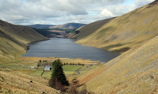
I had wanted to climb The Wiss for a long time, mostly because of its intriguing name, but also because it was situated in some pleasant country overlooking St Mary's Loch. Today I finally got round to it. Once out of the industrialised area of the central belt, it was a nice trip. I took the hill road that goes over the shoulder of Broad Law past the Megget Stane and stopped at the top of the steep bit to take this photo looking back down to Talla Reservoir.....
It was a day for reservoirs-the road then passed Megget Reservoir, which an information board told me was completed in 1983 to provide the main water supply for Edinburgh. It apparently holds 64 million tons of water and it's dam is the largest earth dam in Scotland. It took 6 years to construct using over 3 million tonnes of gravel dug from the floor of the valley.....
I followed the route of the Southern Upland Way for a bit before taking to the hill. It was sheep country so Ben had to remain on his lead until we got higher up and clear of the wooly beasts. The slopes were mainly grassy although there was an area of heather higher up.....
I like the Southern Upland views- this is looking west with the Corbett of White Coombe in the distance in some cloud.....
and this is looking back over the start point towards Broad Law where some heather burning was taking place on the neighbouring Cramalt Craig.....
There was a trig.....
So I perched the camera on it and tried the delayed timer function to get this shot of me and the Furry One with St Mary's Loch in the background.....
I had considered carrying on along the ridge and dropping down to the lochside but it looked heavy going through the heather so I took the lazy option and just returned by the same route. There was a rather grand statue of James Hogg, the Ettrick Shepherd and Borders writer and poet across the road from the car park.....
There was also a small cafe so I nipped in there for a plate of soup, a good ending to an enjoyable walk with some additional things of general interest thrown in. And I still don't know why it's called The Wiss......


3 comments:
St.Mary`s Loch/Loch of the Lowes is a nice spot.Have had many a cuppa in the cafe there.!
I was down there last autumn with the intention of doing the Wiss but the weather was awful so resorted to reading the Sunday paper to see if things improved.They didn`t.
Eventually drove up to Peebles and went up Cademuir Hill on the grounds that if the weather was crap I might as well be in a sitka plantation looking around for a summit :) The top was a lot easier than I thought it would be to find.
Does Ben associate the sight of a rucksack with a day out yet ? Nice to see him enjoying himself.!
Hi Alex,
Ben still sees a rucksac as something to play with and chew!! But he does seem to know when we are going for a hill walk and he travels well in the car. Most importantly, he behaves much better on a walk than he does at home....although we haven't yet come across anyone else sitting at a trig having their lunch.
Some of these hills are really good- Broomy Law the other day was also a fine viewpoint.
Haven't tried to do Cademuir Hill yet, the reports about the trees have put me off.
Aah..it`s a dogs life indeed :)
Cademuir was pretty straightforward other than an initial 20 metres or so of fallen trees.The western top with the old fort on it is a cracking little viewpoint.No need for boots under dry conditions either...just a pleasant stroll.
Never got round to writing it up but will maybe do so if there is a blank week to fill in.
Post a Comment