Monday, 24 September 2012

Bennachie

22 September 2012

Participants - Neil and Ben
Where - Bennachie, 528m/1,735', Sub- 2k Marilyn, Map 38, NJ 662227

Bennachie is the dominant hill in Aberdeenshire, easily recognisable and visible from many parts of the county. I think of it in terms of a mountain rather than a hill but in fact, writing this up, it suddenly struck me that it was lower than Coiliochbhar Hill which I had climbed yesterday. It comprises a high moorland with a series of distinctive granite tops. There are a number of possible starting points and ways up the hill but I like the one that starts at the Forestry Commission car park at Back o' Bennachie- charge £2. A well constructed path led up through the forest and directly to the main top, Oxen Craig. It was another cool but very clear day and the views when I got past the forested area were extensive. This picture is taken from where the path leaves the shelter of the trees and is looking over Aberdeenshire towards the coast.....


I stopped a lot on the way up to admire the views and take photographs, this is looking north over Insch to Hill of Foudland.....


and this is looking north-west to Tap o' Noth with Ben Rinnes behind and to its left.....


There is lots of signage on this hill, no chance of getting lost here.....


We carried on to the top of Oxen Craig where there was a substantial cairn and also a topograph- they certainly cater for visitors hereabouts.....


After a bit of a rest and a chat to some other walkers, it was time to head for the most distinctive feature of Bennachie.....


Down on the moorland again, Ben decided to solve any possible dehydration problems before we carried on to this well known landmark.....


It is crowned by a mass of granite and there are the remains of a Pictish fort just below the top. I believe that there are some hard rock climbs to be had on it, not being a climber the cliffs look terrifying to me!  Fortunately, the walkers path circles the hill at a fairly gentle grade on its way to the top. Not surprisingly, being a weekend, there were a lot of other walkers about with the Mither Tap being the most crowded. I guess that there must be many people who only visit it and are under the impression that they have reached the highest point on Bennachie.

We then re-crossed part of the plateau to visit the most northern tor, Craigshannoch.....


This is the view from it to Oxen Craig.....


and this is looking across the farmlands of Aberdeenshire.....


It was then time to head down and start the journey home, via Alford, Braemar and Perth. It had been a good couple of days, and there are still some sub-2k's in the area that I have not yet done.

Sunday, 23 September 2012

Coiliochbhar Hill

21 September 2012

Participants - Neil and Ben
Where - Coiliochbhar Hill, 533m/1,748', Sub-2k Marilyn, Map 37, NJ 503163

The weather was good and I decided to make another visit to Aberdeenshire. The main focus this time was another ascent of Bennachie, but there were a few other sub-2k Marilyn's in the area that I had not yet climbed. I had chosen Craiglich as one to climb to break up the journey as it was on the direct route that I was taking to Aberdeen but when I pulled up at the start point I saw that there were cows and calves in the field that the track went through. So no go there. A look at the map showed that there was another Marilyn a few miles away that I had not climbed- Coiliochbhar Hill- so I drove down a few country roads to get to it. I had not researched this hill and knew nothing about it so I hoped that there would not be too many obstacles for Ben to manage. In fact, there were sheep in two fields that we had to initially cross so Ben had to remain on his lead for this section. There were also 3 gates, the first was held closed by a stone, the second by a piece of rope, and with a bit of persuasion, Ben managed to crawl underneath the third.

The starting point was just west of the farm at Upper Minmore. I managed to park on the verge at a corner in the road about 100 yards away. This is a view of the hill from close to the start.....


There was a good track which went through the fields and then after the third gate, entered an area of cleared, but replanted, forest. I was now clear of all livestock so Ben was able to be released from his restraint, much to the relief of us both. The track climbed steadily up through the trees before emerging on heather moorland. This is actually one of the higher sub-2k's in the area and the views really started to open out. They were enhanced by a few old Scots pines that had sprouted out of the moorland, here is one fine speciman  in an easterly view towards a distant Bennachie.....
 

Looking round, the best of the westerly view was across the farm lands to the Corbett of Morven.....


Nearing the top of the hill we reached an older forest.....


The track headed off to the left and downhill so I decided just to make my way through the trees, it was only for a short distance and the going was not too bad underfoot. An old fence headed in the required direction. Once out of the wood, the cairn was in sight, here is the approach with another sub-2k, Tap o'Noth in the distance.....


To the north-west was a Graham, the Buck, which I had hurried up one autumn to avoid stalking.....


As usual, Ben was keen to keep on the move, here he is waiting for the signal to set off down again.....


I really enjoyed this hill, particularly as I had known nothing about it! The Aberdeenshire Marilyns are good value in terms of views as most of them are fairly isolated from their neighbours. And the weather forecast was good for tomorrow when I planned to walk the best known of all the hills in the area.


Thursday, 13 September 2012

Drummond Hill

12 September 2012

Participants -  Neil and Ben
Where - Drummond Hill, 460m/1,509', Sub-2k Marilyn, Map 51, NN 749454

This was much more like it, the humidity had gone, there was a bit of a breeze to keep the flies away, and the holiday period was over so the roads and villages had been reclaimed by us oldies. It was a really nice drive through Perthshire by way of Crieff, the Sma glen and Aberfeldy to Kenmore, the starting point for Drummond Hill. Some of the sub-2k's seem to be dreadful areas of dense forestry that will never see me set foot on them but I was hoping for a nice forest walk on this one, although I knew that there would be no view from the top. The view of the hill from the shores of Loch Tay at Kenmore were not particularly encouraging though; it looked a bit like a conifer nightmare.....


However, that was not borne out when we left the forestry car park; the trees were in fact a mix of conifer and deciduous and mainly fairly well spaced out.....


An information board at the start gave some of the history of the area. The forest here was first planted by order of Sir Duncan Campbell, the Laird of Breadalbane, in the 16th century. The area was one of the first managed forests in Scotland. The trees were largely removed to help the war effort in 1914-18 and the hill was later replanted with larch, spruce and Douglas fir, as well as some conifers. The wood is apparently the home of capercaille; I don't know how Ben would have reacted if we'd come across one of them!

The forestry path zig-zagged gently upwards; there was obviously work taking place somewhere on the hill and I came to a notice which said that the higher trail was closed. As I was not walking the trail in its entirety and there was no sign of work in progress where I was I continued. Other notices simply warned visitors to be careful of heavy machinery and not to climb on stacks of logs. At its highest point, there was a view (just) north to the Carn Mairg group.....


I had researched this walk in advance and I knew that I had to leave the track at this point, turn left, and follow an old wall along the spine of the hill. Although it was a bit rough and slow going it was generally dry underfoot......


It was just a case of following the wall on whichever side had the least vegetation.  It looked as though people had lived up here at one time.....


Shortly after passing the ruined building, the ground rose more sharply and suddenly there was the cairn in a gap in the wall; blink and you'd miss it.....


No chance of a view here. Although it looked as though some thinning of the trees was going on, this area looks unlikely to be clear felled any time soon although a lot of work seems to be going on on the north side of the hill. It's a pity that the higher areas of this one are forested, it would be a cracking viewpoint otherwise and a great walk along the spine of the hill. But it's not so it was a case of retracing my steps to the track.....


and following it back to the car park. En route I visited the Black Rock viewpoint which provided a grandstand view of Kenmore and Loch Tay.....


So not too bad after all!

Wednesday, 5 September 2012

Wether Hill

5 September 2012.

Participants - Neil and Ben
Where - Wether Hill, 533m/1,755', Sub-2k Marilyn, Map 77, NX 696942

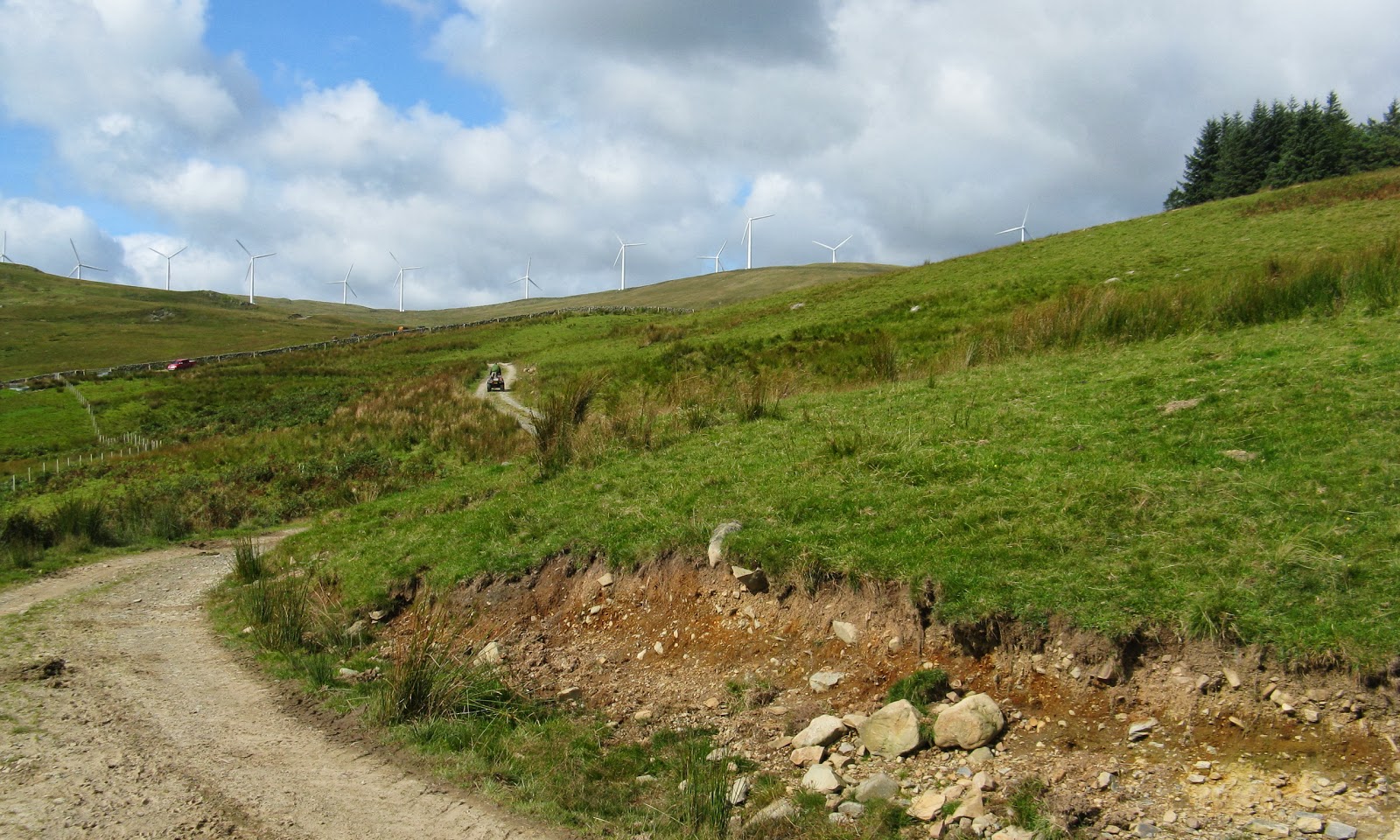
I had been wondering about this one for a while, I couldn't find many reports about it and yet it looked reasonably accessible. I drove down to Thornhill, through the picture postcard village of Moniaive and a couple of miles further on parked at the entrance to the track to the houses at Craiglearan. There was space for a couple of cars on the verge. There is a windfarm on Wether Hill but I wasn't sure where the service road started from. However, the online OS map showed the Craiglearan track joining up with the windfarm road and that looked the shortest route to the top. Ben was on his lead for a lot of the time, there were sheep about and also a herd of cows at one point, although they didn't show any interest in us. There is not a lot to say about the ascent; this is a picture of the original track followed by the windfarm road.....


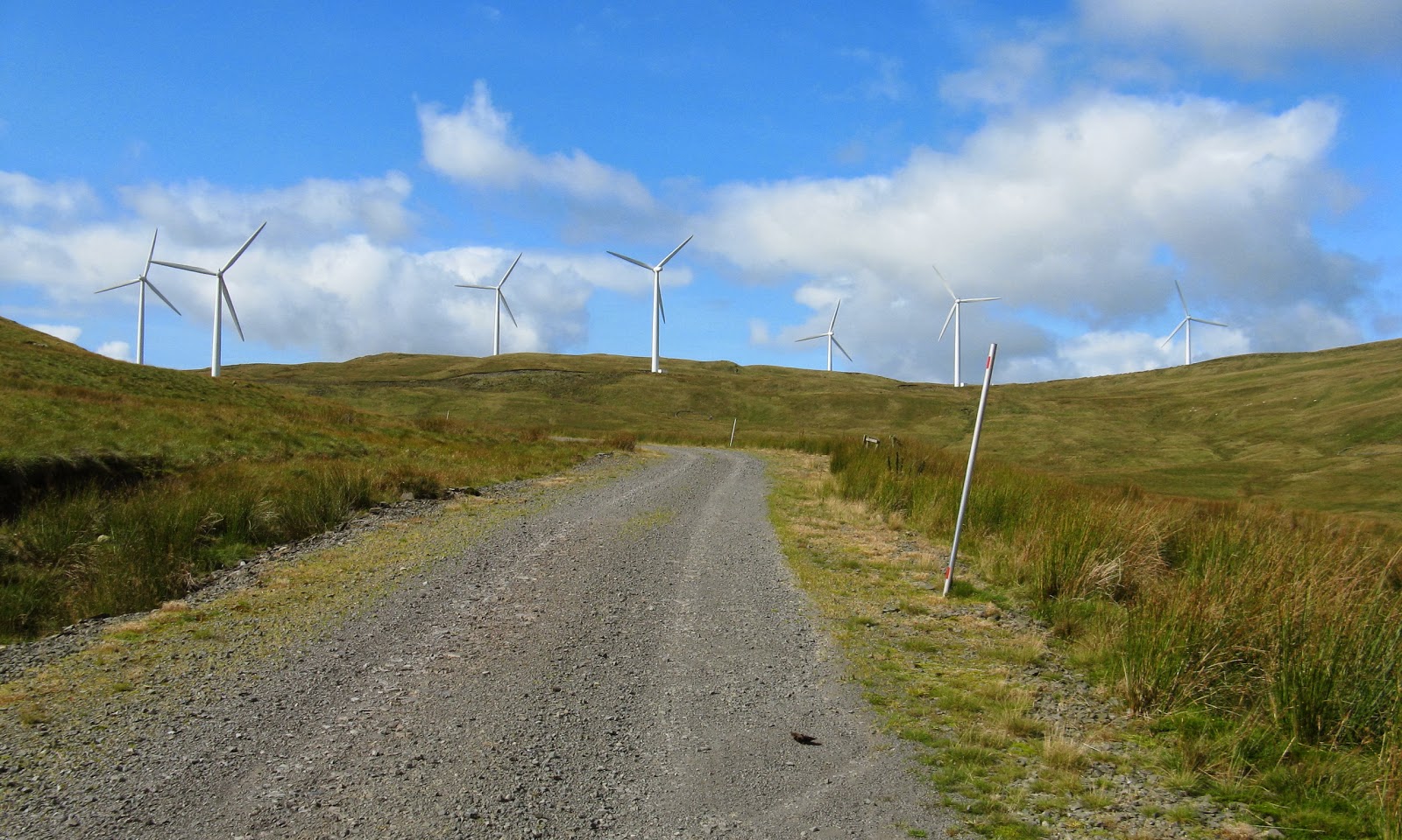
It was a case of following the track/road all the way to the summit. The ascent was gentle as the road zig-zagged across the hillside; this is looking to the top group of turbines that surround the highest point.....


 If anyone is doing this hill in clag, the cairn is close to turbine no. 7. This is it looking west to Cairnsmore of Carsphairn.....


The view was quite good so we had a wee rest at a stone wall and fence just south of the cairn.....


I wouldn't say that the turbines enhanced the view, however.....


Having said that, the road was useful as the grass was a bit clumpy in places.

The return was by the same route. It had been a pleasant walk.


Thursday, 23 August 2012

A foray into Northumberland: Long Crag and Ros Hill

22 and 23 August 2012.

Participants - Neil and Ben

Where - Long Crag, 319m/1,047', Sub-2k Marilyn, Map 81, NU 062069 and Ros Hill, 315m/1,033', Sub-2k Marilyn, Map 81, NU 081253

I find hill walking in Scotland in August a bit dicey; it's usually hot and sticky, frequently wet, and of course its the height of the midge season. So, for a change, I headed to.....


Northumberland is a part of the country that I've never really explored. Dawson's book said that there were a number of Marilyns in the north-east part of the county, the weather forecasters said that that was the part of the country that was likely to get most sunshine and least showers so my mind was made up. The quickest way to get there was over to Edinburgh, round the by-pass and down to Coldstream, then on to Wooler south and east of where there were a number of low lying hill ranges which contained some Marilyns.

Long Crag was my first objective. It is the highest point above some extensive forestry (Thrunton woods) north of Rothbury, where I had booked in for the night. There appeared to be a number of routes through the forest to the open moor. I didn't see a great deal of point in a long walk through trees so I took the shortest route, the most southerly of the forest tracks, starting at 092072. There was space to park three cars at the start; however bad parking by the two cars already there meant that I had to park on the verge. It was really pleasant walking through the forest.....


The track ended after about 1.5 miles but continued as a rough path on to the moor above where it emerged between Coe Crags and Long Crag and close to this boundary stone.....


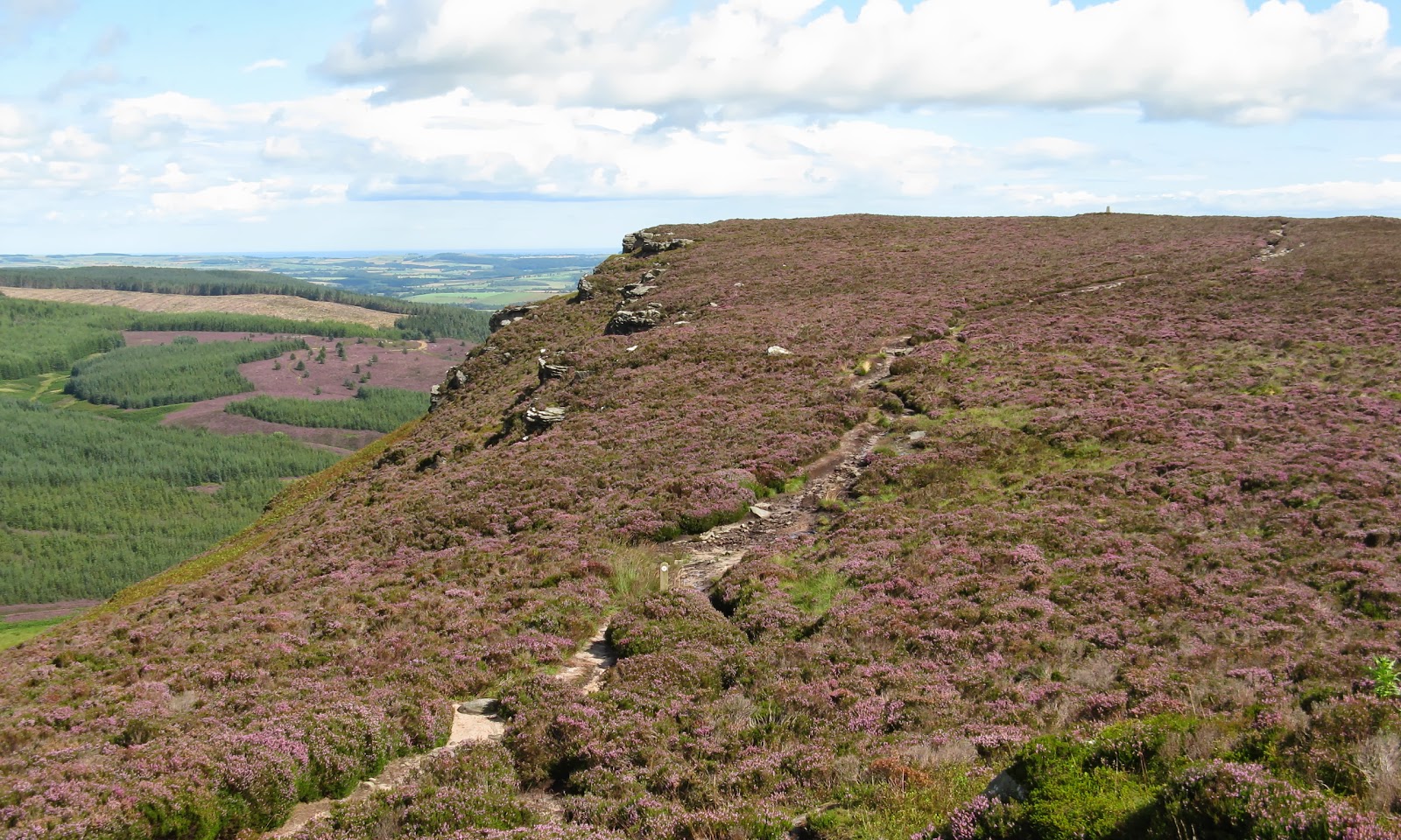
I presume that the "S" and the "A" on the opposite side refer to old parishes but I've no idea what they were. The heather was in full bloom, the path meandered up at a gentle angle, the sun was shining....what more could I want?


 It wasn't far to the trig, where I took the obligatory pic of Ben. It's looking north with the Cheviot in the background.....


And this is looking south to the Simonside group of hills, south of Rothbury.....


The only downside to using this route was that I didn't see the crags that give the hill its name, they were below us to the north. I wandered on to a cairn on a slightly lower west top that looked as though it might give a view of the crags but I could only see the top of them from there This is looking back at the trig with the top of the crags on the left and the North Sea in the distance.....


A few showers were hitting nearby hills but we escaped them all. However, when I reached Rothbury the rain came down in earnest for about an hour so I had to hang about before I could get a wander round the town....


The following day started a bit dull. The objective was Ros Hill, south east of Wooler. It is the highest point of the Chillingham hills and is in the care of the National Trust as it has a 3,000 year old Iron Age hill fort at its summit. This is one of the easiest of the sub-2k's; from the highest point of the minor road that crosses Hepburn Moor this is all that is left to climb.....


And there is a path up! So in about 20 minutes, we were at the trig.....


The plaque on it reads.....


What it does have is an unusual toposcope built into low walls which had been constructed as an extension to the stone dyke that crosses the hill. Unfortunately, it was a bit dull so the views were not as good as they might have been. This is looking towards the coast (I could make out the castles at Bamburgh, Lindesfarne and Alnwick in the distance).....


and this one is to the Cheviot (slightly zoomed).....


The cloud on the Cheviot was starting to lift as we got back to the car.....


 and it brightened up on the drive home, where Ben went straight into the shower as he had found a particularly disgusting muddy pool on the way back down the hill!

Friday, 10 August 2012

Mullach Mor (Holy Island)

9 August 2012.

Participants - Just me, dogs are not allowed on the Island.
Where - Mullach Mor (Holy Island), 314m/1,030', Sub-2k Marilyn, Map 69, NS 063297

This was one from my "must do" list. I love islands and the summit of an island which is itself offshore from another island had to be good! I wondered about going there in the middle of August, the height of the tourist season, but the weather had turned out so good that I decided that I might as well try. If things didn't work out then at least I would have had a trip to Arran. I could have done the whole trip by public transport but decided that it would be sensible to take my car to Ardrossan; there is a big car park at the ferry terminal.  But then a problem...the passenger gangway on to the Caledonian Isles had developed a fault and passengers had to get on via the car deck. And I reckon that the sailing must have been close to being full- 1,000 passengers. So we were 30 minutes late in sailing. That meant that by the time I got to Lamlash pier, I had missed the sailing to Holy Isle that I had meant to catch and the next two sailings were fully booked. Fortunately, they were operating additional sailings and I got across at 1pm. The sea was calm for both legs of the journey, this is a view of Holy Island from the Caledonian Isles......


and this is the Holy Island ferry at Lamlash harbour.....


Quoting from the Island's website "Holy Isle has a long spiritual history stretching back to the 6th century. It is endowed with an ancient healing spring, the hermit-cave of a 6th century monk, St Molaise, and evidence of a 13th century Christian monastery. The island was acquired in 1992 by the Centre for World Peace and Health as a place for peace and meditation." The boat lands close to the Centre buildings and my attention was immediately caught by the Tibetan prayer flags and a number of Stupas, "symbols of the enlightened mind of Buddha whose function is to restore, balance and transform negative energies to heal both the planet and ourselves."


The boat was met on arrival by a member of the Community who explained a bit about the Centre, the rules for visitors, and how to find the paths to places of interest. The climb was straightforward; follow the directions to the start of the hill path and take it all the way up the north ridge to the summit, with ever expanding views. The weather was absolutely glorious with excellent visibility. Here are the photos that I took on the ascent. Firstly north to the Goatfell hills.....


down to Lamlash Bay.....


 down the Firth of Clyde to Ailsa Craig.....


and the approach to the main summit from Mullach Beag.....


Eriskay ponies, Soay sheep and Laanan goats are all found on the island. The sheep were grazing down by the harbour, I saw some of the goats higher up the hill, and although there was plenty evidence that the ponies had been high up, I didn't come across any. On the way down, I spotted them by the shore on the north-east side of the island.

I was on top in just over an hour.....


Here are the photos from there; the island is very steep on its east side and there is a grand feeling of space on the top.....


Then it was back to the jetty, the boat to Lamlash, the bus to Brodick, and the ferry to Ardrossan.....


Although this trip can be done perfectly easily in a day from Glasgow, I think that it might be better to include it as part of a holiday to Arran. The bus service on the island is not great and delays on the ferry can have a knock on effect on the whole trip. At times I found that I was looking at my watch too much. And the delays in the morning meant that I didn't have time to visit the cave, the spring, the rock paintings and the lighthouse. Another visit required! A final look at Holy Isle from the boat on the way back to Ardrossan.....


Definitely a "must do again" hill.