Thursday 27 June 2019

Stroness Hill and Stroness Hill North

26 June 2019

Participants: Just me
Where: Stroness Hill, 352m/1151', P 76m, TuMP, OS 58,. NN 913262 and Stroness Hill North, 351m/1,151', P 48m, TuMP, OS 58, NN 921 271
 
These two hills run east from the Knock of Crieff and Milquanzie Hill and although a TuMP compared to the other two's Marilyn and HuMP status, Stroness Hill is the highest of the range. The maps of this area are not up to date and there are many more tracks than shown including one that leaves the A822 about 1/4 mile past the Foulford golf course and which goes past the foot of Stroness Hill. There is also ample parking at the start. So that was the one that I took. The view of Stroness Hill North (centre) from the start.....
 
 
Looking to Milquanzie Hill from the track.....
 
 
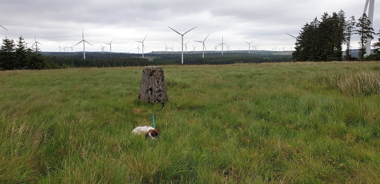
These are rounded, grassy hills, given over to sheep. There was a good ATV track up Stroness Hill which eased the ascent and it didn't take too long to reach the top, unmarked. The wood shown on the map has now gone. Looking east to the North top.....
 
 
These hills sit just south of the Highland Boundary and provide a good view into the Sma' Glen area.....
 
 
The track continued on to pass just south of the highest point of the North top. The highest point was again unmarked but could have been at either of some boulders. Another view into the Sma' Glen.....
 
 
It was easier sticking to the path rather than descending through vegetation that was now growing tall and thick so I returned by the same route. Looking to Stroness Hill from Stroness Hill North.....


A very pleasant walk.

Monday 24 June 2019

A Midsummer's day walk to the 3 Brethren and Peat Law

21 June 2019
 
Participants: Neil and Ben
Where: Hareshaw Hill (Three Brethren), 464m/1,522', P 65m, TuMP, OS 73, NT 433 319 and Peat Law, 426m/1,398', P 69m, TuMP, OS 73, NT 443 307
 
A perfect midsummers day for hill walking, cool, a bit breezy, perfect visibility. A walk to the Three Brethren had been on my list for a while and I decided to do it by following the Southern Upland Way from Yair bridge, north of Selkirk. Although the path initially went through the forest, it was reasonably open and a very pleasant walk.....
 
 
Just follow the signs.....
 
 
The path emerged from the woodland at a junction on the col between Hareshaw Hill and Peat Law......
 
 
It then went up the moorland at the side of the forest to emerge at the distinctive cairns of the Three Brethren. These mark the boundaries of the estates of Buccleuch, Yair and Selkirk Burgh. The first cairn was built by Alexander Pringle, Laird of Yair and Whytbank Tower in 1512. However, one cairn was considered to be insufficient and another two were built at a later date. They are shown on military maps of the mid-1700's so they have stood on Hareshaw Hill for a while! Riders taking part in the Selkirk Common Riding visit them each year and there is a plaque to commemorate this event......


It is a great viewpoint. Looking west.....
 
 
north.....
 
and east to the Eildon Hills with the Cheviot on the horizon.....
 
 
My next objective was Peat Law, to the south.....
 
 
So it was back to the col from where a wide track crossed the east slopes of the hill. I followed this to its highest point so there was only a little heather bashing required to reach the cairns at the top. This is the highest cairn with Hareshaw Hill in the background.....
 
 
There was a better view of the Eildon Hills from here.....
 
 
and a view of Selkirk.....
 
 
I then returned to the col and reversed my ascent route. A great walk in beautiful countryside.


Saturday 22 June 2019

Stirling Castle

19 June 2019
 
Participants: Just me
Where: Stirling Castle, 105m/344', P 79m, TuMP, OS 57, NS 789 941
 
I had been to Stirling Castle a number of times but not since I started bagging TuMPs so I wasn't sure that I had ever been to the highest point. It was a bit difficult  to know where that point actually was as somebody had built a bloody big castle on top of the hill! However, I reckon that it is now the small piece of grass north of the Regimental museum.....
 
 
It was a good number of years since I had last visited and what a difference. This is now a fantastic visitor attraction with lots to see, well presented. I spent a couple of hours and didn't see it all so I'll have to go back. I'm not sure how it compares with Edinburgh Castle but as that's also a TuMP I'll have to pay another visit there some time as well, when the busy summer period is over. The views from Stirling are also magnificent. Here's a few photos from my visit with one of the Castle taken earlier in the year when I was passing.....


The entrance and the main buildings.....


Queen Anne garden.....

The view to the Ochil hills......


The view to Dumyat in the Ochils.....


Looking west to Ben Ledi, Stuc a'Chroin and Ben Vorlich.....


Taking aim at Ben Ledi.....


The view over Stirling to the distant Pentland Hills.....


Looking to the Campsies.....

Wednesday 19 June 2019

Whitelee Hill

18 June 2019
 
Participants: Neil and Ben
Where: Whitelee Hill, 282m/925', P 30m, TuMP, OS 70 NS 546429
 
This is the most southern TuMP in the Whitelee Wind farm in North Ayrshire. I followed the Hareshawmuir road to its end where there is parking for a few cars and followed the track past the now demolished house at Craigends. There has been a lot of new planting amongst the existing conifers, mostly deciduous trees I was glad to see. The view from the start.....


It certainly wasn't an inspiring walk, following a good track almost all the way on virtually level ground. Approaching the highest point.....


I left the main track immediately past a quarry and followed another track past lots of "Danger" and "Keep Out" signs relating to what looked as though it had been a farm at one time to the trig which was in a clearing thus affording some views.....


Really just a longer than usual dog walk but with the bonus of another TuMP tick!

Bell's Hill and Harbour Hill, Pentland Hills

10 June 2019
 
Participants: Neil and Ben
Where: Bell's Hill, 406m/1,332', P 57m, TuMP, OS 66, NT 205 643 and Harbour Hill, 421m/1,381', P 64m, TuMP, OS 66, NT 207 654
 
I decided to do these two hills from Flotterstone rather than from Harlaw as the south side has the better views. There is also the bonus of a café at Flotterstone for a cup of coffee when I finished the walk! Although it was a Monday morning, there were a lot of people about and the car park was almost full when I returned. The trip started with a road walk alongside Glencorse reservoir.....


before heading up the good track between the two hills that I was aiming for. This track crosses the hills to Colinton and Harlaw and is well signposted. Ben on the path with Bell's Hill behind.....


I followed the track as far as the col where there is a junction of fences with gates to let pedestrians through easily. There was a good view back from here so I stopped here again both after my descent from Bell's Hill and after climbing Harbour Hill...... 


A path has formed from the col to the top of Bell's Hill. It was a fine, clear day so the views were good. Looking over the Logan Glen to Carnethy Hill, Scald Law and the Kips.....


to Black Hill......


to Black Hill again but with Threipmuir reservoir as well.....


to Castlelaw Hill.....


Ben at the summit boulders with Castlelaw Hill and Allermuir Hill beyond and Caerketton Hill just showing between them.....


I retraced my steps to the col and picked up another path that followed an old wall almost to the unmarked summit of Harbour Hill. There was a view of Edinburgh from here.....


The best of the views however was from just downhill on the approach path where there was a great panorama of Scald Law and the Kips, Black Hill and East Cairn Hill.....


In only getting round to many of these hills now I can see what I was missing by only concentrating on Scald Law on my infrequent visits to the Pentlands when I stayed in Balerno. They are grand walking country. 

Wednesday 12 June 2019

The Law (Ochil Hills)

3 June 2019

Participants: Just me
Where: The Law, 404m/1,325', P 33m, TuMP, OS 58, NN 956 057

I am gradually getting closer to completing all the listed summits in the Ochil Hills. The Law is easily approached from Glendevon, parking in a layby opposite the entrance to Frandy Fisheries and initially heading up the slopes of  The Seat before crossing the burn and climbing the west slopes of The Law. This is a picture of The Law taken from the road to Frandy Fisheries.....


The view across Glendevon towards Ben Cleuch opened up behind me as I climbed.....


I had to cross a barbed wire fence and after a little bit of heather bashing I was at the unmarked summit with another view towards Ben Cleuch.....


Looking south along Glen Devon towards Down Hill which I climbed in January.....


the view north across some more rolling hills.....


and to Steele's Knowe and the wind turbines immediately to the north.....


I returned by the same route; it had been good use of a few hours.