Wednesday 23 June 2021

Dunglass and an add on to the Thomas Muir Heritage Trail

22 June 2021

Participants: Just me

Where: Dunglass, 153m/502', P 50m, Tump, OS 64, NS 576 789

I walked the Thomas Muir Heritage Trail in stages earlier this year and reckoned that continuing on to Strathblane, again on the route of the old railway line would be worth doing. So yesterday I did that and climbed Dunglass again as it was there! I wasn't disappointed, it was a nice walk in open countryside and Dunglass is a brilliant viewpoint. This is a much longer route to the hill than that from Strathblane to the west, which is how I did it before and as I was using the bus, I had to retrace my steps as well!

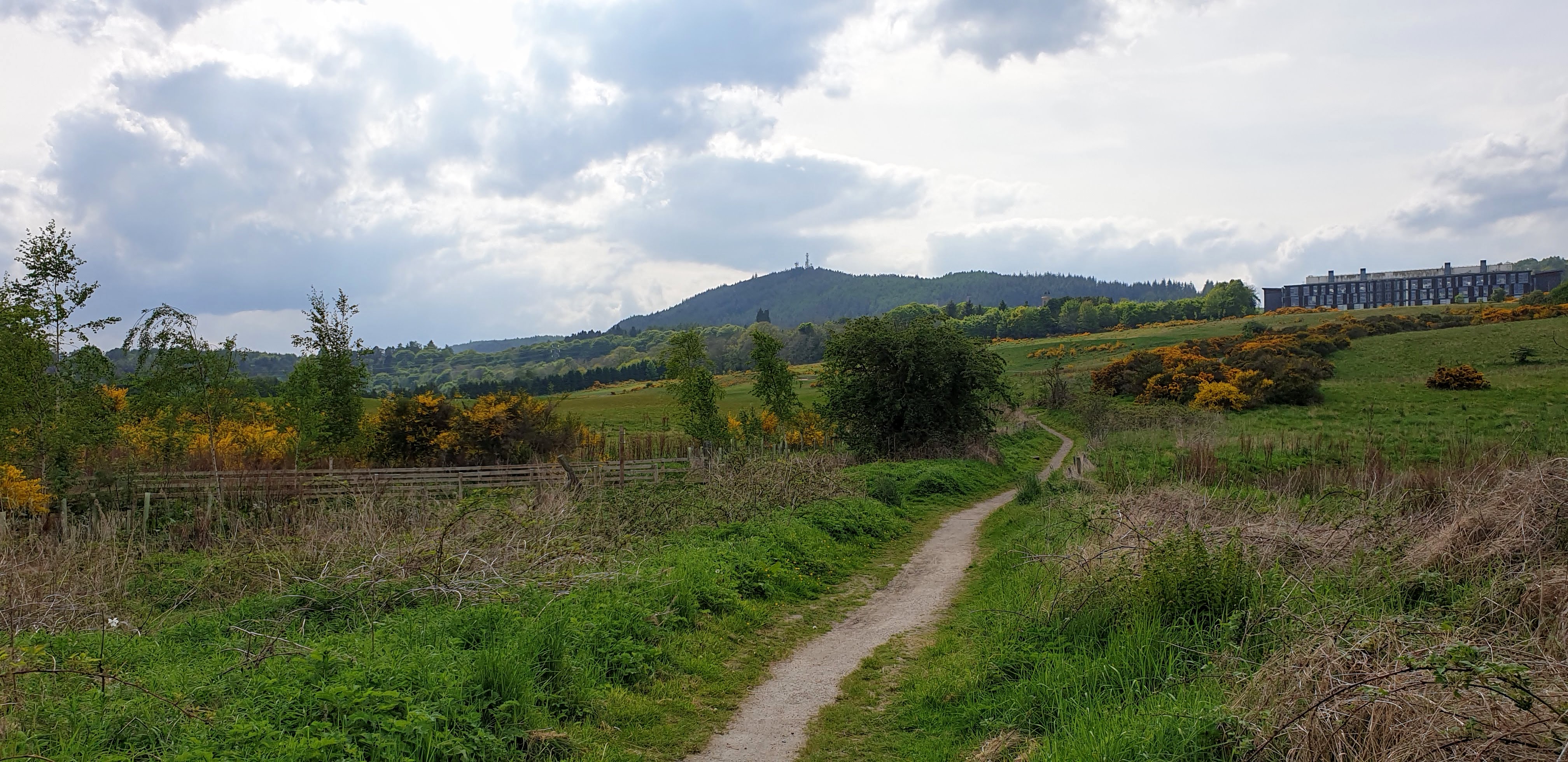
I joined the walk mid way between Lennoxtown and Clachan of Campsie, getting off the bus at a roundabout and junction to a relatively new estate. The start of the track, with Dunglass just visible in the distance (the pointed hill left of centre).....

Some photos of the walk along the track, with views back to Lairs/Cort ma Law in the main Campsie Fells.....


Dunglass appears ahead.....


I arrived at the foot of Dunglass just as the farmer was removing some cows and calves from the field for some sort of branding. It was to be a quick task and I wanted to be back down before they were released back into the field again. I almost made it but by circling round some higher ground I managed to avoid them on the way down. Dunglass close up.....

It is a magnificent view point. Looking east down the valley towards Lairs/Cort ma Law.....

Looking over Strathblane with the hills around Loch Lomond just visible......

Looking to the Kilpatrick Hills.....

Looking to the main Campsie Fells.....

It is well worth doing this walk either on its own or as an add-on to the Thomas Muir Trail or on its own even if Dunglass is not included.


Friday 18 June 2021

Tollie Hill and Albion Park (Fife)

17 June 2021

Participants: Just me

Where: Tollie Hill, 159m/522', P 33m, Tump, OS 58, NT 166 933 and Albion Park, 169m/554', P 36m, Tump, OS 58, NT 188 929

A visit to Fife and the unlikely hill walking start of Cowdenbeath station.....

Tollie Hill lies to the north-east of the town. I walked from the station to Golf Course Road, crossed a playing field and picked up a series of paths that passed the edge of a small loch and led all the way to the summit. The approach....

I hadn't been expecting much but it turned out to be a surprisingly good viewpoint.  North to Benarty Hill.....

Bishop Hill and East Lomond.....

East to Largo Law.....

Lochgelly, my next destination.....

I found another path that took me under the railway line and past a sports centre to the main road.....

 A small  number of Tump summits are in built up areas but Albion Park must be unique as the top is in a football ground, the home ground of Lochgelly Albert! The high point is the top of the west terracing but everything was locked up and the nearest point I could reach was the car park which apparently is acceptable as the "tick" summit.....


Sunday 13 June 2021

Gallow Hill (Bridge of Allan)

 12 June 2021

Participants: Just me

Where: Gallow Hill, 110m/361', P 43m, Tump, OS 57, NS 783 987

Very different from my last visit in winter 2018, the vegetation is very green this year. I took the train to Bridge of Allan, crossed the road from the station and picked up the track that goes to Dunblane. It started as a road past some houses and then became a good path between fields and hedges. A view of Gallow Hill.....

Where the path forked, I took a left and soon crossed a couple of stiles over a farm track. The path then contoured gently up the hill; there was a good view of Stirling from here with the Wallace Monument and Stirling Castle prominent.....


The rhododendrons were out.......


The summit area is in the trees to the right of the path, the actual high point is said to be the moss covered boulder in the bottom left of the photo.....

The trees are pretty thin here and it is easy to get through them to a grassy area from where there are good views of the Ochil hills to the east.....


and to the hills on the highland boundary fault o the north, Ben Ledi on the left and Stuc a'Chroin and Ben Vorlich on the right.....

A pleasant short walk.

Sunday 6 June 2021

Cluny Hill- Nelson's Tower (Forres)

 2 June, 2021

Participants: Just me

Where: Cluny Hill- Nelson's Tower, 77m/253', P 38m, Tump, OS 27, NJ 044 590

This Tump was of interest mainly for the tower that stands on its summit. I took the train to Forres and walked along the main street to Grant Park, which lies below the hill.


There was a broad track up.....


The tower at the summit- Nelson's Tower- was built by public subscription in the period 1806 to 1812 as a memorial to Admiral Lord Nelson. A twenty-one gun salute was fired at the opening ceremony from guns said to have been with Nelson's fleet at the battle of Alexandria. These canons can be seen at the door to the Tower, much restored, I guess.....


The Tower is open to the public but only in the afternoon's and I was there during the morning so no opportunity to see the view from the top. I had to make do with a view over Findhorn Bay and over Grant Park. The residents of Forres are lucky to have such a great and well kept park. There was just time for a wander round part of it before I had to return to the station for my train.....


Another interesting Tump!


Friday 4 June 2021

Dunain Hill (Inverness)

 1 June 2021

Participants: Just me

Where: Dunain Hill (Inverness), 289m/947', P 60m, Tump, OS 26, NH 625 432

My first "away" trip for many months. I chose Inverness as I had one Tump to do there plus I wanted to visit the Tump and historical tower in nearby Forres. My train got in to Inverness early afternoon so there was plenty time to do the Dunain Hill walk.....

Dunain Hill can be seen from most parts of Inverness and is easily recognisable by the masts on its summit. Here seen from Inverness castle.....


I started at the duck pond at the top of Foresters Way. On entering the forest, I was greeted by this odd collection.....

It was simply a case of following a wide track. Mainly shut in by the trees, there were occasional views as the track zig-zagged up the steep hillside and passed an area cleared for power lines. The view down was to the south west part of the city.....

The trig was not the top.....

Neither were the pylons.....

The high point was past the pylons where there were a number of mounds. I thought that this one was the highest, it looked as though there was a bit of a cairn.....

Going back down, there was a view to part of the Black Isle.....

Part way down Forester Way, I joined the Great Glen Way which passed the side of the new Nature Scotland building and continued as a path all the way to the Tomnahurich lock over the Caledonian Canal, which was helpfully just along from where I was staying! A view back from part way down the path.....

and a view of the hill later in the evening.....