Monday 30 July 2018

Gartcarron Hill: Lecket Hill (Campsie Fells)

24 July 2018
 
Participants: Just me
Where: Gartcarron Hill (Campsie Fells), 321m/1053', P67, TuMP, OS 64, NS 651848
 
A short afternoon walk to one of the more northern Campsie Fells. I parked in a lay-by at the edge of the now felled forest from where a rough 4WD track meandered towards the hill. This looks as though it would usually be quite wet ground but bot so today in the continuing mainly dry spell. Gartcarron Hill from the start of the track....
 
 
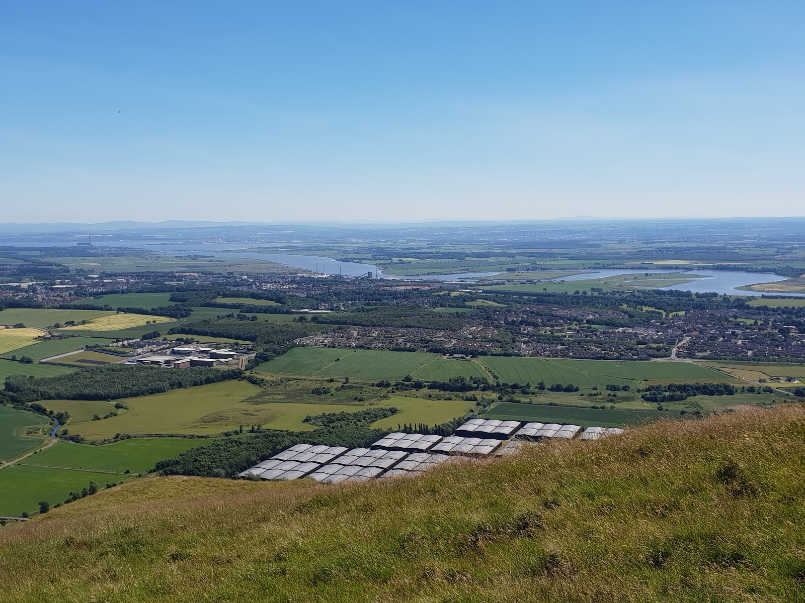
The northern Campsie escarpment with Ben Ledi distant.....
 
 
A view of Little Bin and Meikle Bin.....
 
 
North to Stronend from the summit.....
 
 
30 July 2018

Participants: Just me
Where: Lecket Hill, 547m/1,795', P96m, TuMP, OS 64, NS 645 812

The heat wave had ended- at last- and it was back to normal summer weather. At 1pm, the forecast was saying good sunny spells so I set out; at 2pm as I left the car, it was heavily overcast, by the time I reached the summit it was raining, although it didn't last long. I left the car at a parking spot on the Crow road at the start of a path up the hill. It looks as though this hill will shortly be planted with trees and there were three new fences to get through, fortunately, each had a pedestrian gate. Views back to the Crow road.....


It was quite a steep climb initially but then it levelled out when I reached the moor. The summit in the distance.....


The path went to the cairn. Looking to Meikle Bin.....


and to the southern highland hills.....


Although it was dull, visibility was excellent and I was able to make out both the Arran peaks and Ailsa Craig on the western horizon. It is only 30 minutes from home so I must revisit on a clear winters day.

Friday 20 July 2018

Deuchny Hill (Perth), Earl's Hill (campsie Fells), Tom Dubh (Callander), Keir Hill (Menteith)

5 July 2018

Participants: Neil and Ben
Where: Deuchny Hill, 233m/764', P 61, TuMP, OS 53/58, NO 153 237

Another hot day but this was only a short walk. I parked in the Jubilee car park above Perth and followed tracks and then a rough path that was also part of a MB trail. This is a forested hill but the summit area is clear. A view of the hill from the east.....


View over Perth to Stuc a'Chroin and Ben Vorlich....


Murrayshall Hill with monument in the distance.....


Everything was very dry but Ben sniffed out a pond on the way down.....


No sign of the good weather ending, but it's a bit hot for me!

16 July 2018

Participants: Neil and Ben
Where: Earl's Hill (Campsie Fells), 441m/1,447', P43m, TuMP, OS 57, NS 719 884

There was a little bit of rain yesterday and today was less hot with a nice breeze. I decided on a short journey today to climb one of the northernmost hills in the Campsie's- Earl's Hill. It is easily recognisable by the number of masts and buildings on top; the upside is that this means that there is a track up. I parked in the entrance to the track, there was a gate but no fence so it was easy access for ben on to the hill. There were sheep though so he stayed on his lead. The view was reasonable but generally the hill was not memorable. On the track up.....


The view north over Earlsburn reservoirs to the distant hills of the southern Highlands.....


The Ochil Hills.....


19 July 2018

Participants: Neil and Ben
Where: Tom Dubh, 359m/1,178', P 44m, TuMP, OS 57, NN 649099: Keir Hill, 60m/197', P39m, TuMP, NS 595 983

It was going to be another warm day so I set off early. I had noticed Tom Dubh when I climbed Callander Crags a few weeks previously and it looked as though it would be a fine short walk. I left the car at the parking area just before a gate on the minor road to Braeleny just north of Callander. This is the road we took when approaching Stuc a'Chroin from the south. A forestry track went east from the parking spot and passed very close to the summit of the TuMP. Here is Ben on the track with Stuc a'Chroin in the background......


It was an uneventful walk, apart that is from Ben being sick when on the hill. I therefore decided not to continue on and take in a second TuMP a couple of miles further along the track but to head back. Fortunately, he was OK for the rest of the day. Some photos. Looking towards Callander Crags (Foreground centre).....


Ben at summit with Stuc a'Chroin and Ben Vorlich background.....


Uamh Bheag (Graham) distant, the hill to its left is the one that I might have done.....


Ben Ledi.....


Campsie Fells in the distance.....


I took the Lake of Menteith road home. The road on the east side of the Lake runs very close to Keir Hill so I stopped to bag it. This photo says it all.....


Monday 16 July 2018

Creag nan Eun (Glen Lednock)

6 July 2018
 
Participants: Just me
Where: Creag nan Eun, 416m/1,365', P32, TuMP, OS 52, NN 724 288
 
The hot, clear weather continued so I decided to head for a wee hill that I had had my eye on for a while, Creag nan Eun above the Glen Lednock dam. There is a long ridge running above the south side of Glen Lednock reservoir and the TuMP summit is at the southern end, a rocky peak immediately above the dam. I set off early in an attempt to get the walk completed before the heat really built up and I was the first car in the car park at Invergeldie. The estate have prepared the car park here and appear to be very welcoming. My route was to follow the road part way to the dam before heading off across the river on to the signposted route to Ardeonaig on the south side of Loch Tay. This is the view of Creag nan Eun from the road.....
 
 
Although marked on the map as a track, the Ardeonaig route is in fact a tarred road. I got a good view of my route up it as I approached.....


Just after crossing a second bridge, a 4WD track heads off up the hill. I missed the start of it on the way up and ended up forcing my way through some thick bracken but I made sure that I found it on the way down. After the path veered away across the hillside, I followed grassy runnels up through a gap in the crags to reach the top. As expected there was a fine view of the reservoir, less empty than I thought that it might be given the long spell of dry weather.....


It was also a fine vantage point for lower Glen Lednock (Torlum is the pointed hill in the distance)..... 
 
 
The view looking down on the dam was not as spectacular as I had hoped. I am sure that it will be much better when the reservoir is full.....
 
 
I like Glen Lednock. Many of the hills are quite rough and the scenery is truly highland for being so close to the central belt.

Saturday 7 July 2018

Druim Mor (Callander Crags)

2 July 2018
 
Participants: Just me
Where: Druim Mor (Callander Crags), 344m/1,129', P51, TuMP, OS 57, NN 627 095
 
Most days recently had been too hot for walking but the temperature had relented to the low 20's so I decided on a trip to Callander and a walk up this TuMP taking in Queen Victoria's Cairn. Ben was left in the house where he quite happily sleeps on my bed while I'm away so I had 5 hours for the drive there and back plus the walk. I parked in the Callander Crags car park and followed the red route as far as the top of the crags through pleasant mixed woodland. The path was steep in places especially near the top of the crags where there was a stone staircase. Passing the crags.....
 
 
At the top of the steps I turned right for a short detour to the cairn. It was erected in 1897 by local man Malcolm Ferguson to mark the Diamond Jubilee of Queen Victoria and is a fine vantage point. Approaching the cairn.....
 
 
Looking west to Loch Venacher.....
 
 
Looking down on Callander.....
 
 
The cairn is apparently not at the highest point of Druim Mor, there is a higher point to the north, across some rough ground. This is looking at it from the cairn; it is said to be on the middle hump of the higher ground in the centre of this picture; the height difference is 1 metre although it looked to be lower than the cairn from where I was standing.....
 
 
 I was in two minds about heading over as I had to cross a couple of deer fences which were built in such a way as to deter anyone thinking of climbing them. However I spotted a gate not far from the cairn so set off hoping to find a similar way of passage when I reached the second fence. And I did, result! The ground was very dry so it didn't take long to get to the high point which still seemed to be lower that the cairn. It was however a nice viewpoint for the higher hills. Ben Ledi.....
 
 
and Stuc a'Chroin and Ben Vorlich.....
 
 
Back at the cairn, I decided to complete the red route- a much longer way back to the car park but pleasant, apart from the heat. And I was back with Ben 4.5 hours after leaving him.

Tuesday 3 July 2018

Back to the Ochils- Myreton Hill

24 June 2018

Participants: Just me, it was too hot to take Ben
Where: Myreton Hill, 387m/1,270', P49, TuMP, OS 58, NS 859982

It was a very hot day and I reckoned- correctly as it turned out- that I wouldn't find water on the hill so Ben was left at home. Although only rated as a Tump due to the lack of height drop between it and higher neighbours to the north, you have to make every metre of it's 387 if starting from Menstrie. The Ochils are steep on their southern flank!
 
 
There are a lot of new tracks about here and thousands of trees have been planted. The Ochils will soon look entirely different to what we have been used to up to now. As expected, the track was steep although zigzags helped. At the highest point and where a new fence cut across the hillside, I left the track and headed up the west slopes of Myreton Hill. There was a faint path alongside the fence and it didn't take long to reach the highest point, a grassy mound. The best viewpoint however was at a cairn on the other side of an old wall on the edge of the steep southern escarpment. A few photographs.....
 
Looking west from the high point, Ben Lomond, Ben Ledi, Stuc a'Chroin and Ben Vorlich visible......
 
 
Dumyat, the Wallace Monument and the Campsie Fells.....
 
 
The higher Ochils to the north.....
 
 
Looking down the escarpment to Alva. Knock Hill and Saline Hill centre distance.....
 
 
Across the Forth, Tinto just to the right of centre.....
 
 
A fine walk and one that I think I will do again, perhaps in winter.