Monday 31 August 2020

Dareduff Hill

30 August 2020

Participants: Just me

Where: Dareduff Hill, 269m/883', P 44m, Tump, OS 64, NS 457 525

Another of the Renfrewshire/Ayrshire Tumps, this one should really have been left to the winter! The trees were reasonably spaced out even although I missed the ride that I should have taken on the way in- the start was a bit further along the clearing between the bits of forestry than I expected but I found it OK on the way back. The clearing itself was pretty vegetatious however. Nevertheless I managed to find the high point without difficulty, it was situated above a small pond. This one will be good if they ever chop down the trees. Memo to self- a nice open hill with a good view next.


Sunday 30 August 2020

Creag na Gaoith (Crieff)

29 August 2020

Participants: Just me

Where: Creag na Gaoith, 159m/523', P 87m, Tump, OS 52, NN 830 221

There are a group of three Tumps west of Crieff and north of the River Earn, I had climbed two of them before but the middle of the three, Creag na Gaoith had still to be bagged. The shortest route was from the north but I decided to take the longer route starting at McCrostie Park in Crieff and following a good track alongside the river Earn. This included Lady Mary's Walk, a beautiful stretch of countryside through an avenue of trees with occasional views south to the Marilyn, Torlum. I had set off from home early as the best of the weather was promised in the morning and it certainly lived up to that forecast.....


After the river bank walk, I joined another path which took me uphill to the col between Creag na Gaoith and its eastern neighbour, Laggan Hill. The trees on my objective today looked rather dense from here.....


Looking back to Torlum.....


This path then joined another running along the ridge from Laggan Hill (everything was well signposted) and I followed that to beneath my hill where I found that the trees were in fact widely spaced and easy to climb through. There was a good view west to Mor Bheinn from here.....


The climb was easy until just before the high point which was covered in head high ferns! It's in here somewhere.....


I returned by the same route, an excellent walk.

Monday 17 August 2020

Wardlaw Hill and Craigie Hill (Dundonald)

15 August 2020

Participants: Just me.


Where: Wardlaw Hill, 145m/476', P 82m, Tump, OS 70, NS 3259 328 and Craigie Hill, 157m/515', P 66m, Tump, OS 70, NS 427 325


It was down to Ayrshire for this trip, a couple of easy Tumps near Dundonald. I went to Wardlaw Hill first, it has a mast close to its summit so was visible from a long distance away, I drove down a farm road and parked at a gate at the start of the service road for the mast. The high point was not the mast but a closer trig. There were a couple of horses in the adjoining field, I don't know much about horses but they looked like they were of the racing variety. The trig was a good view point for Ayr and the Heads of Ayr to the south.....


Troon to the west with an outline of the Arran hills on the horizon.....


and the view east with Loudoun Hill visible.....


I then drove east to the small village of Craigie.....


It was very quiet so I just parked on the main road beside the former church. Then it was up the lane next to the church, over a gate into a muddy field, across and up the field, over another gate and up again to some extensive and thick gorse. The summit was clear and there was a route through the gorse- just. There were a number of possible high points but the Hill bagging site had told me which was the highest so that avoided a further battle with the gorse.....


Sunday 16 August 2020

Dalmahoy Hill, Ravelrig Hill and Ratho Hill

8 August 2020

Participants: Just me

Where: Dalmahoy Hill, 246m/807', P 38m, Tump, OS 65, NT 135 669; Ravelrig Hill, 218m/714', P 33m, Tump, OS 65, NT 150 668; and Ratho Hill, 117m/384', P 35m, Tump, OS 65, NT 132 710.

It certainly wasn't a typical Scottish August day- it was dry, warm but not hot and the visibility was crystal clear. I am avoiding the highland hills until the crowds go so it was another central belt trip today, back to my old stomping ground around Balerno.

Ravelrig Hill is one of the newly discovered Tumps. It is a short walk from the main Lanark road and I managed to park in a gated entrance immediately opposite the start of a signed path to Kirknewton, now much overgrown. If it had been a longer walk I would have had to have parked in the village and braved the busy road. The side of the hill to the north is quarried out but fortunately that can't be seen using this approach. And the high point is outwith some extensive and thick gorse. Some photos.

The Pentland Hills from the approach and from the summit.....


The view to East Cairn Hill.....


Looking west from the summit to Kaimes Hill and Dalmahoy Hill.....


Edinburgh from the summit.....


I then drove to Ratho and parked in a new housing estate close to the church. The way to Ratho Hill followed a lane up the side of the church hall, into a field at a gate on the left (cows but no bother), and up the field alongside a wooded area. The high point was at a thick fence post overlooking a newish log cabin....


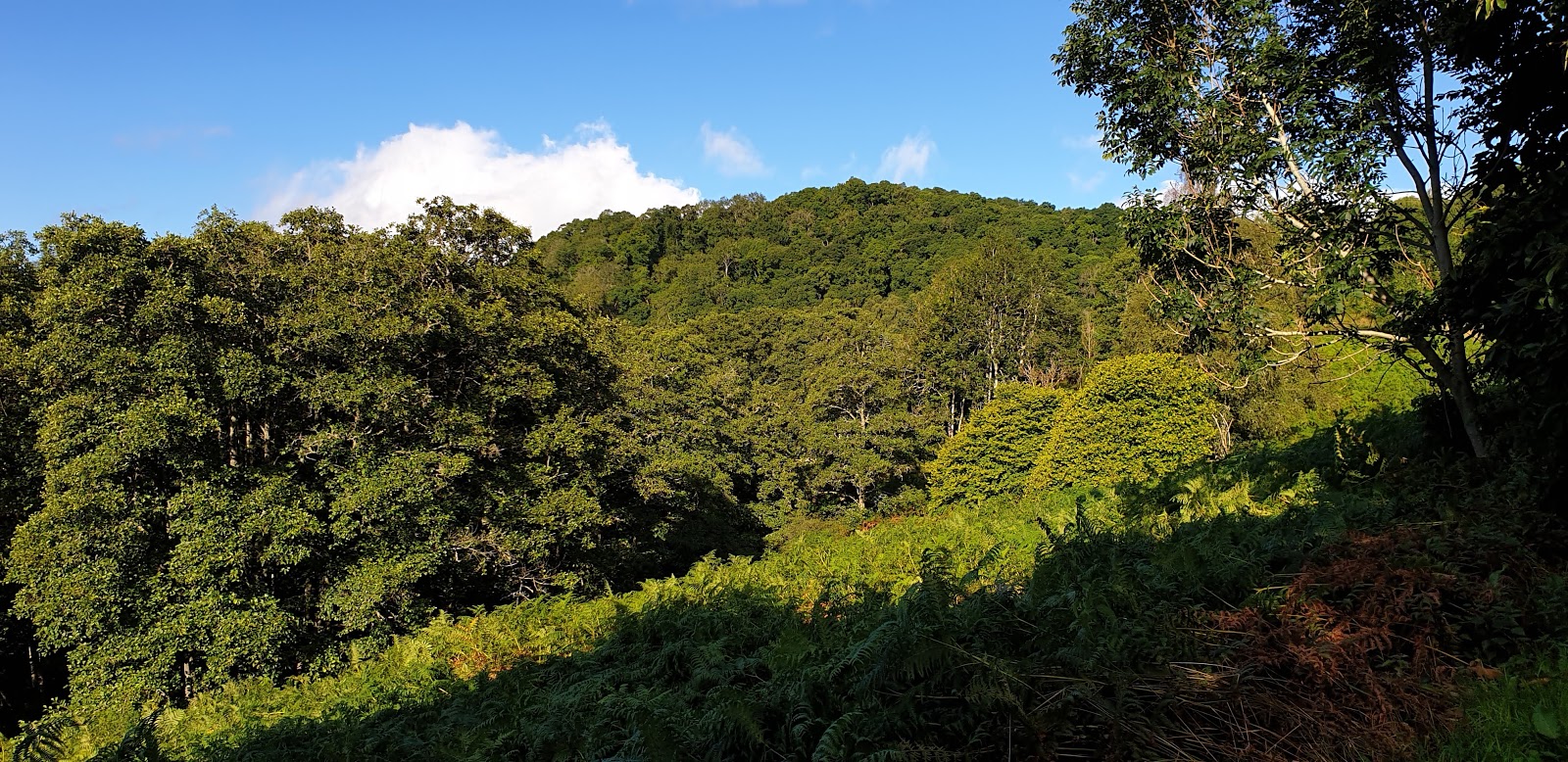
I came back through the wood, there were only glimpses of the Pentland Hills.....


Those were the two hills that I had intended to do but as my way home passed the start of the route up Dalmahoy Hill I thought "Mmmm, I'm here anyway". What a good decision that was. Dalmahoy Hill turned out to be one of the very best of the lowland Tumps. There was plenty parking at the start of the quarry road. I walked up it and crossed a couple of fields picking up a good footpath which went all the way to the top. There were even some rocky sections. Dalmahoy Hill from the north.....


Approaching the summit.....


Which revealed the huge quarry on Ravelrig Hill.....


View to Edinburgh.....


View to Fife.....


View to East and West Cairn Hills in the Pentlands.....


Trig and Edinburgh.....


Trig and Ochil Hills.....


Trig and The Kips and Scald Law in the Pentlands.....


A really excellent day!

Tuesday 4 August 2020

The Girron

3 August 2020

Participants: Just me

Where: The Girron, 528m/1,732', P. 36m, Tump, OS 51, NN 695 258

While I have enjoyed visiting the lower hills close to home so far this year and added to my Tump total, I wanted to at least visit some of the hills above the Highland line before the stalking season put them out of bounds. The forecast for today was excellent, although when I arrived at St Fillans it didn't look that way, bands of drizzle were coming down Loch Earn and the hills were almost out of view.....

Things were improving however and looking west shortly after leaving the forest area blue sky was starting to appear around the Graham, Creag Each..........


Things improved rapidly and soon it was a glorious day. The colours are always at their best after rain and so it was today. It was a great view along and across Loch Earn to Ben Vorlich.....


After leaving the track, progress was aided by a 4WD path up and across the heather. It went most of the way to the summit. The view south to the Glen Artney hills.....


I wasn't absolutely certain where the highest point was, the hill to the north named Creag Odhar looked as though it might be part of The Girron so I climbed it as well. On the way, there was a good view down to Loch Boltachan.....


This top was not in fact part of the Tump but it provided another aspect of the Glen Artney hills this time behind The Girron.....


I returned the same way. This was my first "proper" hill climb of the year and I found that my hill fitness was almost non-existent. I actually had to have a rest going downhill!  


Dundas Hill (Kirkliston)

1 August 2020

Participants: Just me

Where: Dundas Hill, 118m/387', P. 44m, Tump, OS 65, NT 115 765

This Tump is the highest point in Dundas estate south of Kirkliston, near Edinburgh. There was a convenient lay-by close to the south entrance to the estate, which seems to welcome visitors as there are walking routes signposted.  The route passed a picturesque lake and some glamping huts.....


Once passed the lake, I headed up a grass path towards a wall, followed it uphill, through a gate, and joined another track running along the summit ridge. There was a choice of points that might be the summit; I reckoned that it was just south of an old stone wall but it could have been in the trees to the north on a wee ridge. Where I thought it was.....


There was view to the north from the edge of the wooded area.....


and a glimpse of the Pentland Hills to the south from close to what I thought was the summit.....


I wandered back down to the lake on another track and all in all, it was a really pleasant short outing.


Wanlock Dod and Sowen Dod


29 July 2020

Participants: Just me

Where:    Wanlock Dod, 552m/1811', P. 94m, Tump, OS 71, NS 875 140 and Sowen Dod, 546m/1791', P.69m, Tump, OS 71, NS 866 144

I parked at the county boundary for those two gently rolling hills in the northern Lowther Hills. A high starting point plus a rough path up the side of a fence added to their ease of access. There was a small cairn at the top of Wanlock Dod and a gate and a junction of fences marked the high point of Sowen Dod. 

Setting off......


The view to Lowther Hill from the summit of Wanlock Dod.....


The view west to the Marilyn, Green Hill from Wanlock Dod.....


Sowen Dod from Wanlock Dod.....


Green Hill from the col between the two Dod's.....


Approaching the summit of Sowen Dod.....


Summit of Sowen Dod with Tinto on the horizon.....


I returned the same way, a pleasant gentle walk where as I expected, I saw no one else.