Saturday 24 April 2021

Thornliemuir (Neilston)

23 April 2021

Participants: Just me.

Where: Thornliemuir, 237m/778', P 48m, Tump, OS 64, NS 465 590

I took the train to Neilston and walked from there, the only downside was that there was a steep downhill section near to the start down to the A736 and of course the equivalent uphill section at the end. Notwithstanding, it was a pleasant walk with a road then a track all the way to the summit. The track passed through Capellie Farm but there was no one about.....


The trig appears in the distance.....


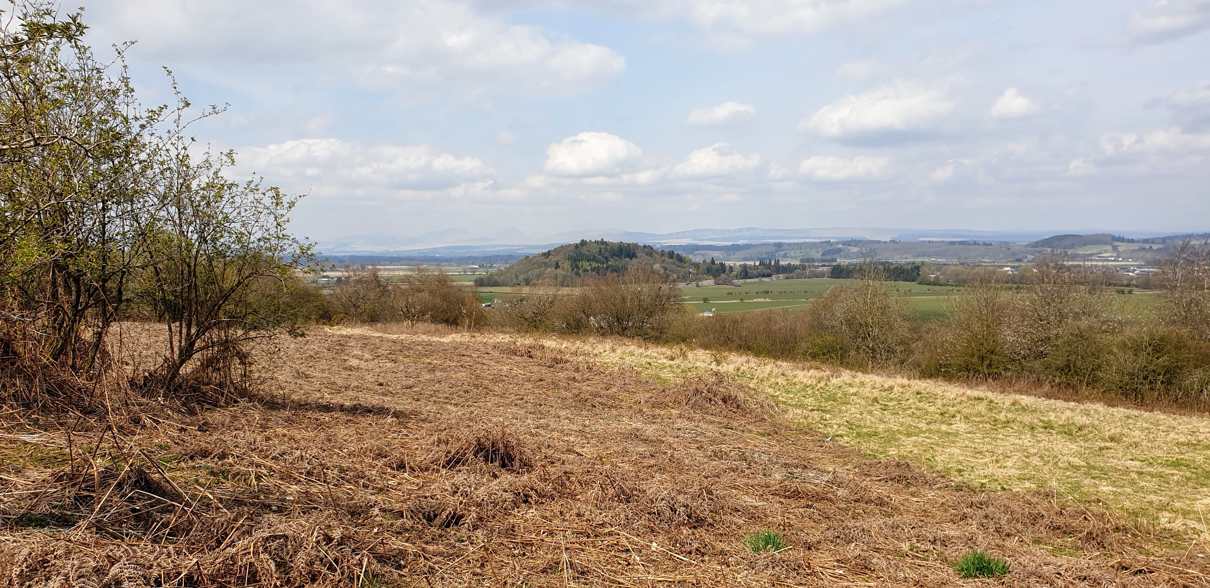
The trig is just south of a wall in a field obviously populated by cows. But they were away in the distance today so I was able to stop and enjoy my lunch with good views all around. It was a bit hazy so the distant views were not so good although I could just make out Ben Lomond to the north .....


the Campsie Fells beyond Paisley and Glasgow were much clearer......


and the hills of Arran were faint on the western horizon.....


 A pleasant spot, one of the high points in the Fereneze Hills.

Dalmeny Oil Depot

 21 April 2021

Participants: Just me

Where: Dalmeny Oil Depot, 88m/289', P30m, Tump, OS 65, NT 147 770

Tumps come in all shapes and sizes but this one is unique in that the Hill Bagging site allows you to claim it even if you haven't visited the high point, which is impossible. It is guarded by a high security fence and security guards. The nearest high point is a bus shelter on the dual carriageway that passes the northern boundary of the site. I traveled by train to Dalmeny station, there is a fine view of the Forth bridge from there.....


I headed for a public walkway that runs south from Queensferry; it made a pleasant walk away from the houses and roads.....


 After passing under the dual carriageway, there was a pedestrian path that led up to the bus stop.....


And here is a view of the bus stop and the hill from the other side of the road.....

An unusual "tick"!  


Saturday 17 April 2021

Free to travel at last! King's Park, Stirling

 16 April 2021

Participants: Just me

Where: King's Park, 69m/226', P 31 Tump, OS 57, 781931

All travel restrictions eased today so to celebrate, I took the train to Stirling, went to King's Park, enjoyed an ice cream in the sunshine and walked to the top of the Tump- my second visit here.....


 A lot of the vegetation has been removed from the top of the hill. Views of Stirling Castle.....


and of the Tump, Craigforth, with Ben Vorlich and Stuc a'Chroin distant.....


The track up between the golf course and the cliff edge.....


Great to see somewhere apart from Glasgow/East Dunbartonshire!

Thursday 15 April 2021

Another visit to the Antonine Wall- Croy Hill

 15 April 2021.

Participants: Just me

Where: Croy Hill, 147m/482', P62m, Tump, OS 64, NS 731 763

Another visit to the Antonine Wall. There is less to see in the way of Roman remains than on Castle Hill but it is a more open hill so the views are better. On this occasion I used bus and train, careful study of the timetables meant that there was not too much waiting around and anyway it was a nice day.


It is a straightforward hill with good paths. I headed to the summit, continued on for a bit before dropping down the north side of the hill to pick up a track in the valley that took me back to the start point. There are a number of Historic Scotland Environment notices on the hill explaining the history of the wall, fascinating stuff.


The view north-west to Cort ma Law in the Campsie Fells with Kilsyth and the canal basin foreground......


Castle Hill.....


Approaching the summit.....


Most of the thick gorse at the summit had been cut down since my last visit although there is a barbed wire fence to cross if you want to get to the actual high point.....


Looking to Castle Hill and the Kelvin Valley.....


Looking to Garrel Hill in the eastern Campsie Fells.....


A Roman ditch and wall.....


Friday 9 April 2021

Castle Hill (Twechar)

 9 April 2021

Participants: Just me

Where: Castle Hill (Twechar), 156m/512', P 77m, OS 64, NS711 759 Tump

A return visit to Castle Hill, but this time I walked from home alongside the Forth and Clyde canal as far as Twechar before following the track up the west flank of the hill. It was a glorious spring morning and I set off early as I thought that there would be a few folk on this hill today- there were, as I was coming down. Looking across the canal (with swan) to Cort ma Law in the Campsie Hills....


On the canal path approaching the hill.....


Looking west towards Milton of Campsie, Kirkintilloch and Glasgow from part way up.....


Castle Hill is notable for the remains of Bar Hill Fort on its summit. The Fort is the highest point on the Antonine Wall which marks the northern boundary of the Roman empire some 1,800 years ago......


They certainly chose well because it is an excellent spot for observing the surrounding countryside. Looking towards the eastern Campsie Fells above Kilsyth.....


and east over Croy to the Forth valley.....


 some foundations remain.....


and the whole site has a number of explanatory boards.....


there is a trig at the east end of the high ground, a very fine viewpoint.....


More views looking west including some Roman ditches.....


I descended the same way in time to get a bus back to Kirkintilloch.

Saturday 3 April 2021

Mounthullie

30 March 2021

Participants: Just me

Where: Mounthullie, 231m/758', P 97m, OS 64, Tump 

I took the bus to Lennoxtown and walked from there up a very quiet country road. The forest that covered the top of the hill is being cut down although the track to the top remained clear. The high point used to be on the rim of a small quarry but that had all been filled in. The soil was firm enough to enable easy walking although it might be a bit messy in rainy conditions. Felled forestry.....


The Campsie Fells through a pile of logs.....


The restored summit area.....


Views of Cort ma Law.....


I could have followed forest tracks back past the Celtic training ground but I wasn't sure whether these would still be available so I just returned by my route of ascent.