Wednesday, 30 January 2013

Creag Each (Glen Tarken)

Participants - Just me
Where - Creag Each (Glen Tarken), 672m/2,204', Graham, Map 51, NN 652264

This was a winter 2009 trip. I drove up to St Fillans at the east end of Loch Earn and parked in a car park on the lochside next to the sailing club and just west of the village. This is Creag Each seen from the approach to St Fillans.....


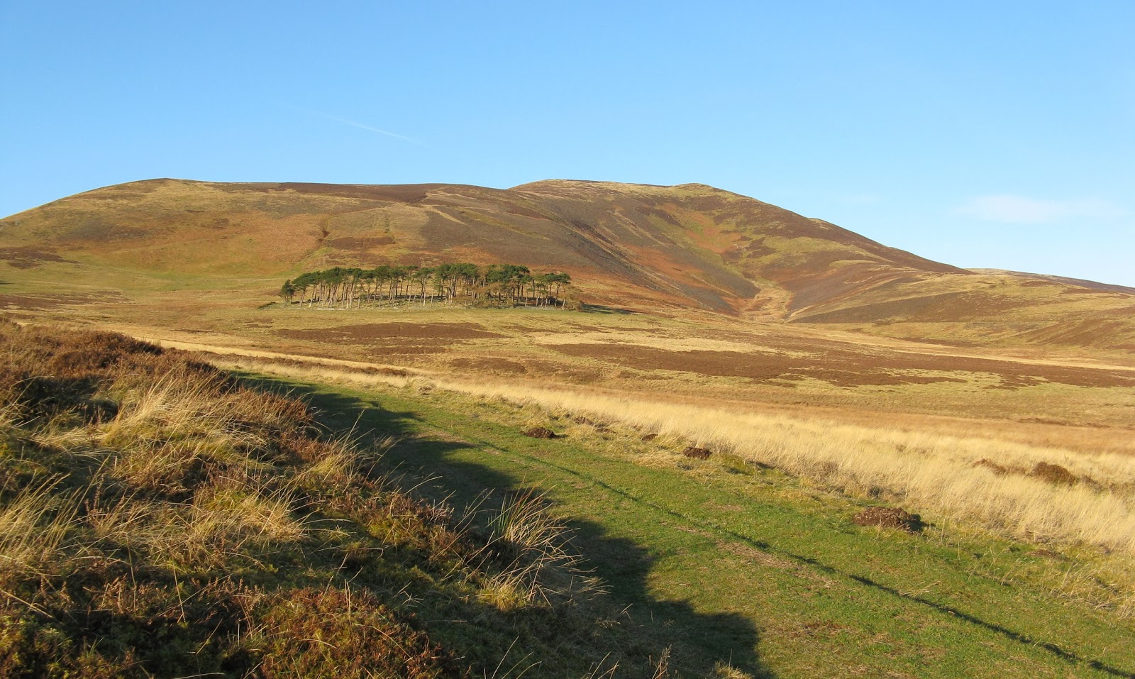
From the car park it was only a short walk back to the start of a track that went up Glen Tarken. The track was in good nick and I made speedy progress (for me!) up the glen to a point where a burn came down from my intended hill. Being December, the worst of the grass and heather was past and as it had been frosty overnight, the ground was reasonably firm. This is looking to the summit from the track.....


As I got higher, the Ben Lawers hills came into view to the north.....


although they were not revealed in all of their glory until I reached the summit.....


The summit of this one was easy to find, a cairn on top of a rocky outcrop. It was a typical December day so the distant views were not that great; this is looking west in the general direction of Glen Ogle.....


There is a second Graham in Glen Tarken, Creag Ruadh. The two together must make a good round in the summer. For today, however, I just wandered back to the car. Creag Ruadh is still on my to do list.

Saturday, 26 January 2013

Hightown Hill and Wauk Hill, 2 from the M74

Driving to and from MBA meetings in the north of England has provided me with the opportunity to climb several sub-2k Marilyns near to the M74. These two small hills are in rural Dumfriesshire and are ideal for a stop to stretch the legs; they are pleasant wee hills but not ones that you would make a specific trip to climb. I climbed both of these in 2009.

Participants - Just me
Where - Hightown Hill, 250m/820', Sub-2k Marilyn, Map 78, NY 902779


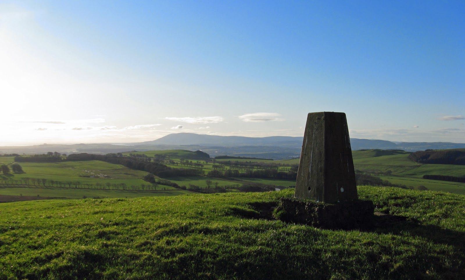
I headed off the motorway to Lochmaben and then along various narrow roads which eventually brought me to the west side of Hightown Hill, which I reckoned would provide the easiest approach. I managed to get the car on to the verge a few hundred yards south of Hightown farm and walked back down the road to opposite the farm to a track which led to the open hillside. From there it was just a short climb up grassy slopes to the trig. For a low lying hill the views were excellent, the first two pics are looking west towards Galloway and the last one is the view south-west to the Solway and Criffel.....


This hill took less than 1 hour up and down including a laze at the trig.


Participants - Just me
Where - Wauk Hill, 357m/1,172', Sub-2k Marilyn, Map 78, NX 841909

Wauk Hill needed a bit more driving to reach it as it is situated south -west of Thornhill. I was returning home from a trip south so headed for Dumfries and then took the road to Moniaive. I decided to approach the hill from the A702, approx 824913. Parking spots here were a problem, there were none! The road to Tynron looked to be very quiet so I took a chance, drove down it for a few hundred yards and got as much of the car on to the verge as possible.

I had to get through a field to get to the hill. I had a choice of two fields, one contained sheep and the other a herd of frisky bullocks. A no brainer! The bullocks accompanied me all the way up the field, fortunately on the other side of a wall. I haven't included them in this pic as I wanted to avoid their attention as much as possible.....


Beyond the field, the ground was uncultivated but there was a semblence of a path in places through the short heather. This one was another good viewpoint. This is towards the Galloway hills.....

 
towards Cairnkinna Hill.....


and east to Queensberry.....


I suspect that I didn't find the best starting point for this hill but it was an impulse walk and it was just a case of finding a reasonable way up.


Wednesday, 16 January 2013

Meall Buidhe (Glen Lyon)...and memories of an earlier escapade


Participants - Just me
Where - Meall Buidhe (Glen Lyon), 932m/3,057', Munro, Map 51, NN 498499

Meall Buidhe is one of the easier of the Munros but its position on the eastern edge of Rannoch Moor makes it well worth climbing. It's a straightforward walk, nothing steep, and I have been there on a few occasions. My last visit, in 2009, was on a glorious spring day when the area was looking at its best. It's a popular area and the start point for both Meall Buidhe and Stuchd an Lochain but there is plenty roadside parking at the end of the public road just before the Loch an Daimh dam.....


I found traces of a path up the gentle slopes although it was a bit wet in places. The view to the west along Loch an Daimh opened up as I got higher; the hill with the snow patch on it in the far is another Meall Buidhe of which more later.....


I reached the ridge just to the west of the top Meall a'Phuill and followed it more steeply to an unnamed 917m top where the ridge swung round to the north. This is the view to the northern section of the ridge from below the 917m top.....


and from the cairn on that top looking south to the Ben Lawers group.....


It was great walking on short grass from there to the summit where I stopped for ages to sit in the sun and admire the views, south-east to the Lawers hills.....


and south west to the other side of Loch an Daimh.....


Most folk climb both Meall Buidhe and Stuchd an Lochain in the one trip. The usual way to do the two Munros is to do one, go back to the start at the dam and then do the other. Standing at the cairn on Meall Buidhe one day many years ago however, we decided that it would be a great idea to link them by walking round Loch an Daimh. The fact that it was already getting on for noon on a fairly shortish day didn't really figure in our thoughts. A look at the map showed that it was roughly 5 miles to the far end and the Corbett of Meall Buidhe, that is 5 miles as the crow flies. However there were lots of ups and downs on the way and with no path, time was already getting on when we eventually reached the second Meall Buidhe. This is a rather remote Corbett and when we got there, the summit seemed closer to Glencoe than to the Loch an Daimh dam. Probably an illusion though. Still, the route back to the dam along the south side of the loch was shorter than the outward route. The only problem was that another Corbett and a Munro stood in the way.

The Corbett of Sron a'Choire Chnapanich has easy grass slopes; unfortunately,you have to make a zig-zag to get to the cols either side of it and these cols are ridden by peat hags. By the time we got to the second col below the west ridge of Stuchd an Lochain we were knackered and darkness was approaching. The thought of having to climb all the way up Stuchd an Lochain just to go down the other side was too much. So we headed for the loch side. Now anyone who has tried to follow the shoreline of one of these man made lochs will know what a daft idea that was. Contouring across a steep hillside is always strength sapping and frustrating. And the shoreline was comprised of uneven boulders so that wasn't an option either. While we tried to follow the edge of the loch as closely as possible, in places the shoreline bit into the hillside and we had to divert upwards. It was only 3 miles but it took an age. We should just have gritted our teeth and climbed the Munro and followed the path down. The loch side approach took longer and it was dark when we eventually got back to the car.

Although we'd made a bit of a b###s of it, this was a fine walk and one to be recommended for a long summers day. On my 2009 trip however, I was content just to sit at the cairn on the Munro and remember the earlier visit to its namesake and then slowly meander my way back to the dam enjoying the view across the glens to Meall Ghaordaidh as I descended.....

Friday, 4 January 2013

Penvalla

2 January 2009

Participants - Just me
Where - Penvalla, 537m/1,765',Sub-2k Marilyn, Map 72, NT 151395

This is an account of a New Year walk. Sadly, not this New Year; although I am recovering from my op, I am nowhere near ready to set foot on a hill. Rather it is a look back to a walk that I did a year or two back when I was staying at Polmood, a hut near Broughton that belongs to the Border Bothies Association. On New Year's day we walked up the valley of the Gameshope burn past the MBA bothy of the same name and on up to Molls Cleuch Dod. Cloud came and went and there was some fresh snow on the tops and it was generally not too bad a day to be out.

The following day dawned clear, frosty and very cold. I was heading home and decided to make a diversion to climb Penvalla, the easternmost hill in the Broughton range. The other hills in the group are best approached from Broughton; the easiest route to Penvalla looked to be from the south. So I drove to Stobo and parked at the side of the road leading to the church. A good track followed the east side of the Easton Burn, a Right of Way that was now part of the John Buchan Way.....


Penvalla soon made an appearance.....


 Approaching a forest area, I heard the sound of gun shots. A pheasant shoot was under way. A lookout had been posted to ensure that no walker got within range of the guns and I had a sudden fear that I was not going to be allowed to go any further. However, the chap was very pleasant, wished me a Happy New Year and told me a bit about the shoot as pheasants flew out of the wood closely pursued by a variety of dogs, folk on bicycles and in 4WD's. All very convivial, unless you were a pheasant.

I was soon on my way again, leaving the wood, crossinsg the burn and following the track out on to the open moorland. The sun was out and it was very pleasant as I climbed steadily up the track.....


At the 382m spot height marked on the map, I left the track and headed over Mid Hill straight for the summit of Penvalla. This is looking to Broughton Heights.....


and back in the direction that I had come to the Peebles valley.....


As the day was short, I didn't linger for too long but retraced my steps back to Stobo. All was now quiet in the woods.

Friday, 28 December 2012

Ben Tianavaig

May 2009

Participants  - Just me
Where - Ben Tianavaig, 413m/1,355', Sub 2k Marilyn, Map 23, NG 511410

The weather seems to have settled in to an overcast and often wet spell. Looking out of my window, the Campsies are more often than not covered in clag. So to cheer myself up, I will end my posts for 2012 with a look back to a trip on a glorious sunny day in 2009. It wasn't a long walk- only 1 hour and 30 minutes to the top- but it represented all that is good with hill walking.

Most of my hillwalking trips to Skye have resulted in me getting no further than Sligachan or Glenbrittle and the Cuillin and the Red Hills. I have never, however, been fully comfortable scrambling about on high, narrow and rocky places and this feeling of unease has got stronger as I have got older. So on this trip I decided to fore go the Cuillin and have a look at some of the smaller hills that the island had to offer. I had also discovered sub-2k Marilyn, another reason to give the scary places a body swerve!

Ben Tianavaig caught my eye as one that should prove interesting. From Portree harbour, it just looked like another hill of no special note.....


But from the south, near the village of Braes, it looked entirely different, like a hill that had been split down the middle with only half remaining, the other half having disappeared into the sea. Really dramatic, I almost expected Johnny Depp and the Black Pearl to sail out from beneath the cliffs. OK, a bit of an exaggeration but it was an unusual hill.....


The above pic is taken from near Braes and this one is from Raasay at the other side of the Sound of Raasay.....

I drove to the village of Camastianavaig and parked at a picnic area at the beach. The map showed a path starting at the houses a couple of hundred yards further on (where the road swung to the left and next to a post box) and going up a narrow "close" between two houses and on to the open hillside. It was a bit rough in places lower down, a good excuse to stop and catch my breath and gaze at the views opening up behind me.....


Ahead, I could see what looked like a band of crags and I wondered if there was an easy route through them. There was, close to the seaward side. Beyond that, the going became excellent on short cropped grass and by sticking close to the cliff edge I got some great views. Arrival at the trig opened up views to Portree and the north.....


The summit was a marvellous perch; the hill dropped away abruptly very close to the trig and it looked like a long way down to the sea. I sat around for ages looking down the Sound of Raasay to the distant Red Hills.....


There seem to be a number of similar small hills in Skye that end in precipitous cliff top views. I look forward to visiting them also.

I hope that everyone who reads this blog enjoys great hill walking in 2013. Happy New Year to all!

Tuesday, 18 December 2012

Beinn a'Mheadhoin

September 2009

Participants - Just me
Where - Beinn a'Mheadhoin, 610m/2,002', Graham, Map 25, NH 219255

So here's the first of my retrospective reports. It was one of these days when I had no firm plan of what I was going to climb, I had enjoyed an excellent walk on Ben Wyvis the day before so I was looking for something that was not too strenuous. I headed to Strathpeffer and the car park for Cnoc Mor but there were a number of signs telling me to keep out as tree felling was taking place. So I thought that I would do something up Glen Strathconnon instead but soon encountered signs saying that there would be long delays on the glen road as resurfacing work was taking place. A three point turn and I headed for the road to Glen Affric instead.

Beinn a'Mheadhoin only really registered with me as a possibility when I stopped in the car park at the bridge over the Abhainn Gleann nan Fiadh to look at the river and to consult the map. The track opposite the car park was the one that I had used years' earlier when I climbed the Glen Affric Munros. I followed it for less than a mile before taking to the hillside. There was a great view of Sgurr na Lapaich from the path, from this angle you wonder why such a striking hill is not a Munro in its own right but closer inspection shows that it is only the sharp end of a gentle ridge that runs all the way to/from Mam Sodhail.....


 Climbing the gentle slopes.the view soon opened out up Gleann nam Fiadh to the Munro of Tom a'Choinich.....


 The going was mainly on grassy slopes and it wasn't long before I could see my objective.....


I reached the flat area that contains the summit in about 1 hour and 15 minutes after leaving the car. There were two cairns, the more westerly was the viewpoint and the other, smaller pile of stones the other side of a small lochan, marked the highest point.

I didn't stay at the smaller cairn long but hastened back to the viewpoint....magnificent! This is the  view to Sgurr na Lapaich, Mam Sodhail, Carn Eige and Tom a Choinich.....


Carn Eige and Tom a'Choinich.....


Toll Creagach.....


across Glen Affric to Sgurr nan Conbhairean and Mullach Fraoch-choire.....


and west to Loch Affric and Mullach Fraoch-choire.....


It's funny how unforseen circumstances can lead to such a great day- although the opposite is true as well I suppose! In this case, a combination of tree felling and road works conspired to direct me to this previously unthought of Graham, one of the best that I have climbed

Tuesday, 27 November 2012

Now for a pause....


I'm going to be out of action for a few months. If it had to happen then I suppose that this is the best time of year! Hopefully, I should be back to hill fitness by the time the better weather and longer days return. In the meantime however I'm going to keep the blog going. I have photographs from walks in 2009 and early 2010 prior to my starting the blog.....the walks are still fresh enough in my memory to put them into trip reports. Hope you enjoy!

Sunday, 25 November 2012

Cairnie Hill

23 November 2012

Participants - Just me
Where - Cairnie Hill, 228m/749', Sub-2k Marilyn, Map 59, NO 279155

I was on my way to the Dundee Mountain Film Festival and as it was a beautiful day I stopped for a walk. I chose Cairnie Hill on the grounds that although I have climbed it before it had not yet been included in this blog. Anyway, its a nice wee hill. There has apparently been doubt as to whether it in fact qualified as a Marilyn but a survey a few months ago found that its relative height was more than 150m so its status has been confirmed.

Cairnie Hill lies above Lindores Loch south of Newburgh. It is not named on the 1:50 000 map but is on the larger scale map. Although the car park was closed, I managed to get the car off the road close to a fisherman's hut from where it was only a short walk south along the road to the start of a track that went to within a few yards of the summit. Lindores Loch looked very pleasant; there was a large flock of swans at the side furthest away from me and it is obviously an over wintering habitat for birds.


This is pheasant rearing country and there were lots in the wood, definitely not a hill on which to take a spaniel! I was pleased to see thet there was still a bit of colour left on the trees and the area around the summit was very pleasant.....


Approaching the top.....


The highest point is apparently a rock close to this beautiful and distinctive old tree.....


I wonder how much longer it will stand. A path is being formed from the track to the tree so this hill must be attracting its share of Marilyn baggers. Its not really surprising as the views are fine; this is to Norman's Law and the Tay.....


and this is across Fife towards Mount Hill which is close to Cupar.....


Cairnie Hill is not at all distinctive from the countryside round about but it provided a very pleasant short walk.