Tuesday, 27 November 2012
Now for a pause....
I'm going to be out of action for a few months. If it had to happen then I suppose that this is the best time of year! Hopefully, I should be back to hill fitness by the time the better weather and longer days return. In the meantime however I'm going to keep the blog going. I have photographs from walks in 2009 and early 2010 prior to my starting the blog.....the walks are still fresh enough in my memory to put them into trip reports. Hope you enjoy!


Sunday, 25 November 2012
Cairnie Hill
23 November 2012
Participants - Just me
Where - Cairnie Hill, 228m/749', Sub-2k Marilyn, Map 59, NO 279155
I was on my way to the Dundee Mountain Film Festival and as it was a beautiful day I stopped for a walk. I chose Cairnie Hill on the grounds that although I have climbed it before it had not yet been included in this blog. Anyway, its a nice wee hill. There has apparently been doubt as to whether it in fact qualified as a Marilyn but a survey a few months ago found that its relative height was more than 150m so its status has been confirmed.
Cairnie Hill lies above Lindores Loch south of Newburgh. It is not named on the 1:50 000 map but is on the larger scale map. Although the car park was closed, I managed to get the car off the road close to a fisherman's hut from where it was only a short walk south along the road to the start of a track that went to within a few yards of the summit. Lindores Loch looked very pleasant; there was a large flock of swans at the side furthest away from me and it is obviously an over wintering habitat for birds.


This is pheasant rearing country and there were lots in the wood, definitely not a hill on which to take a spaniel! I was pleased to see thet there was still a bit of colour left on the trees and the area around the summit was very pleasant.....

Approaching the top.....

The highest point is apparently a rock close to this beautiful and distinctive old tree.....

I wonder how much longer it will stand. A path is being formed from the track to the tree so this hill must be attracting its share of Marilyn baggers. Its not really surprising as the views are fine; this is to Norman's Law and the Tay.....

and this is across Fife towards Mount Hill which is close to Cupar.....

Cairnie Hill is not at all distinctive from the countryside round about but it provided a very pleasant short walk.
Participants - Just me
Where - Cairnie Hill, 228m/749', Sub-2k Marilyn, Map 59, NO 279155
I was on my way to the Dundee Mountain Film Festival and as it was a beautiful day I stopped for a walk. I chose Cairnie Hill on the grounds that although I have climbed it before it had not yet been included in this blog. Anyway, its a nice wee hill. There has apparently been doubt as to whether it in fact qualified as a Marilyn but a survey a few months ago found that its relative height was more than 150m so its status has been confirmed.
Cairnie Hill lies above Lindores Loch south of Newburgh. It is not named on the 1:50 000 map but is on the larger scale map. Although the car park was closed, I managed to get the car off the road close to a fisherman's hut from where it was only a short walk south along the road to the start of a track that went to within a few yards of the summit. Lindores Loch looked very pleasant; there was a large flock of swans at the side furthest away from me and it is obviously an over wintering habitat for birds.


This is pheasant rearing country and there were lots in the wood, definitely not a hill on which to take a spaniel! I was pleased to see thet there was still a bit of colour left on the trees and the area around the summit was very pleasant.....

Approaching the top.....

The highest point is apparently a rock close to this beautiful and distinctive old tree.....

I wonder how much longer it will stand. A path is being formed from the track to the tree so this hill must be attracting its share of Marilyn baggers. Its not really surprising as the views are fine; this is to Norman's Law and the Tay.....

and this is across Fife towards Mount Hill which is close to Cupar.....

Cairnie Hill is not at all distinctive from the countryside round about but it provided a very pleasant short walk.
Monday, 19 November 2012
Tosson Hill
18 November 2012
Participants - Neil, Steven and Ben
Where - Tosson Hill, 440m/1,444', Sub-2k Marilyn, Map 81, NZ 004982
The dying days of autumn so we headed south to catch the last of the colour on the foliage (and add a new sub-2k Marilyn to the list of course!). I was really taken with Northumberland when I visited for the first time earlier in the year, it is so close to Scotland yet entirely different- quaint villages, the different use of stone in buildings, and of course the dialect. It deserves more of a visit than a weekend comprised of short days at the fag end of the year. We were staying at Rothbury which is at the foot of the Simonside Hills and the object on this occasion was Tosson Hill, the highest point in the range.
I drove up some narrow country roads through the hamlet of Great Tosson to a large Forestry Commission car park and picnic area at Simonside forest. It had been frosty overnight and it was a glorious day although the forecast was for more rain and wind to come in later. Although a lot of the foliage had fallen from the trees, the colours were still really strong and emphasised by the deep blue of the sky. The route followed good forest tracks initially; out of the car park past an information board and through a one-barred gate and then gently uphill until opposite a radio mast where we turned left. This is shortly after we left the car.....

At the next junction we turned right; the track rose uphill at the side of the forest and there was a good view back to Rothbury.....

The map that I had printed off the internet suggested that our track should still be deep in the forest but in fact it was just outside. However it was obvious that we were heading for the foot of Simonside crag which was where we wanted to be. But when we got there confusion took over for a few minutes. The other bit of the forest that was marked on the map had been felled and it wasn't immediately obvious where the path that led up on to the moors actually was. After one false start we found it; it wasn't in particularly great condition but it led to where we thought that we wanted to be. As we got higher the views started to open out, this is looking east over Coquetdale and the village of Thropton and the second picture is looking north to the Cheviot.....


We reached a fence and a gate and I took another picture looking north to the Cheviot.....

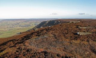
At this point all doubts that we were on the right hill disappeared, we could see a large cairn in the distance across the moorland. The path, still very muddy, ran along the top of Ravens Heugh, another area of cliffs. This is looking back at it from closer to the cairn.....
And then we were there.....


The cloud was already starting to build in the west and there was a fairly brisk, cold wind blowing so we didn't linger for long before setting off back the way we had come.....

This is obviously a very popular walking area; there were lots of people on Simonside and the ridge to Dove Crag but no one else seemed interested in Tosson Hill. Simonside looked a great walk and if I was coming here again I would do that walk and not bother about the Marilyn. Although it was November and I expected that the moorland would be wet I guess that up on the fairly flat plateau it is never very dry underfoot. Past Simonside, I tried a shot of it straight into the sun, there is a figure on top close to the right edge that gives it some scale.....

Participants - Neil, Steven and Ben
Where - Tosson Hill, 440m/1,444', Sub-2k Marilyn, Map 81, NZ 004982
The dying days of autumn so we headed south to catch the last of the colour on the foliage (and add a new sub-2k Marilyn to the list of course!). I was really taken with Northumberland when I visited for the first time earlier in the year, it is so close to Scotland yet entirely different- quaint villages, the different use of stone in buildings, and of course the dialect. It deserves more of a visit than a weekend comprised of short days at the fag end of the year. We were staying at Rothbury which is at the foot of the Simonside Hills and the object on this occasion was Tosson Hill, the highest point in the range.
I drove up some narrow country roads through the hamlet of Great Tosson to a large Forestry Commission car park and picnic area at Simonside forest. It had been frosty overnight and it was a glorious day although the forecast was for more rain and wind to come in later. Although a lot of the foliage had fallen from the trees, the colours were still really strong and emphasised by the deep blue of the sky. The route followed good forest tracks initially; out of the car park past an information board and through a one-barred gate and then gently uphill until opposite a radio mast where we turned left. This is shortly after we left the car.....

At the next junction we turned right; the track rose uphill at the side of the forest and there was a good view back to Rothbury.....

The map that I had printed off the internet suggested that our track should still be deep in the forest but in fact it was just outside. However it was obvious that we were heading for the foot of Simonside crag which was where we wanted to be. But when we got there confusion took over for a few minutes. The other bit of the forest that was marked on the map had been felled and it wasn't immediately obvious where the path that led up on to the moors actually was. After one false start we found it; it wasn't in particularly great condition but it led to where we thought that we wanted to be. As we got higher the views started to open out, this is looking east over Coquetdale and the village of Thropton and the second picture is looking north to the Cheviot.....


We reached a fence and a gate and I took another picture looking north to the Cheviot.....

At this point all doubts that we were on the right hill disappeared, we could see a large cairn in the distance across the moorland. The path, still very muddy, ran along the top of Ravens Heugh, another area of cliffs. This is looking back at it from closer to the cairn.....

And then we were there.....


The cloud was already starting to build in the west and there was a fairly brisk, cold wind blowing so we didn't linger for long before setting off back the way we had come.....

This is obviously a very popular walking area; there were lots of people on Simonside and the ridge to Dove Crag but no one else seemed interested in Tosson Hill. Simonside looked a great walk and if I was coming here again I would do that walk and not bother about the Marilyn. Although it was November and I expected that the moorland would be wet I guess that up on the fairly flat plateau it is never very dry underfoot. Past Simonside, I tried a shot of it straight into the sun, there is a figure on top close to the right edge that gives it some scale.....

Sunday, 11 November 2012
Cademuir Hill.....Luck or what?
11 November 2012
Participants - Neil, Steven and Ben
Where - Cademuir Hill, 416m/1,365', Sub-2k Marilyn, Map 73, NT 242377
I had looked at Cademuir Hill in passing on a number of occasions and done just that, passed it. The few reports that I had read talked about huge problems in finding a route through the forest that covers the upper part of this hill; the most recent comments that I had come across were "not a nice hill" and "thoroughly unpleasant". Anyway, we were going to Peebles for a Sunday outing and the temptation to give the hill a go proved too strong. I expected that I would have no chance in finding the cairn, particularly as I don't have a gps and the few paths marked on the map apparently bore little resemblance to what is on the ground.
We parked in the Cademuir Forest car park on the south-west side of the hill. A rough path headed up towards the forest.....

This path reached a forestry road at a red marked waymark post. I reckoned that the top of the hill was roughly above us (obviously!) but slightly further to the north. So we turned left on to the track and followed it until it turned into a path which headed steeply uphill. After about 150 yards the path levelled out and I guessed that we must have come all the distance in a northerly direction that we needed. There seemed to be a break in the trees above us at this point - it was not obvious that it continued any distance but we decided to take it anyway so turned right. In fact, there were what looked like old vehicle tracks so the going was OK. Higher up, we appeared to arrive at a junction of similar forest breaks and solely on instinct, we turned right at this point and then almost immediately left. We were back following the vehicle tracks uphill. There was only one fallen tree that we had to get past and not long after that, the forest break that we were following flattened out and we were looking at glimpses of sky through the trees.....

The ground looked higher to our right so we went that way. It looked as though we had hit on the summit area so we scouted around a bit. And, miracle of miracles, after rounding another fallen tree we spotted the cairn.....

Here is the evidence to prove that we made it to the top.....


And here is a close up of one of the party, who was persuaded to sit still for a moment with a shout of "Ben.....num nums" which is dog speak for food in our house.....

There were, of course no views. I suspect that there are other breaks in the trees that lead to the cairn from the main track but we didn't bother to look. We just went back the same way. Going downhill, there was a view of the 407m top, which has no trees, to the west.....

So Cademuir Hill turned out to be not difficult at all; in fact it was easy peasy! Luck or what?
Participants - Neil, Steven and Ben
Where - Cademuir Hill, 416m/1,365', Sub-2k Marilyn, Map 73, NT 242377
I had looked at Cademuir Hill in passing on a number of occasions and done just that, passed it. The few reports that I had read talked about huge problems in finding a route through the forest that covers the upper part of this hill; the most recent comments that I had come across were "not a nice hill" and "thoroughly unpleasant". Anyway, we were going to Peebles for a Sunday outing and the temptation to give the hill a go proved too strong. I expected that I would have no chance in finding the cairn, particularly as I don't have a gps and the few paths marked on the map apparently bore little resemblance to what is on the ground.
We parked in the Cademuir Forest car park on the south-west side of the hill. A rough path headed up towards the forest.....

This path reached a forestry road at a red marked waymark post. I reckoned that the top of the hill was roughly above us (obviously!) but slightly further to the north. So we turned left on to the track and followed it until it turned into a path which headed steeply uphill. After about 150 yards the path levelled out and I guessed that we must have come all the distance in a northerly direction that we needed. There seemed to be a break in the trees above us at this point - it was not obvious that it continued any distance but we decided to take it anyway so turned right. In fact, there were what looked like old vehicle tracks so the going was OK. Higher up, we appeared to arrive at a junction of similar forest breaks and solely on instinct, we turned right at this point and then almost immediately left. We were back following the vehicle tracks uphill. There was only one fallen tree that we had to get past and not long after that, the forest break that we were following flattened out and we were looking at glimpses of sky through the trees.....

The ground looked higher to our right so we went that way. It looked as though we had hit on the summit area so we scouted around a bit. And, miracle of miracles, after rounding another fallen tree we spotted the cairn.....

Here is the evidence to prove that we made it to the top.....


And here is a close up of one of the party, who was persuaded to sit still for a moment with a shout of "Ben.....num nums" which is dog speak for food in our house.....

There were, of course no views. I suspect that there are other breaks in the trees that lead to the cairn from the main track but we didn't bother to look. We just went back the same way. Going downhill, there was a view of the 407m top, which has no trees, to the west.....

So Cademuir Hill turned out to be not difficult at all; in fact it was easy peasy! Luck or what?
Monday, 22 October 2012
Hallin Fell
21 October 2012
Participants - Just me
Where - Hallin Fell, 388m/1,273', Sub-2k Marilyn, Map 90, NY 433198
Today's MBA meetings finished just after 2pm which meant that I unexpectedly had a few hours daylight to have another walk before heading up the road. Langwathby is only a few miles east of the Lake District and I had noted a small walk that I could reach with only about 20 miles driving. It was of course another sub-2k Marilyn! Hallin Fell sits on the east side of Ullswater and is reached by a narrow road from Pooley Bridge to Martindale. Ideal, although I was concerned that it being a Sunday and a glorious autumn day that the whole world and his family would be out and I would be unable to find a place to park. Anyway it was worth taking a chance. This is a view of the hill across Ullswater which I took later in the afternoon.....

There was a car park just past the highest point of the road at the church and other parking was available on the verges. Amazingly, I found a space, the last one. This is obviously a popular wee hill, easy of access and a superb viewpoint. Grassy paths led from the car park directly to the summit; it only took about 20 minutes to climb. This is from part way up, looking south down Howe Grain towards High Raise and High Street.....

My trip had coincided with the time of year when the autumn colours were at their best. This hill is recognisable from miles around by the large stone cairn, marked on the map as an obelisk, on its summit.....

It sits immediately above the Lake; this is looking north towards Pooley Bridge and Penrith.....

this is across the Lake to Gowbarrow Fell with the top of Blencathra beyond.....

this is across the Lake to Little Mell Fell, another sub-2k in the area.....

and this is looking south towards the Helvellyn group of hills.....

The sun was warm and I sat around for a while. I really like the Lake District, it is just a pity that it is so crowded and that the roads are so narrow. I would hate to visit in the height of summer!
I dragged myself away eventually, drove back to Pooley Bridge and then down Ullswater as far as Patterdale before reluctantly heading back to the motorway and home. It had been a real bonus walk.
Participants - Just me
Where - Hallin Fell, 388m/1,273', Sub-2k Marilyn, Map 90, NY 433198
Today's MBA meetings finished just after 2pm which meant that I unexpectedly had a few hours daylight to have another walk before heading up the road. Langwathby is only a few miles east of the Lake District and I had noted a small walk that I could reach with only about 20 miles driving. It was of course another sub-2k Marilyn! Hallin Fell sits on the east side of Ullswater and is reached by a narrow road from Pooley Bridge to Martindale. Ideal, although I was concerned that it being a Sunday and a glorious autumn day that the whole world and his family would be out and I would be unable to find a place to park. Anyway it was worth taking a chance. This is a view of the hill across Ullswater which I took later in the afternoon.....

There was a car park just past the highest point of the road at the church and other parking was available on the verges. Amazingly, I found a space, the last one. This is obviously a popular wee hill, easy of access and a superb viewpoint. Grassy paths led from the car park directly to the summit; it only took about 20 minutes to climb. This is from part way up, looking south down Howe Grain towards High Raise and High Street.....

My trip had coincided with the time of year when the autumn colours were at their best. This hill is recognisable from miles around by the large stone cairn, marked on the map as an obelisk, on its summit.....

It sits immediately above the Lake; this is looking north towards Pooley Bridge and Penrith.....

this is across the Lake to Gowbarrow Fell with the top of Blencathra beyond.....

this is across the Lake to Little Mell Fell, another sub-2k in the area.....

and this is looking south towards the Helvellyn group of hills.....

The sun was warm and I sat around for a while. I really like the Lake District, it is just a pity that it is so crowded and that the roads are so narrow. I would hate to visit in the height of summer!
I dragged myself away eventually, drove back to Pooley Bridge and then down Ullswater as far as Patterdale before reluctantly heading back to the motorway and home. It had been a real bonus walk.
Dufton Pike
19 October 2012
Participants - Just me
Where - Dufton Pike, 481m/1,578', Sub-2k Marilyn, Map 91, NY 699266
It was the weekend of The Mountain Bothies Association AGM which this year was being held in the village of Langwathby in the north Pennines. The weather forecast was reasonable so I set off a day early with the intention of doing some walking. I hadn't walked anything in the Pennines so I was spoiled for choice. When I got to Penrith, the cloud was still down on the higher tops so I decided on Dufton Pike, a sub-2k which was part of but to the west of the main Pennine chain. It also had the advantage of being a distinctive hill rather than part of a great plateau which I suspected would be rather wet after the summer that we had just endured. I parked in the village car park in Dufton, a typical north of England village with a village green and picture postcard houses. Dufton Pike rose steeply behind the houses.....

There were choices as to routes but I decided on the most direct approach. I turned right when leaving the car park and followed the road round by a farmhouse where there was a sign indicating "Pennine Way to Garrigill and public bridleway to High Scald Fell". I took this and found myself in a narrow lane bounded by stone walls with the hill rising ahead.....

This gave way to a hill track which apparently once served to connect the village with lead mining activity in the hills ahead. High Scald Fell was ahead.....

I think that Scotland has got the best deal as far as access to hill land is concerned. The position in England with some land being strictly private and some being open access land and some being open access but with restrictions seems confusing to me. I even came across signs which told me that dogs were banned in certain areas at certain times of the year. The Scottish position of responsible access is much more straightforward and to my mind sensible. You could only access Dufton Pike at certain designated points apparently.....

I duly found the gate which gave access to a direct ascent of Dufton Pike, climbing the steep slope on a trail of short grass. The summit was a remarkably small area, and there was no trig or cairn. This is looking north into the Pennines, to Great Dun Fell which is part of the ridge leading to Cross Fell, the highest hill in the range.....

I still had loads of time so I descended the north-west ridge and picked up another public footpath which ran along the foot of the north side of the hill to rejoin the track that I had started out on, Rather than head straight back to Dufton, I decided to walk up the valley- Rundale I think that it was called- as far as what looked like an old limestone kiln that I had spotted from the summit.....


This is a view back to Dufton Pike from the head of the valley.....

It is always good to go to a new area. I love the distinctive stone buildings and walls and the old fashioned villages in this part of England and this short walk has certainly encouraged me to go back and explore other parts of the Pennines.
Participants - Just me
Where - Dufton Pike, 481m/1,578', Sub-2k Marilyn, Map 91, NY 699266
It was the weekend of The Mountain Bothies Association AGM which this year was being held in the village of Langwathby in the north Pennines. The weather forecast was reasonable so I set off a day early with the intention of doing some walking. I hadn't walked anything in the Pennines so I was spoiled for choice. When I got to Penrith, the cloud was still down on the higher tops so I decided on Dufton Pike, a sub-2k which was part of but to the west of the main Pennine chain. It also had the advantage of being a distinctive hill rather than part of a great plateau which I suspected would be rather wet after the summer that we had just endured. I parked in the village car park in Dufton, a typical north of England village with a village green and picture postcard houses. Dufton Pike rose steeply behind the houses.....

There were choices as to routes but I decided on the most direct approach. I turned right when leaving the car park and followed the road round by a farmhouse where there was a sign indicating "Pennine Way to Garrigill and public bridleway to High Scald Fell". I took this and found myself in a narrow lane bounded by stone walls with the hill rising ahead.....

This gave way to a hill track which apparently once served to connect the village with lead mining activity in the hills ahead. High Scald Fell was ahead.....

I think that Scotland has got the best deal as far as access to hill land is concerned. The position in England with some land being strictly private and some being open access land and some being open access but with restrictions seems confusing to me. I even came across signs which told me that dogs were banned in certain areas at certain times of the year. The Scottish position of responsible access is much more straightforward and to my mind sensible. You could only access Dufton Pike at certain designated points apparently.....

I duly found the gate which gave access to a direct ascent of Dufton Pike, climbing the steep slope on a trail of short grass. The summit was a remarkably small area, and there was no trig or cairn. This is looking north into the Pennines, to Great Dun Fell which is part of the ridge leading to Cross Fell, the highest hill in the range.....

I still had loads of time so I descended the north-west ridge and picked up another public footpath which ran along the foot of the north side of the hill to rejoin the track that I had started out on, Rather than head straight back to Dufton, I decided to walk up the valley- Rundale I think that it was called- as far as what looked like an old limestone kiln that I had spotted from the summit.....


This is a view back to Dufton Pike from the head of the valley.....

It is always good to go to a new area. I love the distinctive stone buildings and walls and the old fashioned villages in this part of England and this short walk has certainly encouraged me to go back and explore other parts of the Pennines.
Thursday, 11 October 2012
Meall Odhar
9 October 2012.
Participants - Just me; Ben had to miss out because there were a lot of sheep about, deer on the hill and a deer fence that I wouldn't have been able to get him over.
Where - Meall Odhar, 656m/ 2,152', Graham, Map 50, NN 298298
I decided on the approach from the south, using the track to Cononish farm, and therefore parked at Dalrigh. The main reason was that this looked a much more open route than that from Tyndrum via the old mines with the other hills in view all of the way. It was a fabulous early autumn day with the colours starting to come out on the trees.....

My objective soon came into view, it is the hill on the right in this picture, the Corbett, Beinn Chuirn is the other hill.....

I couldn't let the opportunity pass to take the classic picture of Ben Lui and its central gully.....

The area between the track and the hill was heavily forested but I knew that there were fire breaks that I could use and that one in particular was a recognised route. To reach it, I went through an old gate and crossed the more westerly of two rough fields, following 4x4 tracks where I could and heading for the top left hand corner of the field....

Sure enough, this led to a wide break in the trees with the makings of a path up it.....

Beyond the trees, it was just a case of climbing the steeper slopes of the hill towards the east ridge. I disturbed a small herd of deer at one point and every so often there was the roar of a stag from one of the hillsides round about.....

This is looking east towards Ben More, Stobinian and Cruach Ardrain from higher up.....

The cairn was surprisingly big for a lower hill (the shoulder of Beinn Chuirn is behind with the Cruachan hills distant).....

There was hardly any wind and it was really pleasant wandering around looking at the views and taking pictures. This is looking to Ben Lui.....

and this is to Beinn Dorain and the Auch Corbetts.....

The only downside was a constant humming noise from the gold mine at the foot of Beinn Chuirn. I presume that it was the sound of drilling. But apart from that, it was the perfect day to be out and the walk back to the car was lovely.....


Participants - Just me; Ben had to miss out because there were a lot of sheep about, deer on the hill and a deer fence that I wouldn't have been able to get him over.
Where - Meall Odhar, 656m/ 2,152', Graham, Map 50, NN 298298
I decided on the approach from the south, using the track to Cononish farm, and therefore parked at Dalrigh. The main reason was that this looked a much more open route than that from Tyndrum via the old mines with the other hills in view all of the way. It was a fabulous early autumn day with the colours starting to come out on the trees.....

My objective soon came into view, it is the hill on the right in this picture, the Corbett, Beinn Chuirn is the other hill.....

I couldn't let the opportunity pass to take the classic picture of Ben Lui and its central gully.....

The area between the track and the hill was heavily forested but I knew that there were fire breaks that I could use and that one in particular was a recognised route. To reach it, I went through an old gate and crossed the more westerly of two rough fields, following 4x4 tracks where I could and heading for the top left hand corner of the field....

Sure enough, this led to a wide break in the trees with the makings of a path up it.....

Beyond the trees, it was just a case of climbing the steeper slopes of the hill towards the east ridge. I disturbed a small herd of deer at one point and every so often there was the roar of a stag from one of the hillsides round about.....

This is looking east towards Ben More, Stobinian and Cruach Ardrain from higher up.....

The cairn was surprisingly big for a lower hill (the shoulder of Beinn Chuirn is behind with the Cruachan hills distant).....

There was hardly any wind and it was really pleasant wandering around looking at the views and taking pictures. This is looking to Ben Lui.....

and this is to Beinn Dorain and the Auch Corbetts.....

The only downside was a constant humming noise from the gold mine at the foot of Beinn Chuirn. I presume that it was the sound of drilling. But apart from that, it was the perfect day to be out and the walk back to the car was lovely.....


Subscribe to:
Posts (Atom)