Sunday, 31 March 2013

Lamington Hill

31 March 2013

Present - Just me
Where - Lamington Hill, 492m/1,615', Sub-2k Marilyn, Map 72, NT 001305

It was the first day of British Summer Time. A snow storm had swept through about a week ago, the hills remained covered in snow and although the biting east wind that had blown across my part of Scotland over the last couple of weeks had dropped slightly, it was still a day for full winter gear. I can't remember when last winter hung on so long; there is little sign of spring flowers yet, the birds are still fairly quiet and I only passed one field with lambs in it. Still, it wasn't raining/snowing and the visibility was great!

I drove down through Lanark, round Tinto, and on to the car park beside the church at Lamington village. This is a view of Lamington Hill from near Wiston....
.

There was even snow on the track through the woods. The wooded area didn't last long and I was soon out on to the open hillside with a great view of Tinto to the north.....


The snow had blown into the dyke where deep drifts had formed and other parts of the hill had been swept clear although the ground was rock hard. Lamington Hill is a nice gentle gradient and the track went all the way to the top, although in parts it was under snow today.....

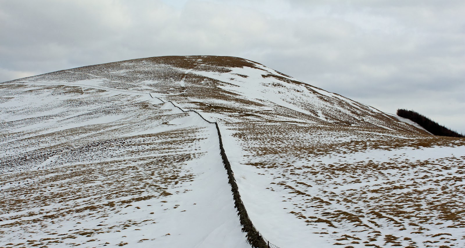

 The hill lies between the two dominant hills in this area, Tinto.....


and Culter Fell and it's neighbours.....


There wasn't much shelter at the top and my hands quickly got cold while I was taking photographs so after about 10 minutes I headed back down. I took this pic of another Marilyn, Dungavel Hill, as I went down through the wood.....


Then it was back to the car, boots off, a short drive to the services at Abington and a large cup of hot chocolate. A short day but another good one.

Thursday, 14 March 2013

Dun Leacainn

13 March 2013

Participants - Neil and Ben
Where - Dun Leacainn, 360m/1,181', Sub-2k Marilyn, Map 55, NN 035016

There have been a few reports for this hill on the Scottish Hills site recently which made it easy for me- thanks folks! The forecast had been for very cold conditions overnight with a danger of ice on the roads but in fact the roads were dry and the temperature up on the day before as we headed for Inverary. I couldn't resist stopping to take the classic view of the town as we approached.....


I carried on to the Folk Museum at Auchindrain and parked in a lay-by a couple of hundred yards further on opposite the start of the track that led to the hill.....


There isn't any choice of route if you want to avoid the blanket conifers that more or less surround the hill; it's a case of following the track for about a mile to just after it's high point where a rough path branches off to the left and traverses along the north slopes. Without this path the going would be a nightmare; this area has been felled. Enough said! I followed the path to just past the standing forest to my right to where I could see to the top of the hill. There were a few yards of brash covered ground to cover before I reached the grassy slopes but it wasn't bad going at all. However, new trees have been planted here so it might not be so easy in a few years time. It wouldn't have cost the forestry folk much to have made a path through this area so that walkers could have a permanent access to the hill.

The grass mostly gave way to heather higher up. I found this bit steep after my absence from the hills and needed a few stops. The compensation was that the view across the loch to the Arrochar hills was starting to open up.....


I aimed for the col between the two tops. Reaching the ridge we were immediately faced with this view down Loch Fyne....wow......


The two tops were only a few hundred yards apart and the unadorned west top is apparently the summit by about 1 metre. The east top.....


was by far the better viewpoint and had a trig, a wooden bench and a flag that had seen better days.


 Ben sat still long enough to have his picture taken; that is him up to 90 hills now.....


The weather was almost spring like so I made use of the bench while I had my cups of chocolate and between taking pics of the hills on the other side of Loch Fyne.....


Some old favourites amongst the snow covered peaks in the distance; Ben Lui, Beinn an Lochain and so on. We eventually dragged ourselves away and retraced our steps to the path.....


and the track to the car and I completed a satisfying day with a wander around Inverary on the way home (plus a coffee and cake from one of the many cafes in the town).

Saturday, 2 March 2013

Craig of Monievreckie, further rehabilitation

1 March 2013

Participants - Neil and Ben
Where - Craig of Monievreckie, 400m/1,312', Sub-2k Marilyn, Map 57 NN 547020

I'm trying to ease my way back into hillwalking gradually after my operation. The Knock of Crieff was a good re-introduction, Blaeloch Hill was a bit longer but still gentle. It was time to try something just a little bit steeper and rougher. I actually hadn't expected to be out again so soon but the weather was defying the forecast and the sun was splitting the sky. And anyway, Ben needed a good walk! I'd climbed Craig of Monievreckie a couple of times previously, it's a good mix of forest walk and rough moorland, although a good path has now formed between the forest and the summit. The best view of the hill is from the approach to Aberfoyle on the Strathblane road....


I parked in the Braeval car park from where the track wound steeply up through the trees. We were following the red route. I started slowly, Ben shot off like a bullet out of a gun; he runs off at top speed for a short distance and then returns. After a bit, he settles down and sticks closer to me. After about a mile, we came to the path that led on to the hill; it started just before the track took a sharp bend to the left. Shortly after we reached a fence with a walker friendly gate and got a first view of the hill.....


I think that this must be a popular local walk, the path is now much more defined than I remember it being previously. This is looking to Ben Lomond and Ben Venue from part way up.....


The path went over a subsidiary top, down into a wee gorge and then up the main top. Here we are approaching the trig.....spot Ben!.....


It was warm for the time of year and there was no wind, a very pleasant day for lounging about on the top. Two other walkers arrived from the east side of the hill, they had followed one of the other forest tracks before cutting up through the trees. Unfortunately there was a bit of a haze so it wasn't the best day for photography but here is what I took anyway.

Ben at the trig.....


Ben Lomond (zoomed).....


Ben Venue.....


Ben Ledi....


Lake of Menteith.....


We returned by the same route, a pleasant two and something hour walk. Ben enjoyed his day as well.....


Monday, 25 February 2013

Blaeloch Hill

25 February 2013

Participants - Just me
Where - Blaeloch Hill, 407m/1,335', Sub-2k Marilyn, Map 63, NS 243553

Last time that I climbed Blaeloch Hill,in 2009, it was just an area of barren moorland. On that occasion, I approached it from Fairlie on the Ayrshire coast, up the Fairy Glen and on to some pretty rough and boggy terrain. In the interim, they have built a wind farm, one of a number in this area.  The wind farm access is from the north, from the Kilbirnie to Largs road and there is therefore now a rather wide track up that side of the hill.The track suited me today however as it starts at a high point on the road just before the descent into Largs and it winds its way gently upwards across the hillside to within a few hundred yards of the summit. Ideal for the next stage in my recuperation! It is a bloody big scar on the hillside nonetheless.....


The wind farm company welcome visitors and have provided a car park at the start and information boards at various points on the track. There is not a lot to say about the walk up; it was just a case of putting one foot in front of the other until I emerged onto the plateau at the site of the first turbine where I left the track for the moor, thankfully frozen ground today. There was nothing to indicate the highest point. The key to this one, if you don't have a gps, is to find the Blae Loch; the highest point is somewhere on the grassy ridge above it.....


I had been looking forward to getting a good view towards Arran but unfortunately it was very hazy towards the coast, This is looking in the general direction.....


There was a flock of golden plovers near the summit- my favourite hill bird. They didn't seem bothered by the turbines, which stretched out behind me.....


Not far from the summit lie the remains of a crashed aircraft, a Fairey Firefly that crashed just feet below the highest point of the hill in October 1944. Both the pilot and co-pilot, who were on a radio navigation training exercise, were killed. This pic was taken on my previous visit....


Although it was a glorious sunny day, it was a bit windy and cold and there was no handy cairn to shelter behind so I didn't spend too long looking around. I returned by the same route.....


Although this is an easy walk by this route, I was quite tired by the time that I got back to the car. This was by far the longest walk that I have tried - c.5 miles - since I came out of hospital.  It was great to be back on the hills though!

Tuesday, 19 February 2013

We're back! The Knock of Crieff

18 February 2013

Participants - Neil, Steven and Ben
Where - The Knock of Crieff, 279m/915', Sub-2k Marilyn, Map 52 NN 873233

I'm making good progress following my surgery although it will be many weeks yet before I'm able to put in a long shift on the hills. I've had very little exercise over the last 3 months, the longest walk that I've been able to manage has been to the paper shop and back, a total distance of about 1.5 miles. That particular walk is getting easier as the days go by so today I felt that it was time to push myself a little harder. Also, there's only so much reading about hills and looking at hill walking websites that a guy can do without cracking up, so, with the better weather arriving, I decided to try a little uphill walking. What I needed was a low hill, with a gradual gradient and a good path, one that was not too long a drive from home, and of course was a Marilyn so I could get my 2013 list started. The Knock of Crieff which I've done a number of times before met all those criteria. It would also be a new hill for Steven and Ben. I've got a new camera and this was its first outing. So, as if I needed it, I had another excuse to take it slowly and and stop often!


Not only is The Knock a low hill but it has a high starting point- a car park at the back of the Hydro hotel. The first part of the walk was through deciduous woodland.....


 and there were glimpses through the trees of the high hills to the north.....


It actually felt warm especially so when we emerged from the shelter of the trees into the sunshine at the viewpoint at the top of the first part of the hill. The sun was still quite low and there was also a bit of a haze so the best of the views were to the north, towards the hills around Glen Turret.....


Then it was on towards the true summit of the Knock.....


Although there has been some felling, the summit is still surrounded by dense conifers. The path drops down a bit, then crosses a cleared area which for some reason is fenced.....


before entering the forest proper. This is another look at the Glenturret hills before we entered the forest.....

Unlike some hills that we've done in the not too distant past- Drummond Hill and Cademuir Hill come to mind- the cairn on the Knock is easily found being right at the side of the path.....


We decided to return by the same route. Although the Knock is more of a woodland walk than a hill, I really enjoyed my day out, it was good to get the boots on again. Now to scour the maps for some easy Marilyns that I haven't done yet!


Wednesday, 30 January 2013

Creag Each (Glen Tarken)

Participants - Just me
Where - Creag Each (Glen Tarken), 672m/2,204', Graham, Map 51, NN 652264

This was a winter 2009 trip. I drove up to St Fillans at the east end of Loch Earn and parked in a car park on the lochside next to the sailing club and just west of the village. This is Creag Each seen from the approach to St Fillans.....


From the car park it was only a short walk back to the start of a track that went up Glen Tarken. The track was in good nick and I made speedy progress (for me!) up the glen to a point where a burn came down from my intended hill. Being December, the worst of the grass and heather was past and as it had been frosty overnight, the ground was reasonably firm. This is looking to the summit from the track.....


As I got higher, the Ben Lawers hills came into view to the north.....


although they were not revealed in all of their glory until I reached the summit.....


The summit of this one was easy to find, a cairn on top of a rocky outcrop. It was a typical December day so the distant views were not that great; this is looking west in the general direction of Glen Ogle.....


There is a second Graham in Glen Tarken, Creag Ruadh. The two together must make a good round in the summer. For today, however, I just wandered back to the car. Creag Ruadh is still on my to do list.