Saturday, 5 November 2016

Auchineden Hill and the Whangie

5 November 2016

Participants: Just me
Where: Auchineden Hill, 357m/1171', Hump, Map 64, NS 494 804
 
Another good late autumn day, although much colder than it has been lately. There was a light covering of snow on the higher hills way to the north- I think the Ben Lawers group. After an extended and very warm autumn, it looks as though winter is on its way. I hadn't been to Auchineden Hill for a while, it was only a short drive, so that was my choice. I started early, as it was a Saturday and this is a popular hill with a large car park at the start.

The path rises from the car park and then contours along the north side of the hill. It was a bit muddy in places but not too bad given the number of feet that must walk along it. It splits in places but I stuck to the lower path and in due course arrived at the curious rock formation known as the Whangie. This is really weird and, if you don't know that it's there, unexpected. In a land of grassy humps, a rock amphitheatre is the last thing that you would expect. It is a strange geological phenomenon, caused by extreme temperatures which froze slabs of rock to a glacier. As the glacier moved, it caused a split in the hillside leaving rock walls to rise on either side of the gap. Local folklore tells it differently; it was a swish of the Devil's tail that caused the rock to split. Whichever is correct, the result is a gash about 300' long and 50' deep.

It is where previous generations of Glasgow climbers- and maybe some of the present generation also- learnt to climb and it figures strongly in Scottish mountaineering lore. No climbing for me but I wandered about for a bit looking at the remarkable rock formations.....


Through the Whangie and back on grassy slopes, I continued to the trig on Auchineden Hill. This is a good viewpoint. The trig with the Campsies background.....
 

Looking to the Luss hills and Ben Lomond.....
 

The Kilpatrick hills with Burncrooks reservoir and Duncolm.....
 

It was cold and a bit windy even at this modest height so after taking the photos I headed along another path which dropped down to join the path of ascent. There were more good views of the Campsies on the way back to the car.....


 Lots of folk were coming along- the early start had paid dividends.


Tuesday, 1 November 2016

Kinnoull Hill

1 November 2016
 
Participants: Just me. Ben has had a lump removed from his leg and is not allowed to walk just now.
Where: Kinnoul Hill, 222m/728', Tump, Outside Perth.

What a wonderful autumn day, bright sunshine and wonderful colours, although I reckon that the foliage is now getting past it's best. Kinnoull Hill is part of Scotland's first woodland park and is easily identified by the folly near it's summit, seen by everyone passing on the Perth-Dundee road. This is, of course, modelled on these on the banks of the Rhine. The area is criss-crossed by paths and there are a couple of car parks on the north side of the hill which make the ascent very easy. However, I decided to park in the main car park at the south Inch and walk from there.
 
The pictures speak for themselves.


Friday, 21 October 2016

A Visit to Shropshire: Caer Caradoc Hill

14 October 2016

Participants: Just me
Where: Caer Caradoc Hill, 459m/1506', Sub-2k Marilyn, Map 137, SO 477953
 
This was my final days walking. The objective was Caer Caradoc Hill above Church Stretton, on the opposite side of the valley from Long Mynd. This picture was taken the day after, when I was stuck in the MBA AGM in perfect weather conditions. Sods law!.....
 
 
Like a number of the hills that I had climbed during the week, it is volcanic in origin and was formed by rock thrust upwards by movement deep down in the Stretton fault, which apparently runs from Staffordshire to south Wales.
 
It was quite dull when I parked in the main car park in Church Stretton but the forecast was an improving one. My route crossed the railway, then the A49, turned first left along a lane which became a track which was a permissive path, through a field, then some woods and then another permissive path up the south ridge. This is looking back at Church Stretton from the field area.....
 
 
The hill top area was another Iron Age fort which local legend suggests was also the site of a battle between Caractacus and the Roman legions during the latters conquest of Britain. Whatever, it is not as impressive as Burrow, although it is in an equally commanding position. This is the remains of a ditch.....
 
 
and there were various rock outcrops towards the top.....
 
 
The exact summit was unmarked and could have been at any one of a number of rocky areas. I wandered round them all just to make sure.
 
The weather was really dull at this point which was a shame as I had really been looking forward to this hill. This is looking to Church Stretton.....
 
 
and this is north along the ridge of hills in this particular range.....
 
 
The weather had started to improve but by this time lots of people were arriving so I decided to set off down and take some photos looking back up so that I would have a photographic record of the ascent. Here they are in descending order.....


So that was my trip. Nine new Marilyns, all interesting, as were the towns and villages that I passed through.

A Visit to Shropshire (and Wales): Y Golfa

13 October 2016

Participants: Just me
Where: Y Golfa, 341m/1119', Sub-2k Marilyn, Map 125, SJ 182071
 
I decided to have the morning looking round Shrewsbury- a busy and interesting City. The weather wasn't too bad, there were showers around but basically it was another useable day. So I decided that I had better get my boots back on and spend the afternoon on a hill. Something short and easy; Y Golfa a couple of miles west of Welshpool fitted the bill. This one was definitely mixing both language and sports- its western slopes were occupied by a golf course! And what a course. Well kept, looked testing, and fantastic views. Apparently Welsh course of the year a couple of years ago.
 
There was a narrow layby on the main road which I didn't fancy so I drove up a minor road to the golf club house and asked permission to park there. It was readily granted, there was apparently only one person playing the course. A track took me most of the way and where it ended I followed the edge of the fairway to the heathery area which contained the trig. About an hour there and back. Here are the photos.....


It was certainly different!


A Visit to Shropshire: Callow Hill and Burrow

12 October 2016

Participants: Just me
Where: Callow Hill, 334m/1096', Sub-2k Marilyn, Map 137, SO 459849 and Burrow, 358m/1175', Sub-2k Marilyn, Map 137, SO 381831
 
It was a getting better sort of day. I drove south to the village of Craven Arms and followed some (very) narrow country roads to a parking place north of Callow Hill between the hamlets of Lower Dinchope and Moorwood. This is a view of the hill from the drive down.....
 
 
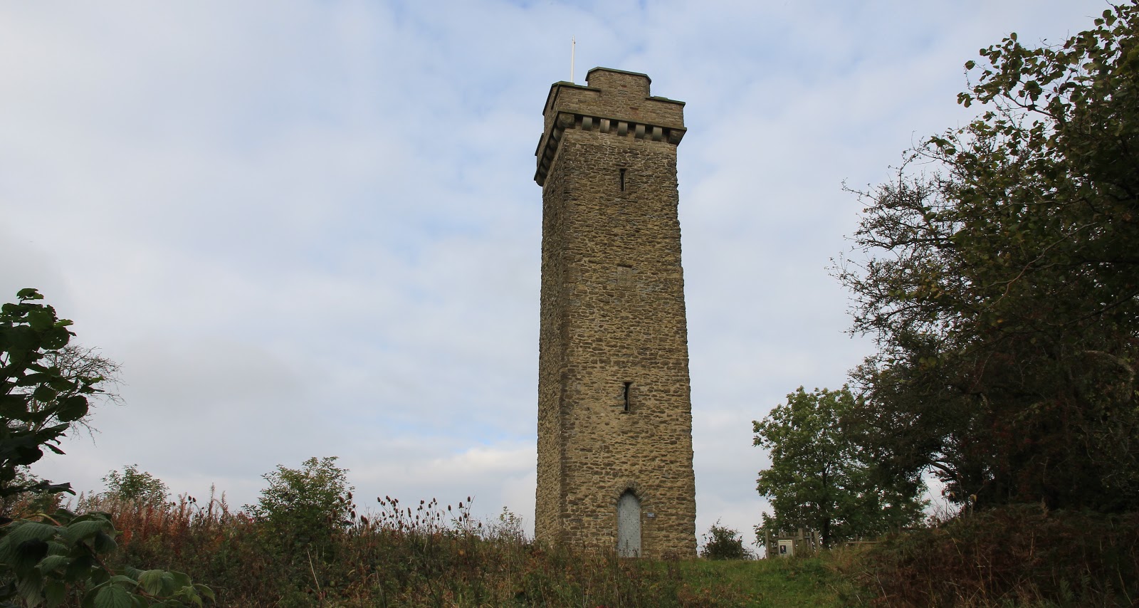
I had chosen this hill because it has a prominent landmark on top- Flounders Folly. The Folly was built from local sedimentary mudstone in 1838 and is today a Grade II listed building. It is named after its builder- Benjamin Flounders, and remained in good condition for the first 100 years of its existence. However, it began to suffer damage and started to deteriorate from around the 1940's and was eventually fenced off in the 1980's. Around the Millennium, a local group started raising funds for restoration and it was reopened in 2005. It is only open to the public at certain times; unfortunately, the day of my visit was not one of them so I didn't get to see the view from the top which must be very fine on a clear day.
 
 
There was a good public footpath from the car park and it didn't take long until the tower came into view.....


It was a bit hazy so the views were not particularly sharp. These photos are looking up the valley towards Stretton; the first shows Caer Caradoc which was on my "to climb" list and the second The Wrekin (just visible far right)....


As I returned to the car, the sun was starting to come out and it was turning into a very promising day.
 
By the time I reached my next hill, Burrow, less than 10 miles away on the other side of Craven Arms, the weather was perfect. I parked in the village hall car park at Aston on Clun. It was also the car park for the village shop, which sold me a big cup of tea for £1 on my return from the hill. On the way to the hill, I passed this tree, the Arbor Tree.....
 
 
Apparently, it was a Celtic custom to dress the tree to seek favour from Brigit, their goddess of fertility. Nowadays, on the last Sunday in May, villagers dress the tree in flags-which remain throughout the year- as part of their local festival.
 
The way to the hill went between some houses and then became a track through fields, going through a couple of gates and then narrowly uphill through some forestry to join a forest road.....
 
 
The interest in this hill was that it contained a large Iron Age fort, complete with ramparts and ditches and hut platforms. It was one of the best that I have seen. There was no commercial forestry at the summit area, only some lovely mature deciduous trees. By now the sun was blazing down so I spent some time exploring the fort and sitting on the ramparts enjoying the views.....


It was easy to see why there was a fort here. Burrow commands the countryside for miles around.This is looking towards Stretton and the Long Mynd and Caer Caradoc......

 
to Corndon Hill and Wales.....
 
 
and to some nice Shropshire countryside in the direction of Hereford.....
 
 
A really interesting day. Burrow also marked the half way point for me for the Marilyn list, not that I have any intention of climbing them all, far less being able to.