Participants: Just me
Where: Callow Hill, 334m/1096', Sub-2k Marilyn, Map 137, SO 459849 and Burrow, 358m/1175', Sub-2k Marilyn, Map 137, SO 381831
It was a getting better sort of day. I drove south to the village of Craven Arms and followed some (very) narrow country roads to a parking place north of Callow Hill between the hamlets of Lower Dinchope and Moorwood. This is a view of the hill from the drive down.....

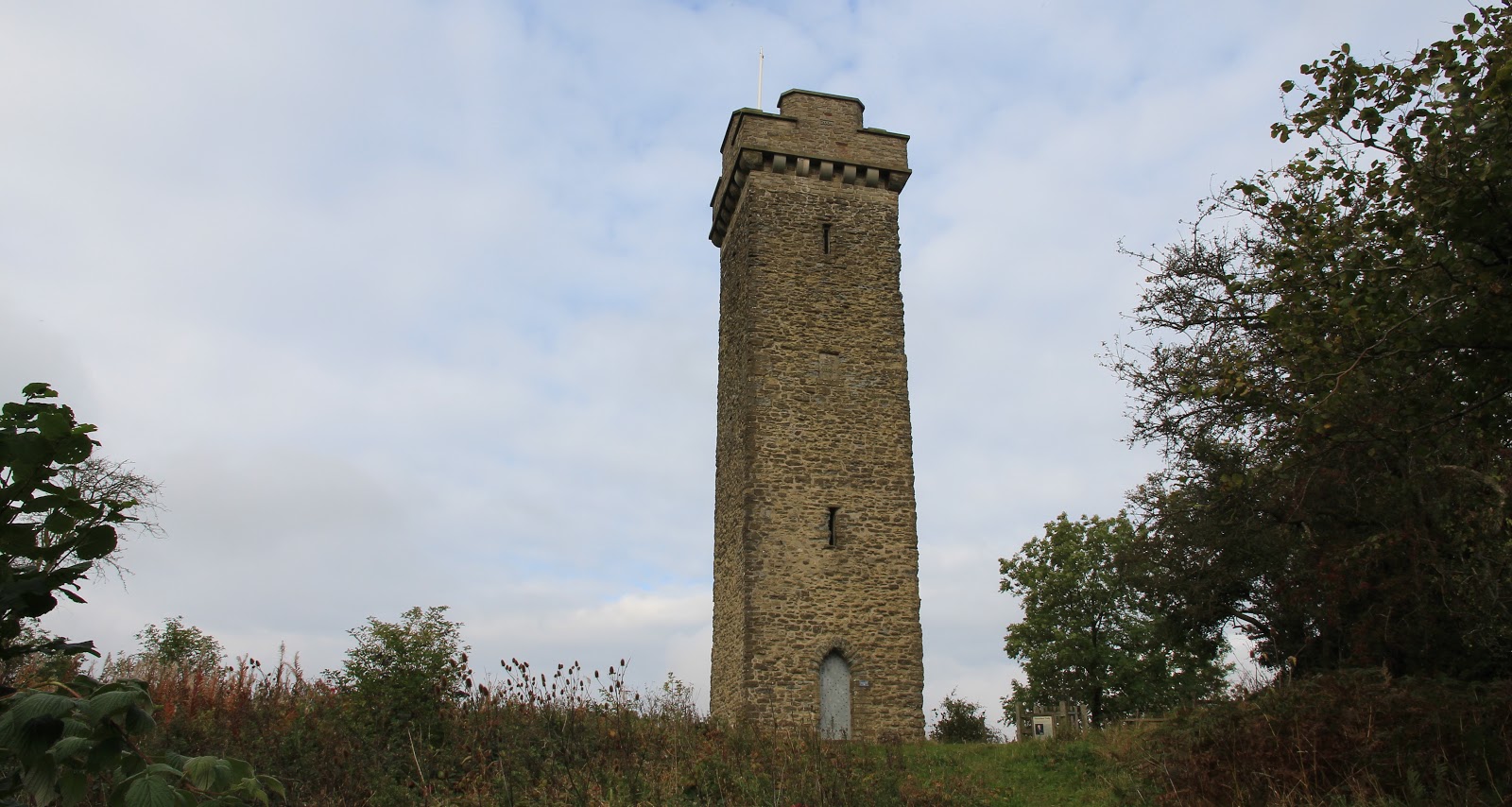
I had chosen this hill because it has a prominent landmark on top- Flounders Folly. The Folly was built from local sedimentary mudstone in 1838 and is today a Grade II listed building. It is named after its builder- Benjamin Flounders, and remained in good condition for the first 100 years of its existence. However, it began to suffer damage and started to deteriorate from around the 1940's and was eventually fenced off in the 1980's. Around the Millennium, a local group started raising funds for restoration and it was reopened in 2005. It is only open to the public at certain times; unfortunately, the day of my visit was not one of them so I didn't get to see the view from the top which must be very fine on a clear day.

There was a good public footpath from the car park and it didn't take long until the tower came into view.....


It was a bit hazy so the views were not particularly sharp. These photos are looking up the valley towards Stretton; the first shows Caer Caradoc which was on my "to climb" list and the second The Wrekin (just visible far right)....


As I returned to the car, the sun was starting to come out and it was turning into a very promising day.
By the time I reached my next hill, Burrow, less than 10 miles away on the other side of Craven Arms, the weather was perfect. I parked in the village hall car park at Aston on Clun. It was also the car park for the village shop, which sold me a big cup of tea for £1 on my return from the hill. On the way to the hill, I passed this tree, the Arbor Tree.....

Apparently, it was a Celtic custom to dress the tree to seek favour from Brigit, their goddess of fertility. Nowadays, on the last Sunday in May, villagers dress the tree in flags-which remain throughout the year- as part of their local festival.
The way to the hill went between some houses and then became a track through fields, going through a couple of gates and then narrowly uphill through some forestry to join a forest road.....

The interest in this hill was that it contained a large Iron Age fort, complete with ramparts and ditches and hut platforms. It was one of the best that I have seen. There was no commercial forestry at the summit area, only some lovely mature deciduous trees. By now the sun was blazing down so I spent some time exploring the fort and sitting on the ramparts enjoying the views.....


It was easy to see why there was a fort here. Burrow commands the countryside for miles around.This is looking towards Stretton and the Long Mynd and Caer Caradoc......

to Corndon Hill and Wales.....

and to some nice Shropshire countryside in the direction of Hereford.....

A really interesting day. Burrow also marked the half way point for me for the Marilyn list, not that I have any intention of climbing them all, far less being able to.
1 comment:
That looks enjoyable. Mature deciduous woodlands really add to paths down there,and despite a larger population England seems to have looked after its traditional woods much better than the north managed.
Post a Comment