Participants: Neil and Ben
Where: Minch Moor, 567m/1,859', sub-2k Marilyn, Map 73, NT 359330
I headed to the Borders meaning to climb Cademuir Hill near Peebles but as I approached I saw that the forestry were busy chopping down trees on the summit ridge so carried on to Traquair for another ascent of the Minch Moor. It is a good walk with wide summit views and some interesting "extra" features. It was a warm day but the humidity of recent weeks had gone making it much more comfortable for walking. The views appear almost immediately, this is the view from near the start with my objective on the horizon.....

and this is looking back at Traquair and the Tweed valley.....

and this is looking back at Traquair and the Tweed valley.....

The Minch Moor is an old drove road which at one time was the main route across southern Scotland. It has been in use for over 800 years, and is now part of the Southern Upland Way. It is the route by which Montrose and his cavaliers fled from Philiphaugh after the battle there.....

The track soon passed the site of the old Minchmoor bothy which the MBA decided to give up because of vandalism and problems with litter. Sadly, matters didn't improve after the SUW rangers took over responsibility for maintaining it and the building was subsequently demolished. It is not the only bothy that could be reached easily from a public road that has suffered that fate. There is now a horse memorial close to the place where the bothy stood; I hope that it receives more respect.
I was now clear of the forest and looking over Pipers Knowe where there is a "growing sculpture" created in 2005 by Charles Poulsen known as Point Of Resolution. It comprises large, irregular ovals cut into the heather. Couldn't see the point in it myself but it provided an excuse to stop walking for a few minutes. A little further on I came to the Cheese Well, a wayside spring whose name relates to the ancient custom of leaving presents of cheese for the fairies to ensure a safe and successful journey for the drovers who used this route from Traquair to Yarrow. Coins have replaced cheese today......

The path from the main drove route to the summit is signposted. All of this area is part of the Borders mountain biking system and there were a lot of bikers about.....

Fortunately, the biking trails are separate from the walkers route, although they converge at the summit.
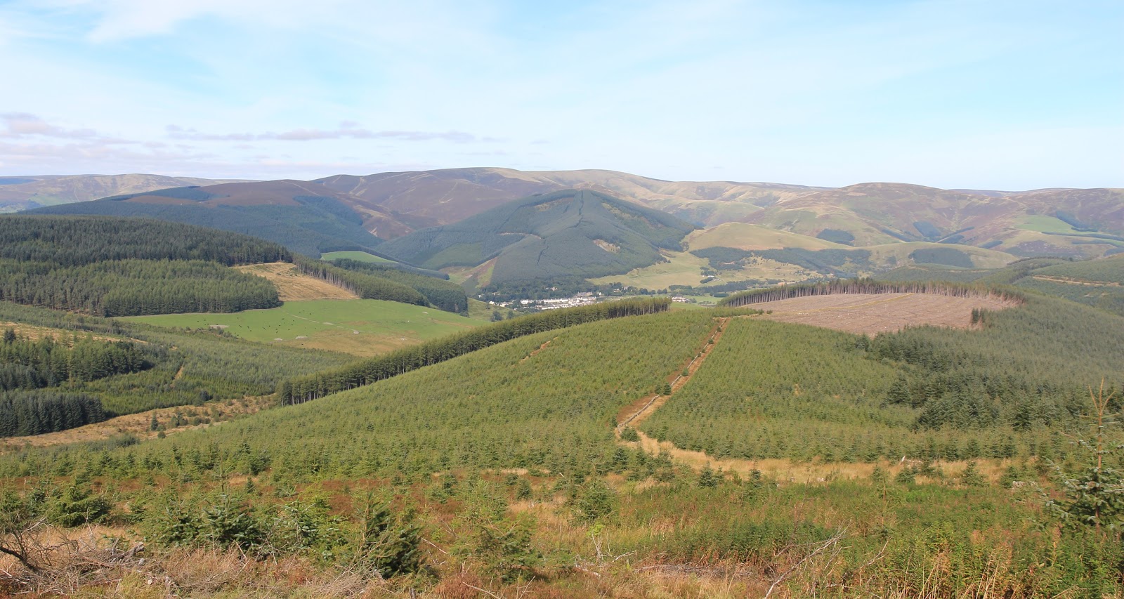
Some views from the summit looking east.....


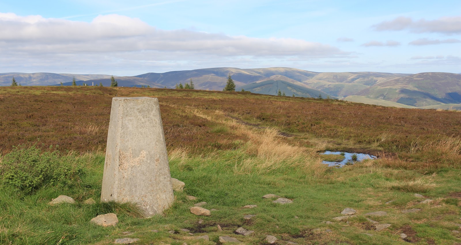
The trig with the hills around Windlestraw Law in the background (north side of the River Tweed)......

A view over Walkerburn.....

The familiar shape of the Eildon Hills in the distance.....

I returned by the same route. The visibility was really sharp by now and there was an excellent view ahead to the hills around Dun Rig.....

So the forestry work at Cademuir turned out to be lucky and gave me an excellent day on the wide open spaces of the Minch Moor.

The track soon passed the site of the old Minchmoor bothy which the MBA decided to give up because of vandalism and problems with litter. Sadly, matters didn't improve after the SUW rangers took over responsibility for maintaining it and the building was subsequently demolished. It is not the only bothy that could be reached easily from a public road that has suffered that fate. There is now a horse memorial close to the place where the bothy stood; I hope that it receives more respect.
I was now clear of the forest and looking over Pipers Knowe where there is a "growing sculpture" created in 2005 by Charles Poulsen known as Point Of Resolution. It comprises large, irregular ovals cut into the heather. Couldn't see the point in it myself but it provided an excuse to stop walking for a few minutes. A little further on I came to the Cheese Well, a wayside spring whose name relates to the ancient custom of leaving presents of cheese for the fairies to ensure a safe and successful journey for the drovers who used this route from Traquair to Yarrow. Coins have replaced cheese today......

The path from the main drove route to the summit is signposted. All of this area is part of the Borders mountain biking system and there were a lot of bikers about.....

Fortunately, the biking trails are separate from the walkers route, although they converge at the summit.
Some views from the summit looking east.....


The trig with the hills around Windlestraw Law in the background (north side of the River Tweed)......
A view over Walkerburn.....
The familiar shape of the Eildon Hills in the distance.....

I returned by the same route. The visibility was really sharp by now and there was an excellent view ahead to the hills around Dun Rig.....

So the forestry work at Cademuir turned out to be lucky and gave me an excellent day on the wide open spaces of the Minch Moor.
1 comment:
Nice photos. I'm always in two minds about bothies these days and the general increase in information about exact locations, even the remote ones, appearing online everywhere. Can't be good in the long run.
Post a Comment