Tuesday, 29 September 2015

Craiglich

27 September 2015

Participants: Just me
Where: Craiglich, 476m/1,562', Sub-2k Marilyn, Map 37, NJ 533054
 
Aberdeenshire is a great area for sub-2k Marilyns. They are mostly isolated hills so tend to be good viewpoints, especially in the autumn when the surrounding countryside is a mass of colour. I still had a few to bag, the forecast was excellent so I set off for another night at Alford. Craiglich at Tarland was the target for a stop on the way up. It has the advantage of a high starting point, a large lay by on the B9119 3 miles east of the village. The track starts immediately opposite the lay by and goes through a field initially before entering the woods. A bit up the track, there was this wonderful view across the farming land to the Graham, Pressendye.....


After about a mile, another track branched off left up the hillside. It was marked with a cairn. Soon I was out of the trees and crossing the moorland with the trig ahead. There was a massive cairn as well, looks as though it was some sort of man made structure maybe a memorial (?) at one time.....
 
 
It was a very fine viewpoint. From south to north;
 
the view to Mount Keen.....
 
 
to Lochnagar.....


to Pressendye.....


to Coiliochbhar Hill.....
 
 
to Bennachie.....
 
 
and across the farm lands to the east.....
 
 
It was well worth the little effort involved. I spent about half an hour at the trig and was still up and down in around 2 hours.
 

Monday, 21 September 2015

Castle Hill (Bar Hill)

21 September 2015

Participants: Neil and Ben
Where: Castle Hill, 155m/509', Tump, NS 709761

It was a short walk close to home today. Castle Hill is on the route of the John Muir Trail but is better known for being part of the Antonine Wall. It also contains traces of Roman fortifications, including the highest fort on the route of the Wall. You can still see the foundations of both the fort and a bath house, and there is also an impressive ditch. The summit, a little way to the east of the Roman remains, is an Iron Age fort and provides a superlative view of the Kelvin valley. Standing at the top, you can see exactly why this was an important military position.
 
I parked at the north end of Croy village from where a good track headed to the hill.  Historic Scotland had provided some good information boards.....
 
 
Looking up the ditch to the top of the hill.....
 
 
Ben investigating the remains of the fort.....
 
 
the remains of the bath house are better preserved.....
 
 
Ben at the trig with Kilsyth in the background......


The view towards Cumbernauld was not so good, the trees get in the way.....
 
 
but there is an uninterrupted view north to the Campsie Fells.....


Sunday, 20 September 2015

Meall Mor, Glencoe

19 September 2015

Participants: Just me
Where: Meall Mor (Glencoe), 676m/2,218', Graham, Map 41, NN 106559

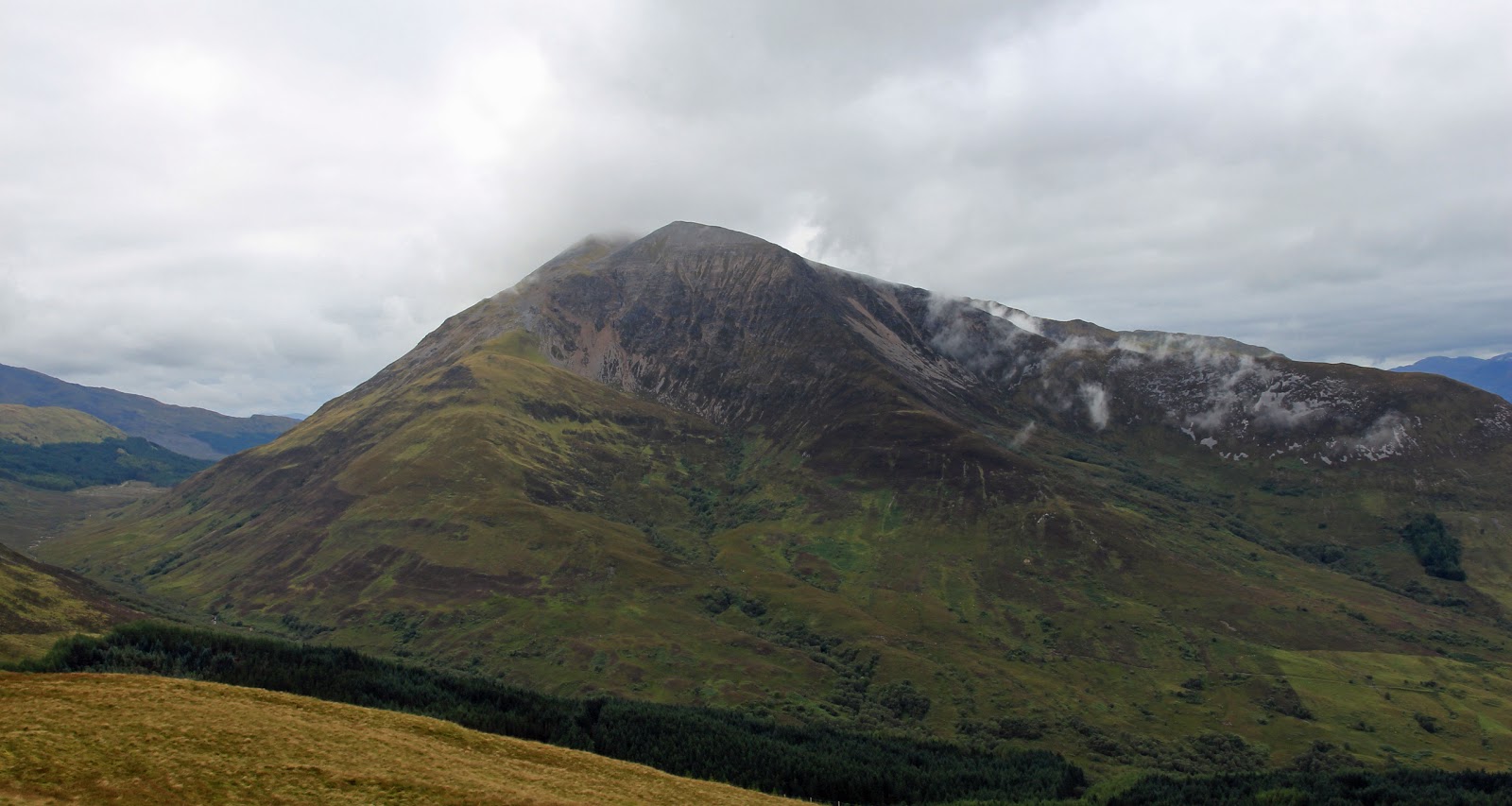
"The weather will be gorgeous, be careful of the strong sun" gushed the BBC weather forecaster. That, together with an MWIS forecast of 90% cloud free summits, had me heading for Glencoe to climb the Graham, Meall Mor. There was a fair amount of low level mist when I left the car in the NTS visitor centre car park, but that dissipated as I got higher and it looked as though the forecast was going to be correct. The cloud breaking up over Bidean.....
 
 
and over Sgorr nam Fiannaidh of the Aonach Eagach on the opposite side of the glen.....
 
 
The track that I was following is relatively new and is not marked on the map. It has a great surface, and winds up in giant zig-zags to the 1,000' contour at a gentle angle. A good way to climb this hill, which otherwise is one of the steeper variety. Soon, the hill came into sight.....
 
 
I left the track at its highest point. The forest up here had been cut down, but there was a nice grassy path through what remained taking me on to the hillside. By this time, I was starting to wonder about the weather. The cloud was getting thicker. Looking west, it was obviously raining. The slope was steep, but grassy. I reached a new deer fence but there was a gate (unlocked). The cloud on the neighbouring hills lifted and dropped. Of the gorgeous sunny day, there was no trace. The summit area was a bit of a plateau, which was a surprise. The summit was on a narrow rocky outcrop which wasn't all that far away.
 
Another walker appeared, having come up the other side of the hill, which was shorter but much steeper. He provided some scale to the photo of the summit area.....
 
 
 The cairn itself was in a great position, with high hills all around. Here it is with the Aonach Eagach in the background.....
 
 
The cloud relented a bit after the drizzle passed through, although it never cleared completely. Still, it meant that I got some atmospheric photos on the way down.
 
Bidean nam Bian......
 
 
The neighbouring Graham, Sgorr a'Choise.....
 
 
Beinn a' Bheithir.....
 
 
Loch Leven and Ballachulish.....
 
 
The Pap of Glencoe.....
 
 
and, from just above the forest, a view down the length of Glencoe. It shows clearly what a shut in glen it is and today, it was certainly looking dark and gloomy.....


The sun came out 10 minutes from home. So the forecasters were right after all!

Wednesday, 9 September 2015

Bengray

8 September 2015

Participants: Just me
Where: Bengray, 366m/1,202', Sub-2k Marilyn, Map 83, NX 630598: Approached over Benfadyeon, a Tump
 
The forecast was excellent, the forecaster hadn't mentioned mist and low cloud but when I set out, the mist was down to the road. So I hung about for an hour, read my paper and then decided to set out in the belief that the sun would dry the atmosphere up. I parked on the minor road from Gatehouse of Fleet to Laurieston opposite Laghead farm; a track was marked as leaving there and going to Loch Whinyeon which was a possible route to my hill. After about 30 or so minutes a memorial bench appeared out of the gloom; this was at a viewpoint just short of the loch. Today's view.....
 
 
It was quite warm so I made use of the seat for half an hour then wandered on to the loch where I had another stop in a small fishing hut. And still the mist didn't lift. So I set off back downhill and half way back to the car the sun appeared through the clouds and it looked as though something was happening. So I turned round and set off uphill again. This time, I left the path and went up Benfadyeon and the cloud lifted with me. From Benfadyeon, I could at last see Bengray and there was no doubt now that the sunshine was arriving.....


I followed a good 4WD track before striking up the steep slopes of the hill. Loch Whinyeon appeared below through the mist.....
 
 
It was really humid and I was struggling. Of course, there had to be a false top but eventually I was there. The highest point appears to be slightly north of the trig. The haze made the views disappointing......


But it was a big improvement on earlier; the sun was beating down as I made my way back. Loch Whinyeon again.....

 
and the view back to Bengray from Benfadyeon........
 
 
It wasn't a great distance nor ascent but I ended up more tired after this one that on any other outing this year. This would be a good hill on a crisp winter's day.

Pibble Hill

7 September 2015

Participants: Just me
Where: Pibble Hill, 383m/1,257', Sub-2k Marilyn, Map 83, NX 533605

I had looked at Pibble Hill when I was climbing Cairnharrow a few years ago and thought "naw, won't get me on that one". But here I was again and it looked just as rough a walk as I had remembered.....
 
 
But appearances can be deceptive, there were traces of a 4WD track from time to time and it wasn't at all boggy. I parked at a cattle grid near to the highest point of the road and headed straight across the moor to join the ridge at its west end. From here, there was a fine view of the Graham, Cairnsmore of Fleet, to the north.....
 
 
It was then an easy stroll along the ridge to the highest point, paralleling a well built stone wall, which actually started where I had parked the car.....
 
 
I had certainly underestimated this hill. It was a fine open viewpoint. Again, looking to Cairnsmore of Fleet.....
 
east to Bengray (centre, horizon) which I intended to climb tomorrow.....
 
 
and south to Cairnharrow........
 
 
Just shows that you can't judge on first impressions! I would climb this one again if I was ever back in the area.


Wednesday, 19 August 2015

Muncaster Fell

17 August 2015

Participants: Neil and Ben
Where: Muncaster Fell, 231m/758', Sub-2k Marilyn, Map 97, SD 112983

We went slightly further south today to visit Muncaster Fell. The weather was great and it really was a delightful little hill although there was a catch.....read on!

There is a big car park for Muncaster castle a few hundred yards along the road from the fell track and it seems that you are allowed to park there for the hill, so I did. We walked up the track to Muncaster Tarn- a really nice bit of water.....


With lots of water lillies.....


Not long after, we reached a fence with a gate and the hill came into view. What was that object next to the trig, looks suspiciously like a cow?.....


Worse still, there were quite a few sheep scattered among the bracken so there was nothing for it but to put Ben on his lead. Now if there is one thing that he hates it is to be on the lead and he is a strong dog. I can manage going up hill but coming down is positively dangerous!


The cow that we had seen from a distance turned into a small herd and they also had possession of the trig.....

Taking no chances, we skirted round them and fortunately the highest point is 20 or so yards north of the trig. But I didn't waste much time before dropping down a bit out of sight of the cattle, who didn't seem that interested actually and neither did Ben. It was a good viewpoint, this is looking along the ridge of the Fell towards the high hills south of Wasdale.....


Across (hidden) Wasdale to Seatallan.....


and on the other side, down to Eskdale......


Of course, looking the other way we could see Sellafield.....


With the Isle of Man on the horizon.....


By this time the cows had moved away from the trig but we circled below it just to be sure and headed back downhill. I only landed on my back once trying to keep Ben from charging off! I was glad when we exited the livestock zone.

And then we were tourists for the rest of the day.