Monday, 6 April 2015

Hunt the trig- Strathfinella Hill

6 April 2015

Participants: Neil
Where: Strathfinella Hill, 414m/1,358', Sub-2k Marilyn, Map 45, NO 693787
 
A problem with some of the sub-2k's is that the Forestry Commission have seen them as ideal territory for planting legions of conifers, in some cases, totally obliterating any view and making finding the summit extremely difficult. Strathfinella Hill is one of these; this is a photo of it taken from outside Fettercairn.......
 
 
But today Google Earth proved its worth. The obvious route from the south seemed to be totally in the forest but Google Earth showed me an alternative route from the Glen of Drumtochty where half the walk was on open hillside. It also showed a convenient ride into the forest that led to a main track that went round the hill with a branch (oops- no pun intended) path that went to within yards of the trig.
 
And, amazingly, it worked out on the ground. There was a good parking area just past Loch Saugh at the start of the forest. I was soon out on the open hill where the going was quite good underfoot. The temperature was rising which gave me an excuse to stop and look back at the view- to Hill of Wirren and (zoomed) to Clachnaben.....


Then it was into the forest to join the main track which was actually quite pleasant.....
 
 
Following Google Earth instructions exactly, after about 10 minutes I came to a 4-way junction and turned left. I knew from other folk's blogs that there was a rough path off into the forest after about 20m- here it is marked by a single small stone; if you didn't know that it was there then you could have a lot of fruitless searching.....
 
 
And after a few yards- the trig! No view here.....
 
 
So it was back the same way after which I went for a look at Edzell castle, the ancient seat of the Lindsays. Pity it was too early in the year for the formal garden to be in bloom. But it was a nice spot to sit in the sun for a wee while.....


Thursday, 2 April 2015

A wee walk on Lendrick Hill

2 April, 2015

Participants: Neil and Ben
Where: Lendrick Hill, 456m/1,496', Sub-2k Marilyn, Map 58, NO 019036

Can't believe that it's 5 years since I last did this one, a sub-2k in the eastern Ochils. Since then, a narrow break in the forest seems to have become the trade route, the start is marked with a cairn at the side of the main track just after a big bend. It had been frosty overnight and the underfoot conditions in the forest were very slippery- no sunlight gets in here. Rather than come back that way, I went a few hundred yards east from the top to a much shorter, wider and grassy break that I had used before. There was a fence at the top of the forest but after a little searching I found a bit where Ben could squeeze through. Here's a few photographs: Ben at the cairn with the Lomond hills and Loch Leven beyond; Ben at the cairn with another sub-2k, Innerdouny, background; west to Tarmangie and Whitewisp; north to the Grampians; and Innerdouny (with forest) from the descent firebreak.


Wednesday, 25 March 2015

Another visit to the Craig of Monievreckie

25 March 2015

Participants: Neil and Ben
Where: Craig of Monievreckie, 400m/1,312', Sub-2k Marilyn, Map 57, NN 547020

Just a short hill walk today taking advantage of the good conditions. This is becoming a favourite trip but it's a good viewpoint. The forest roads are being improved so it looks as though they are getting ready for some serious felling. Here are a few photographs; Ben at the trig, Ben Ledi, Ben Venue, Crianlarich hills, Campsie Fells.


Thursday, 19 March 2015

In the shadow of Nevis- Bidien Bad na h-Iolaire

18 March 2015
 
Participants: Neil and Ben
Where: Bidein Bad na h-Iolaire, 528m/1732', Sub-2k Marilyn, Map 41, NN 090713
 
This one had been on my radar for some time because of the view that it was bound to give of Ben Nevis. It can be approached from Glen Nevis but that way seemed to involve a lot of forestry walking; the better route was obviously from the narrow road that runs from Fort William to Lundavra. Looking at other blogs and walking sites, most folk seemed to start from well down the road and to follow the south-west ridge; however, that involved crossing fields and fences and I had Ben with me. So I opted for the longer route via the track to Cow Hill and the lumpy north ridge.
 
I followed the track to its highest point just before the start of the forest. My hill was in view most of the way and as I got higher Ben Nevis also came into view.....


The sun was out and it was warm, unfortunately it was also hazy. There was a steep, rough, heathery section immediately after leaving the path but once up that the walking became a bit easier. There were also a succession of humps that I mostly climbed over although I managed to skirt some of them on the way back. Part way up I came across an old path crossing the hillside and disappearing into the forest, it must have been the old route across the hill before the trees were planted and the new path network was put in place. There is not much to say about the ascent apart from that it was a bit of a plod! Just as well there was a good view of the Ben on one side and of the Corbett, Stob Coire a'Chearcaill across Loch Linnhe on the other side.....
 
 
And then at last I was on a narrowish ridge and the cairn appeared ahead- two cairns in fact. Here is Ben at the top...
 
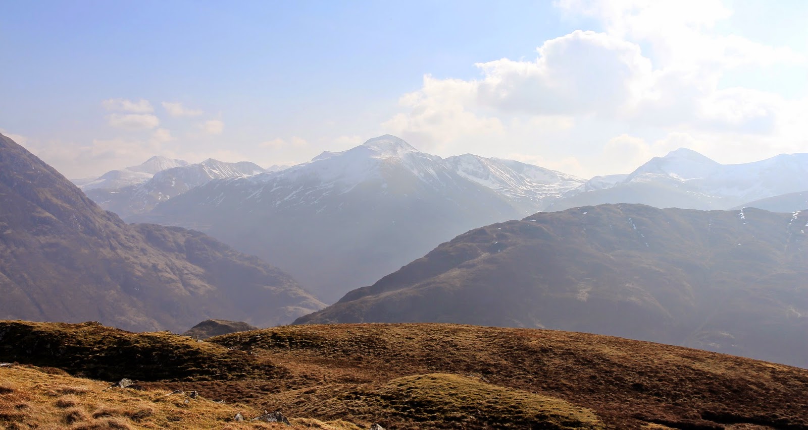
This would be an amazing viewpoint on a crisp, clear day. The afternoon would be best from the point of view of photography and the position of the sun. Even today with the haze it was good and certainly atmospheric. This is the view up Glen Nevis to Sgurr a'Mhaim.....
 
 
Across Loch Linnhe to Stob Coire a' Chearcaill.....
 
 
and down to Fort William.....
 
 
And of course to Ben Nevis. The zig-zags of the tourist path were clearly visible, and the snow on the upper reaches looked really deep. I was looking almost straight at the big south-east face which unfortunately has seen a number of accidents over the years. From this angle, you could see just how close it was to the tourist path and how easy a small navigation error in thick mist would lead you into trouble. Certainly, when I did Nevis by the tourist route I didn't realise that any of those gullies and cliffs were there.
 
 
Did I say that it was warm? I sat about at the cairn for a while and then it was just a case of reversing the route. 4 hours and 45 minutes- a good walk before setting off down the road home.

Tuesday, 10 March 2015

Beinn an t-Sidhein

10 March 2015

Participants: Neil and Ben
Where: Beinn an t-Sidhein, 572m/1,877', Sub-2k Marilyn, Map 57, NN 547179

It is  a few years since I climbed this one and in the intervening period, a lot of the forestry has been felled. The forestry folk have also kindly built a new path that goes a lot of the way to the col below the first top. I parked in Strathyre and crossed the old bridge over the River Balvag; the start of the hill path was directly in front of me. Here is Ben on the path and a view to the north from a bit higher up.....


The big advantage of the forestry work is that you now have a view of Loch Lubnaig most of the way up. The sun was in the wrong place for good photography but you can't have everything......
 
 
It was a bit wet once off the main path; the old path has almost disappeared but the route is obvious. I rounded the south top and the main spine of the hill plus the summit was now in view.....
 
 
Unfortunately, the forestry land ended there and it was separated from the rest by a fence. There was a style for me but not one that Ben could manage. However, after a bit of searching I found a gap under the fence at a wet area and he managed to wriggle through. Ben More and Stobinian were now in view (the second and third photos are zoomed). There were a few showers about but also strong sunlight and the colours were really vivid. The snow that had been down to about 200m on the Campsies a couple of days before had had a severe fright, that should surely be it now for another winter.


There was a rough path along the ridge and it was a grand walk with the Crianlarich hills on one sideand Ben Vorlich, Stuc a'Chroin and Beinn Each on the other. Ben found a nice pool to provide a foreground to the latter hills.....
 
 
There was a very small cairn at what might or might not be the highest point with a view north to the Corbetts of Craig Mac Ranaich and Meall an t-Seallaidh.....
 
 
We returned by the same route; there is a good view of Strathyre from lower down....previously obscured by the forest.....
 
 
A good short walk of 3 hours duration.

Wednesday, 18 February 2015

Kirkby Moor- Lowick High Common

17 February 2015

Participants: Neil and Ben, although Ben only had a short walk on the lower slopes, a herd of sheep was the problem this time.

Where: Kirkby Moor, Lowick High Common, 333m/1,092', Sub-2k Marilyn, Map 97, SD 260840

The final hill of the trip was the least interesting. As its name implies, it is high moorland, not made any better by the fact that there is both past and present quarrying activities on the lower slopes and a small wind farm high up. It looks like it is one of the earlier wind farms- the turbines are quite small and very noisy.

Starting point was a small car park just past Gawthwaite from where I could see the old quarry workings with one of the turbines behind.....


The path varied from4 WD track width to sheep track width but I knew from the map that the cairn was just past the first turbine at the edge of the old quarry workings so it was easy to find.....


The distant moorland looked higher but thankfully it wasn't......


and the best of what view there was was towards Black Coombe further round the coast.....


I was back at the car in 50 minutes after which I went to have a look round Grange- over- Sands- a very genteel wee town in a great situation on Morecambe Bay.

The next day it was raining so we went home.

Whitbarrow, Lord's Seat

17 February 2015

Participants: Neil and Ben, though Ben didn't make the summit.
Where: Whitbarrow, Lord's Seat, 215m/706', Sub-2k Marilyn, Map 97, SD 441870
 
The second day of the trip was even cloudier than the first, although it again stayed dry. Two more hills were on the agenda. The first, Whitbarrow, was another limestone escarpment, situated just off the A590 road to Barrow in Furness.....
 

The starting point was a small car park at the entrance to Witherslack Hall school, a couple of miles drive up some narrow roads.....


Not long after the start, the path went through a tight barbed wire fence by means of a narrow wooden style. No way was I getting Ben over that so it was back to the car for him! The path went round the edge of the school's football pitches.....


before climbing steeply through some scrub land and passing areas of limestone boulders. I was quite glad that Ben wasn't there as the path was narrow and the drops were quite big. Eventually, the path reached a wall and another style after which it levelled out a bit before heading over the plateau towards the top of the escarpment.....


It was easy to see the direction that the prevailing wind came from!


I could see the cairn on the horizon but got a surprise when I reached it.....


Just as well Ben wasn't there, he hasn't met cows before and I don't know how he would react. I am sure that this must be a great view point on a good day but that was not today as the distant high Lakeland peaks were covered in clag.  Even at this modest height it was cold and breezy- well, it was February after all- so after a couple of photographs I went back down.....


1 hour 15 minutes for this one and I would do it again on a better day; I think that a walk taking in the whole length of the escarpment must be a good outing.