Sunday, 19 February 2012

Middlefield Law

19 February 2012

Participants - Just me
Where - Middlefield Law, 466m/1,530'

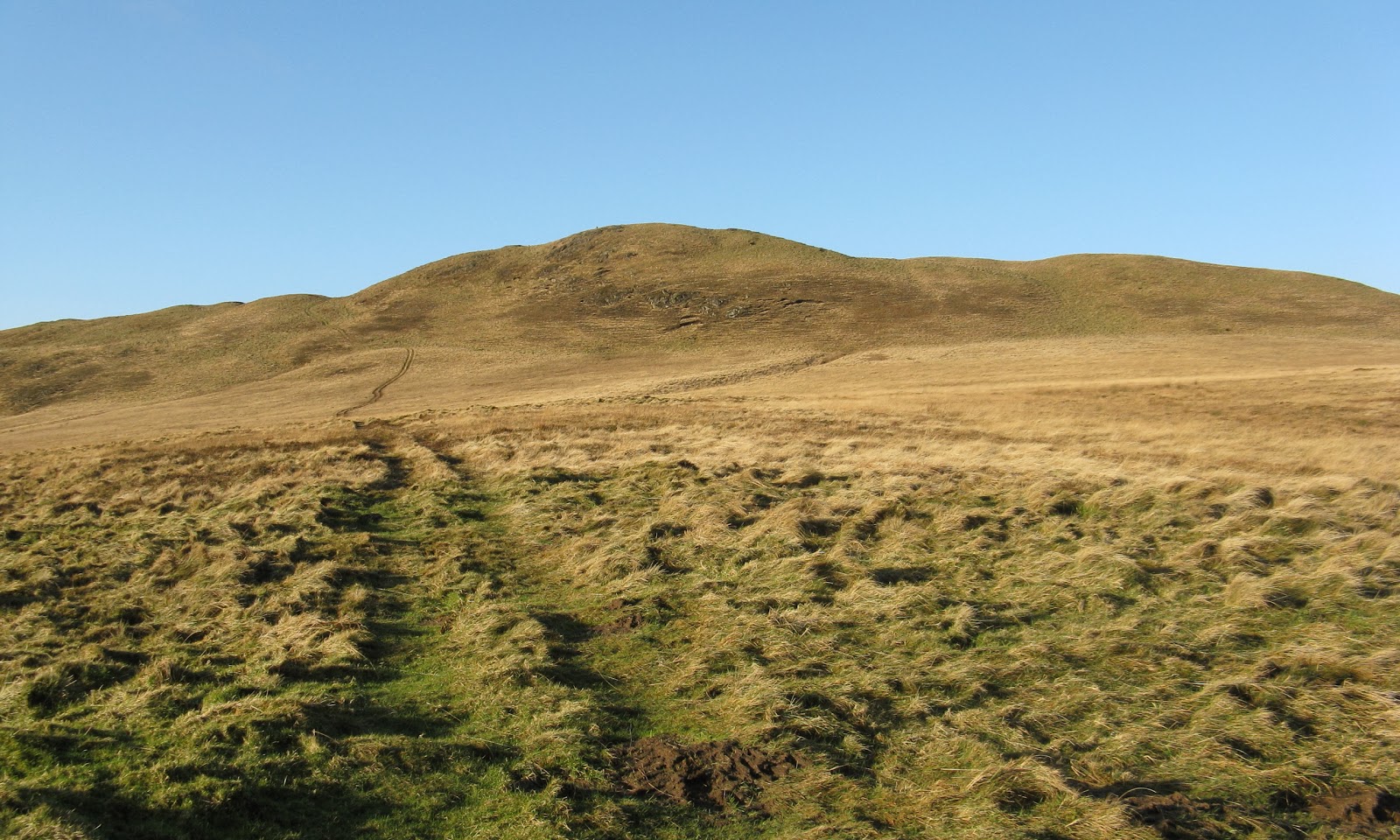
It was a nice crisp day and I hadn't been out for a walk for ages so I drove down to Muirkirk for a walk along the River Ayr Way. It's a nice walk with a bit of industrial heritage interest thrown in and as it never seems to be very busy it's ideal for Ben. On the way back I decided to nip up Middlefield Law; there were a lot of sheep on the hill, Ben had fallen asleep in the car and as it was only a short walk- 50 minutes up and down- I just left him to it. He's quite happy staying on his own for a while; he just curls up in the back of the boot and falls asleep! This is the view of the hill from the walkers car park at Kames, the other side of Muirkirk.....


The approach was along a narrow road that runs along the south side of the hill. Just under a mile from the turn off the B743 and just before the buildings at Forkings, there is roadside parking, a gate onto the hill, and the start of a track. Take the track! This hill contains some of the worst tussocks I have found anywhere and this track appears to be the only way of avoiding them. The only other time I climbed Middlefield Law I was unaware of the existence of the track and it was hell on earth trying to make progress.....


The summit is marked by a large cairn and a slightly lower trig point. The cairn appears to be a modern memorial cairn although I read somewhere that it might occupy the site of an earlier burial cairn.....


Most other hills of note are quite distant from here so it was views of the wide variety today. Didn't matter, I was just glad to be out on a hill again! This is looking east to Tinto, still with some snow on it.....


and south to Cairn Table. The extent of the tussocks on the south side of the hill are well seen in this pic.....


Needless to say, I returned by the same route!

Friday, 13 January 2012

Green Lowther

13 January 2012

Where - Green Lowther, 732m/2,403', Graham, Map 71, NS 900120
Participants - Neil and Ben

I always think that the Lowther hills provide good value walking for short winter days. Especially as there is a tarmaced road all of the way from start to summit thus avoiding any chance of muddy boots. Just right for today as my boots had not fully recovered from the mud bath on Grey Hill earlier in the week! For only the third time this winter, I had to scrape ice off the car, but it showed that a high pressure system had definately moved in and that a fine day was in prospect.

The other advantage of the Lowther hills is the high starting point- the village of Wanlockhead which claims to be the highest in Scotland.....


There is also ample parking and I got the car into a space right next to the building at the start of the private road that runs all the way to the summit. These are among the best known hills in Scotland because of the radar and radio stations on their tops and these installations do add a sense of the different to the walk, especially the "golf ball" on the top of Lowther Hill. There was a good view of the days objective from a point not far after the start.....


They may be industrialised hills but a lot of grouse shooting also takes place. Grouse were everywhere; Ben had a great time raising them! Evidence that this is prime shooting territory was the number of mink/stoat traps, although I have yet to see anything caught in one.....


The road winds up and across the hillside to the top of Lowther Hill but most of it can be avoided by diverting on to grassy tracks which though steeper, are also more direct as they cut out all of the corners. They are also easier on the feet. In no time at all, we were approaching the "golf ball", which I think is quite artistic and attractive.....


The sign restricting access to the site had disappeared and all of the gates were open although there was nobody about so we just followed the road through the compound. The main top of Green Lowther was about a mile away and despite the road, I find this a grand walk along a broad ridge with wide ranging views. This is Green Lowther from Lowther Hill.....


The area is becoming even more industrialised with the construction of the Clyde wind farm at the side of the M74; some of the turbines can be seen to the right of the summit in the picture above and in the next two pictures. I suppose that it is only the presence of the radar station that saves the Lowther Hills from the march of the turbines. This is approaching the summit of Green Lowther.....


and this is the trig set amongst the clutter of the radio station masts. Not artistic here at all, just an ugly mess. And not a place to hang around at but it was easy enough to move away from the installations to look at the views.....


I decided to stay high for as long as possible so retraced my steps along the ridge to Lowther Hill......


before descending by the service road.  I got a good view of Wanlockhead on the descent; I guess that surrounded by hills it must be a very cold place in the winter time. Today, the frost never lifted from around the houses.....


I find the village a really interesting place; on previous visits I have wandered round the Museum of Lead Mining and had a look at some of the old mining areas. An interesting full day can be had combining the hill walk with visiting the various places of interest. But not at this time of year; today it was back in the car and a drive to the nearest place that sold a cup of hot chocolate!

Monday, 9 January 2012

Grey Hill

9 January 2012

Participants - Steven, Ben and Neil
Where - Grey Hill, 297m/975', Sub-2,000' Marilyn, Map 76, NX 164928

There has been a lot of weather in west central Scotland in the past weeks, rain, wind, a little snow, rain, wind. You get the picture. Even Ben was starting to get fat from lack of exercise. So when a good day eventually came along, there was only one thing to do....grab it.

The better weather was coming in from the west so it was into the car for a run down the Ayrshire coast. Grey Hill is a small lump just to the south of Girvan but it promised a good view of Ailsa Craig. I took the Newton-Stewart road out of Girvan and after a couple of miles, at Pinmore, turned on to a single track road that passed the east slopes of the hill. There was space to park a car just off the road near the farm of Knocklaugh from where a path started up towards the hill. There were two immediate problems; the entrance to the path was by a stile and Ben has so far proved unable to tackle these on his own. So he had to be lifted over. The second problem was that the "path" was a sea of mud; Ben was on his lead at this stage and was so excited and desperate to be off that I had to watch that I was not dragged face down into and then through the mud! Having survived that, we wandered up a very wet hillside for a bit before arriving at this sign and another fence and stile.....


Having lifted Ben over again, things improved after that. The hillside was much drier as we gained height and the only worry was that there were a lot of sheep about. However, they had obviously clocked us and they soon moved off. There was a 4wd track higher up but on the way up that was where the sheep were so we detoured towards the north ridge to avoid them.....


It was good firm going on short grass and we were soon at the trig; it was indeed a good viewpoint. This is Steven and Ben with Girvan in the background.....


me and Ben with Ailsa Craig in the background.....


and a zoomed shot of Ailsa Craig. It looks like an exciting Marilyn to do.....


It could have been a spring day, warm with only a gentle breeze. Going down, we had to repeat the dog lifting exercise but managed to avoid a lot of the wetter ground although not the mud. And going down through the trees....was that a midge....surely not! What was not in dispute was the snowdrops that were fully out in sheltered spots beside the burn. And sitting in the car preparing to leave we watched a treecreeper running up an old tree in front of us. Could spring really be on its way?

Friday, 2 December 2011

Meall nam Maigheach

4 October 2009

Participants - Just me
Where - Meall nam Maigheach, 779m/2,558', Corbett, Map 51, NN 586436

Well I guess that that's just about it for the year. Can't see me getting out much until after the New Year now. Weather's just too dank and miserable. Time to start making plans for all the good weather we're going to get next year!

So to keep the blog going, here is a report of a walk I did in October 2009, a year when the October weather was benign and the autumn colours were at their best. Meall nam Maigheach is probably the least visited of the Lawers hills due to the rough nature of the ground and the fact that most folk head straight to the Munros. However they forget that you get good views of the Munros from nearby hills and I think that it is worth putting up with the rough terrain on Meall nam Maigheach for that alone.

The hill is best seen from the Lochan na Lairige on the Loch Tay to Glen Lyon road.......


The guide books say that the best way to climb it is from a roadside hut due west of the summit following a wall up but there is very little parking there and this route seems to provide only a very short day. So although I knew that I was letting myself in for some very rough terrain, I opted to follow the spine of the hill. I left the car at the north end of the loch where there is lots of parking; near here is the start point of a path that goes to the Munro of Meall a'Choire Leith. I followed the path for a short distance before taking to the hillside. It was rough but by following sheep tracks and sticking to the highest ground I was able to make reasonable progress.....


The starting height was over 500m so it was certainly not steep! The going got a bit easier as I approached the summit where there were two cairns. I reckoned that the most southerly one was higher but the other one, about 10 minutes further on, was the better viewpoint and that was where I stopped for my lunch. There were a number of small pools on the summit area which provided foreground for photographs.  Here are some that I took. This is the summit cairn with the Ben Lawers hills in the background.....


The northerly cairn with the Carn Mairg group of hills on the other side of Glen Lyon beyond.....


Looking to Carn Gorm, the most westerly of the Carn Mairg hills.....


Looking to Stuchd an Lochain at the head of Glen Lyon.....


and a shot of a distant Ben More and Stobinian beyond the Glen Lochay hills.....


I spent a fair bit of time on the summit just lazing about and taking in the views before it was time to tackle the heather and bog again. The compensation was the good view that I got of the Lawers hills on the way down.....


I have walked this hill a few times; it is in a great situation and in my view it is well worth putting up with the rough going to reach a great viewpoint....but only in good weather of course!

Tuesday, 22 November 2011

Kirkland Hill

22 November 2011.

Participants - Neil and Ben
Where - Kirkland Hill, 511m/1675', Sub-2,000' Marilyn, Map 71, NS 731163

I had climbed Kirkland Hill once before. On that occasion, I approached it from the south, from Kirkland. An excellent track led from a car parking area to a farm and carried on through the farmyard to the old church of St Connel's; unfortunately, walkers were diverted away from the farm and the track through a couple of very muddy fields with cattle in them before rejoining the track further on. As there must be very few walkers in this neck of the woods, I thought that this was a tad unfriendly!

Not wanting to face mud and cattle today, especially as I had Ben with me, I decided to try a route from the east. The map showed a single track road leaving the B740 just before the junction with the A76 and going about 5 miles before ending at the buildings at Fingland. So I took this; it was a surprisingly good surface although there weren't many passing places. The hill came into view as I got closer....


About 4 miles in, after a big bend in the road, I reached a cattle grid at the start of a right of way to Kirkland and Kirkconnel. There was just enough room for a car at the entrance to the track.....


Kirkland Hill appears to be the highest point of the moors above Sanquhar and as I was already at 300m at the start point, there wasn't a lot of ascent. However although there wasn't much height gain it was pretty rough going mainly over tussocks until I got near to the summit.....


The weather on the drive down had been great but it clouded over as I approached the top, although it proved just to be some passing cloud and I was back with blue sky and sunshine before I reached the car again. The trig looked as though it wasn't exactly at the highest point but there wasn't much in it. The next picture is of the trig looking south east to the Lowther hills and the one after looking east towardsTinto.....


So not a long walk but an unexpected bonus to get such good weather in late November. Having done both routes, I reckon that the one from Kirkland is better, if you don't mind mud and cows!

Wednesday, 9 November 2011

Cairngorm

7 November 2011

Participants - Neil, Steven and Ben
Where - Cairngorm, 1245m, Munro, Map 36

You don't get many days like this in November, or any other month in 2011 come to think of it! Clear blue skies and perfect visibility and hardly any wind. It was just a pity that daylight hours are getting short and as I had to drive home afterwards, the objective had to be a hill that we could be up and down in a few hours. Cairngorm and part of the Northern corries fitted the bill exactly.

We drove up to the Coire Cas car park and set off up the main track to the Ptarmigan. I had the notion to come back down on the railway so took a picture of the train going up.....


 The main track is a bit boring so after passing the upper buildings, we headed for the Fiacall a'Choire Chais which was broad and stony and led up the west side of the corrie to its top at 1141m. This was a very easy way up but got us away from the ski area and provided ever widening views into and beyond Coire an t-Sneachda.....


We paused for a bit at the cairn at the top of the ridge. This is a favourite viewpoint of mine; coming up this way it provides a first view into the main range as well as the distant views to the north and west. Today we could easily make out Morven in Caithness and whole ranges of hills beyond Ben Wyvis; unfortunately they are so distant that my photographs don't do them justice.....


It was far too early in the day to go to the summit so we dropped down to the col for a wander along the top of Coire an t-Sneachda as far as the high point at 1176m. From here, we could glimpse the tops of Cairn Toul and the Angels Peak.....


look across the plateau to Ben Macdui (this one taken on a previous visit; the sun was in the wrong place today).....


look south over the top of Carn Etchachan to Loch Etchachan and Derry Cairngorm.....


and round to Beinn Mheadhoin.....


The latter brought back memories of days when I climbed Cairngorm, dropped down the back to Loch Avon to visit the Shelter Stone, climbed Beinn Mheadhoin and then came back either the same way or via the Saddle. Wouldn't be able to do that now! Today, we simply retraced our steps to the col and climbed the stony west slopes of Cairngorm.....


Here is a summit pic, looking down to Glenmore.....


Not far from the cairn is the weather station, I noted that it said that the wind speed here had reached 176 mph one February day.....


I suppose that the train ride down is a bit expensive- £7.50 for an adult and £1 for a dog- but it is a bit of an adventure and I think worth doing if only because it is a different and unique Scottish hill experience. Dogs had to travel in the standing only compartment at the back of the carriage (with their owners of course); I suppose you could say therefore that I ended up in the dog house! Here are a couple of views through the window; glad that that deer missed us!!!......


The sun was getting low in the sky as we drove back past Loch Morlich so I stopped and took a picture of where we had been, and also looking across the loch towards Glen Einich.....


They summed up the day perfectly.

Tuesday, 8 November 2011

Creag Bheag (Kingussie)

6 November 2011

Participants - Neil, Steven and Ben
Where - Creag Bheag, 487m/1,597', Sub-2,000' Marilyn, Map 35, NH 745017

All of the forecasts were agreed- it was going to be good weather. So a chance- last of the year I would imagine- to do something further away from home. As it would only be for a couple of days I didn't fancy driving too far so we booked into Aviemore which would let me do this for me new Marilyn on the way up and something more substantial the following day before driving home again.

Creag Bheag stands above Kingussie and is another one of these good wee hills to break up a journey. We started at the main car park behind the big hotel; again no problems with route finding on this one, it was well signposted.....


The path wound a way through birch woods, then pine trees before reaching the open hill. The summit area was a series of knolls, each with a cairn on it. It was a bit difficult to decide which was the highest point and the map showed two 487m spot heights. We concluded that the west top might be slightly higher but as we were traversing the hill anyway it didn't matter as we visited them all.   Here I am with Ben at the west top with the Cairngorms in the background, it was a bit breezy so another bad hair day.....


Here's a selection of views from the ridge. This is looking to A'Chailleach in the Monadliath.....


back along the ridge with Creag Dhubh beyond.....


and over Kingussie to the Cairngorms.....


There was a substantial stone shelter just below the east top....


and the hill drops sharply and roughly to the north to the trench containing Loch Gynack.....


The east ridge was much steeper and the path rougher and also muddy and Ben was more brown than white by the time that we got down to lower ground. However the loch was close at hand and a few minutes swim cleaned the worst of the mud off. From the loch, the path, still signposted, went through a gate and into more woodland and we soon arrived at the edge of the golf course and then the public
roads that led back to the car park. And the forecast was promising even better weather tomorrow!