Thursday, 25 June 2015

Blundering about on Cruach nan Caorach

23 June 2015

Participants: Neil and Ben
Where: Cruach nan Caorach, 458m/1,503', Sub-2k Marilyn, Map 55, 991804
 
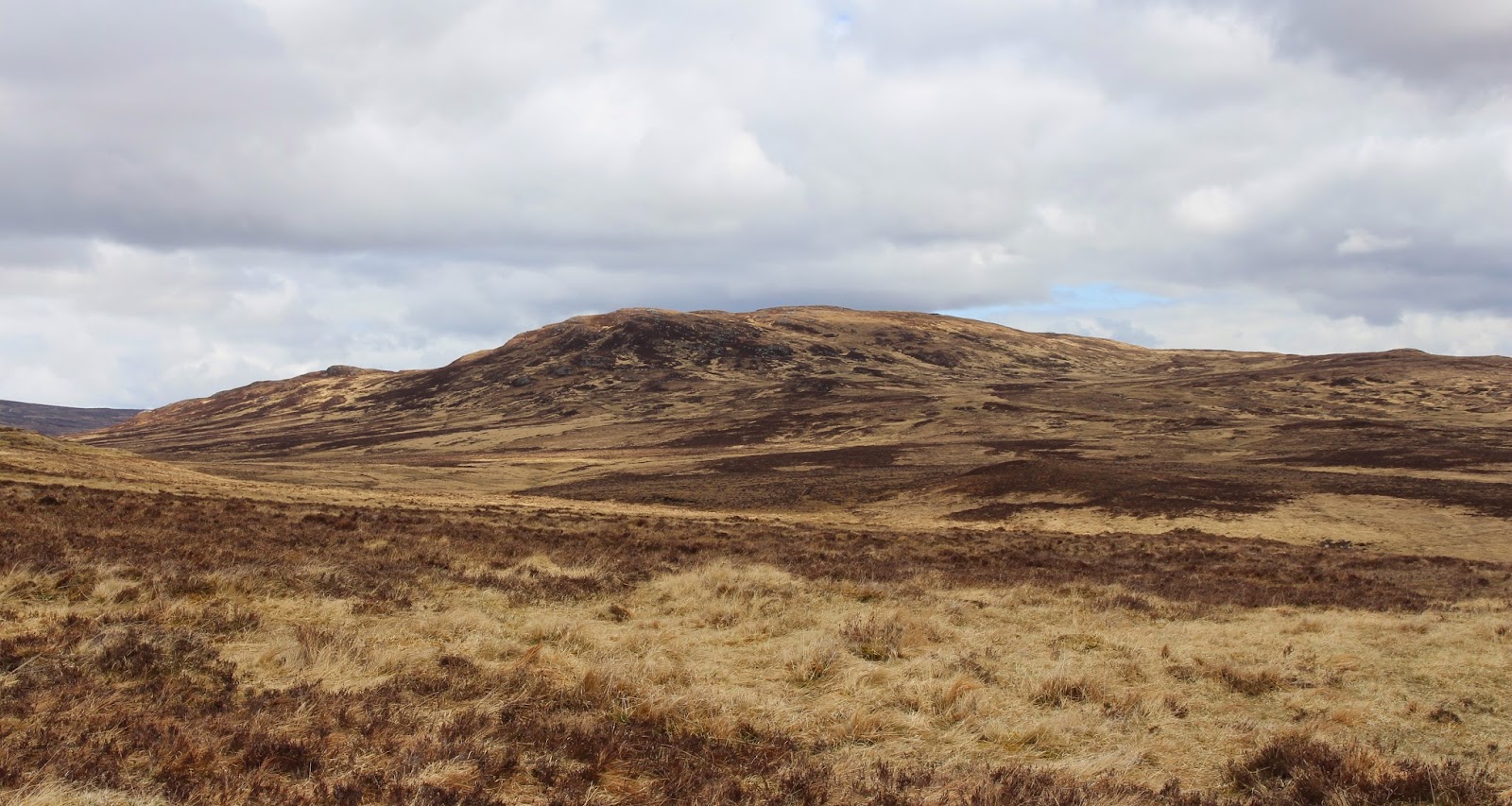
This was one of the few Cowal Marilyns that I still had to do. The direct frontal assault from the shores of Loch Ruel looked brutal with lots of crags so I drove to the high point of the Glendarual to Otter Ferry road which took most of the ascent out of  the equation. This is a view of the hill (left hand summit) from near to the start and again from a mile  or so in.....


There was a bit of forestry involved from this side and I faced the usual problem of  new tracks which were not shown on the map. I had taken the precaution however of taking advice as to the route. Initially, the track went downhill which was a bit of a bugger, especially on the way back. However, the weather was good and the route advice was proving to be excellent. Then it all went wrong. I was supposed to branch off a track on to what was said to be a rough 4WD path. However, my informant had failed to specify where exactly this point was and the heavy brigades of the Forestry Commission had been at work and had churned up the hillside alongside the track. So I missed the turn off, carried on along the track for further than I like to admit, and added about an hour and a half to the walk. The other problem of course was that I couldn't see the hill for the trees so had nothing to focus my bearings on.
 
Eventually I turned back and this time investigated the churned up area and found what might have been a path. It disappeared from time to time but at least I now knew where I was and could see the summit in the distance. On the horizon behind me, was an old friend- Jura.....
 
 
Next I came to a fence which I managed -just- to hold down far enough for Ben to jump over. On the way back, I found a gate. The summit area was not far away and I could see the trig.....


although there was a sting in the tail in the shape of a drop before a final steep climb to the trig. It was a good viewpoint looking down the Kyles of Bute.....


to Arran.....
 
across Loch Fyne and Kintyre to Jura.....
 
 
Ben was tired.....
 
but time was now getting on so we didn't linger. I reckoned that the path I wanted probably ran by the side of the fence and so it proved. Now I know the route exactly this would be quite an easy hill but that would take all the fun out of it!

Thursday, 11 June 2015

Island Davaar

Participants: Just me
Where: Island Davaar, SIB, Map 68

I hadn't slept very well- lots of coughing and spluttering and I certainly wasn't feeling at my best. However, I felt a bit better when I hit the fresh air and as it was an absolutely glorious day, I decided to walk out to Island Davaar before setting off down the road. The island is at the entrance to Campbeltown Loch and is accessible 3 hours either side of low tide by walking across the Doirlinn, a narrow spit of shingle. There is a hill walkers list of islands- the SIBS, the Significant Islands of Britain- and Davaar is on it. It rises to a height of 115m.....


I was really lucky with my timing, low tide was at noon so the island was accessible from 9.00am. There is a parking area at the start of the Doirlinn and it seems to be a popular walk, although most people seem to stick to the shoreline rather than climb to the top. There is rock art in one of the caves. This is the island from the start of the Doirlinn.....


The island is grazed by sheep and goats. Here are the sheep with a nice background of the Arran hills.....


and here are the goats.....

There was a rough path up the grassy slopes and I was at the trig in an hour.....


What a great viewpoint! This is looking down on Campbeltown, Campbeltown Loch and the Doirlinn.....


the Arran hills from the summit.....


looking up the Kilbrannan Sound.....


and on the southern horizon, Ailsa Craig.....


A great way to spend a couple of hours or so.

Mull of Kintyre Marilyns- Cnoc Moy and Beinn na Lice

9 June 2015
 
Participants: Just me
Where: Cnoc Moy, 446m/1,464', Sub-2k Marilyn, Map 68, NR 611152 and Beinn na Lice, 428m/1,404', Sub-2k Marilyn, Map 68, NR 602085
 
I had only been down the Kintyre peninsula once before- with work on a dreich January day. So it was a part of the country that I was unfamiliar with- time to put that right. I drove down the east side so I got a good view of the Arran hills, this is from the harbour at Carradale.....


The weather on the following day was a bit hazy and there looked to be a bit of a sea mist around. I had been fighting a cold for a day or two so decided to do Cnoc Moy and then decide whether I was up for the other hill. I had spotted an approach from the south east following a forestry track and passing a farm at Gartnacopaig. A lot of the forest had been cut down and I soon got a view of my hill.....


I left the track before I got to some other buildings at Largiebaan and took to the grassy hillside; the going underfoot was good- miraculous compared to some of the other hills in the area! Looking back, I could see Sanda island.....
 
 
The haze made the views a bit disappointing, this is looking to Machrihanish beach from the trig.....


This is The Slate, another sub-2k and one that definitely wasn't on my list of hills to do, as well as being covered in trees it is apparently very rough, even by Kintyre standards.....
 
 
I could also see my next intended hill in the distance.....
 
 
Fortunately, I didn't have to reach it cross country. It was back to the car in what I thought was a very reasonable 3 hours 45 minutes. I didn't feel great but Beinn na Lice only takes about 40 minutes so I jumped in the car and headed to the Mull of Kintyre.
 
The sun shone all of the way until I got to within a few hundred yards of the road end. But I suppose that I shouldn't have expected anything else but mist rolling in off the sea!
 
 
Anyway, there were breaks so I did get a view from time to time. The hillside was very rough but no matter, the cairn and trig soon came into view.....


This is the radio mast on the nearby Torr Mor, with the coast of Northern Ireland just visible beyond.....


So a nice couple of hills, and easy. Driving back up the road on the west side of the peninsula the following day- a day of crystal clear visibility- I got a great view of Cnoc Mor from Machrihanish beach.....


Saturday, 30 May 2015

Mochrum Fell

30 May 2015

Participants: Neil and Ben
Where: Mochrum Fell, 317m/1,040', Sub-2k Marilyn, Map 77, NX 723750

A road closure south of Dalmellington meant that a long drive was made even longer, so not a good start to the day. Mochrum Fell is a forested area and not all of the tracks are marked on the map so I also had a bit of faffing about trying to find the route on the ground. However, once I found out where I was it all went smoothly. I approached the hill from the south- from a narrow country road that left the main road at Parton, north of Castle Douglas. The track through the forest was very pleasant, this is my first view of the hill from it.....
 
 
At a junction, I turned right and almost immediately turned uphill on a forest ride. It was not too bad but should probably be avoided in the midge/tick/fly season. I could have avoided it by continuing on the track for a bit and then doubling back on another track but the ride was the easiest and shortest option. It brought me out at another junction and there, straight ahead, were the final slopes of my hill and even better, a rough 4WD track heading upwards.....
 
 
Mochrum Fell was completely forested until recently but the upper reaches have been felled. That's the good news, the bad news is that they have replanted so if you want to climb this hill, I suggest that you do it soon! The hillside was a bit of a mess with old branches and stumps but the rough track went to within 50m of the top so there was no bother.....
 
 
It was very pleasant on top with good views. Ben, the trig, and Corserine in the distance.....
 
 
the Galloway hills.....
 
 
Cairnsmore of Fleet.....
 
 
A pleasant short walk.
 

Wednesday, 20 May 2015

Ben A'an (Trossachs)

20 May 2015
 
Participants: Neil and Ben
Where: Ben A'an, Trossachs
 
It was a sunny day and, unusually for this spring, it was also dry. I couldn't be bothered driving far so headed for the Trossachs and Ben A'an which I hadn't climbed for a year or two. The Forestry Commission are busy felling here and the normal path is closed until October. However, a temporary path has been put in which joins up with the usual route at the foot of the steep final slopes. However.....it was muddy and then some. Goodness knows what it will be like once the main tourist season starts and footfall increases substantially.
 
The new path climbs steeply to the west of the usual route. There were occasional glimpses of the summit cone of Ben A'an.....
 
 
and south to Ben Venue......
 
 
I had forgotten just how steep the upper slopes were but lots of stone steps had been put in and it wasn't too long until we reached the summit area from where there was a good view down Loch Katrine......


The actual summit is quite sharp and is on the edge of a considerable drop. I was a bit worried that Ben might see something interesting and head for the edge so we stayed on top only long enough to take a couple of photographs; again, down Loch Katrine......
 
 
and a zoom shot of the still snow covered Stobinian and Ben More........
 
 
Then it was back down to meet the mud!

Saturday, 2 May 2015

Creag a'Mhadaidh

1 May 2015

Participants: Just me
Where: Creag a'Mhadaidh, 612m/2,008', Graham, Map 42, NN 634650

A day that started off bright and sunny soon clouded over and there were showers about although, apart from some gentle snowflakes while I was sitting at the summit, they stayed off until I was driving home. I had recently purchased the new SMC guide to the Grahams and decided to follow their recommended route to this rather remote hill mid-way between Loch Rannoch and Drumochter. So I parked at the start of the Right of Way track about a mile or so past Kinloch Rannoch.....


The track went through farm land and past a few ruins, all that remains of the settlement of Old Annat.....


and past a forest before emerging on to the moorland. My hill seemed an awful long way from here.....


There was a good view back to Schiehallion, still with a fair covering of snow on it.....


The path continued at a gentle incline past a small dam and up to the col between Creag a'Mhadaidh and it's westerly neighbour, Gualann Sheileach for which the map gives the same height but which I believe is in fact slightly the lower of the two. It was time to leave the track and head across the moor.....


As moorland crossings go, it was pretty benign and it didn't take too long to reach the ridge. The summit was only yards away marked with a substantial cairn for what I am guessing is not a heavily frequented hill. Loch Errochty is in the background.....


For a lot of the way up I had been looking at a fairly substantial hill with some decent snow patches on it and looking at the map I saw that it was Beinn Mholach, a Corbett. It is years since I climbed it and I can't remember the route, only that it was a long way.....


Creag a'Mhadaidh is a hill for those who like wide open spaces and distant views. The next nearest hills are Beinn Mholach and then to the north the Drumochter hills........


Sitting at the cairn I heard the distinctive sound of a Golden Plover; earlier in the day I had heard my first Cuckoo of the season, seen my first Wheatear and raised a Snipe. But I saw no other people, this is indeed another empty quarter. However, it is also close to the area where it is proposed to build the Talla a'Bhaigh windfarm, a desecration of wild land if ever I saw one.

The long way back, just as well there is a good track......


It took me 2 hours 50 minutes up and 5 hours 45 in total, for what was a very pleasant walk.