Tuesday, 21 July 2020

Lauder Common, Woodheads Hill and Gala Hill

20 July 2020

Participants: Neil and Ben

Where: Lauder Common, 378m/1,240', P.35m, Tump, OS 73, NT 489 461; Woodsheads Hill, 303m/994', P.64m, Tump; and Gala Hill, 275m/902', P.129m, Hump, OS 73, NT 492 349

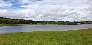
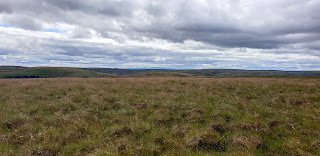
The most insignificant hill can provide some of the best views. That was certainly the case with Lauder Common, a Tump between the Border villages of Lauder and Stow. It didn't even manage to get named on the map and unless you were bagging Tumps, you would drive past without giving it a second thought. 

I had been on this road before, a number of years ago when I climbed the Marilyn, Sell Moor Hill, to the south of Lauder Common. There was plenty parking and a number of tracks headed up. It was obviously well known to local dog walkers, I saw more folk (and dogs) here than on any other Tump that I'd bagged. The path up.....


 and looking back to Sell Moor Hill.....


Approaching the high point looking east to Lauderdale.....


The Eildon Hills were prominent to the south with The Cheviot on the horizon.....


Ben surveying the view west.....


Having a rest in the heather.....


I drove on through Lauder and took another minor road to Galashiels. This passed another Tump, Woodheads Hill so naturally I stopped to pay it a visit. It was literally a three minute walk from the car to the high point which had been quarried. The "summit" was somewhere along the rim of the quarry.....


and the view south was again to the Eildons.....


The target hill in Gala was Gala Hill, tree covered with good tracks up. There was little of interest here apart from the trig at the top.....


Another pleasant day out in the Scottish Borders.

Friday, 17 July 2020

Keir Brae and a walk round Loch Ore

16 July 2020

Participants: Neil and Ben

Where: Keir Brae, 139.4m/457', P. 30.7m, Tump, OS 58, NT 237 945

Another trip to Fife this time to bag another of the new Tumps- Keir Brae at Cardenden. The use of Lidar technology is making measurement more accurate but is a bit of a two edged sword for hill baggers; hills are being added to the lists but at least an equal number are being deleted. I feel as if I'm bagging to stand still!

There was plenty parking available and a good track into the wood and then a network of paths through it. There was a trig which wasn't the high point but which I visited anyway. The views to the north from the edge of the wood took in the Lomond Hills. The high point was in the higher trees at the edge of a steep drop down towards the busy A92. 


It was still early in the day so I drove to Lochore Meadows Country Park for a walk around the loch. The car park area was busy but we only had to walk a few hundred yards to get away from the crowds. The park is well kept and impressive- a redeveloped coal mining area, much improved since the only other time I had been there. The loch walk is 3.5 miles long on a good track with great views of the Marilyn, Benarty Hill. Really nice and must be even more interesting in winter when all the over wintering birds are present.


Monday, 13 July 2020

Winton Hill, Carfrae Hill, Redstone Rig and Arniston Colliery Bing

11 July 2020
Participants: Neil and Ben

Where: Winton Hill, 132m/433', P.36m, Tump, OS 66, NT 438709; Carfrae Hill, 226m/741', P.47m, Tump, OS 67, NT 572684; Redstone Rig, 441m/1,447', P.54m, Tump, OS 67, NT 608644; Arniston Colliery Bing, 182m/598', P.33m, Tump, OS 66, NT 339620


I always enjoy a trip to East Lothian, it is very pleasant countryside in a genteel sort of way. For this visit, I had planned a circular route taking in 4 Tumps roughly centered around Gifford. First up was Winton Hill, a wooded top just south of Tranent. It made a very pleasant start to the day with good paths apart from around the summit area which was a mix of scrub and brambles......


The strip of trees was narrow so only slight diversions were needed to get to the edge to take in the views. South to the Lammermuir Hills.....


North-west to the Pentland Hills.....


Over a field of corn to Fife.....


I then drove south through Gifford and turned off at Danskine on to a minor road which took me almost to the top of Carfrae Hill. There was a convenient field entrance in which to park, then a short walk up the road and through a gate at the edge of some trees and a few yards into a field saw me at the high point. Couldn't be easier! Another view towards the Lammermuir Hills and another field of wheat this time looking towards North Berwick Law and Traprain Law.....


Continuing south, I was soon in moorland. I find the Lammermuir Hills bleak and unwelcoming not helped by "Keep Out" notices and vast grouse shooting areas. And yet there is a sense of openness and beauty. Redstone Rig was the target, fortunately only a short walk from the road as the conditions underfoot were a mix of tussocks and heather, not nice. For some reason, there was a cairn on this insignificant bump......


The view north to the Pentland Hills.....


and south to the Cheviot......
 

Back to the car, I reversed the route as far as Pencaitland and then cut across country to Arniston to add another of the new Tumps, Arniston Colliery Bing. This one looks much more like a natural hill than some of the other bings on the Tump list. There was easy parking, a good path up, and a glimpse of the Pentland Hills from near the top.....


Tuesday, 7 July 2020

A Couple of Most Unusual TUMPS: St Ninian's, Fife

6 July 2020

Participants: Neil and Ben

Where: St. Ninian's East, 181m/594', P.49m, Tump, OS 58, NT 131924 and St. Ninian's West, 170m/558', P.32m, Tump, OS 58, NT 125926: Hillfield Crescent, 77m/255', P.34m, Tump, OS 65, NT 126830

These are two of the “new” Tumps and an unusual pair they are. They stand in the middle of what used to be a vast open-cast coal mine between Kingseat and Kelty in Fife. I read somewhere that the site comprises 930 acres and the mining village of Lassodie once occupied part of this land. When the mine closed, the owners, Scottish Coal commissioned landscape artist Charles Jencks to develop a landform which it was intended would transform the area and provide a major attraction. But no sooner was work started than it ended when the owners went into administration. Charles Jencks was also the founder of the Maggies Cancer Centers.

There are apparently still hopes that the site will eventually be used for a major leisure project but for now, nature has taken over, the area is a green, if not completely pleasant, land and of benefit to dog walkers and Tump baggers.

I started the walk from the Thornton Woods entrance to the north. This gave me a longer walk but also meant that I was starting near what was the rim of the quarry so it was all downhill initially. And of course uphill coming back.

From the approach track.....


I visited the east hill first, the higher of the two and the most interesting. Ben on the approach.....


There are two ways up, a long, easily graded track that winds its way round and round the hill or a number of steeper shortcuts- we did a combination of the two. The hill has three tops, all of about equal height, and all adorned with artwork comprising old tyres and trees with other bits and pieces lying around- all unfinished sculptures. The best exhibit was an avenue of old mining machinery. It would have been good if it had been finished.....


We wandered around having a look at all the exhibits before setting off again for the West Hill, much the inferior of the two. Knock Hill at Saline was on the horizon.....


The West Hill had a narrow summit ridge with a couple of tops and not being able to decide which was higher we did them both.....


Then it was back down to the track and uphill to the car. An unusual hill walk, but interesting. Anybody doing the Tumps had better do these two before the area becomes a theme park!

I drove home by Inverkeithing so that I could also bag another new Tump- Hillside Crescent- which as its name implies is now a housing scheme. The high point however was a patch of grass so better than another new Tump in Kilsyth......