Monday, 28 March 2011

Meall Buidhe (Glen Ogle)

27 March 2011.

Participants - the usual suspects
Where - Meall Buidhe (Glen Ogle), 719m/2,359', Graham, Map 51, 578277

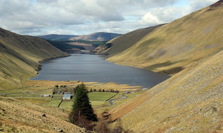
It was very misty when I looked out but with a poor forecast for much of the coming week, I was banking on today turning out ok so I could get my walk. So I put my trust in the MWIS and put The Furry One in the boot and turned the car north. By the time I got to the highest point of the Crow road- which resembles more of a track in places with enormous potholes- blue sky was appearing over the hills ahead and it was looking good. I didn't have any definite objective in mind. Ben Ledi was looking good so I stopped for a look but the car park was full. So I pressed on through Strathyre and Lochearnhead and this view of Meall Buidhe from just outside the latter made my mind up.....


I parked at the picnic area at the head of Glen Ogle. This would be a rough hill to climb were it not for a track that gently ascends from the car park to a phone mast at about the 550m height.....


The forest area was contained on the lower slopes and I was soon clear of that and the views were opening up behind me (pity about the unsightly mast but there is a price to pay for everything and the useful track makes up for it).....


The going was rough after leaving the track and I kept to the higher ground as much as possible aiming for the foot of the north ridge of Meall Buidhe. I spied a few sheep on the slopes of Beinn Leabhainn, the more northerly top, but the large flocks encountered on the last two walks were thankfully absent and Ben was off his lead all day. Since he discovered that he likes water, he is in to every pool that he passes.....


I was congratulating myself that I would be taking a nice clean dog back home when he decided to investigate a particularly juicy peat hag!

With Meall Buidhe being in the centre of the hills of the southern highlands, it is a really good viewpoint. This is looking to the Glen Dochart Munros- Ben Challum, Sgiath Chuil etc as we approached the top.....


The top was marked by three cairns, the most northerly one appears to be the highest point......


Meall nam Tarmachan and some of the Ben Lawers group are to the north.....


But I think that the best view is from the other cairns looking down Glen Ogle to Loch Earn with Ben Vorlich and Stuc a'Chroin beyond. It was worth climbing just for this view alone.....


although the view to Ben More and Stobinian ran it close.....


Judging by the number of cars parked in lay-bys, the Munros and Corbetts were hotching with folk; Ben and I had this lowly Graham to ourselves.

Thursday, 24 March 2011

The Wiss

23 March 2011.

Participants - Me and Ben
Where - The Wiss, 589m/1,933', Sub-2,000' Marilyn, Map 73, NT 264206

I had wanted to climb The Wiss for a long time, mostly because of its intriguing name, but also because it was situated in some pleasant country overlooking St Mary's Loch. Today I finally got round to it. Once out of the industrialised area of the central belt, it was a nice trip. I took the hill road that goes over the shoulder of Broad Law past the Megget Stane and stopped at the top of the steep bit to take this photo looking back down to Talla Reservoir.....


It was a day for reservoirs-the road then passed Megget Reservoir, which an information board told me was completed in 1983 to provide the main water supply for Edinburgh. It apparently holds 64 million tons of water and it's dam is the largest earth dam in Scotland. It took 6 years to construct using over 3 million tonnes of gravel dug from the floor of the valley.....


I was now not far away from the start point for The Wiss; a car park and picnic area close to Tibbie Shiels Inn- one of the oldest hostelry's in Scotland apparently- on a narrow strip of land between St Mary's Loch and Loch of the Lowes; the lower slopes of The Wiss are in the background in this picture.....


I followed the route of the Southern Upland Way for a bit before taking to the hill. It was sheep country so Ben had to remain on his lead until we got higher up and clear of the wooly beasts. The slopes were mainly grassy although there was an area of heather higher up.....


I like the Southern Upland views- this is looking west with the Corbett of White Coombe in the distance in some cloud.....


and this is looking back over the start point towards Broad Law where some heather burning was taking place on the neighbouring Cramalt Craig.....


There was a trig.....


So I perched the camera on it and tried the delayed timer function to get this shot of me and the Furry One with St Mary's Loch in the background.....


I had considered carrying on along the ridge and dropping down to the lochside but it looked heavy going through the heather so I took the lazy option and just returned by the same route. There was a rather grand statue of James Hogg, the Ettrick Shepherd and Borders writer and poet across the road from the car park.....


There was also a small cafe so I nipped in there for a plate of soup, a good ending to an enjoyable walk with some additional things of general interest thrown in. And I still don't know why it's called The Wiss......

Sunday, 20 March 2011

Broomy Law

19 March.
Participants - Me and Ben
Where - Broomy Law, 426m/1,399', Sub-2,000' Marilyn, Map 72, 085429

Broomy Law was one of the few Marilyn's that I had not climbed that was within range of a short half day trip. I had passed it on umpteen occasions but had never stopped and with another dry but cloudy day forecast and with fresh snow still covering the highland hills, the time had arrived to add it to the list. The minor road to the village of Candy Mill had a very broad entrance so I parked there and walked back along the main road for a couple of hundred yards to the start of the track to Brownsbank farm which continued as the access track to the phone masts on top of the hill.....


There were lots of sheep about so Ben had to stay on his lead for most of the way. There was no cairn or trig, just a collection of unsightly phone masts. I doubt if Broomy Law would get many visitors were it not for the fact that it is on the Marilyn list....


It wasn't obvious which was the actual highest point; here is Ben looking for it with Tinto, the hill that we climbed earlier in the week, in the background.....


There were no sheep at the top of the hill and the top field was also clear so I was able to let Ben off the lead. To extend the walk, we continued on to the slightly lower east top. There are a number of sub-2,000' Marilyns about here; this is looking to Black Mount.....


Then it was back on the lead for The Furry One and a return by the same route with expansive views to the west......

Friday, 18 March 2011

Tinto

17 March.

Participants - Me and Ben
Where - Tinto, 711m/2,334', Graham, Map 72, NS 953344

Rain and low cloud in the morning had given way to something a bit more hopeful so I gathered up the Furry One and set off around lunch time for Tinto. This is a good hill for me as it is quite a short drive, is an easy walk with a path all of the way and, on a good day, has very good views. I took this photo of it on some distant summers day.....

It was certainly not like that today as I pulled in to a brand spanking new car park at Fallburn, there was some fresh snow higher up and it was a bit grey overhead but looked as though it might improve as the afternoon went on.....


It is a real motorway of a track and considering the weather we have had and the amount of usage it gets, it was not too muddy. Higher up, it improves enormously and amazingly, so did the weather. This is looking east to the Pentlands from a point just before the final rise to the summit. 


There were still showers about and we reached the top just as a heavy one passed close by.....


Is the cairn on Tinto the biggest in Scotland? It apparently dates back to the Bronze Age.....


As usual Ben was there first.....


There used to be a view indicator but over the years it has got vandalised and is now in a sorry state.....


Two more views; another looking east down to the start and one looking south to the Culter hills and beyond to Broad Law.....


So not too bad a day after all. I have been up Tinto many times but never on a really good day; such days tend to see me heading north to something a bit more rugged and "highland" which is a shame really as Tinto is an excellent wee hill. On the way down, Ben was interested in the call of a grouse but turned tail when it suddenly exploded out of the heather. Hope he stays like that; I don't fancy having to try to get him back if he runs off on a grouse moor!

Sunday, 6 March 2011

Mendick Hill

6 March 2011.

Participants - Me and Ben
Where - Mendick Hill, 451m/1,481', Sub-2,000' Marilyn, Map 72, NT 121505

Early yesterday afternoon, MWIS was forecasting that today would be good in the south east of Scotland with some sunshine plus an 80% chance of cloud free summits, when I looked at their forecast again before going to bed it had changed to more cloudy and 40% and when I got up this morning it was saying that there would be hardly any brightness and with only a 20% chance of cloud free summits. Oh well! It still looked as though the best weather might be in the east so I headed that way without really knowing which hill I would be doing! And so I found myself parking close to West Linton golf club and heading along the track that runs to Dolphinton en route for an ascent of Mendick Hill, a south-western outlier of the Pentland Hills. It was indeed cloudy although it looked at times as though it might break up but in fact it never did. However the tops were clear. This is Mendick Hill from the start of the walk.....


An information board near the start explained that the route that I was following ran roughly in line with a road built by the Romans nearly 2,000 years ago. This road linked their garrison at Biggar with one at Elginhaugh, a bridge-head fort guarding the crossin of the river North Esk near Dalkeith. In the 18th century, part of this route was used as a turnpike; it included an arched bridge built in 1620 over the West Water where no doubt the fees were collected.....


No fee was necessary to cross the bridge today but I stopped on it anyway to take another photo of Mendick Hill.....


There were lots of sheep about and Ben was on and off his lead constantly. Further on, just past a renovated house, I came across a sign saying "Mendick Hill" so took to the hill, contouring west across the slopes to avoid the steepest parts (as well as a few sheep that had wandered out of the fields and on to the hill). It was a bit wet lower down but firm and grassy higher up.....


It was not a great day for photography; this is looking towards Scald Law and the Kips.....


and this is what the same view looks like on a good day.....


The sun was doing its best to come out but this was all that it managed; a view south-west towards the Broughton Heights.....


We went back the same way, dodging some more sheep.