Saturday, 8 July 2017

Knockinhaglish Hill

5 July 2017

Participants: Neil and Ben
Where: Knockinhaglish Hill, 113m/371', Tump, Map 57, NS 483 848

It was a pleasant afternoon after rain in the morning so I headed the short distance through Strathblane almost to Croftamie. I parked at the junction of the A81/B834, followed the track west and then took a rougher track through a couple of fields to the radio mast at the top of the hill. There were sheep in the first field so Ben stayed on his lead.....
 
It was difficult to know where the highest point was, it certainly wasn't the trig although it was the best viewpoint with a glimpse of Loch Lomond and the Luss hills......

south to Dumgoyne and the Campsie's.....


and Auchineden Hill.....


Tuesday, 4 July 2017

Dundee Hills: Gallow Hill, The Law, Balgay Hill

3 July 2017

Participants: Neil and Ben
 
Where: Gallow Hill, 175m/574', Tump, OS 54, NO 365342; Dundee Law, 174m/571', Tump, OS 54, NO 391313; and Balgay Hill, 146m/479', Tump, OS 54, NO 377308
 
Whenever I go to a city abroad- and that is rarely nowadays- I always head for the highest point so that I can get an idea of the layout of the place. It occurred to me recently that it might be interesting to visit some of Scotland's cities and do the same thing, with the added bonus that most city hills will be on the Tump list.
 
As the city where I was born, Dundee holds a special attraction for me. For most of the last forty plus years, nothing much seemed to happen and it got a bit down at heel. All that has changed with lots of exciting new developments, mainly centred on the waterfront and it is now a place with a vibrant feel to it, a mix of the old and the new with lots of places of interest linked to its industrial heritage. I left it as a very small child, so apart from the Law, I had not visited its hills before.
 
The highest point within the city boundary is not, as you would expect, the Law Hill, but Gallow Hill, which is a metre higher and lies to the north of the city as part of Templeton Woods and Clatto Country Park. There was a car park for the latter so I went there. This was a very easy walk, there was virtually no height to be gained from the car park and I was at the highest point and back inside 20 minutes.

A path through a meadow led to a grotesque bit of architecture- a concrete water tower- at the edge of Templeton Woods.....


The hill summit seemed to be just outside the compound. There was a view of the Sidlaws from the meadow, but nothing much else of note....


It was such a short walk that I also did a round of Clatto reservoir before going back to the car- not a great deal of water in it today but plenty warning signs of the dangers of blue-green algae.

Next was the hill that defines Dundee- the Law. An extinct volcano, remains of an Iron Age fort and now topped with a magnificent war memorial and with a landscaped viewing area, it has everything required of a signature point for the city. I could have driven to the top but opted to park at the start of the hill road and walk from there. It wasn't far. I had been there a few times before but the weather today was easily the best and the views magnificent.  The War Memorial with the rail bridge and Fife background.....
 

Ben beside the radio mast with a view north to the Sidlaws with Craigowl prominent.....
 

North to the Sidlaws.....
 

North-west over the city with Cox's stack showing up well. The stack is a chimney 283'high, an A listed building in an Italian style and one of the few remaining relics of the jute industry in the city. It was part of the Camperdown works, one of the largest industrial sites in the country in the 19th and early 20th centuries......
 

Balgay Hill and the upper Tay estuary......
 

The rail bridge across the Tay.....
 

The road bridge and the lower estuary......
 

I sat about for a while just taking in the views and then headed off on the short drive to the final hill of the day- Balgay Hill. No extensive views here, just a pleasant woodland park at the top of which was the Mills Observatory, Britain's first purpose built public observatory. Unfortunately, it is only open on a few days in the year so I couldn't get in to see the displays.....


So after visiting the highest point of the hill, which could be anywhere immediately round the building, we went for a stroll in the park instead......
 

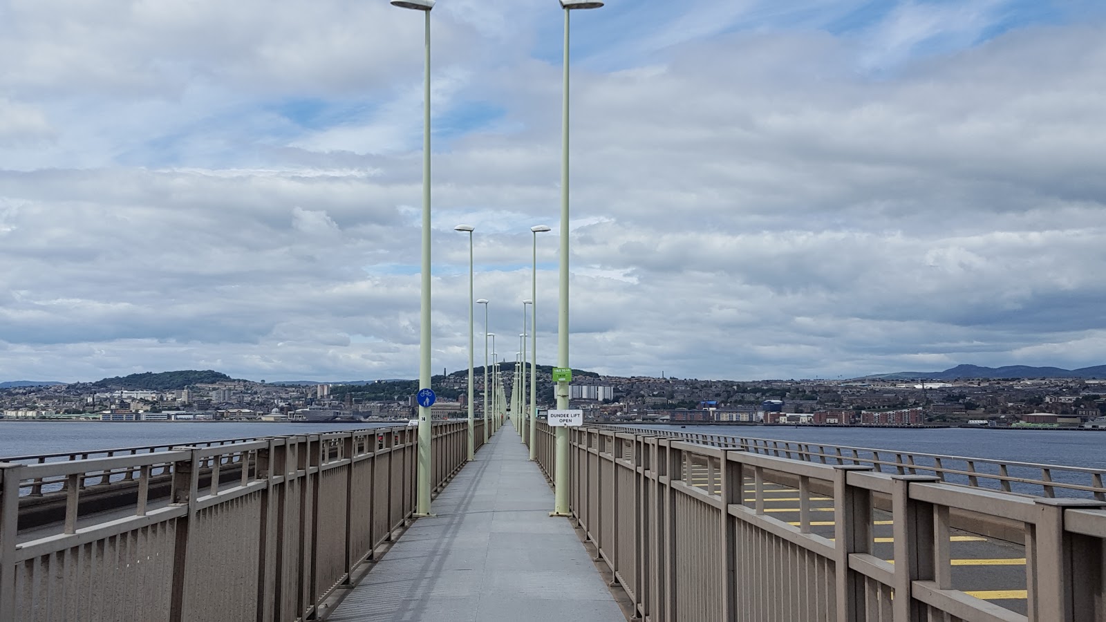
Rather than head straight home, I drove across the bridge to the visitor area on the Fife side for the view across the Tay to the city.....


I hadn't realised just how much there was to do in Dundee. Now that I've done the hills, I need to go back to visit the attractions.


Monday, 26 June 2017

A "new" Tump- Heronryhill

26 June 2017

Participants: Just me
Where: Heronryhill, 105m/344', Tump, OS 64, NS 695 737
 
I noticed on the Hill Bagging website a couple of weeks ago that a "new" Tump had been added to the list, a couple of miles from my house, So I just had to go and have a look! I must admit that this hill had not attracted my attention before, no doubt because it was really only a bit of high ground covered in trees. In fact, it didn't look like a hill at all. Nevertheless......
 
To make it even easier, there was a road running just to the west of it with space to park a car a few hundred yards from the start of a track that went through fields to communications masts not far from the highest point. This is the hill from the start of the track.....


The track had at one time continued past the masts but today it was completely grown over. Maybe its there in winter time. There was a faint path through the grass and I soon arrived at the summit area. Slightly covered in vegetation......
 
 
Much of the summit area is taken up by a small water board reservoir, now covered over and within a locked compound..... 


Apparently the highest point of the hill is just to the south of the compound, in amongst the rhododendrons. I'll take the Hill Bagging websites word for it.
 
Surprisingly, once clear of the vegetation on the summit area, the view over west central Scotland is quite good.....


So that was my curiosity assuaged, apart from one thing. Why is it called Heronryhill? 

Wednesday, 7 June 2017

Binns Hill and Linlithgow Loch

7 June 2017

Participants: Neil and Ben (loch walk only)
Where: Binns Hill, 113m/371', Tump, OS 65, NT 053786

A half day walk today- we went to Linlithgow and had a walk round the loch followed by a visit to Binns Hill, a Tump and another hill with a tower on top of it. The loch is a good stroll of just over 2 miles on a well surfaced path with great views of Linlithgow Palace.....


It's very popular at weekends but was nice and quiet today and I was able to stop and note the many species of birds that live on the loch. Ben went too close to a nesting swan and got hissed at for his trouble; I've never seen a dog jump backwards in alarm before!

It was a short drive from Linlithgow to Binns Hill which is part of the estate of the same name now in the care of the National Trust for Scotland. There appears to have been a manor house here since the 15th century. The estate was purchased by the Dalyell family in 1612 and they have lived here ever since, although the house and grounds were given to the NTS to look after in 1944. The most recent famous Dalyell was Sir Tam MP who died recently. I didn't have time today but I must do the tour next time I'm here.


It was only a short walk from the car park at the house to the hill on a marked path through woodland. The hill is topped by Binns tower- a folly erected in 1826.....


There were others at the folly......


It was a day of clear atmosphere which is why I came and the views were good for so small a hill. Looking to the Pentlands behind Edinburgh.....


North across the Forth to Fife.....


Blackness castle, the Forth and Fife.....


Up the Forth to the Perthshire hills. You can just make out Ben Ledi, Stuc a'Chroin and Ben Vorlich.....


An excellent short walk with lots of interest.

Saturday, 3 June 2017

Crieff: Laggan Hill and Tom a'Chasteil and another Monument

2 June 2017

Participants: Neil and Ben
Where: Laggan Hill, 154m/505', Tump, OS 52, NN 842223 and Tom a'Chasteil (Sir David Baird's Monument), Tump, 133m/436', OS 57, NN 825217

I had spotted what looked to be an interesting walk near Crieff and as it was another nice day, off we went again. I parked in the MacRosty Park car park; what a beautifully kept park this is! Crieff is one of these towns where walkers are obviously made very welcome, there were signposted walks everywhere! Our route was across the bridge over the Turret Burn and then a sharp left turn onto a path that ran alongside the water. The burn shortly joined the River Earn and the path widened to a track that ran through an avenue of trees- Lady Mary's Walk, named apparently after Lady Mary Murray whose family were local landowners in the early 19th century. I must come back here in the autumn when the old oak, beech and lime trees are bound to be a spectacular sight. Ben really enjoyed this part of the walk, he was in and out of the river on a number of occasions.


Torlum, a sub-2k Marilyn that I have climbed a few times.....
 

Did I mention signposts? There was a choice at this one but our route now lay in the direction of Laggan Hill.....
 
 
The broad track was replaced by a narrower path.....
 

with Laggan Hill in the distance.....
 

The upper reaches of the hill were covered in trees and thick vegetation so the views were a bit limited. The only real view of the big hills around Glen Turret was at a point just before we entered the forest....
 

There was a rusty old seat at the highest point of the track and the summit was said to be close to that. Ben had a look for it.....
 

From there it was all downhill. There were occasional breaks in the forest as we got lower; this is looking towards Crieff and the Knock.....
 

There was a choice of routes when we reached the houses but we carried on down to re-join our outward route at the beginning of Lady Mary's Walk.......
 

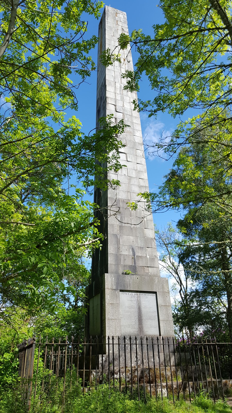
I could have extended the walk to take in the next hill on the day's list- Tom a'Chasteil, but I had read that the path between the two hills was rough and overgrown in places. And anyway, it was easier to take the car and drive round to Strowan and do the ascent from there. The attraction of this hill was the monument that crowned it- Sir David Baird's Monument. This is one monument that is well deserved.  http://perthshirecrieffstrathearnlocalhistor.blogspot.co.uk/2012/07/general-sir-david-baird-1757-to-1829.html
 
I would not have noticed this hill had it not been for the Monument and the story behind it. It is completely tree covered and there was no view whatsoever. Indeed, it was difficult to find a place from where to take a photograph! But worth it just to learn a bit more about this remarkable man.


So another good day- the Tumps are proving more interesting than I expected!