Monday, 24 March 2014

Meikle Bin

24 March 2014

Participants: Neil and Ben
Where: Meikle Bin, 570m/1,870', Sub-2k Marilyn, Map 57, NS 667822

It had been frosty overnight and the sky remained clear, so I had to get out. In this year of grey and cloudy skies, you have to take advantage of a good day when it comes along. Driving into Glasgow yesterday, I had noticed that there had been a considerable new dump of snow on the hills which would obviously have been very soft and laborious to walk through. So I quickly forgot any idea of driving to find a new Marilyn and went instead to re-visit one of the nearest to me and which was snow free- Meikle Bin in the Campsie Fells. Driving along by the Carron Valley reservoir, it was clear that I was in for a good day.....
 
 
 The tracks had been repaired by removing the top surface so although the surface was hard on the way in to the hill, by the time that I was returning it had turned quite muddy- just right for a white coated spaniel. Ben hadn't been out on the hill for a while and was racing about. He is a strong dog now and there is no way that I would manage him on the lead when he is in full excitement mode. Fortunately there is no need for a lead on Meikle Bin. This is the hill from near the start of the walk.....
 
 
The forestry folk had erected new signage since I was last here.....
 
 
There were glimpses of the surrounding hills as I got higher, this is looking to Stronend.....
 
 
And the short bit between the forest road and the open hill has now been made into a proper, drained path. It used to be a real wet area previously.....
 
 
It is further that it looks from the end of the forest to the summit but the angle is gentle.....
 
 
and we were soon there. What a great view today of the snow covered highland hills. In the next photo you can see from the Luss hills round to Ben Chonzie in Perthshire.....


This is looking down on the Carron valley reservoir.....
 
 
and this is looking south to the central belt.....
 
 
There were quite a few folk- and dogs- about. However, there was a cold wind blowing at the top so we dropped back down to the forest where the FC have considerately erected a bench and table for folk to sit at and have their cup of tea.

Thursday, 13 March 2014

Blake Fell

12 March.

Participants: Just me
Where: Blake Fell, 573m/1,879', Sub-2k Marilyn, Map 89, NY 110197

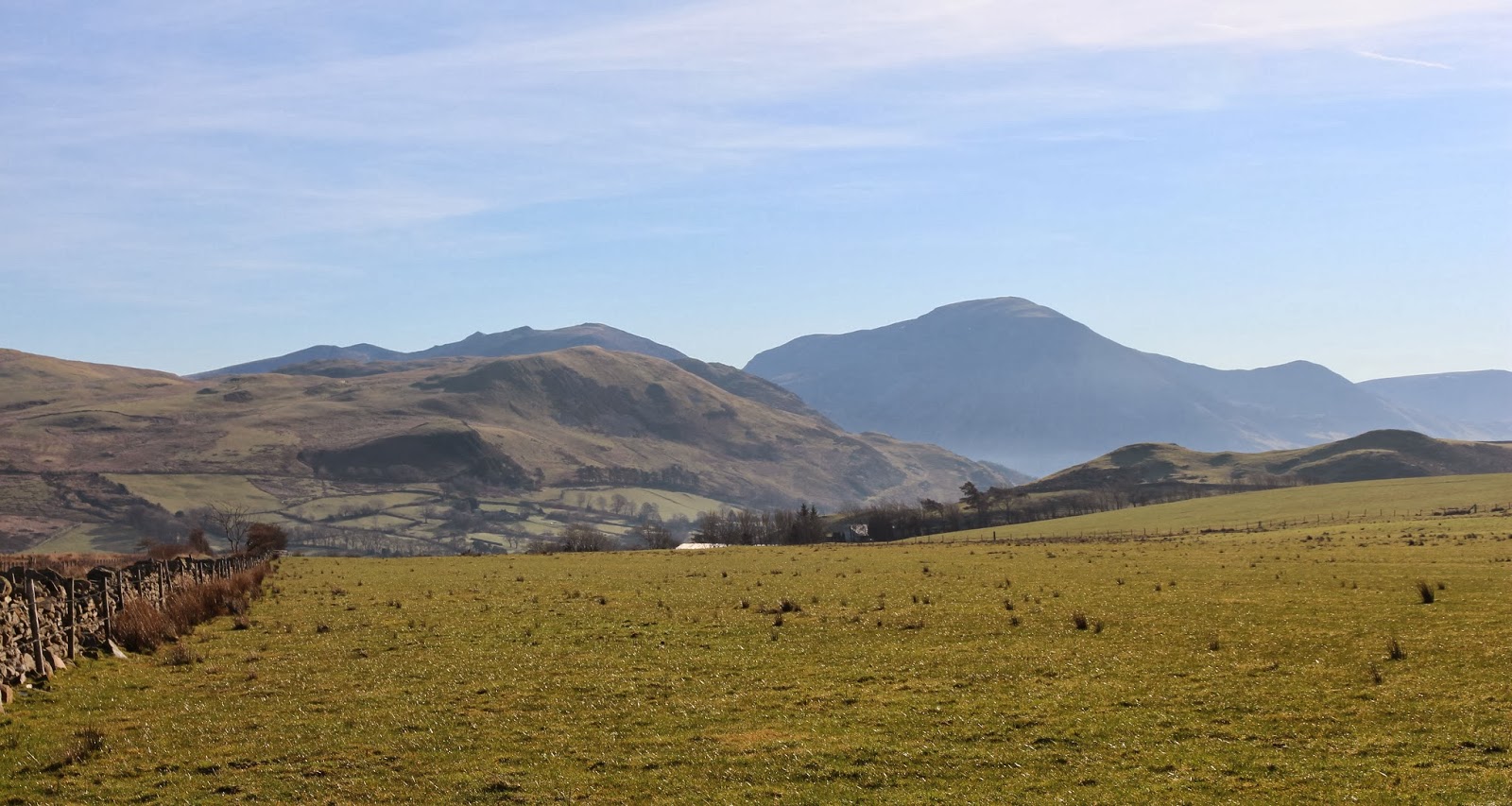
Day 3 of my short trip to the Lakes dawned bright and sunny although there was more of a haze than previously. Today's hill was on the other side of Loweswater from Low Fell and approached from the village of Lamplugh. About a mile past the village there was a small Forestry Commission car park, Feldyke, and this was the start point. Shortly after leaving the car I got my first view of the hill. My route was up to the right hand of the two notches and then following the skyline.....


In less than a mile I reached a small reservoir, Cogra Moss, a strange name for a piece of water.....


My route ran along the track on the south side of the water before taking to a narrow path that went steeply up the hillside at the side of the trees to emerge on the hillside at the foot of Low Pen. There had been a lot of felling in this area and the route of the path from below was not obvious. However, it leaves the track just where the lake ends and once on it, the route is clear. Out of the trees, there was now a fence to follow all the way to the summit and to ease things even further, a good path had also developed. I got a fine view of the steep west slopes of Blake Fell from up here.....


It was a good ridge walk, rather like being in the Southern Uplands, say, around Ettrick and there was a good view down to Cogra Moss.....


A gentle walk over High Pen and a steeper pull up Blake Fell saw me at the shelter on top.....


The view towards High Stile etc. was definitely hazy today; Crummock Water can just be seen in the middle distance in this photo.....


There were a few other folk about and it obviously receives a fair number of visitors. After loafing about at the top, I returned by the same route; I could have continued over the summit and down the other side of the hill but a lot of this route was in the forest. I reckon that the car to car walk was about 6 miles with about 400m of ascent and I took a leisurely 4 hours. Here is another photo that I took of Blake Fell and Cogra Moss from almost back at the car.....

Low Fell

11 March 2014

Participants: Just me
Where: Low Fell, 423m/1,388', Sub-2k Marilyn, Map 89, NY 137226

I woke up to a stunner of a day! I was getting the Lake District at it's best. I drove south from Cockermouth and took the side road through a place called Mockerin heading for Loweswater. Just before dropping down to the lake I stopped to take this picture of the fells that I was heading for with the bulk of Grassmoor beyond.....


There was plenty of roadside parking at the end of the track to the farm of Askill which I followed for less than a mile before taking to the hillside of Darling Fell. It was already warm and I was down to shirt sleeves before I'd gone very far. This was the view that I got when I reached the top of Darling Fell; Low Fell is ahead with Whiteside and Grassmoor in the background.....


Grassmoor looks really steep from this side, I did it from the other side over Grisedale Pike which is quite a gradual ascent.
 
It was just empty moorland to the north- well, apart from numerous sheep- and with a distant view of Skiddaw.....


The cairn on Darling Fell was a couple of hundred yards beyond the highest point, presumably because that is the better view point. Crummock Water is the lake in the distance with Buttermere showing just beyond it.....


What was less welcome was a view of a hundred metre drop and re-ascent to Low Fell! But it was worth the effort, Low Fell was another stunning viewpoint overlooking the length of Crummock Water with the High Stile range to it's right.....


I was now very much closer to Grassmoor.....


I sat for quite a while at the cairn, it was a day to linger.....


There were a few other people about, all seeming to have started from the north, over Fellbarrow and across the plateau. And that was the way that I started back, over to Sourfoot Fell and then angling back across the moor to join the track that I had left earlier in the day. This is a view back at Low Fell from the moor.....


Back at the car, I continued along Loweswater and followed the road through Lorton Vale back to Cockermouth, stopping at Scale bridge to take this last photo of Low Fell.....


The walk was about 4 miles with about 400m of ascent and took a leisurely 3 hours.

Watch Hill, Setmurthy Common

10 March 2014

Participants: Just me
Where: Watch Hill, Setmurthy Common, 254m/833', Sub-2k Marilyn, Map 89, NY 158318

At long last! A high pressure area had moved in- long time since we've seen one of them. The sky was blue, the sun was shining. The downside- I was terribly unfit. So it was some sub-2ks for me and there were some on the fringes of the Lake District that I had still to do that fitted the bill. But that meant that there was another downside- I couldn't take Ben as the Lake District Fells are full of sheep and I would have had to have kept him on his lead just in case. And neither of us would have liked that.

And the first hill on my list- Watch Hill- was really easy- just a small swelling in the landscape.....


I was heading for Cockermouth and Watch Hill is on the fringes of that town. It looked from the map as if there was a choice of routes up but I decided to approach it from the north-east near Iselgate bridge walking up through the forest and the across the fields. There was room for a few cars at the start of the track. After about a mile of forest walking I reached the fields and headed up to the ridge. It was then just a gentle stroll over short grass; this is looking to the summit.....


and this is looking back.....


The main view was to Skiddaw.....


The summit wasn't marked but is supposed to be just inside the field very close to the forest edge. I thought that there might be a higher point just into the forest so I had a look but it was dense in there so I couldn't be sure. Rather than go back down the same way, I carried on from the summit over a style into the trees and down a rough path to meet another forest road which I followed back to meet the one that I had come up on. It had been a pleasant, short walk- about 3 miles taking about 1 hour 30 minutes.

Sunday, 16 February 2014

Craig of Monievreckie (again!)

16 February 2014

Participants: Neil and Ben
Where: Craig of Monievreckie, 400m/1,312', Sub-2k Marilyn, Map 57 NN 547020

I'll just do a short report and put up a few pictures from todays walk as the Craig has featured a few times in the blog already. The 20 odd mile drive from home takes me into the fringes of the Highlands which is one of the reasons why I like this hill so much- you can see proper hills from it! And what a difference a bit of blue sky makes- it seems to have been almost perpetual grey since about the beginning of December.

I parked up at the Braeval forestry car park a couple of miles east of Aberfoyle and set off up the forest track. It didn't take long till I reached the gate on to the open hillside.....


There was some snow on the ground, even at this level and the higher hills were plastered. This is looking to the trig and then past it east to Beinn Dearg, another sub-2k.....


Ben was fair enjoying himself running around but he stopped long enough at the trig to get his photo taken with Ben Venue in the background......


And then it was back the same way!

Thursday, 30 January 2014

Benbeoch

30 January 2014

Participants: Just me
Where: Benbeoch, 464m/1,522', Sub-2k Marilyn, Map 77, NS 495083

Well that was something different! Benbeoch stands in the middle of an open cast coal mine or, more correctly, Benbeoch is an opencast coal mine. Jealously guarded by Scottish Coal, I had read accounts of  hill walkers hiding behind boulders to avoid the security, climbing the hill on Christmas day when there was no work going on and other such surreptitious activities. Such is the world of the Marilyn bagger. However, all that changed a few months ago when the company went bust. One day they were there, the next they were gone.
 
So it was with a fair bit of confidence that I parked opposite the farm of Pennyvenie on the B741 just east of Dalmellington. On the hill, the map was no good as all the contours had been made meaningless by the opencast workings. I had looked at Google Earth before I left the house to see what the land looked like but in the event it had changed a lot in the short time since GE was produced.
 
However, the hill turned out to be simplicity itself. Through a gate opposite the farm, across a field and through another gate on to this track heading uphill with my summit ahead of me.....
 
 
I followed it until it met a much wider and smoother track, presumably the main "road" in the mine.....
 
 
I turned left along that track for a few hundred yards until I could see a way up the hill, following the line of an old wall. The route was roughly in the direction of the left hand skyline in this picture.....
 
 
The whole place was deserted. Not a soul to be seen, nor a piece of machinery. Once off the track I followed the wall which led me to a couple of gates in a barbed wire fence that crossed the hill. Why that fence was needed is a mystery as there clearly had not been any animals on the hill for years. Soon I could see the cairn.....
 
 
which turned out to be quite substantial.....
 
 
I was surprised to find a tattered Union Jack on a thick metal pole stuck into the cairn; I suspect that it had been put there to commemorate some long ago battles (or maybe not so long ago) rather than as a hint as to which way to vote in the forthcoming referendum....
.
 
The views were certainly different.....


It's only when you are actually looking down on these mines that you realise their scale. It's going to take a lot of time and money to restore all of that ground. Given that an opencast mine has a fairly short shelf life anyway, I can't imagine that this one will ever open again. So Benbeoch is once again available for all to climb, and if you can manage to ignore the sight of the workings, it's not a bad walk either. 

Wednesday, 8 January 2014

Benarty Hill

8 January 2014

Participants: Neil and Ben
Where: Benarty Hill, 356m, Sub-2k Marilyn, Map 58, NT 153979

Well that's my 2014 hill walking underway. The weather has been awful since the start of December with almost constant rain and gales but the forecasters seem a bit more optimistic that there is calmer weather to come. We shall see.

I decided to start the year with one of the smaller Marilyns, Benarty Hill in Fife and which I last climbed in 2011. It is lower than the other Lomond hills but has a very distinctive outline.....


The easiest approach seems to be from the south, from the road that goes to Ballingry. There was room to park a couple of cars at the start, and the path up was way-marked.....


The path rose steeply at first up some wooden steps. It got narrower higher up and there was an old fence and wall combination to cross to get out of the trees and on to the open moorland. From that point there was a good view west to Knock Hill and Dumglow....


It was then a simple task of following a narrow path across the moorland to the trig. A few yards past the trig the hill fell away steeply to the north down to Loch Leven. I only stopped at the edge long enough to take this photograph of the loch and Bishop Hill as I didn't want Ben to wander about at the top of a vertical slope.....


The flat moorland doesn't allow for extensive views but here is a picture of Ben at the trig with the Lomond hills in the background.....


and a view west to the Ochils.....


It was only a short walk, a leisurely 1 hour and 10 minutes car to car. After I got changed, I drove round to the RSPB Vane Farm reserve There were a lot of Whooper Swan on the loch but not a great deal else so after a quick look from the hides I repaired to the café for a plate of soup. It was carrot and orange, unusual but nice. What has become of good old fashioned lentil soup in cafes nowadays, I ask myself?

All in all, a pleasant day out.

Sunday, 29 December 2013

Craig of Monievreckie and reflections on 2013

29 December 2013

December has not been a good month for hill walking, especially if you live in the west of Scotland. It seems to have been one storm after another but at least there hasn't been any snow. But today the weather had relented, just in time for a final hill walk in 2013. I didn't want to drive far so it was back to an old favourite, the sub-2k Craig of Monievreckie neat Aberfoyle.

I made an early start as the forecast was for more rain coming in later in the day. There was a lot of cloud about, but that was only to be expected for late December. However the sun was making periodic appearances, so it was quite atmospheric. I won't bother describing the route because it was the same as that I have blogged in the past. Above the forest and out on the hillside I was surprised at how vibrant the colours were. This is looking to Ben Venue with the sun just catching the snow at it's very top......


It was a bit cloudier to the west but I could make out Ben Lomond through the gloom.....


and then we were at the summit.....


There was a bit of cloud in the valley when we got there, it made the Lake of Menteith look very atmospheric.....


But the cloud soon dispersed. The best of the view was to the east, towards Beinn Dearg, another sub-2k....
.

While I was having my cuppa at the trig, four folk and two dogs appeared, also taking advantage of the break in the weather.

This walk gave me the opportunity to reflect on my walking in 2013. A year that had started with me recuperating from major cancer surgery and not knowing whether I would be back on the hills or not. However I recovered quickly and by the time that the main walking season arrived in April I was confident enough to head to some of the rougher stuff in the highlands. I concentrated mostly on sub-2k Marilyns although I also managed some new Grahams. I had been conscious that there were two milestones approaching- Ben's 100th listed hill and my own 700th Marilyn. Ben reached his first on Knockan, an inauspicious wind turbine covered hill in Banffshire. I was less sure about me reaching 700 but a good spell of weather in October and November saw me there (on Fionn Bhealach in Arran) and in fact I finished the year having made a good start on another 100!

To be honest though, I am simply glad just to be out on the hills again.

To everyone who reads this blog, have a great New Year.

Neil and Ben