26 May 2012
Participants - Just me
Where - Creag Mhor (Loch Voil), 658m/ 2,160', Graham, Map 57 NN 510185
Hot, hot, hot! Scotland was enjoying a heatwave and it looked like continuing for a few more days yet. Only problem was that I knew that it would be too hot for me to walk in; however, MWIS was saying that although the temperatures would be in the mid-20's, there would be a strong easterly breeze today and on the basis of that forecast, I decided to give it a go. Creag Mhor was the nearest Graham that I had never climbed; I'm not sure why as it is less than an hours drive from the house. Anyway, I set off early as I was determined to get the climb over before the real heat of the day set in.
I parked in the car park at Ballimore farm at the end of the public road in Glen Buckie. I chose what looked like the least steep route- head for the east top and walk along the ridge. This is the route seen from the car park, I walked back along the road a few hundred yards and climbed up alongside the forest before heading for the east top- the pointed top in this picture.....
It was warm, but just as forecast, the breeze increased in strength as I got higher and as the going underfoot was on grass rather than heather, all in all it wasn't too bad. I still needed plenty pauses though- to check out the view you understand! This is looking back down the slopes to Ballimore farm with Ben Vane in the background.....
There was plenty of wildlife to look at as well- buzzards, a few deer- and I also came across this pipits nest with three eggs. The mother flew off as I approached otherwise I would not have noticed it. A quick photo and then on as quickly as possible so as not to disturb the mother too much......
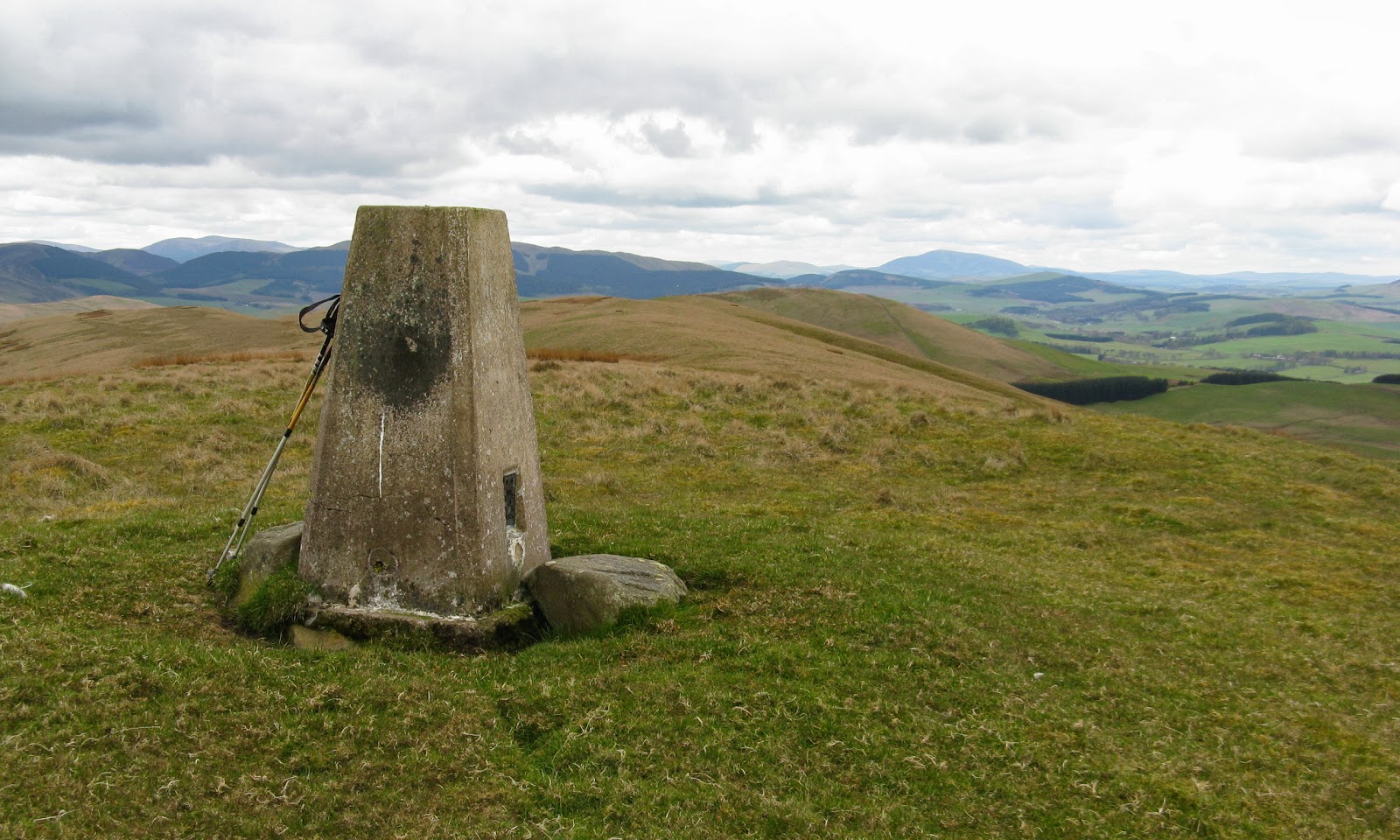
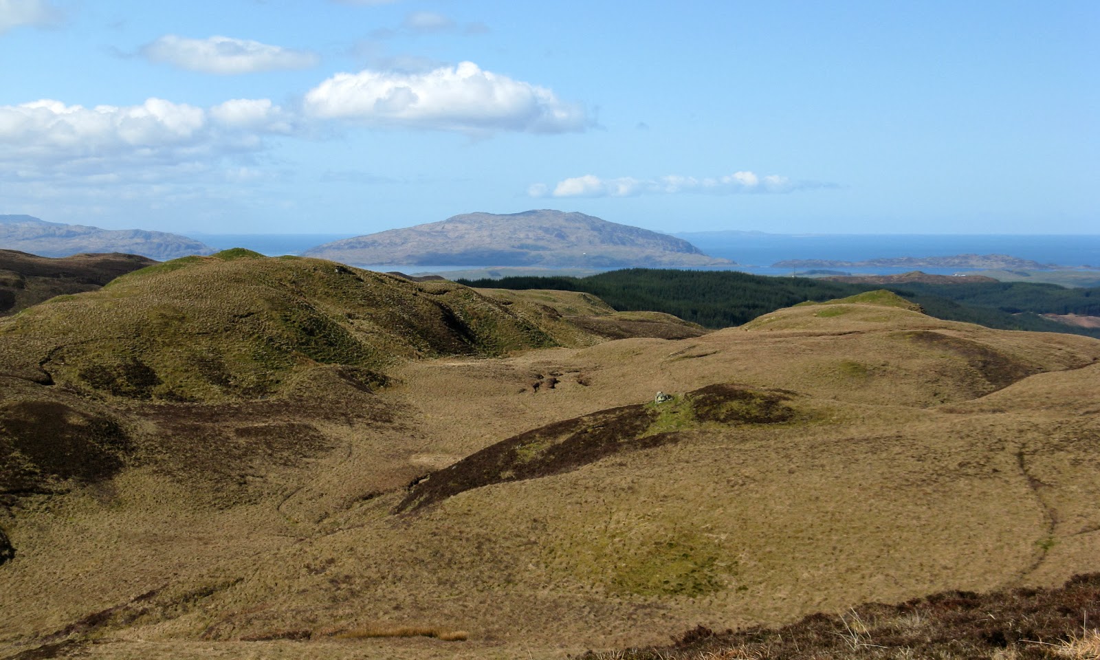
The summit ridge had a few up and downs and false tops and of course the highest point was at the far end, marked by a few stones on top of a rock. Stobinian was well seen from here.....
and zoomed.....
and to the east Ben Vorlich and Stuc a'Chroin.....
I sat at the summit for a while before taking a more direct line back down to the road- steeper but shorter. Lower down, there was a good view to the neighbouring Corbett, Beinn Stacath.....
The heat was suffocating down in the glen; no way would I have been able to walk in that. But the breeze higher up saved the day!
Saturday, 26 May 2012
Wednesday, 16 May 2012
Hill of Persie
16 May 2012
Participants - Just me
Where - Hill of Persie, 447m/1,466', Sub-2k Marilyn, Map 53 NO 050419
I guess that Hill of Persie is one for the dedicated Marilyn bagger only! It hardly merits more than a passing glance when driving up the A93 towards the Cairngorms.....
Nevertheless it is on the list so on a day that promised early sunshine I found myself parking on the broad verge at the end of the road leading to Persie House and farm.....
It was still cold; the wind was coming from a northerly direction, there were sleet showers forecast and I was glad that I was not tackling any of the higher hills which still had a covering of snow. I walked up the tarmac road past the house and through the farm and on to a broad track that led to the houses at Craighead. Immediately past the houses, I took to the hill. There was lots of evidence that cows graze this hill extensively but they were not in evidence today. The going underfoot was easy and I soon picked up a 4WD track which more or less continued all the way up the ridge. Part way up, a few fallow deer ran across the hill in front of me.....
The summit was at the edge of the forest- no cairn but easily enough found, it's at the point where an old wall makes a major change of direction.....
The wall provided shelter from the wind and it was pleasant sitting in the sun. One advantage of the current cold spell is that the air is very clear so the views are good. This is looking towards Ben Vrackie and Carn Liath.....
and this view is to the Graham, Mount Blair.....
I descended by the same route, this is looking down to Persie and its lochs from about half way down the hill.....
I found this hill a pleasant way to spend a couple of hours or so, nothing strenuous but another fine viewpoint to mark my 150th Scottish sub-2k.
Participants - Just me
Where - Hill of Persie, 447m/1,466', Sub-2k Marilyn, Map 53 NO 050419
I guess that Hill of Persie is one for the dedicated Marilyn bagger only! It hardly merits more than a passing glance when driving up the A93 towards the Cairngorms.....
Nevertheless it is on the list so on a day that promised early sunshine I found myself parking on the broad verge at the end of the road leading to Persie House and farm.....
It was still cold; the wind was coming from a northerly direction, there were sleet showers forecast and I was glad that I was not tackling any of the higher hills which still had a covering of snow. I walked up the tarmac road past the house and through the farm and on to a broad track that led to the houses at Craighead. Immediately past the houses, I took to the hill. There was lots of evidence that cows graze this hill extensively but they were not in evidence today. The going underfoot was easy and I soon picked up a 4WD track which more or less continued all the way up the ridge. Part way up, a few fallow deer ran across the hill in front of me.....
The summit was at the edge of the forest- no cairn but easily enough found, it's at the point where an old wall makes a major change of direction.....
The wall provided shelter from the wind and it was pleasant sitting in the sun. One advantage of the current cold spell is that the air is very clear so the views are good. This is looking towards Ben Vrackie and Carn Liath.....
and this view is to the Graham, Mount Blair.....
I descended by the same route, this is looking down to Persie and its lochs from about half way down the hill.....
I found this hill a pleasant way to spend a couple of hours or so, nothing strenuous but another fine viewpoint to mark my 150th Scottish sub-2k.
Wednesday, 9 May 2012
Wether Law
9 May 2012
Participants - Just me
Where - Wether Law, 479m/1,570', Sub-2k Marilyn, Map 72, NT 194483
Wether Law appears to be something of an overlooked sub-2k Marilyn. I searched all the usual web sites looking for reports of others' trips but there was nothing. Obviously not a very popular hill! It sits south of the Pentland Hills and west of Penicuik, the highest point of an area of grassy hills and forest. There was plenty of parking at Halmyre just off the A701. I followed a track round a nursery and through a couple of fields containing large flocks of sheep. From early on, the views of the Pentlands (behind me) were good......
The track continued into a forest where lots of felling had taken place. Fortunately, there had been rides through the forest and these were still clear so I followed one of these down to the Fingland Burn with Wether Law now in full view ahead.....
After crossing the burn, there was another obstacle- a combined wall and barbed wire fence;
presumably the wall was there first and then the fence was added to keep the sheep in/out. Anyway I found a place where I could cross without too much difficulty and set off up the grassy slopes of the hill, aiming for a radio mast at the west end of the summit ridge. It was a pleasant walk from the mast to the trig following a 4WD track....
This is the view east from the trig looking to the Pentlands.....
and in the other direction with Tinto on the horizon.....
No wall to wall sunshine today and no expansive seascapes either but it was still a pleasant walk. The sub-2k's certainly provide variety!
Participants - Just me
Where - Wether Law, 479m/1,570', Sub-2k Marilyn, Map 72, NT 194483
Wether Law appears to be something of an overlooked sub-2k Marilyn. I searched all the usual web sites looking for reports of others' trips but there was nothing. Obviously not a very popular hill! It sits south of the Pentland Hills and west of Penicuik, the highest point of an area of grassy hills and forest. There was plenty of parking at Halmyre just off the A701. I followed a track round a nursery and through a couple of fields containing large flocks of sheep. From early on, the views of the Pentlands (behind me) were good......
The track continued into a forest where lots of felling had taken place. Fortunately, there had been rides through the forest and these were still clear so I followed one of these down to the Fingland Burn with Wether Law now in full view ahead.....
After crossing the burn, there was another obstacle- a combined wall and barbed wire fence;
presumably the wall was there first and then the fence was added to keep the sheep in/out. Anyway I found a place where I could cross without too much difficulty and set off up the grassy slopes of the hill, aiming for a radio mast at the west end of the summit ridge. It was a pleasant walk from the mast to the trig following a 4WD track....
This is the view east from the trig looking to the Pentlands.....
and in the other direction with Tinto on the horizon.....
No wall to wall sunshine today and no expansive seascapes either but it was still a pleasant walk. The sub-2k's certainly provide variety!
Friday, 4 May 2012
Ben Hiant
2 May 2012
Participants - Neil and Ben
Where - Ben Hiant, 528m/1,731', Sub-2k Marilyn, Map 47, NM 537632
I have a list of hills that I have always wanted to climb but have never got round to doing, possibly because of a pre-occupation with Munros and Corbetts when I was younger and fitter. Not surprisingly, most of these wanted hills are in the west, so weather has also played a part as it would be a sin to climb them on a claggy, wet day.
Ben Hiant is a long way away, even from Ardgour it is the best part of 40 miles, much of it on a single track road. It didn't help that Highland Council were resurfacing the bit from just past Salen to Kilchoan so there were some delays but how come this Council can do this sort of work on a single track, dead end road when in East Dunbartonshire the most we get is a few stones thrown in a pothole from time to time? Something wrong somewhere!
Anyway it was another brilliant day and I was in no hurry. This is the first view of the hill from the side of Loch Sunart.....
and this is it from above the beach at Camas nan Geall.....
I parked in an old quarry close to the highest point of the road; the hill path started immediately opposite. The first part of the walk was up straightforward grassy slopes and soon the Small Isles came into view to the north, Rum with Eigg in front and Skye to the right.....
Soon I was on a narrower part of the ridge and I could see south to the Sound of Mull with Ben More to the right.....
Beyond this, the hill steepened considerably and I could see that there were rocky sections with the cairn situated right at the edge of big drops. Hmmm, all Ben's hills to date have been of the broad, grassy variety and he does tend to range about hillsides a bit without thought for obstacles and dangers.....
Anyway we pressed on; the path avoided most of the rocky bits and Ben stuck to it and close to me. His hill sense is obviously better than I thought. Here he is at the top: what was all the fuss about?......
It was a summit to linger on, there was no wind and it was warm. I could see the Outer Hebrides on the horizon, closer to hand this is the view to the mountains of Mull.....
and the Cuillin of Rum with the Sgurr of Eigg in the foreground (another hill on my wee list).....
and down to Kilchoan and the western part of Ardnamurchan.....
I must have spent about half an hour at the top before reluctantly dragging myself away and reversing the upward route. Again Ben stuck close to me and avoided leaping about rocks. After the walk, I carried on to Kilchoan where there was an excellent community run tearoom. This is another view of Ben Hiant from the ferry pier.....
and I couldn't resist stopping to take another picture of the Small Isles on the way back.....
A great wee hill, well worth the effort of getting there!
Participants - Neil and Ben
Where - Ben Hiant, 528m/1,731', Sub-2k Marilyn, Map 47, NM 537632
I have a list of hills that I have always wanted to climb but have never got round to doing, possibly because of a pre-occupation with Munros and Corbetts when I was younger and fitter. Not surprisingly, most of these wanted hills are in the west, so weather has also played a part as it would be a sin to climb them on a claggy, wet day.
Ben Hiant is a long way away, even from Ardgour it is the best part of 40 miles, much of it on a single track road. It didn't help that Highland Council were resurfacing the bit from just past Salen to Kilchoan so there were some delays but how come this Council can do this sort of work on a single track, dead end road when in East Dunbartonshire the most we get is a few stones thrown in a pothole from time to time? Something wrong somewhere!
Anyway it was another brilliant day and I was in no hurry. This is the first view of the hill from the side of Loch Sunart.....
and this is it from above the beach at Camas nan Geall.....
I parked in an old quarry close to the highest point of the road; the hill path started immediately opposite. The first part of the walk was up straightforward grassy slopes and soon the Small Isles came into view to the north, Rum with Eigg in front and Skye to the right.....
Soon I was on a narrower part of the ridge and I could see south to the Sound of Mull with Ben More to the right.....
Beyond this, the hill steepened considerably and I could see that there were rocky sections with the cairn situated right at the edge of big drops. Hmmm, all Ben's hills to date have been of the broad, grassy variety and he does tend to range about hillsides a bit without thought for obstacles and dangers.....
Anyway we pressed on; the path avoided most of the rocky bits and Ben stuck to it and close to me. His hill sense is obviously better than I thought. Here he is at the top: what was all the fuss about?......
It was a summit to linger on, there was no wind and it was warm. I could see the Outer Hebrides on the horizon, closer to hand this is the view to the mountains of Mull.....
and the Cuillin of Rum with the Sgurr of Eigg in the foreground (another hill on my wee list).....
and down to Kilchoan and the western part of Ardnamurchan.....
I must have spent about half an hour at the top before reluctantly dragging myself away and reversing the upward route. Again Ben stuck close to me and avoided leaping about rocks. After the walk, I carried on to Kilchoan where there was an excellent community run tearoom. This is another view of Ben Hiant from the ferry pier.....
and I couldn't resist stopping to take another picture of the Small Isles on the way back.....
A great wee hill, well worth the effort of getting there!
Ardsheal Hill
1 May 2012
Participants - Neil and Ben
Where - Ardsheal Hill, 263m/864', Sub-2k Marilyn, Map 49, NM 995568
Another spell of warm, sunny weather had arrived so I took the opportunity to do a couple of hills on the west coast and booked accommodation at Ardgour. On the way up, I made a small diversion to Duror to climb one of the smaller of the sub-2k's, Ardsheal Hill. This is the shot that I took of it later in the evening from across Loch Linnhe, it is the middle of the three hills, not at all big but with views out of all proportion to its size.....
This was my second visit, on the first occasion I tackled it by its south ridge from Cuil, in order to get the views all day if I recall correctly, but it was a rough, tough way up and not at all pleasant. So this time I parked the car in the community hall car park a mile north of Duror from where a track went up the east slopes to a radio mast just short of the summit. Just before reaching the mast, a path had formed which took me the final few metres of height to the trig. The existence of this path suggested that this must be a popular walk and when I arrived at the top it was not difficult to see why; you overlook Loch Linnhe and straight across the loch are the mountains of Ardgour. Here's Ben approaching the trig with a still snow covered Ben Nevis in the background.....
The views really open out at the trig; looking up the loch to Ben Nevis.....
looking to the Corran narrows with the ferry in the second shot.....
and down Loch Linnhe to Mull.....
But I reckon that the best of the view is straight across the loch to the mountains of Ardgour with Garbh Bheinn prominent, a long time since I've climbed it.....
Then it was on to the Corran ferry and over to Ardgour. Crossing this ferry, I always get the feeling of being transported to a different world, it's like crossing to an island!
And the forecast was good again for the following day, when I planned to tackle Ben Hiant, which has been on my wanted list for years and years.
Participants - Neil and Ben
Where - Ardsheal Hill, 263m/864', Sub-2k Marilyn, Map 49, NM 995568
Another spell of warm, sunny weather had arrived so I took the opportunity to do a couple of hills on the west coast and booked accommodation at Ardgour. On the way up, I made a small diversion to Duror to climb one of the smaller of the sub-2k's, Ardsheal Hill. This is the shot that I took of it later in the evening from across Loch Linnhe, it is the middle of the three hills, not at all big but with views out of all proportion to its size.....
This was my second visit, on the first occasion I tackled it by its south ridge from Cuil, in order to get the views all day if I recall correctly, but it was a rough, tough way up and not at all pleasant. So this time I parked the car in the community hall car park a mile north of Duror from where a track went up the east slopes to a radio mast just short of the summit. Just before reaching the mast, a path had formed which took me the final few metres of height to the trig. The existence of this path suggested that this must be a popular walk and when I arrived at the top it was not difficult to see why; you overlook Loch Linnhe and straight across the loch are the mountains of Ardgour. Here's Ben approaching the trig with a still snow covered Ben Nevis in the background.....
The views really open out at the trig; looking up the loch to Ben Nevis.....
looking to the Corran narrows with the ferry in the second shot.....
and down Loch Linnhe to Mull.....
But I reckon that the best of the view is straight across the loch to the mountains of Ardgour with Garbh Bheinn prominent, a long time since I've climbed it.....
Then it was on to the Corran ferry and over to Ardgour. Crossing this ferry, I always get the feeling of being transported to a different world, it's like crossing to an island!
And the forecast was good again for the following day, when I planned to tackle Ben Hiant, which has been on my wanted list for years and years.
Saturday, 28 April 2012
Cruach na Seilcheig (Argyll)
28 April 2012
Participants - Neil and Ben
Where - Cruach na Seilcheig, 380m/1,247', Sub-2k Marilyn, Map 55, NM 854110
It's always good to go to a new area and the sub- 2k's are a good excuse for doing that. The area east of Kilmelford is not one that I had been to before and there were a few sub-2k's there. The trick was to pick the one that would provide the best views and Cruach na Seilcheig looked like the best for that; close to the sea and with no forestry on it. So with a good forecast for the following day, I drove up and spent the night at Connel and was ready for my exploration of new country more or less first thing in the morning.
I left the main road at Kilmelford and took the single track road that eventually went to Taynuilt. After about two miles, I found a place to park at the west end of Loch an Losgainn Mor and took to the hillside from there. There were a few ups and downs but the going underfoot was not too bad- a mix of heather and grass. I would think that this is a prime area for midges in the summer! This is a view back to the place I parked the car from a short distance up the hill.....
and this is a view to the top of the hill from the same spot.....
They give an idea of what the going was like.
This is an area of many lochans. There was one just below the summit, Loch a' Clachain, great if you're a spaniel.....
From about here there was a good view down to Kilmelford.....
For anyone who climbs this hill on a misty day (which would be a great shame as it is a fantastic viewpoint) there are two cairns and it is the second one that you come to that looks to be higher. From here, the view is down the Sound over many small islands to Jura with the Paps clearly visible. If the weather stays the way it was today then the MBA volunteers will have a great time renovating the new bothy at Cruib on Jura. Here is Ben posing for his usual photograph at the summit.....
And this is the view to another Island Marilyn, Cruach Scarba on the island of the same name.....
The best of the view from the more northerly cairn was to Ben Cruachan.....
There was hardly any wind and it actually felt quite warm so I spent a bit of time at the summit looking at the views (and listening to the first cuckoo of the year). I had certainly made the right choice of hill! Back at the car, I continued my exploration and followed the road to Taynuilt. This is Loch Avich looking north......
As the road goes north, there is more and more forest and views of Loch Awe are few and far between, which was a bit of a disappointmet. This is from one of the few viewpoints looking to Ben Lui which had collected a fair dump of snow overnight.....
A lot of forestry operations were taking place and I noticed that a new wind farm was also to be built at one point. The road surface was good and there was hardly any traffic so it was an enjoyable drive. Hopefully the weather will now settle down and I'll get a few more west coast excursions.
Participants - Neil and Ben
Where - Cruach na Seilcheig, 380m/1,247', Sub-2k Marilyn, Map 55, NM 854110
It's always good to go to a new area and the sub- 2k's are a good excuse for doing that. The area east of Kilmelford is not one that I had been to before and there were a few sub-2k's there. The trick was to pick the one that would provide the best views and Cruach na Seilcheig looked like the best for that; close to the sea and with no forestry on it. So with a good forecast for the following day, I drove up and spent the night at Connel and was ready for my exploration of new country more or less first thing in the morning.
I left the main road at Kilmelford and took the single track road that eventually went to Taynuilt. After about two miles, I found a place to park at the west end of Loch an Losgainn Mor and took to the hillside from there. There were a few ups and downs but the going underfoot was not too bad- a mix of heather and grass. I would think that this is a prime area for midges in the summer! This is a view back to the place I parked the car from a short distance up the hill.....
and this is a view to the top of the hill from the same spot.....
They give an idea of what the going was like.
This is an area of many lochans. There was one just below the summit, Loch a' Clachain, great if you're a spaniel.....
From about here there was a good view down to Kilmelford.....
For anyone who climbs this hill on a misty day (which would be a great shame as it is a fantastic viewpoint) there are two cairns and it is the second one that you come to that looks to be higher. From here, the view is down the Sound over many small islands to Jura with the Paps clearly visible. If the weather stays the way it was today then the MBA volunteers will have a great time renovating the new bothy at Cruib on Jura. Here is Ben posing for his usual photograph at the summit.....
And this is the view to another Island Marilyn, Cruach Scarba on the island of the same name.....
The best of the view from the more northerly cairn was to Ben Cruachan.....
There was hardly any wind and it actually felt quite warm so I spent a bit of time at the summit looking at the views (and listening to the first cuckoo of the year). I had certainly made the right choice of hill! Back at the car, I continued my exploration and followed the road to Taynuilt. This is Loch Avich looking north......
As the road goes north, there is more and more forest and views of Loch Awe are few and far between, which was a bit of a disappointmet. This is from one of the few viewpoints looking to Ben Lui which had collected a fair dump of snow overnight.....
A lot of forestry operations were taking place and I noticed that a new wind farm was also to be built at one point. The road surface was good and there was hardly any traffic so it was an enjoyable drive. Hopefully the weather will now settle down and I'll get a few more west coast excursions.
Subscribe to:
Posts (Atom)