Friday, 20 August 2010

Steeles Knowe

18 August 2010.

Participants - Just me
Where - Steeles Knowe, 485m/1,592', Sub-2,000' Marilyn, Map 58, NN 969080

For this week's walk, it was back to the Ochils, where there are lots of Marilyns. The last time I went up Steeles Knowe I simply followed the wind farm access road from Glen Devon, an easy but not really a hill walking route! This time, I parked in an FC car park on the Yetts o'Muckhart to Dunning road opposite the entrance to the track up the Corb Glen and so approached the hill from the east. The track initially went through a small wood, then through a gully/gorge, then it meandered across the side of Muckle Law before reaching a farm at Coulshill. I left the track about 1/2 mile before the farm, crossed the burn, and took to the grassy slopes of Steeles Knowe. This is a picture from fairly high up on the hill looking back at the way I came; the notch towards the left of the picture is the gully.....


My return route was over the hills on the right of the picture- Rowantree Craigs, Green Law, Sim's Hill and John's Hill before dropping back to the track near the entrance to the little wood which made an excellent round. There were rough tracks over all of the hills and I also used the wind farm road so it was all easy going. This is the less popular side of the Ochils, I only met one other walker all day.

What used to be a remote trig in the middle of moorland is now surrounded by turbines.....


This is looking back at the summit which is at a point between the two turbines on the right.....


and this is looking back at Steeles Knowe from Rowantree Craig.....


Despite the mechanised intrusion, this is still a good walk. I was out for 4 hours and the distance was about 7 miles with just over 300m of ascent. More of this area is attracting turbines however- I noticed that another wind farm on the other side of Glen Devon was being constructed.

Sunday, 15 August 2010

Beinn Ime, Beinn Narnain

13th August 2010.

Participants - Just me
Where - Beinn Ime, 1011m/3,318', Munro; Beinn Narnain, 926m/3,038', Munro, Map 56

 Although they are among the nearest Munros to my home, it was years' since I had last climbed these two. I hadn't even been up the improved path from the car park at the head of Loch Long which provides a longer, but easier, approach to the Cobbler corrie. A board in the car park provided some information about how these hills were formed.....


The weather was really nice and there were occasional views from the path down the length of Loch Long......


The Forestry Commission has planted all of this area and although it is a mixed woodland, they have been a bit heavy with the conifers. In a few years time, I guess that it will be just another forest walk with little to see. However, once past the forested area, things improved- the Cobbler came into view for one thing......


All of the paths to the Cobbler seem to have been improved since the last time that I was here. The routes on Beinn Ime and Beinn Narnain however have been left to their own resources and were as rough and wet as ever. Favouritism! I had set out intending to do Beinn Narnain but arriving at the Bealach a'Mhaim, Beinn Ime didn't seem to be all that far away.....


and it would have been a shame to have come this far and not done it. There was a good view west from the Bealach to Beinn Donich and Beinn an Lochain.....


No matter what direction I do it from, I find Beinn Ime a bit of a slog; from this side it is a long, gradual incline up wet grassy slopes. This is looking back from close to the top with Ben Lomond and Beinn Narnain in the background......


The top certainly gives an impression of space and height when looking down Glen Kinglass towards Loch Fyne.....


After chatting with a couple of other people at the top I headed back down to the Bealach with my next objective, Beinn Narnain, ahead.....


And this is the reverse view- Beinn Ime from the slopes of Beinn Narnain.....


Although it is lower, I think that Beinn Narnain has the better views. This is looking down the Clyde estuary with Ailsa Craig and the hills of Arran on the horizon......


And this is looking over the Spearhead towards Ben Lomond.....


I was getting tired, I had not brought enough water, so it was a slow journey back down the path on legs that were getting increasingly wobbly. There was a final view of Ben Lomond over Arrochar before I collapsed into the car.....


According to "The Munros", the day involved 1,320m of ascent. I estimated that the distance was about 9 miles and it took me 7 1/2 hours.

Wednesday, 11 August 2010

Eildon Mid Hill and Sell Moor Hill

8 August 2010.

Participants - Just me
Where - Eildon Mid Hill, 422m/1,385', Sub-2,000' Marilyn, 73, NT 548323; Sell Moor Hill, 423m, Sub-2,000' Marilyn, Map 73, NT 480444

 Iron Age settlers, the Devil, a wizard, King Arthur, the Romans, writers and poets. As well as being among the best known hills in Scotland, the Eildons are associated with all of the above. Although rising to only 422m at Eildon Mid Hill, they dominate the surrounding countryside and can be seen from miles around. One of the best places to view all three hills is from Scott's view to the east from where millions of pictures must have been taken; here is my effort.....


According to legend, the Eildons were originally a single hill which was cleft into three pieces by the devil who had been summoned by a local wizard, Michael Scott. Another legend associates King Arthur with the peaks.

I was returning from an MBA meeting at Hope bothy- a great wee howff in the hills near Peebles which unfortunately had just been sold (the bothy, not Peebles!) and will no longer be available to provide rough shelter. I had a bit of time to spare so decided to renew acquaintance with the Eildons. The hills are criss-crossed with paths and the route from Melrose initially follows the route of St Cuthberts Way.....


I headed for the highest point first- which is a Marilyn. It has a view indicator which incorporates a plaque to Sir Walter Scott.....


The weather was a bit changeable, alternating between bright sunshine and heavy cloud cover and the atmosphere was sometimes a bit flat for good photography. I had to hang about to get the better weather breaks for pics.This is Melrose from Mid Hill.....


and this is a zoomed shot of Melrose Abbey.....


Then it was back to the col and up Hill North, which I would have said was actually to the east but never mind! This is a view back to Mid Hill and the much lower Wester Hill from the slopes of Hill North.....


and this is Hill North from part way up Mid Hill.....


Hill North contains most of the historical interest. There has been a settlement here together with an outer defence system since around 1,000BC although I couldn't see any obvious signs. One feature that did stand out was a natural shelf on the south side of the hill which presumably was also used by the early settlers.....


Apparently Hill North was also extensively used by the Romans as a signal station and the Eildons stand above the Roman fort of Trimontium. So lots of interesting history and pre-history to read up about.

On the way home, I made a slight diversion to take in Sell Moor Hill, 422m. It is a fairly recent addition to the Marilyn tables and was a new "tick" for me. It hardly qualifies for the description of "hill"; it is really only the high point of fields and moorland between Stow and Lauder and I approached it from close to the high point of the road between the two. It was only about 70m of ascent over about 1/2 mile following a path through a couple of fields. This is the summit trig looking west to the Moorfoot Hills.....

Friday, 6 August 2010

Brown Carrick Hill

5 August 2010.

Participants - Just me
Where - Brown Carrick Hill, 287m/943', Sub-2,000' Marilyn, Map 70, NS 283159

 The weather was still mixed with a lot of showers rattling in so rather than going to get wet on one of the hills of the highlands, I opted for a trip down the Ayrshire coast for this week's walk. The highest point of the Carrick hills- Brown Carrick Hill- is a Marilyn and even better, there is a minor road starting about 5 miles south of Ayr that crosses these hills and makes the ascent a dawdle. You can see the Carrick hills from the beach at Ayr, this is a picture that I took late afternoon on a previous visit.....


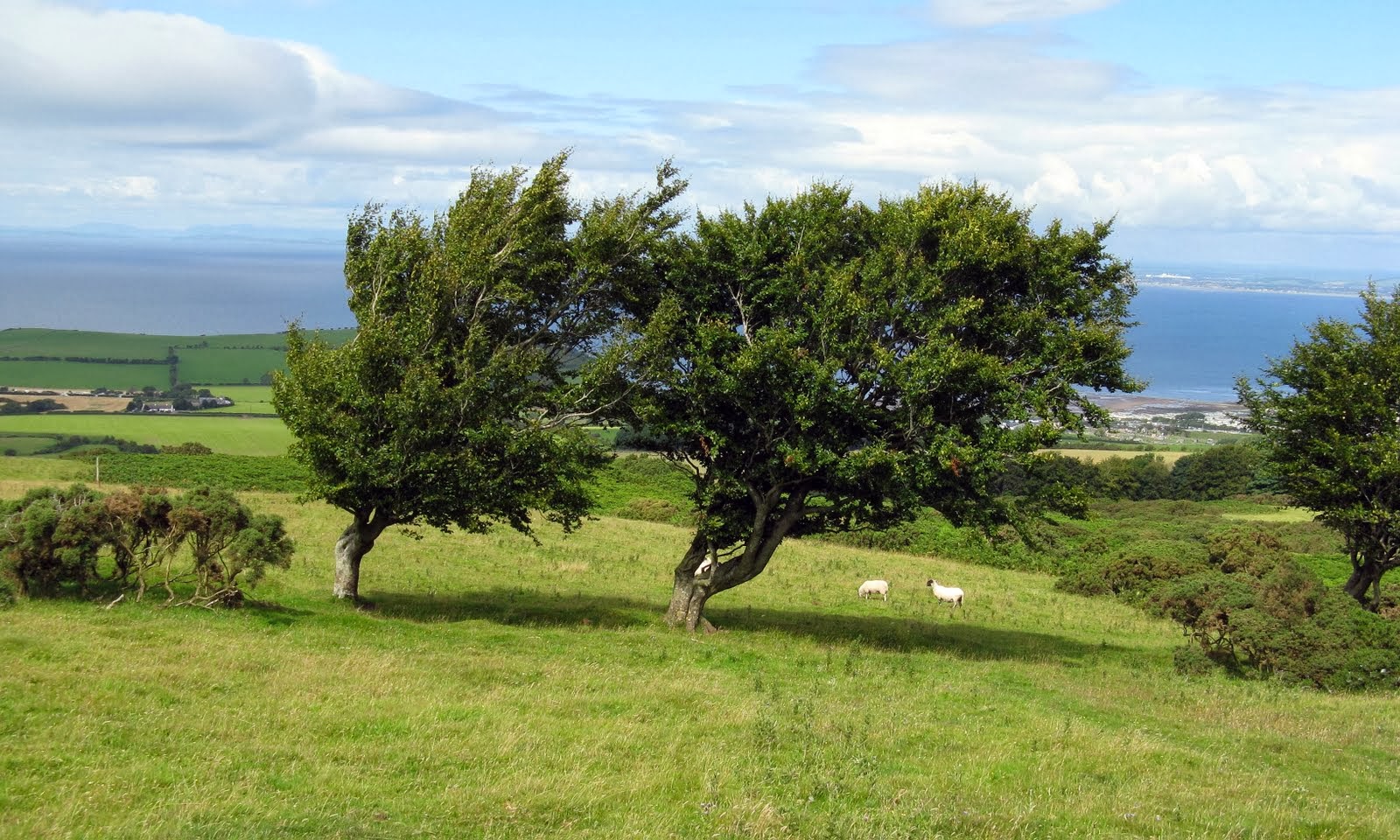
The highest point was about a quarter of a mile beyond the top with the communications mast on it; and there was a service road to the mast. The hills hereabouts are exposed to the winds off the Atlantic- many of the trees lean sideways showing the direction and strength of the prevailing winds.....


Arran dominates the views although today it kept disappearing in the rain showers that were blowing about......


The views of the Ayrshire coast were also impressive, this is looking north over Ayr itself.....


Looking past the trig, I could see another island that I must try and visit sometime- Ailsa Craig- which must be one of the most impressive Marilyns.....


The Carrick hills provide good, open, views proving again that you don't have to climb a Munro to get a good hill day out!

Friday, 30 July 2010

Conic Hill and Inchcailloch Island

29 July 2010.

Participants - Just me
Where - Conic Hill, 361m/1,185', Sub-2,000' Marilyn, Map 56, NS 432923

 Conic Hill is a favourite short walk close to home; although only about 20 miles from Glasgow, the views are highland rather than lowland. Rising above Loch Lomond, and with the route of the West Highland Way crossing it, it is also very popular! This is a view from the car park at Balmaha.....


On every previous occasion, I had followed the "tourist path" that leaves from the north side of the car park. Today I tried something different- I followed the WHW for a short distance, crossed a field,then the Balmaha- Rowerdennan road, and picked up a rather overgrown path at the foot of the west ridge. This soon got better and the views opened out. This is looking up the ridge from near its start. It shows the knobbly nature of the hill.....


And this is from a bit higher up near to where today's route joins the "tourist path" which is also part of the WHW.....


Conic Hill sits on the Highland Boundary Fault which separates the highlands and the lowlands. Apparently, around 400 million years ago, two continents collided pushing landmasses together to form Scotland; the Highland Boundary Fault is where the two continents met. The Loch Lomond islands seen here from half way up Conic Hill are also part of the Fault Line. Inchcailloch, which I visited later in the day, is the large island closest to the shore....


The Luss hills on the other side of Loch Lomond were seen well from here.....


While the westerly top is the best viewpoint and appears to be the one most visited, the most easterly "bump" is the true summit- by about 2m by the look of it- and a cairn is gradually taking shape on it. Here it is with Ben Lomond in the background.....


Conic Hill was only a short walk and the day was still young. What to do next? I love islands but had never been to Inchcailloch Island and a leaflet in the Visitor Centre said that a boat to there ran regularly from Balmaha boatyard.....


There were a couple of walking routes on the island, which was heavily wooded- oak and alder mainly.....


but there were a couple of viewpoints including one at the summit (85m). This is the view from the summit south over Endrick Bay to the Fintry hills.....


and north up Loch Lomond to Ben Lomond.....


I had picked up a guide book in the Visitor Centre. It said that, according to legend, St Kentigerna, an Irish princess, settled on the island about 1,300 years ago and set up a nunnery. She is apparently remembered in the name of the island which means island of the old women. 500 years later a church was built and dedicated to her memory; only the foundations remain plus some grave stones in the cemetery which continued in use well into the 20th century. It is all a bit run down today though.....


I spent a leisurely couple of hours wandering about the island; an interesting addition to a visit to Conic Hill.

Tuesday, 27 July 2010

Corwharn

27 July 2010.

Participants - Just me
Where - Corwharn, 611m/2,005', Graham, Map 44, NO 288651

 The hills of Angus were where I was first introduced to hill walking and it is always good to go back. All of the forecasts for today were in agreement- cloud and showers in the west, bright with some sun in the east- so I headed east for a Graham that I had not yet climbed, Corwharn. I parked in a car park and picnic area about a mile from the head of the Backwater Reservoir. This is a relatively new Reservoir- it was opened in 1969 to supply drinking water to folk in Dundee, Angus and parts of east Perthshire. It was quite scenic with the hills of Glen Shee in the background.....


Unfortunately, my map for this area was quite old and everything wasn't marked on it. I therefore took a punt and followed the road towards its end for about 1/3 mile to take a track that I had noticed going into a forest on the side of the hill that I wanted to be on. After about 15 minutes walking it was clear that the track was heading deep into the forest rather than up through it. I was just about to turn back when I spotted a break heading steeply uphill, took another chance and followed it and 10 minutes later I emerged on the ridge of Milldewan Hill, exactly where I wanted to be. I could see Corwharn in the distance (left hand one of the two tops).....


As I had hoped, there was a track along the ridge. This is from it getting closer to another top called Cairn Corse.....


The area was clearly prime grouse rearing and shooting territory, I came across a few scrapes in the ground containing a mix of food and grit.....


There weren't many grouse about however.....funny how they seem to know when August 12 is approaching!

It was great wandering along the ridge especially as the weather was getting better and better. This is the view west to Mount Blair.....


and north to the Munros of Mayar and Driesh.....


I had noticed a prominent cairn on Corwharn from the moment that I reached the ridge. It turned out to be a stone man and was almost, but not quite, at the highest point on the hill. I reckoned that it was about 7 feet high. This is it with Cat Law in the background.....


I was at the top two hours after leaving the car. It was about 3 miles with only about 1.000' of ascent. For the return, I had thought of dropping down to Glen Quharity but the weather was now so good it would have been a shame to leave the ridge so I just went back the same way. However, rather than fight the forest again, I followed the ridge to its end and dropped down almost directly to the car park. I was glad that I came this way as I came across these two Fallow Deer at the edge of the forest.....


Most of the reports that I have read about this hill recommend an approach from the Glen Prosen side. Although perhaps slightly shorter, looking at the map and from the top of the hill, that route looks a bit shut in for most of the way whereas getting straight up on to Milldewan Hill from the reservoir as I did provides a grand ridge walk with excellent views all the way.