24 November.
Participants - Me and Ben
Where - Common Hill, 488m/1,600', Sub-2,000' Marilyn, Map 71, NS 792308.
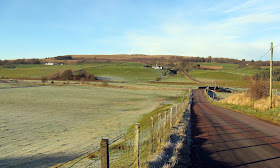
The best of the weather was in the west so I headed down the motorway for a walk with Ben on Common Hill, a Marilyn outside Douglas. I drove as far as the houses at Douglas West where there was lots of parking. This is Common Hill from the Douglas West road.....
For some reason, each of the tops of this hill has a different name- Common Hill, Broomerside Hill, Henry's Hill, Hagshaw Hill, etc. It contains one of Scotland's earliest wind farms which was extended a few years ago.....
One advantage of the wind farm is the track that meanders all the way to the summit at a gentle gradient. Ben barked at the turbines when he first spotted them but soon stopped when he saw that I was not bothering about them. Here he is approaching the first of the turbines.....
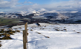
All of the snow of the previous week had melted. I could see last week's hill, Dungavel Hill, just to the left of the trig in this photo, with the Culter hills beyond......
Tinto was prominent.....
as was Cairn Table to the west.....
There was also a good view of Tinto from the track on the way back.....
It was a walk of about 4 miles with about 240m of ascent, a fairly gentle leg-stretcher and just right for a young dog. Hope that this good weather continues!
Thursday, 25 November 2010
Monday, 15 November 2010
Dungavel Hill- first taste of winter
15 November.
Participants - Me and Ben
Where - Dungavel Hill, 510m/1,673'. Sub-2,000' Marilyn, Map 71/72, NS 942305
The weather was great when I got up and looked like staying that way for a few hours before the next rain came in from the west. So there was just time to do a Marilyn! I got a surprise though as I drove south- everything south of Lanark was covered in snow and it had obviously snowed down to road level before mostly melting low down. I wondered how Ben would take to the snow but I needn't have worried, he loved it. This is Dungavel Hill from Newton; we went up by the long west ridge having found a parking spot beside a cattle grid on a narrow road that goes to Roberton.....
Although grass and heather poked up through the snow, in places it was surprisingly deep, more than 6 inches. Not thinking ahead as usual, I hadn't bothered to bring my gaiters so my feet were soon wet. Ben sort of bounced uphill through the snow and we made good progress. The trig had seen better days.....
Fortunately there was a fence at the top so I was able to tie Ben's lead to it so that I could get some photographs. This is Ben at the top with the Culter hills in the background.....
another view of the Culter hills from slightly down the east ridge.....
and looking up the Clyde valley towards Biggar with the Pentlands in the distance.....
Tinto is very close to the north but there was a cap of cloud on it all day....
The journey down had been a bit slow as there were roadworks in Lanark so I went back by the motorway. This is a last view of the hill from the A73.....
Wednesday, 10 November 2010
Moncreiffe Hill, Ben's first Marilyn
10 November 2010.
Participants - Me, Steven and Ben
Where - Moncreiffe Hill, 223m/732', Sub-2,000' Marilyn, Map 58, NO 136199
The beginning of November until the shortest day is my least favourite time of year; daylight hours getting shorter, grey skies, lots of rain- depressing really. But occasionally a good weather day comes along and today was one. Ben is now 4 months old and has lots of energy; he has been going for walks in the country parks near to home and I reckoned that it was now time to take him on his first hill walk! I chose Moncreiffe Hill just to the south of Perth. Although it is a Marilyn, it is more like a woodland walk than a true hill- it has wide tracks and gentle inclines so is just right for a wee dog. And it's summit is an excellent viewpoint for human companions. This is a view that I took of it from near to Bridge of Earn on a previous visit.....
We parked at the car park on the south side of the hill; here are Steven and Ben setting off on the walk.....
Unfortunately, there has been a bit of timber harvesting recently and the tracks were well churned up. There were also some new tracks going in. The woodland was a mix of conifers and deciduous trees and although the best of the autumn foliage was past, I was pleased to see that there was still some colour left on what leaves remained.....
A steeper uphill section on a new track led to the summit- Moredun Top- which is clear of the trees. Apparently it contains the remains of an Iron Age fort; logical for one to be built here I suppose as the top looks down on all of the low ground for miles around. Here I am with Ben at the cairn with Stuc a'Chroin and Ben Vorlich in the far distance. All of the higher hills had some snow on them.....
And here is Ben topping out on his first Marilyn (Perth in the background). Isn't he a good dog sitting patiently to have his photo taken? Hmmm, not quite, what you can't see is Steven behind the cairn holding him in position.....
Moredun Top is a great viewpoint for such a small hill, particularly on a day like this. This is looking to the Lomond Hills in Fife.....
down the Tay towards the estuary; Norman's Law is the hill in the distance.....
and across the Friarton bridge to Perth with the Glenshee hills distant.....
We carried on following the track in an easterly direction and in places the mud got worse. Even so, it was a nice walk through the forest and it took us just over two hours....
Ben slept in the car on the way home, but was full of life again as soon as he got out.


