Friday 31 May 2013

Beinn Bhalgairean

30 May 2013

Participants - Neil and Ben
Where - Beinn Bhalgairean, 636m/2,085', Graham, Map 50 NN 203241

This one hasn't had many write ups as far as I could see although its position, just west of the Ben Lui group, suggested that it might be a good viewpoint. It is the lower of two Grahams situated in the "empty" country between the head of Loch Lomond and Loch Awe, an area that also has quite extensive forestry of the conifer kind.

I parked the car just in to the track that goes to Succoth from where there was a good view to Beinn a'Cleibh and Ben Lui to the east.....


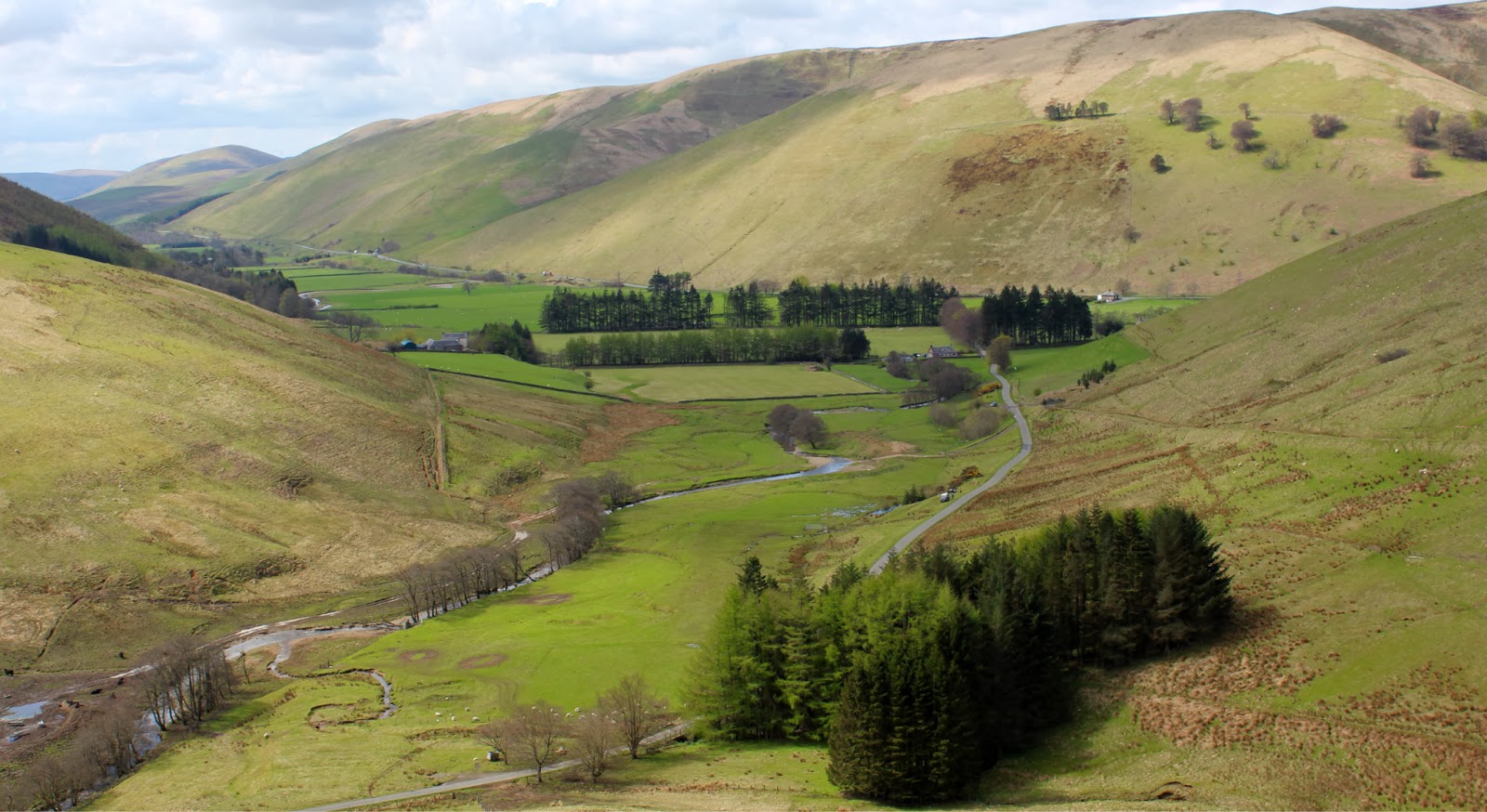
Further along the track, as we gained height, there was a view back to the Dalmally horseshoe, a range of high hills that featured prominently in my day.....


The track passed the entrance to the lodge and carried on at a fairly gentle angle to pass under the railway line at this bridge.....


Higher up still, I got an even better view of the Dalmally horseshoe, this time with Beinn a'Chochuill and Beinn Eunaich added on as a bonus.....


I remember this forest from years ago when I tried to climb Beinn a'Cleibh from here and ended up on top of some other hill, to this day I haven't worked out what. It might have been the other Graham, Meall nan Gabhar, but I can't be sure.....


Everything was much more obvious today though as there has been considerable felling since my last visit. After about 3 miles or so of steady climbing, the track turned back on itself and about 100m further on, a side track entered the forest.....


This was our route and after only a short distance, we emerged on to the open hillside with our objective straight ahead....


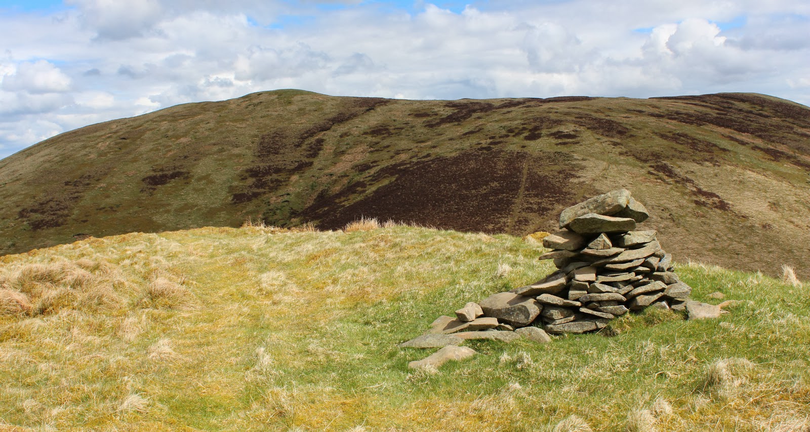
I knew from reports on the Scottish Hills site that there was a six foot deer fence between us and the summit but that there was a gate which could be found by continuing to follow the track rather than heading straight for the top of the hill. Unfortunately, I followed the track too far but managed to get Ben under the fence at a loose bit. We found the gate on the way down. The top was indeed a great viewpoint. Here are the Dalmally hills again.....


and Ben at the cairn with Glen Lochay behind him....


Further round were Beinn a'Cleibh and Ben Lui.....


and to the south the elusive twin topped Munro Beinn Bhuidhe.....


It was a warm day and I needed a few stops on the way back down. The good track got me up and down easily but walking on that type of surface is sore on the feet. However, without it, theses two would be remote hills indeed. I reckon that the walk was about 9 miles and it took 5hours and 15 minutes. Another hill that is well worth doing.

Sunday 26 May 2013

Beinn Dubh Airigh

25 May 2013

Participants - Neil and Ben
Where - Beinn Dubh Airigh, 459m/1,506', Sub-2k Marilyn, Map 55, NM 958035

I would not have climbed Beinn Dubh Airigh were it not for the Internet. This Marilyn is part of a low lying group of hills between Loch Fyne and Loch Awe and is a long way from the nearest road. However, my research revealed that there was a Forest Drive between the two lochs that passed within a mile of the foot of the hill. And even better, the hill could be climbed without getting tangled up in acres of conifers. So after contacting the FC Argyll area office to check that the Drive was open, I set off.

The Drive started at Auchindrain, a few miles south of Inverary. The surface was good and although there were obviously on-going forestry operations, I didn't come across any forestry vehicles. My objective came into view.....


After about 6 miles, and at the highest point of the Drive, I parked the car in a very convenient off-track space.....


My route started immediately opposite- into the forest along a rough 4WD track. After about 200m, I came to a stream where the track forked and where I turned south-west and followed the stream along a much rougher forestry ride. However there was really only one obstacle- a fallen tree not far from the start of the ride and after about another 300m or so I emerged onto the open hillside. There were three hillocks ahead and I aimed for the central one which was crowned by a huge boulder. When I reached the top of this the trig on Beinn Dubh Airigh came into view ahead.....


There were lots of lochans between the hills; I passed this one on the way to the summit.....


The top was crowned by a fine looking old trig, much more acceptable than the usual concrete thing. Here is Ben at the trig with the Arrochar hills in the background.....


I could see Loch Awe with Ben Cruachan beyond it.....


and the Island of Scarba out west.....


It was a bit hazy but I could also just make out the hills of Mull and Jura. All the while I was hearing the sound of a cuckoo; spring had finally arrived. It was also quite warm so I got out of the wind just below the trig and sat around for a while. Ben unusually was also content to sit around. He is normally keen to be off and running all the time but as he hadn't been on a hill walking expedition for a while he was probably a bit tired. Here are a couple of pics of him at the trig.....


So another enjoyable day in a less frequented area. I only saw one other car on the Forest Drive, it doesn't seem to be particularly well advertised. But without it I would not have had Beinn Dubh Airigh on my Marilyn list.


Sunday 19 May 2013

Ellson Fell

16 May 2013

Participants - Just me
Where - Ellson Fell, 537m/1,762', Sub-2K Marilyn, Map 79, NY 410985

The first rule when visiting a hill in a previously unvisited area is to take a map. Mine was on a shelf in my living room where I had put it the night before so as not to forget to take it.

At least I had researched the starting point- about a mile off the A7 on the side road that went to Hermitage castle. There was plenty of space to park at a cattle grid. The south-west ridge of Ellson Fell was straight in front of me, it looked rather steep......


It was just a case of plodding up following a 4WD track. There was a good view back to the valley of the A7.....


and as I got higher I could see the Lake District Fells on the horizon. At the top of the steep bit, which apparently is called Castlewink, the ridge narrowed considerably and I could see a high point ahead left.....


There was a lower top with a substantial cairn which I subsequently discovered was named point 494 on the map. This is looking to the main top (left).....


This was where the map would have come in handy! After the highest point, which didn't have any marker, the ridge descended a bit then curved round towards a higher hill that I could see.....


Uncertainty crept in. I knew that it had to be a different range of hills, probably those containing the Graham, Caldcleuch Head, but...... There was obviously a substantial dip between the ridge that I was on and this other hill but I couldn't see how substantial so, to be sure, I carried on round the ridge for a bit before deciding that the top that I had just left was indeed the summit of Ellson Hill. However, it was a nice wee ridge and I got this picture of Ellson Fell and another Marilyn, Wisp Hill (right) from it......


The first thing I did when I got home was look at the map and confirm that the higher hill that I had seen was, in fact, a Caldcleuch Head outlier and that I had indeed reached the top of Ellson Fell. So all was well. I would have been ever so slightly miffed having travelled all that way to have got back and found that I had not reached the top!

Wednesday 8 May 2013

Drumcroy Hill

7 May 2013

Participants - Just me
Where - Drumcroy Hill, 512m/1,680', Sub-2k Marilyn, Map 42, NN 741629

I didn't have any great expectations about this hill, the map showed that it was covered in trees. However, I look on hillwalking as more than just climbing the hill. The journey there and back can be very interesting and this one involved a trip that took in Crieff, the Sma Glen, Aberfeldy and Tummel Bridge.

Summer had arrived and I heard my first cuckoo of the year as I drew up in the parking space at the highest point of the road between Tummel Bridge and Trinafour, where the map showed the main bit of forest ending. The initial 100 yards was through thick heather.......


but then I was able to walk between an old wall and a deer fence where the going was much better.....


As I got higher I got a view back to the Corbett of Beinn a'Chuallaich.....


and across to the Errochty dam and Loch Errochty.....


After about a mile, another wood came in from the north. However, it was not one of the blanket conifer variety but one of much older vintage with trees that were well spaced out.....


It was really nice wandering through these trees on a mossy carpet, with occasional glimpses of the hills to the north....


although I was disappointed to see that some young conifers were making an appearance.....


Near to the summit, there was a bit of a tangled mess of fallen trees so I hopped back over the wall where the going was easier. And then I was at the cairn, a few stones on top of the wall.....


There was no view, although there was some open ground to the south a few yards away. I don't suppose that many people have sat about at this particular cairn but it was very pleasant for about 10 minutes or so before I headed back the way that I had come, with fine views of Beinn a'Chuallaich through the trees in front of me.....


This was undoubtedly the best time of year to climb this hill, before the flies and midges appeared and the heather got too long. Back at the car I thought to myself " well, that wasn't too bad after all".

Wednesday 1 May 2013

The Stob

30 April 2013

Participants - Just me
Where - The Stob, 753m/2,470', Graham, Map 51, NN 491231

This Graham doesn't seem to be very high in the popularity stakes, which is a shame as it turned out to be a great viewpoint.

There are forests on both sides of the hill and it looks as though it is eeksy peeksy in terms of distance. I decided to go in by the glen on the east side, where there seemed to be fewer trees. There was lots of space to park at the start of the track, just west of Tulloch farm. It was a glorious morning, not a cloud in the sky. I took this picture not far from the start, looking west along Loch Voil with the Corbetts of Beinn Stacath across the loch and Stob a'Choin in the distance .....


and this one looking back down the track towards the loch with Ben Vorlich and Stuc a'Chroin in the background.....


It was a steady pull up the good track. After a couple of miles, I reached the end of the trees and found myself in a bit of an amphitheatre with craggy slopes all around. They turned out to be steeper than they looked. I followed the fence to the end of the forest on the left and took to the grassy slopes.....


As I expected, this was a hill with many lumps and bumps. It was not one to do on a foggy day.  From one of these bumps, I got a good view back down towards Ben Vorlich and Stuc a'Chroin.....


 Eventually, what was clearly the summit came into view.....


Not much in the way of a cairn, but a stunning view towards Stobinian and Ben More.....


I was surprised to find another walker at the top. He had come up by the other glen and it was no surprise when he said that he was bagging the Grahams. We had a good chat and I took the opportunity to get my picture taken with the Munro twins in the background.....


I also took this picture of them without me cluttering up the foreground.....


This view is east to the Ben Lawers hills.....


and on the way back down I took this shot of Benvane and Ben Ledi.....


It had taken me 4 hours 15 minutes which seems to be an average time for this hill. I was really pleased with myself though- only 5 months after major cancer surgery and I had managed to reach the top of The Stob without any more huffing and puffing than would have been the case had I climbed it before my illness. At last I feel that I am getting back to where I was before, thanks to the staff at Gartnavel Hospital.